Celebrating 25 years of DDD's Excellence and Social Impact. ✖

Multisensor Fusion

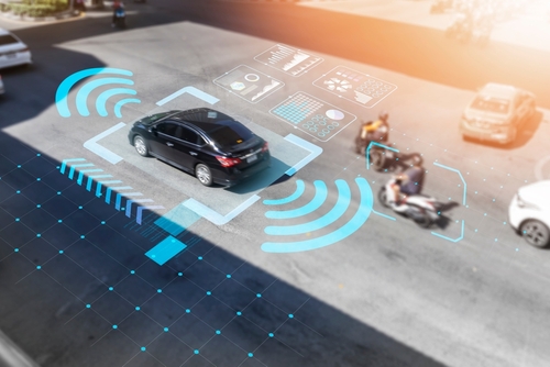
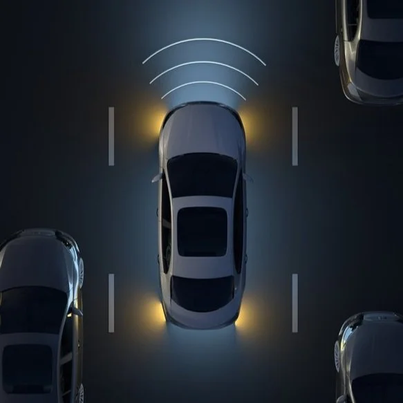
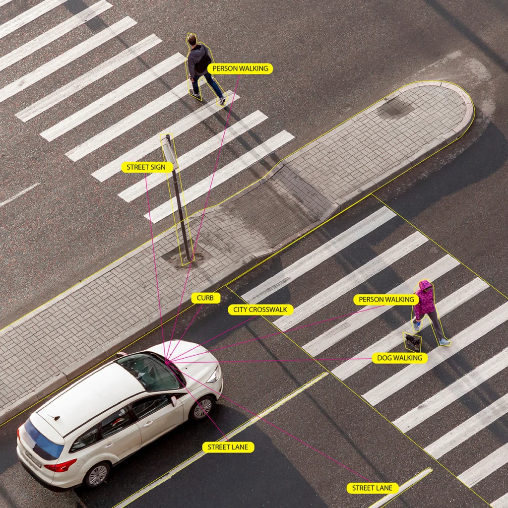
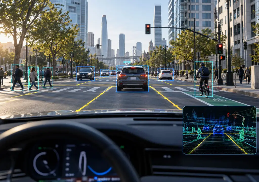
Urban driving scene illustrating sensor fusion annotation using camera and LiDAR data for autonomous vehicle perception.

How to Run a Sensor Fusion Annotation Pilot including Acceptance Metrics and Evidence Checklist

Sensor fusion annotation pilot acceptance should rest on measurable evidence that both sides agree on before the first frame is labeled. The core measures are 3D geometric accuracy, camera-LiDAR projection consistency, track identity continuity, and first-pass quality, each scored per scenario slice against a blind gold set. Competing suppliers should work on identical data, guidelines, and scoring scripts, with the buyer owning adjudication. A passed pilot shows a supplier’s quality ceiling, so production readiness needs its own evidence.

Camera and LiDAR labels can each look correct in isolation and still disagree once they are projected into the same frame. That disagreement rarely shows up in a supplier demo, which is why teams evaluating multisensor fusion annotation vendors or robotics data services need a pilot designed to expose it. A well-built pilot turns the buyer’s question about consistency and calibration across camera and LiDAR labels into numbers two suppliers can be compared on.

Key Takeaways

  • Agree on clear pass-or-fail rules before the pilot starts, so no one argues later about what “good” means.
  • Check that camera and LiDAR labels match each other, because each can look right on its own and still disagree when combined.
  • Test every supplier on the same data and instructions, with enough examples of rare situations, such as night driving, to judge them fairly.
  • Score the work against hidden test samples the suppliers cannot spot, and let the buyer settle any disputed labels.
  • Count work that passed the first time separately from work that needed fixing, since repeated fixes become an extra cost once volumes grow.
  • Treat a passed pilot as a starting point, and ask each supplier for the same proof of quality, staffing, and capacity before you buy.

What Is a Sensor Fusion Annotation Pilot and What Does Acceptance Mean?

A sensor fusion annotation pilot is a time-boxed, paid trial in which a supplier labels a sample of the buyer’s own multi-sensor logs under production-like conditions. The output usually combines 2D boxes or segmentation on camera frames with 3D LiDAR point cloud annotation, linked by shared object IDs across sensors and time. Some programs add radar returns, which carry velocity cues for object association. Multi-sensor annotation, camera-LiDAR fusion labeling, and 2D-3D linked annotation all describe the same deliverable.

Acceptance is the pre-agreed rule that decides whether a delivered batch passes. It names the metric, the threshold, the sampling method, and the person who scores the result. Without that rule in writing before work starts, most pilots end in a negotiation over what “good” meant. ITU-T Recommendation F.749.23, approved in August 2026, now sets out content, method, data format, and acceptance criteria for bird’s-eye-view (BEV) fusion annotation in automated vehicles.

Fusion labels also depend on calibration data that usually comes from the buyer’s sensor rig. Intrinsic calibration describes each camera’s lens and focal properties. Extrinsic calibration describes where each sensor sits relative to the others, and time synchronization aligns their timestamps. The MultiCorrupt benchmark found that miscalibration and mismatched sampling rates create spatial and temporal misalignment between LiDAR and camera data, and that detector robustness varies with the fusion strategy. A pilot that never tests how a supplier detects and escalates calibration problems tells the buyer little about production logs.

Which Measures Belong in a Sensor Fusion Annotation Pilot?

The measures should mirror the failure modes that hurt fused perception models. Aggregate accuracy hides most of them. Report each measure per class and per scenario slice from the operational design domain (ODD), such as night, rain, dense traffic, and long range. Five groups of measures cover most programs.

Measure group What it checks Typical metrics
3D geometric accuracy Cuboid position, size, and heading against the gold set 3D IoU, BEV IoU, center error (m), yaw error (degrees)
Detection completeness Missed and spurious objects, including small and distant ones Recall and precision at an agreed match threshold
Cross-modal consistency Whether 3D and 2D labels describe the same object in the same place Projected-cuboid vs. 2D-box IoU, cross-sensor ID match rate
Temporal and identity consistency Stable object identity and placement across frames ID switches per 100 tracks, track fragmentation, motion-compensated placement error
Operational quality How the supplier behaves while producing labels First-pass acceptance, rework cycles, guideline query rate, throughput

How is cross-modal consistency between camera and LiDAR labels measured?

Cross-modal consistency deserves the most attention because single-sensor QA cannot see it. A supplier can score well on cuboid IoU and on 2D boxes separately while the two disagree after projection. Checking each projected cuboid against its linked 2D label is the most direct test of how a supplier handles consistency and calibration across camera and LiDAR labels. The same check should confirm that one physical object carries one ID in every sensor view.

Why do temporal errors need their own measures?

Temporal errors are easier to miss than geometric ones. A WACV 2026 study of systematic errors in 3D box annotations found boxes in public driving datasets misplaced by up to 2.5 m, with highly dynamic objects most affected. The cause was timing: a rotating LiDAR observes different parts of a moving object at different moments within one sweep. A pilot should therefore include fast-moving objects and score their placement against motion-compensated gold labels.

What thresholds are realistic for 3D cuboids?

Thresholds should reflect what careful humans can achieve on the same data. In a human label study on the Waymo Open Dataset, experienced labelers matched verified ground truth at about 81% mean 3D IoU and 88% BEV IoU. Agreement fell from about 86% 3D IoU within 30 m to about 73% beyond 50 m. Range-banded thresholds, set from the buyer’s own internal agreement on the gold set, avoid failing good suppliers on normal variation.

How Can Two Suppliers Be Tested Fairly?

A fair comparison removes every difference except the suppliers themselves. Most unfair pilots break on small things, such as one supplier receiving a clarification by email that the other never saw. These controls keep the comparison clean:

  • Same input: identical sequences, calibration files, and sensor metadata, stratified across the slices that matter.
  • Same guideline version: one frozen document, with every clarification published to both suppliers through a shared query log.
  • Same output schema: a common export format, so one scoring script evaluates both deliveries.
  • Same time box and volume: equal deadlines, with delivery timestamps recorded.
  • Blind gold set: buyer-adjudicated items mixed into the batch, so suppliers cannot tell which items are scored.
  • Blind scoring: reviewers see deliveries under neutral supplier codes.
  • Declared staffing: each supplier names the pilot team and confirms that team will start production.

The staffing declaration matters more than it looks. A common red flag is quality that drops after the first batch, which suggests a supplier placed its strongest annotators on the pilot. A second, smaller batch scored a few weeks later tests whether the first result holds.

Who Should Adjudicate Disputed Annotations?

The buyer should own adjudication, because the buyer owns the definition of ground truth. A small panel works well: a perception engineer who knows how the model consumes labels, the guideline owner, and a senior reviewer who did not label the item. Suppliers should be able to appeal a scored error with evidence, such as a camera frame showing an occluded object.

Every dispute should be logged with a root cause. Three causes cover most cases: annotator error, guideline ambiguity, and gold set error. Only annotator errors should count against a supplier. Guideline ambiguities trigger an update issued to both suppliers, and gold errors are corrected and rescored for everyone.

Differences within the range of normal human variation should not be scored as errors at all. Measuring that range on the buyer’s own data keeps adjudication focused on real mistakes.  Well-designed inter-annotator agreement protocols make these boundaries explicit and provide a consistent framework for reviewing disagreements at scale.

Should Reworked Outputs Count in First-Pass Acceptance?

First-pass acceptance should count only items that passed on first submission. Reworked items belong in a separate final acceptance rate, reported with the number of rework cycles and the time each cycle took. Blending the two hides the cost that production will carry.

The gap between the two rates is often the most useful number in the pilot. A supplier with high final acceptance and low first-pass acceptance depends on the buyer’s reviewers to find its errors. At production volume, that review effort becomes a hidden cost that the per-label price does not show.

Both rates should carry into the contract. The pilot’s first-pass result becomes the baseline for the rework trigger, measured with the same gold set protocol. An AI training dataset SLA is where those rework terms, turnaround commitments, and cost responsibilities become enforceable.

How Much Pilot Data Is Enough?

Enough data is the amount that supports a confident decision on each slice that matters. Counting frames overstates the evidence, because consecutive frames in a sequence are highly correlated. Count independent sequences and labeled objects per slice instead.

A simple statistical rule helps with sizing. If a supplier makes zero errors on n independent objects, the 95% upper bound on its true error rate is roughly 3/n. Supporting an error rate below 1% on a slice therefore needs about 300 clean objects in that slice. Rare slices, such as pedestrians at night or motorcycles at long range, usually set the pilot size.

Most programs control cost by sampling rare slices more heavily than their natural frequency. The pilot also needs enough consecutive frames per sequence to measure ID switches and track fragmentation. A few long sequences reveal more about temporal consistency than many isolated frames.

Does Passing a Pilot Prove Production Readiness?

A pilot shows what a supplier can do under close attention on a small batch. Production readiness depends on whether that quality holds when volume, staff, and data conditions change. Those are separate questions, and they need separate evidence.

Useful readiness evidence includes a surge test at several times pilot throughput, annotator qualification records, and a ramp plan with named leads. It also includes proof that the supplier catches calibration drift when new vehicles or sensor rigs enter the data. Security posture matters for automotive work, where TISAX alignment is often expected.

The strongest signal is a second blind batch scored after ramp-up, using the same gold set protocol. If the result holds on that batch, the buyer has evidence about the operation as well as the labels. This is also where many AI pilots fail to scale because throughput, reviewer calibration, and feedback loops often weaken once production volume increases.

What Evidence Checklist Supports Sensor Fusion Annotation Pilot Acceptance?

Before procurement, each supplier should hand over the same set of artifacts. Comparing these side by side is more reliable than comparing headline accuracy claims. The checklist below works as an acceptance gate:

  1. A calibration validation report showing how intrinsic, extrinsic, and time-sync issues were detected and escalated.
  2. The frozen guideline version, with the full query log and every clarification issued.
  3. A per-slice metric report covering 3D geometry, detection completeness, and projection consistency.
  4. A track continuity report with ID switches and fragmentation per sequence.
  5. An error taxonomy with counts by class, slice, and root cause.
  6. The adjudication log, including disputes, outcomes, and gold set corrections.
  7. First-pass and final acceptance rates, with rework cycle counts and turnaround.
  8. Item-level lineage recording annotator, reviewer, QA pass, and timestamp.
  9. A staffing and ramp plan, with qualification records for the production team.
  10. Security and compliance evidence relevant to the data and region.

A supplier that cannot produce one of these artifacts during the pilot is unlikely to produce it at production volume. Missing evidence should count as a failed criterion, with the same weight as a missed metric threshold. Agreeing on that rule before the pilot avoids disputes after the results arrive.

How Digital Divide Data Can Help

Digital Divide Data runs sensor fusion pilots around the evidence described above. DDD’s multisensor fusion data services start with perception goals, sensor stack, and quality benchmarks agreed with the client. Work then moves through calibrated ingestion, cross-sensor annotation, and multi-layer QA for spatial, temporal, and semantic consistency. Edge cases and adverse conditions get a dedicated robustness review before delivery.

That sequence comes from production programs. In one engagement with an autonomous vehicle developer, DDD began with sensor synchronization and calibration validation. It then delivered linked 2D, 3D cuboid, and radar annotations with persistent object IDs across modalities. The multisensor fusion case study for robust autonomous perception describes how this reduced radar-camera association errors and improved 3D localization for occluded objects.

For pilots, DDD builds the evaluation set first, measures throughput on the team that will run production, and reports first-pass and final acceptance separately. Delivery runs under SOC 2 Type 2 and ISO 27001 controls, with TISAX alignment for automotive data. Clients get the per-slice reports, adjudication logs, and lineage records that procurement needs to compare suppliers.

Run a sensor fusion pilot that gives procurement evidence it can trust. Talk to an Expert.

Conclusion

A sensor fusion annotation pilot earns its cost when the acceptance rule, the gold set, and the adjudication process exist before the first label. Teams that set these up compare suppliers on evidence, catch cross-modal and temporal errors early, and sign contracts with baselines they can enforce. Teams that skip them compare demos, then find calibration and identity problems after the labels are already in the model.

The evidence checklist turns a supplier claim into a procurement decision. For related reading, multi-sensor data labeling covers the annotation techniques behind fused datasets. The guide on designing a pilot that proves the operation extends the production-readiness tests described here.

References

Beemelmanns, T., Zhang, Q., Geller, C., & Eckstein, L. (2024). MultiCorrupt: A multi-modal robustness dataset and benchmark of LiDAR-camera fusion for 3D object detection. https://arxiv.org/abs/2402.11677

International Telecommunication Union. (2026). Recommendation ITU-T F.749.23: Requirements for bird’s-eye view sensor fusion data labelling in connected and automated vehicles. ITU-T Study Group 21. https://www.itu.int/rec/T-REC-F.749.23-202608-P

Miro, A. J., af Klinteberg, L., Timus, B., Asefaw, A., Khoche, A., Gustafsson, T., Mansouri, S. S., & Daneshtalab, M. (2026). Correcting and quantifying systematic errors in 3D box annotations for autonomous driving. 

https://openaccess.thecvf.com/content/WACV2026/html/Miro_Correcting_and_Quantifying_Systematic_Errors_in_3D_Box_Annotations_for_WACV_2026_paper.html

Qi, C. R., Zhou, Y., Najibi, M., Sun, P., Vo, K., Deng, B., & Anguelov, D. (2021). Offboard 3D object detection from point cloud sequences. In Proceedings of the IEEE/CVF Conference on Computer Vision and Pattern Recognition (CVPR). https://arxiv.org/abs/2103.05073

Frequently Asked Questions

Which services address consistency and calibration across camera and LiDAR labels?

Look for multisensor fusion annotation services that validate calibration and time sync before labeling, link 2D and 3D labels with persistent object IDs, and check every projected cuboid against its 2D label. In a pilot, ask each supplier to prove this with a calibration validation report and a per-slice projection consistency report.

What IoU threshold should I use to accept 3D cuboid labels?

Set it from measured human agreement on your own data, and band it by range. In one Waymo Open Dataset study, experienced labelers reached about 81% 3D IoU and 88% BEV IoU against verified ground truth, with lower agreement at long range, so stricter thresholds tend to penalize normal variation.

Should the gold set be hidden from annotation suppliers?

A hidden gold set mixed into the regular batch means the supplier cannot give scored items extra attention, so the score reflects normal work. Scoring deliveries under neutral supplier codes keeps the comparison fair as well.

Why count sequences instead of frames when sizing a pilot?

Consecutive frames in one sequence are highly correlated, so many frames from the same drive add little independent evidence. Counting independent sequences and labeled objects per slice gives a truer picture, and long sequences are also needed to measure ID switches and track fragmentation.

How to Run a Sensor Fusion Annotation Pilot including Acceptance Metrics and Evidence Checklist Read Post »

multisensor fusion data

The Role of Multisensor Fusion Data in Physical AI

Physical AI succeeds not only because of larger models, but also because of richer, synchronized multisensor data streams.

There has been a quiet but decisive shift from single-modality perception, often vision-only systems, to integrated multimodal intelligence. But they are no longer enough. A robot that sees a cup may still drop it if it cannot feel the grip. A vehicle that detects a pedestrian visually may struggle in fog without radar confirmation. A drone that estimates position visually may drift without inertial stabilization.

Physical intelligence emerges at the intersection of perception channels, and multisensor fusion binds them together. In this article, we will discuss how multisensor fusion data underpins Physical AI systems, why it matters, how it works in practice, the engineering trade-offs involved, and what it means for teams building embodied intelligence in the real world.

What Is Multisensor Fusion in the Context of Physical AI?

Multisensor fusion combines heterogeneous sensor streams into a unified, structured representation of the world.

Fusion is not merely the act of stacking data together. It is not dumping LiDAR point clouds next to RGB frames and hoping a neural network “figures it out.” Effective fusion involves synchronization, spatial alignment, context modeling, and uncertainty estimation. It requires decisions about when to trust one modality over another, and when to reconcile conflicts between them.

In a warehouse robot, for example, vision may indicate that a package is aligned. Force sensors might disagree, detecting uneven contact. The system has to decide: is the visual signal misleading due to glare? Or is the force reading noisy? A context-aware fusion architecture weighs these inputs, often dynamically.

So fusion, in practice, is closer to structured integration than simple aggregation. It aims to create a coherent internal state representation from fragmented sensory evidence.

Types of Sensors in Physical AI Systems

Each sensor modality contributes a partial truth. Alone, it is incomplete. Together, they begin to approximate operational completeness.

Visual Sensors
RGB cameras remain foundational. They provide semantic information, object identity, boundaries, and textures. Depth cameras and stereo rigs add geometric understanding. Event cameras capture motion at microsecond granularity, useful in high-speed environments. But vision struggles in low light, glare, fog, or heavy dust. It can misinterpret reflections and cannot directly measure force or weight.

Tactile Sensors
Force and pressure sensors embedded in robotic grippers detect contact. Slip detection sensors recognize micro-movements between surfaces. Tactile arrays can measure distributed pressure patterns. Vision might tell a robot that it is holding a ceramic mug. Tactile sensors reveal whether the grip is secure. Without that feedback, dropping fragile objects becomes almost inevitable.

Proprioceptive Sensors
Joint encoders and torque sensors measure internal state: joint angles, velocities, and motor effort. They help a robot understand its own posture and movement. Slight encoder drift can accumulate into noticeable positioning errors. Fusion between vision and proprioception often corrects such drift.

Inertial Sensors (IMUs)
Gyroscopes and accelerometers measure orientation and acceleration. They are critical for drones, humanoids, and autonomous vehicles. IMUs provide high-frequency motion signals that cameras cannot match. However, inertial sensors drift over time. They need external references, often vision or GPS, to recalibrate.

Environmental Sensors
LiDAR, radar, and ultrasonic sensors measure distance and object presence. Radar can operate in poor visibility where cameras struggle. LiDAR generates precise 3D geometry. Ultrasonic sensors assist in short-range detection. Each has strengths and blind spots. LiDAR may struggle in heavy rain. Radar offers less detailed geometry. Ultrasonic sensors have a limited range.

Audio Sensors
In advanced embodied systems, microphones detect contextual cues: machinery noise, human speech, and environmental hazards. Audio can indicate anomalies before visual signals become apparent. Individually, each modality provides a slice of reality. Fusion weaves these slices into a more stable picture. It does not eliminate uncertainty, but it reduces blind spots.

Why Physical AI Depends on Multisensor Fusion

Handling Real-World Uncertainty

The physical world is messy. Lighting changes between morning and afternoon. Warehouse floors accumulate dust. Outdoor vehicles encounter rain, fog, and snow. Sensors degrade. Vision-only systems may perform impressively in curated demos. Under fluorescent glare or heavy fog, they may falter. Sensor noise is not theoretical; it is a daily operational reality.

When vision confidence drops, radar might still detect motion. When LiDAR returns are sparse due to reflective surfaces, cameras may fill the gap. When tactile sensors detect unexpected force, the system can halt movement even if vision appears normal.

Fusion architectures that estimate uncertainty across modalities appear more resilient. They do not treat each input equally at all times. Instead, they dynamically reweight signals depending on environmental context. Physical AI without fusion is like driving with one eye closed. It may work in ideal conditions. It is unlikely to scale safely.

Grounding AI in Physical Interaction

Consider a robotic arm assembling small mechanical parts. Vision identifies the bolt. Proprioception confirms arm position. Tactile sensors detect contact pressure. IMU data ensures stability during motion. Fusion integrates these signals to determine whether to tighten further or stop.

Without tactile feedback, tightening might overshoot. Without proprioception, alignment errors accumulate. Without vision, object identification becomes guesswork. Physical intelligence emerges from grounded interaction. It is not abstract reasoning alone. It is embodied reasoning, anchored in sensory feedback.

Fusion Architectures in Physical AI Systems

Fusion is not a single algorithm. It is a design choice that influences model architecture, latency, interpretability, and safety.

Early Fusion

Early fusion combines raw sensor data at the input stage. Camera frames, depth maps, and LiDAR projections might be concatenated before entering a neural network.

But raw concatenation increases dimensionality significantly. Synchronization becomes tricky. Minor timestamp misalignment can corrupt learning. And raw fusion may dilute modality-specific nuances.

Late Fusion

Late fusion processes each modality independently, merging outputs at the decision level. A perception module might output object detections from vision. A separate module estimates distances from LiDAR. A fusion layer reconciles final predictions.

This design is modular. It allows teams to iterate on components independently. In regulated industries, modularity can be attractive. Yet, late fusion may lose cross-modal feature learning. The system might miss subtle correlations between texture and geometry that only joint representations capture.

Hybrid / Hierarchical Fusion

Hybrid approaches attempt a middle ground. They combine modalities at intermediate layers. Cross-attention mechanisms align features. Latent space representations allow modalities to influence one another without fully merging raw inputs.

This layered design appears to balance specialization and integration. Vision features inform depth interpretation. Tactile signals refine object pose estimation. However, complexity grows. Debugging becomes harder. Interpretability can suffer if alignment mechanisms are opaque.

End-to-End Multimodal Policies

An emerging approach maps sensor streams directly to actions. Unified models ingest multimodal inputs and output control commands.

The benefits are compelling. Reduced pipeline fragmentation. Potentially smoother integration between perception and control. Still, risks exist. Interpretability decreases. Overfitting to specific sensor configurations may occur. Safety validation becomes more challenging when decisions are deeply entangled across modalities.

Data Engineering Challenges in Multisensor Fusion

Behind every functioning physical AI system lies an immense data engineering effort. The glamorous part is model training. The harder part is making data usable.

Temporal Synchronization

Sensors operate at different frequencies. Cameras may run at 30 frames per second. IMUs can exceed 200 Hz. LiDAR might rotate at 10 Hz. If timestamps drift, fusion degrades. Even a millisecond misalignment can distort high-speed control.

Sensor drift and latency alignment require careful engineering. Timestamp normalization frameworks and hardware synchronization protocols become essential. Without them, training data contains hidden inconsistencies.

Spatial Calibration

Each sensor has intrinsic and extrinsic parameters. Miscalibrated coordinate frames create spatial errors. A LiDAR point cloud slightly misaligned with camera frames leads to incorrect object localization. Calibration must account for vibration, temperature changes, and mechanical wear. Cross-sensor coordinate transformation pipelines are not one-time tasks. They require periodic validation.

Data Volume and Storage

Multisensor systems generate enormous data volumes. High-resolution video combined with dense point clouds and high-frequency IMU streams quickly exceeds terabytes.

Edge processing reduces transmission load. But real-time constraints limit compression options. Teams must decide what to store, what to discard, and what to summarize. Storage strategies directly influence retraining capability.

Annotation Complexity

Labeling across modalities is demanding. Annotators may need to mark 3D bounding boxes in point clouds, align them with 2D frames, and verify consistency across timestamps.

Cross-modal consistency is not trivial. A pedestrian visible in a camera frame must align with corresponding LiDAR returns. Generating ground truth in 3D space often requires specialized tooling and experienced teams. Annotation quality significantly influences model reliability.

Simulation-to-Real Gap

Simulation accelerates data generation. Synthetic data allows edge-case modeling. Yet synthetic sensors often lack realistic noise. Sensor noise modeling becomes crucial. Domain randomization helps, but cannot perfectly capture environmental unpredictability. Bridging simulation and reality remains an ongoing challenge. Fusion complicates it further because each modality introduces its own realism requirements.

Strategic Implications for AI Teams

Multisensor fusion is not just a technical problem. It is a strategic one.

Data-Centric Development Over Model-Centric Scaling

Scaling parameters alone may yield diminishing returns. Fusion-aware dataset design often delivers more tangible gains. Teams should prioritize multimodal validation protocols. Does performance degrade gracefully when one sensor fails? Is the model over-reliant on a dominant modality? Data diversity across environments, lighting, weather, and hardware configurations matters more than marginal architecture tweaks.

Infrastructure Investment Priorities

Sensor stack standardization reduces integration friction. Synchronization tooling ensures consistent training data. Real-time inference hardware supports latency constraints. Underinvesting in infrastructure can undermine model progress. High-performing models trained on poorly synchronized data may behave unpredictably in deployment.

Building Competitive Advantage

Proprietary multimodal datasets become defensible assets. Closed-loop feedback data, collected from deployed systems, enables continuous refinement. Real-world operational data pipelines are difficult to replicate. They require coordinated engineering, field testing, and annotation workflows. Competitive advantage may increasingly lie in data orchestration rather than model novelty.

Conclusion

The next generation of breakthroughs in robotics, autonomous vehicles, and embodied systems may not come from simply scaling architectures upward. They are likely to emerge from smarter integration, systems that understand not just what they see, but what they feel, how they move, and how the environment responds.

Physical AI is still evolving. Its foundations are being built now, in data pipelines, annotation workflows, sensor stacks, and fusion frameworks. The teams that treat multisensor fusion as a core capability rather than an afterthought will probably be the ones that move from impressive demos to dependable deployment.

How DDD Can Help

Digital Divide Data (DDD) delivers high-quality multisensor fusion services that combine camera, LiDAR, radar, and other sensor data into unified training datasets. By synchronizing and annotating multimodal inputs, DDD helps computer vision systems achieve reliable perception, improved accuracy, and real-world dependability.

As a global leader in computer vision data services, DDD enables AI systems to interpret the world through integrated sensor data. Its multisensor fusion services combine human expertise, structured quality frameworks, and secure infrastructure to deliver production-ready datasets for complex AI applications.

Talk to our expert and build smarter Physical AI systems with precision-engineered multisensor fusion data from DDD.

References

Salian, I. (2025, August 11). NVIDIA Research shapes physical AI. NVIDIA Blog.

Qian, H., Wang, M., Zhu, M., & Wang, H. (2025). A review of multi-sensor fusion in autonomous driving. Sensors, 25(19), 6033. https://doi.org/10.3390/s25196033

Hwang, J.-J., Xu, R., Lin, H., Hung, W.-C., Ji, J., Choi, K., Huang, D., He, T., Covington, P., Sapp, B., Zhou, Y., Guo, J., Anguelov, D., & Tan, M. (2025). EMMA: End-to-end multimodal model for autonomous driving (arXiv:2410.23262). arXiv. https://arxiv.org/abs/2410.23262

Din, M. U., Akram, W., Saad Saoud, L., Rosell, J., & Hussain, I. (2026). Multimodal fusion with vision-language-action models for robotic manipulation: A systematic review. Information Fusion, 129, 104062. https://doi.org/10.1016/j.inffus.2025.104062

FAQs

  1. How does multisensor fusion impact energy consumption in embedded robotics?
    Fusion models may increase computational load, especially when processing high-frequency streams like LiDAR and IMU data. Efficient architectures and edge accelerators are often required to balance perception accuracy with battery constraints.
  2. Can multisensor fusion work with low-cost hardware?
    Yes, but trade-offs are likely. Lower-resolution sensors or reduced calibration precision may affect performance. Intelligent weighting and redundancy strategies can partially compensate.
  3. How often should sensor calibration be updated in deployed systems?
    It depends on mechanical stress, environmental exposure, and operational intensity. Industrial robots may require periodic recalibration schedules, while autonomous vehicles may rely on continuous self-calibration algorithms.
  4. Is fusion necessary for all physical AI applications?
    Not always. Controlled environments with stable lighting and limited variability may operate effectively with fewer modalities. However, open-world deployments typically benefit from multimodal redundancy.

The Role of Multisensor Fusion Data in Physical AI Read Post »

SensorFusion

Sensor Fusion Explained: Why Multiple Sensors are Better Than One

Sensor fusion is the science of bringing together data from multiple sensors to create a clearer and more reliable picture of the world. Instead of relying on a single input, like a camera or a LiDAR unit, fusion combines their strengths and minimizes their weaknesses. This approach has become a cornerstone in the design of modern intelligent systems.

Its importance is evident across sectors that demand precision and safety. Autonomous vehicles must interpret crowded urban streets under varying weather conditions. Robots working in warehouses or on assembly lines require accurate navigation in dynamic spaces. Healthcare devices are expected to track patient vitals with minimal error. Defense and aerospace applications demand resilient systems capable of functioning in high-stakes and unpredictable environments. In each of these cases, a single sensor cannot provide the robustness required, but a fusion of multiple sensors can.

In this blog, we will explore the fundamentals of sensor fusion, why combining multiple sensors leads to more accurate and reliable systems, the key domains where it is transforming industries, the major challenges in implementation, and how organizations can build robust, data-driven fusion solutions.

What is Sensor Fusion?

At its core, sensor fusion is the process of integrating information from multiple sensors to form a more complete and accurate understanding of the environment. Rather than treating each sensor in isolation, fusion systems combine their outputs into a single, coherent picture that can be used for decision-making. This integration reduces uncertainty and allows machines to operate with greater confidence in complex or unpredictable conditions.

Researchers typically describe sensor fusion at three levels.

Data-level fusion combines raw signals from sensors before any interpretation, providing the richest input but also the heaviest computational load.

Feature-level fusion merges processed outputs such as detected edges, motion vectors, or depth maps, balancing detail with efficiency.

Decision-level fusion integrates conclusions drawn independently by different sensors, producing a final decision that benefits from multiple perspectives.

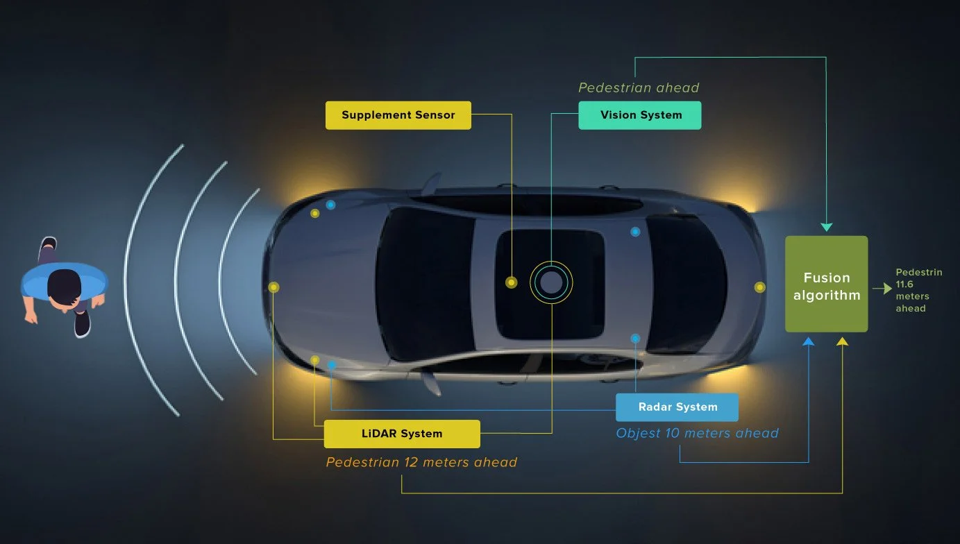
A practical example is autonomous driving. Cameras provide detailed images of road markings and traffic lights. LiDAR offers precise three-dimensional maps of the surroundings. RADAR supplies depth and velocity information even in poor weather. Together, these complementary inputs create a robust perception system capable of handling the complexity of real-world driving.

Why Multiple Sensors are Better Than One

Relying on a single sensor exposes systems to blind spots and vulnerabilities. Cameras, for example, provide rich semantic detail but struggle in low light or fog. LiDAR excels at generating precise depth information but can be costly and less effective in heavy rain. RADAR penetrates poor weather but lacks fine resolution. By combining these technologies, sensor fusion leverages strengths while compensating for weaknesses.

Redundancy and reliability

If one sensor fails or becomes unreliable due to environmental conditions, others can maintain system performance. This redundancy is essential for applications such as autonomous vehicles, where safety is paramount and failures cannot be tolerated.

Complementary sensing

Each sensor type captures a different aspect of the environment. LiDAR provides depth, cameras supply semantics like color and texture, and inertial measurement units (IMUs) track orientation and movement. Fusing these inputs produces a richer understanding than any single stream could provide.

Noise reduction

Individual sensors inevitably generate errors or false readings, but integrating data across multiple sources helps filter out anomalies and improve signal quality. This is particularly important in environments where accuracy is critical, such as industrial systems or surgical robotics.

Sensor Fusion Key Domains and Applications

Sensor fusion is not limited to a single industry. Its value is evident wherever accuracy, reliability, and resilience are mission-critical. The following domains illustrate how multiple sensors working together outperform single-sensor systems.

Autonomous Vehicles

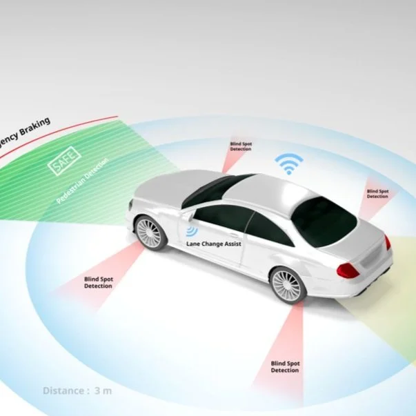
Autonomous driving is one of the most visible examples of sensor fusion in action. Cars integrate cameras, LiDAR, RADAR, GPS, and IMUs to perceive their surroundings and make real-time driving decisions. Cameras identify road signs and traffic lights, LiDAR provides precise 3D maps, RADAR measures speed and distance in poor weather, and IMUs track the vehicle’s orientation.

Robotics

Robots operating in unstructured environments face challenges that single sensors cannot overcome. Mobile robots often fuse cameras, LiDAR, and IMUs to navigate cluttered warehouses, hospitals, or outdoor terrain. This combination allows robots to avoid obstacles, map their surroundings, and move safely in real time.

Healthcare

In healthcare, precision and reliability are essential. Modern wearable devices integrate multiple biosensors, such as heart rate monitors, accelerometers, and oxygen sensors, to provide continuous patient monitoring.

Industrial and Manufacturing

Factories and production lines are adopting sensor fusion to drive efficiency and predictive maintenance. IoT-enabled facilities often combine pressure, vibration, and temperature sensors to anticipate machine failures before they occur.

Remote Sensing and Defense

Defense, aerospace, and environmental monitoring rely heavily on multi-platform fusion. Satellites, drones, and ground sensors collect data that is integrated for decision-making in scenarios ranging from disaster response to surveillance.

Major Challenges in Sensor Fusion

While the benefits of sensor fusion are clear, implementing it effectively is far from straightforward. The process introduces technical and operational challenges that can affect reliability, scalability, and cost.

Complexity and computational demands
Fusing data from multiple sensors requires significant processing power. Raw data streams must be synchronized, filtered, and integrated in real time, often under strict latency constraints. This increases the computational load and demands specialized hardware or optimized algorithms, particularly in safety-critical systems like autonomous vehicles.

Calibration issues
For fusion to work, sensors must be aligned both spatially and temporally. Even minor calibration errors can introduce distortions that degrade performance. For example, a camera and LiDAR mounted on the same vehicle must maintain perfect alignment to ensure depth data matches visual inputs. Maintaining this calibration over time, especially in harsh environments, remains a difficult problem.

Data overload
Multiple high-resolution sensors generate massive volumes of data. Managing bandwidth, storage, and processing pipelines is a constant challenge, especially when real-time decisions are required. In industrial environments, this data volume can overwhelm traditional infrastructure, forcing a shift to edge computing and advanced data management strategies.

Failure amplification
If not carefully managed, fusion can amplify sensor errors instead of correcting them. A poorly calibrated or faulty sensor can introduce noise that contaminates the fused output, leading to worse outcomes than relying on a single reliable sensor.

How We Can Help

Building effective sensor fusion systems depends on high-quality data. Cameras, LiDAR, RADAR, and biosensors all generate vast amounts of raw information, but without accurate labeling, integration, and processing, this data cannot be turned into actionable intelligence. This is where Digital Divide Data (DDD) provides critical value.

DDD specializes in supporting organizations that rely on sensor fusion by delivering:

  • Multimodal data annotation: Precise labeling for LiDAR point clouds, camera images, RADAR data, and IMU streams, enabling fusion algorithms to align and learn effectively.

  • Domain-specific expertise: Teams with experience across automotive, robotics, healthcare, industrial IoT, and defense ensure that annotations reflect real-world conditions and operational requirements.

  • Scalable workflows: Proven processes that can handle large, complex datasets while maintaining consistency and quality.

  • Quality assurance: Rigorous multi-step checks that ensure the reliability of labeled data, reducing downstream risks in model training and deployment.

By combining technical expertise with scalable human-in-the-loop processes, DDD helps organizations strengthen the data backbone of their fusion systems. This ensures that projects can move from development to deployment with confidence in both accuracy and safety.

Read more: Cuboid Annotation for Depth Perception: Enabling Safer Robots and Autonomous Systems

Conclusion

Sensor fusion is no longer an optional enhancement in advanced systems; it is a foundational requirement. The integration of multiple sensors provides the redundancy, accuracy, and resilience that modern applications demand. From autonomous vehicles navigating crowded roads, to robots operating in dynamic environments, to healthcare devices monitoring patient health, the ability to combine and interpret diverse streams of data has become essential.

As artificial intelligence matures, sensor fusion will shift from rigid, rule-based systems to adaptive models capable of learning from context and environment. This transition will deliver machines that are not only accurate but also more resilient, transparent, and trustworthy. Sensor fusion represents the bridge between raw sensing and meaningful intelligence, allowing machines to perceive and respond to the world with human-like robustness.

Looking to strengthen your AI systems with reliable, multimodal data for sensor fusion?

Partner with Digital Divide Data to power accuracy, safety, and scalability in your next-generation solutions.


References

MDPI. (2024). Advancements in sensor fusion for underwater SLAM: A review. Sensors, 24(11). https://doi.org/10.3390/s24113792

Science Times. (2024, June 17). Sensor fusion and multi-sensor data integration for enhanced perception in autonomous vehicles. Retrieved from https://www.sciencetimes.com

Samadzadegan, F., Toosi, A., & Dadrass Javan, F. (2025). A critical review on multi-sensor and multi-platform remote sensing data fusion approaches: Current status and prospects. International Journal of Remote Sensing, 46(3), 1327-1402. https://doi.org/10.1080/01431161.2024.2429784


FAQs

Q1. What is the difference between sensor fusion and sensor integration?
Sensor integration refers to the process of connecting different sensors so they can work within the same system, while sensor fusion goes a step further by combining the data from these sensors to produce more accurate and reliable results.

Q2. How does sensor fusion improve safety in autonomous systems?
By combining multiple data sources, fusion ensures that a single point of failure does not compromise the entire system. For example, if a camera is obstructed by glare, LiDAR and RADAR can still provide reliable data for navigation, reducing the risk of accidents.

Q3. How does edge computing relate to sensor fusion?
Since fusion requires real-time processing of large volumes of data, edge computing helps by bringing computation closer to the sensors themselves. This reduces latency and makes it possible to run fusion algorithms without depending on cloud infrastructure.

Q4. What role does machine learning play in sensor fusion today?
Machine learning, particularly deep learning, is increasingly used to replace or augment traditional fusion methods like Kalman filters. These models can learn complex, non-linear relationships between sensor inputs, improving performance in dynamic or uncertain environments.

Q5. Which industries are expected to adopt sensor fusion next?
Beyond current uses in vehicles, robotics, healthcare, manufacturing, and defense, sensor fusion is expected to see growth in smart cities, precision agriculture, and environmental monitoring, where diverse data sources must be combined for effective decision-making.

Sensor Fusion Explained: Why Multiple Sensors are Better Than One Read Post »

Stereo2BVision2Bin2BAutonomy

How Stereo Vision in Autonomy Gives Human-Like Depth Perception

Depth perception is fundamental to how humans interact with their environment. It allows us to judge distances, avoid obstacles, and manipulate objects with precision. For machines, replicating this ability is one of the most challenging and important tasks in computer vision. Without a reliable understanding of depth, even the most advanced robotic systems remain limited in how safely and effectively they can operate in dynamic, unstructured settings.

Stereo Vision addresses this challenge by enabling machines to see the world in three dimensions using two cameras positioned at a fixed distance apart. By comparing slight differences between the two camera views, systems can infer depth and create accurate 3D representations of their surroundings. Unlike monocular vision, which relies on inference and assumptions, or LiDAR, which requires active light emission and specialized sensors, Stereo Vision is passive, scalable, and often more cost-effective.

In this blog, we will explore the fundamental principles of Stereo Vision in Autonomy, the algorithms and pipelines that make it work, the real-world challenges it faces, and how it is being applied and optimized across industries to give machines truly human-like depth perception.

Understanding Stereo Vision in Autonomy

At its core, Stereo Vision is built on the concept of disparity, which refers to the small differences in how an object appears in the left and right camera images. Human eyes naturally use this principle to perceive depth. The brain compares the relative positions of features seen by each eye and interprets the differences as distance. Stereo Vision systems replicate this process by mathematically analyzing the offset between corresponding pixels in two images.

To make this work, Stereo Vision relies on epipolar geometry, the mathematical relationship between two camera perspectives. Once images are rectified, corresponding points from the left and right views are constrained to lie on the same horizontal line, drastically simplifying the search for matches. This rectification step transforms a complex 2D correspondence problem into a more manageable 1D problem along scanlines.

From disparity, depth is calculated using triangulation. The baseline, or distance between the two cameras, and the focal length of the lenses provide the geometric foundation for depth estimation. A larger baseline generally improves accuracy at longer distances, while a smaller baseline is better suited for near-field applications such as augmented reality or robotic grasping.

Building a Stereo Vision Pipeline for Autonomy

Developing a reliable Stereo Vision system requires more than placing two cameras side by side. It involves a carefully designed pipeline where each stage contributes to the accuracy and stability of the final depth output.

The process begins with camera synchronization and calibration. Both cameras must capture frames at precisely the same moment, and their internal parameters, such as focal length, lens distortion, and alignment, must be measured and corrected. Accurate calibration ensures that disparities correspond to true geometric differences rather than hardware inconsistencies.

Once calibration is complete, the next step is image rectification. This process transforms the images so that corresponding points lie on the same scanlines, making correspondence matching computationally efficient. Rectification also accounts for lens distortion, ensuring that straight lines in the scene remain straight in the images.

The core of the pipeline is correspondence matching, where the system searches for pixel pairs that represent the same feature in both images. The differences between these pairs form the disparity map, which is then converted into a depth map using the known baseline and camera parameters. Depth maps provide a metric representation of the environment that can be fed into higher-level perception and planning systems.

To make the system robust, confidence estimation and error handling are integrated into the pipeline. This involves filtering out unreliable matches caused by low texture, repetitive patterns, or occlusions. By flagging uncertain regions, the system can avoid misleading outputs and support safer decision-making in downstream tasks.

When combined, these steps form the backbone of a minimal Stereo Vision setup. Even at a prototype stage, a properly executed pipeline can deliver real-time depth perception that rivals more complex and expensive active sensing systems.

Algorithms for Stereo Vision

The effectiveness of Stereo Vision depends heavily on the algorithms used to match points across the two camera images and to interpret disparity into reliable depth. Over the years, two broad categories of approaches have emerged: classical methods and learning-based methods.

Classical Algorithms

Include block matching and semi-global matching. Block matching works by sliding a small window across the images to find corresponding regions, while semi-global matching improves accuracy by aggregating costs along multiple directions to enforce smoother and more consistent disparity maps. These methods are efficient and well understood, making them attractive for systems where resources are limited. However, they can struggle in challenging conditions such as low texture, repetitive patterns, or reflective surfaces.

Modern Deep Learning 

Cost volume networks use convolutional layers to construct and analyze a 3D volume of potential matches between image pairs, while attention-based models bring the ability to focus on relevant features and context. These methods significantly improve accuracy, generalization, and robustness to noise. They can also incorporate semantic information, enabling systems to reason about objects and scenes beyond raw geometry.

Real-World Challenges in Stereo Vision

While Stereo Vision provides a strong foundation for depth perception, deploying it in real environments exposes limitations that must be carefully addressed.

Low-texture Regions 

Major challenges arise in low-texture regions such as blank walls, smooth floors, or uniform surfaces. Without distinctive features, it becomes difficult to find reliable matches between the left and right images. Similarly, repetitive patterns such as tiles or grids can create ambiguous matches, leading to errors in the disparity map. Addressing these issues often requires advanced algorithms that integrate contextual cues or apply regularization to enforce consistency.

Reflective and Transparent Surfaces

Glass, mirrors, or shiny objects often appear differently between the two cameras or may not produce valid correspondences at all. This can result in missing or incorrect depth values. Systems designed for safety-critical applications must detect these conditions and apply fallback strategies rather than relying on uncertain data.

Lighting

Low light reduces image quality and increases noise, while high dynamic range scenes with bright and dark regions can overwhelm sensor capabilities. Without appropriate handling, depth maps in these conditions may be incomplete or unreliable. Techniques such as exposure control, HDR imaging, and noise reduction are essential for improving robustness.

Dynamic Environments

Motion blur caused by fast-moving objects or camera shake can degrade matching accuracy. Additionally, occlusions occur when parts of a scene are visible in one camera but not the other, creating regions with inherently missing data. Designing systems to handle temporal cues and maintain consistency across frames is key to overcoming these obstacles.

Read more: 3D Point Cloud Annotation for Autonomous Vehicles: Challenges and Breakthroughs

Integrating Stereo Vision into Autonomous Systems

Stereo Vision does not exist in isolation. Its true value is realized when depth maps and 3D reconstructions are integrated into larger perception and decision-making pipelines. Effective integration ensures that the raw depth information is transformed into actionable insights that enable autonomy and interaction.

Combining Stereo Vision with inertial measurement units (IMUs) and simultaneous localization and mapping (SLAM)

While Stereo Vision provides dense spatial information, IMUs contribute high-frequency motion data, and SLAM algorithms maintain a consistent map of the environment. Together, these elements create robust localization and navigation capabilities even in dynamic or partially observable spaces.

Foundation for 3D reconstructions

By aggregating depth data over time, systems can build point clouds, meshes, or voxel grids that represent the geometry of entire environments. These reconstructions support advanced functions such as obstacle avoidance, path planning, and detailed scene analysis.

Feeds directly into navigation and manipulation tasks

Collision detection, free space estimation, and object grasping all rely on accurate depth perception. Depth maps inform not only where obstacles are but also how they can be avoided or interacted with safely.

Deploying Stereo Vision on edge devices and embedded platforms requires optimization for resource efficiency. Depth pipelines must run in real time on hardware with limited compute and power budgets, such as embedded GPUs or NPUs. This involves balancing accuracy with throughput and ensuring that the entire system operates within the latency constraints necessary for safe autonomy.

When fully integrated, Stereo Vision enables machines to see and act in three dimensions with confidence. From drones navigating tight spaces to XR systems aligning virtual content with physical environments, integration is the step that transforms raw perception into intelligent action.

Read more: How Accurate LiDAR Annotation for Autonomy Improves Object Detection and Collision Avoidance

Performance and Optimization for Stereo Vision

Achieving high-quality depth perception through Stereo Vision is only part of the challenge. For systems operating in real-world environments, performance must also be optimized to meet strict requirements for speed, efficiency, and reliability. Without careful engineering, even accurate algorithms may fail to deliver usable results within operational constraints.

Latency

Depth maps must be generated quickly enough to support safe decision-making, whether it is a robot avoiding a moving obstacle or a vehicle detecting a pedestrian. Even small delays can reduce responsiveness and compromise safety. Throughput is equally important, as the system must maintain consistent frame rates without stalling under heavy workloads.

Memory and Compute Requirements

Stereo Vision algorithms, particularly deep learning models, often demand significant resources. Cost, volume, construction, and refinement can consume large amounts of memory, while complex neural networks may exceed the capabilities of embedded devices. Techniques such as tiling, streaming, or simplifying the cost-volume help reduce these demands without sacrificing accuracy.

Model Optimization

Compression techniques like quantization, pruning, and distillation reduce model size and computation while preserving accuracy. Operator fusion and hardware-aware optimizations further accelerate inference, enabling deployment on edge platforms.

Power and Thermal Management

Embedded systems often operate in environments where power is limited and cooling options are minimal. Efficient algorithms and hardware acceleration ensure that depth pipelines can run continuously without overheating or draining batteries too quickly.

Defining service-level objectives early helps guide optimization efforts. Metrics such as maximum latency, minimum frame rate, and acceptable depth error provide clear targets for engineering teams. By designing with these constraints in mind, Stereo Vision systems can achieve the balance of accuracy and efficiency required for real-world applications.

Applications of Stereo Vision

The versatility of Stereo Vision makes it a valuable tool across a wide range of industries. By enabling machines to perceive depth in a way that closely mirrors human vision, it unlocks capabilities that support autonomy, precision, and safety.

Robotics

Stereo Vision is used for obstacle avoidance, object manipulation, and navigation in dynamic environments. Robots can move through cluttered spaces, identify grasp points for picking tasks, and operate safely alongside humans. The passive nature of stereo cameras also makes them suitable for indoor and warehouse operations where active sensing may be disruptive.

Autonomous vehicles rely on Stereo Vision for near-field perception, detecting small obstacles, curbs, or road debris that might be missed by longer-range sensors. Depth information from stereo cameras complements other modalities, such as LiDAR and radar, by providing dense spatial detail at short to medium distances. This combination enhances safety and improves decision-making in complex traffic conditions.

Drones

Stereo Vision provides lightweight and power-efficient depth perception for mapping, navigation, and precision landing. Unlike heavy active sensors, stereo rigs can be deployed on small aerial platforms without significantly affecting flight time or maneuverability. Stereo-based depth also supports autonomous inspection of infrastructure, agriculture monitoring, and environmental surveys.

Extended Reality (XR)

Depth perception enables room-scale mapping, realistic occlusion handling, and accurate tracking of hands and objects. These capabilities are crucial for immersive experiences where the boundary between the virtual and real worlds must be seamless.

The Future of Stereo Vision in Autonomy

Stereo Vision is advancing rapidly, driven by improvements in algorithms, sensor technology, and system integration. Future developments will push the boundaries of accuracy, adaptability, and scale, making depth perception even more human-like and reliable.

One major trend is the rise of large-scale foundation models trained specifically for Stereo Vision. These models can generalize across diverse environments with minimal adaptation, reducing the need for costly task-specific data collection. They are expected to deliver consistent performance even under challenging conditions, such as unusual textures or extreme lighting.

All-weather and cross-spectral perception will further expand Stereo Vision’s utility. By combining visible spectrum cameras with thermal, infrared, or gated sensors, systems will be able to operate seamlessly in fog, rain, darkness, or glare. This fusion enables around-the-clock reliability for safety-critical applications like autonomous vehicles and defense tech.

Omnidirectional rigs are another area of progress. By capturing a full 360-degree view of the environment, Stereo Vision systems will eliminate blind spots and deliver comprehensive scene awareness. This capability is particularly valuable for robots and drones operating in dynamic environments where threats or obstacles may come from any direction.

A growing focus is also on depth and motion fusion. Instead of treating geometry and movement separately, future systems will jointly model depth and temporal changes, creating what is sometimes referred to as four-dimensional perception. This approach enhances the ability to track dynamic scenes and anticipate interactions in real time.

Simulation and synthetic data will play a larger role in training and validation. Synthetic environments allow developers to generate edge cases that are rare in real-world data, such as extreme weather or unusual objects. This approach accelerates development while improving robustness and safety.

Taken together, these advancements point toward Stereo Vision becoming a core enabler of autonomy, XR, and advanced robotics. Its future lies in systems that are not only more accurate but also more resilient, scalable, and adaptable to the complexities of the real world.

How We Can Help

Digital Divide Data (DDD) supports organizations building Stereo Vision systems by providing ML Model Development Solutions that improve accuracy, robustness, and scalability for autonomous systems. DDD enables dataset diversity by curating real-world imagery across lighting conditions, environments, and object types. This ensures that Stereo Vision systems perform reliably under domain shifts such as poor weather, low light, or reflective surfaces.  DDD also offers ongoing validation services, helping organizations monitor system performance and recalibrate datasets over time.

By partnering with DDD, companies can accelerate Stereo Vision development cycles while maintaining rigorous quality standards. This reduces both time to deployment and the risks associated with unreliable perception in safety-critical applications.

Conclusion

Stereo Vision has emerged as one of the most practical and effective approaches for giving machines human-like depth perception. By leveraging two cameras and the principles of geometry, it enables an accurate three-dimensional understanding without the cost and complexity of active sensing technologies. As performance improves and new modalities emerge, Stereo Vision will play an increasingly central role in enabling machines to navigate, interact, and make decisions with confidence.

Achieving truly human-like depth perception is not just about building better algorithms. It requires aligning optics, geometry, and AI, supported by rigorous testing and operational safeguards. Organizations that adopt Stereo Vision today are positioning themselves to benefit from its rapid advancements and future-proof their systems for the next generation of autonomy and immersive technology.

Partner with DDD to build Stereo Vision datasets that give your machines truly human-like depth perception.


References

EPFL. (2025). HELVIPAD: A dataset for omnidirectional stereo depth estimation. Proceedings of the IEEE/CVF Conference on Computer Vision and Pattern Recognition (CVPR). Retrieved from https://cvpr.thecvf.com

Bonghi, R. (2025, June 17). R²D²: Building AI-based 3D robot perception and mapping with NVIDIA Research. NVIDIA Developer Blog. https://developer.nvidia.com/blog/r2d2-building-ai-based-3d-robot-perception-and-mapping-with-nvidia-research/

Tosi, F., Bartolomei, L., & Poggi, M. (2024, July 10). A survey on deep stereo matching in the twenties (arXiv preprint arXiv:2407.07816). arXiv. https://arxiv.org/abs/2407.07816


FAQs

Q1. How does Stereo Vision compare to LiDAR in terms of cost and scalability?
Stereo Vision is generally less expensive and easier to scale because it uses passive cameras rather than specialized active sensors. While LiDAR provides high accuracy at long ranges, Stereo Vision offers denser near-field perception at lower cost.

Q2. Can Stereo Vision systems operate effectively at night?
Standard stereo cameras struggle in complete darkness, but performance can be extended with infrared illumination, thermal cameras, or cross-spectral setups that combine visible and non-visible light.

Q3. What level of computing power is required for modern Stereo Vision pipelines?
Requirements vary widely. Classical methods can run on modest CPUs, while deep learning approaches often require embedded GPUs or NPUs. Optimization techniques such as quantization and pruning make advanced models feasible on edge devices.

Q4. How long does it take to calibrate a Stereo Vision system?
Initial calibration can be done in under an hour with the right tools. However, systems in production should include mechanisms for periodic recalibration or automated drift detection to maintain accuracy.

Q5. Is Stereo Vision suitable for outdoor environments with weather variability?
Yes, with the right design. Rugged enclosures, HDR sensors, and cross-spectral setups allow Stereo Vision to function in rain, fog, and bright sunlight. Event-based cameras further extend the capability under extreme lighting.

How Stereo Vision in Autonomy Gives Human-Like Depth Perception Read Post »

Multisensordatalabeling

Challenges of Synchronizing and Labeling Multi-Sensor Data

By combining data from cameras, LiDAR, radar, GPS, and inertial sensors, Multi-sensor systems provide a more complete and reliable picture of the world than any single sensor can achieve. They are central to the functioning of autonomous vehicles, humanoids, and defense tech, and smart infrastructure, where safety and accuracy depend on capturing complex, real-world environments from multiple perspectives.

The power of sensor fusion lies in its ability to build redundancy and resilience into perception. If a camera struggles in low light, LiDAR can provide depth information. If LiDAR fails to capture fine details, radar can deliver robust detection under poor weather conditions. Together, these technologies make decision-making systems more trustworthy and less prone to single points of failure.

However, the benefits of multi-sensor fusion are only realized if the data from different sensors can be synchronized and labeled correctly. Aligning multiple data streams in both time and space, and then ensuring that annotations remain consistent across modalities, has become one of the most difficult and resource-intensive challenges in deploying real-world AI systems.

This blog explores the critical challenges that organizations face in synchronizing and labeling multi-sensor data, and why solving them is essential for the future of autonomous and intelligent systems.

Why Synchronization in Multi-Sensor Data Matters

At the heart of multi-sensor perception lies the challenge of aligning data streams that operate at different speeds. Cameras often capture 30 frames per second, LiDAR systems may generate scans at 10 hertz, while inertial sensors produce hundreds of measurements each second. If these data streams are not carefully aligned, the system may attempt to interpret events that never occurred in the same moment, leading to a distorted view of reality.

Each sensor has its own internal clock, and even small timing differences accumulate into significant errors over time. Transmission delays from hardware, networking, or processing pipelines add further uncertainty. A system that assumes perfect synchronization risks misjudging the position of an object by several meters simply because the data was captured at slightly different moments.

These misalignments have real-world consequences. A pedestrian detected by a camera but not yet seen by LiDAR may cause an autonomous vehicle to hesitate or make an unsafe maneuver. A drone navigating in windy conditions may miscalculate its trajectory if inertial and GPS signals are out of sync. In safety-critical systems, even millisecond errors can cascade into poor perception, faulty tracking, or incorrect predictions.

Synchronization is therefore not just a technical detail, but a foundation for trust. Without reliable alignment, sensor fusion cannot function as intended, and the entire perception pipeline becomes vulnerable to inaccuracies.

Spatial Alignment and Calibration in Multi-Sensor Data

Synchronizing sensors in time is only one part of the challenge. Equally important is ensuring that data from different devices aligns correctly in space. Each sensor operates in its own coordinate system, and without careful calibration, their outputs cannot be meaningfully combined.

Two kinds of calibration are essential. Intrinsic calibration deals with the internal properties of a sensor, such as correcting lens distortion in a camera or compensating for systematic measurement errors in a LiDAR. Extrinsic calibration focuses on the spatial relationship between sensors, defining how a camera’s view relates to the three-dimensional space captured by LiDAR or radar. Both must be accurate for multi-sensor fusion to function reliably.

The complexity grows when multiple modalities are involved. A camera provides a two-dimensional projection of the world, while LiDAR produces a sparse set of three-dimensional points. Radar adds another dimension by measuring velocity and distance with lower resolution. Mapping these diverse representations into a unified spatial frame is computationally demanding and highly sensitive to calibration errors.

In real-world deployments, calibration does not remain fixed. Vibrations from driving, temperature fluctuations, or even minor impacts can shift sensors slightly out of alignment. These small deviations may not be noticeable at first but can lead to substantial errors over time. Maintaining accurate calibration requires not only precise setup during installation but also periodic recalibration or the use of automated self-calibration techniques in the field.

Spatial alignment and calibration are therefore continuous challenges. Without them, synchronized data streams still fail to align, undermining the very foundation of multi-sensor perception.

Data Volume and Infrastructure Burden

Beyond synchronization and calibration, one of the most pressing challenges in multi-sensor systems is the sheer scale of data they generate. A single high-resolution camera can produce gigabytes of video in just a few minutes. Add multiple cameras, LiDAR scans containing hundreds of thousands of points, radar sweeps, GPS streams, and IMU data, and the result is terabytes of information being produced every day by a single platform.

This volume creates immediate infrastructure strain. Streaming large amounts of data in real time requires high-bandwidth networks, which may not always be available in the field. Storage quickly becomes a bottleneck as fleets or robotic systems scale up, forcing organizations to invest in specialized hardware and compression strategies to keep data manageable. Even after data is collected, replaying and analyzing synchronized streams can overwhelm conventional computing resources.

While handling the output of a single prototype system may be feasible, expanding to dozens or hundreds of units multiplies both the data volume and the engineering effort required to process it. Fleets of autonomous vehicles or large-scale robotic deployments demand infrastructure capable of handling synchronized multi-sensor data at an industrial scale.

Without a robust infrastructure for managing this data, synchronization and labeling efforts can stall before they begin. Effective solutions require not only technical methods for aligning and annotating data, but also scalable systems for moving, storing, and processing the information in the first place.

Labeling Across Modalities for Multi-Sensor

Once data streams are synchronized and calibrated, the next challenge is creating consistent labels across different sensor modalities. This task is far more complex than labeling a single dataset from one sensor type. A bounding box drawn around a vehicle in a two-dimensional camera image must accurately correspond to the same vehicle represented in a LiDAR point cloud or detected by radar. Any misalignment results in inconsistencies that weaken the training data and undermine model performance.

The inherent differences between modalities add to the difficulty. Cameras capture dense, detailed images of every pixel in a scene, while LiDAR provides a sparse but geometrically precise map of points. Radar contributes distance and velocity information, but with far less spatial resolution. Translating annotations across these diverse data types requires specialized tools and workflows to ensure that one object is labeled correctly everywhere it appears.

Human annotators face a significant cognitive load in this process. Interpreting and labeling fused data demands constant switching between modalities, perspectives, and representations. Unlike labeling a single image, multi-sensor annotation requires reasoning about depth, perspective, and cross-modality consistency simultaneously. Over time, this complexity can lead to fatigue, higher error rates, and inconsistencies across the dataset.

Accurate cross-modal labeling is essential for developing reliable perception systems. Without it, even perfectly synchronized and calibrated data cannot fulfill its potential, as the downstream models will struggle to learn meaningful representations of the real world.

Noise, Dropouts, and Edge Cases

Even when sensors are carefully synchronized and calibrated, their outputs are never perfectly clean. Each modality carries its own vulnerabilities. Cameras are affected by changes in lighting, glare, and shadows. LiDAR struggles with highly reflective or absorptive surfaces, producing gaps or spurious points. Radar can be confused by multipath reflections or interference in complex environments. These imperfections introduce uncertainty that complicates both synchronization and labeling.

Temporary sensor failures, or dropouts, create additional challenges. In real-world deployments, a camera may briefly lose exposure control, a LiDAR might skip a frame, or a radar might fail to return usable signals. When one sensor drops out, the task of aligning and labeling across modalities becomes inconsistent, and downstream models must compensate for incomplete inputs. Reconstructing reliable data streams under these conditions is difficult and often requires fallback strategies.

Edge cases amplify these issues. Rare scenarios such as unusual weather conditions, fast-moving objects, or crowded environments test the limits of both the sensors and the synchronization pipelines. These cases often expose weaknesses that remain hidden in controlled testing, yet they are precisely the scenarios that autonomous and robotic systems must handle reliably.

Addressing noise, dropouts, and edge cases is therefore not optional but central to building trust in multi-sensor systems. Without robust strategies to manage imperfections, synchronized and labeled data will fail to represent the realities of deployment environments.

Generating Reliable Ground Truth

Reliable ground truth is the benchmark against which perception systems are trained and evaluated. In the context of multi-sensor data, producing this ground truth is particularly demanding because it requires consistency across time, space, and modalities. Unlike single-sensor datasets, where annotations can be applied directly to a single stream, multi-sensor setups demand multi-stage pipelines that ensure alignment between different forms of representation.

Creating such pipelines involves carefully cross-checking annotations across modalities. A pedestrian labeled in a camera image must be accurately linked to the corresponding points in LiDAR and any detections from radar. These checks are not simply clerical but essential to prevent systematic labeling errors from cascading through entire datasets. Each stage adds cost, complexity, and the need for rigorous quality assurance.

Dynamic scenes make this process even more complex. Fast-moving objects, occlusions, and overlapping trajectories can cause labels to become inconsistent across frames and modalities. Ensuring temporal continuity while maintaining spatial precision requires sophisticated workflows that combine automated assistance with human oversight.

Uncertainty is another factor that cannot be ignored. Some scenarios do not allow for precise labeling, such as partially visible objects or sensor measurements degraded by noise. Forcing deterministic labels in such cases risks introducing artificial precision that misleads the model. Representing uncertainty, whether through probabilistic annotations or confidence scores, provides a more realistic foundation for training and evaluation.

Reliable ground truth is therefore not just a product of annotation but a process of validation, consistency checking, and uncertainty management. Without this level of rigor, synchronized and calibrated multi-sensor data cannot be fully trusted to support safe and scalable AI systems.

Tooling and Standardization Challenges of Multi Sensor Data

Even with synchronization, calibration, and careful labeling in place, the practical work of managing multi-sensor data is often slowed by limitations in tooling and a lack of standardization. Most annotation and processing tools were designed for single modalities, such as 2D image labeling or 3D point cloud analysis, and are not well-suited to handling both simultaneously. This forces teams to work with fragmented toolchains, exporting data from one platform and re-importing it into another, which increases complexity and the risk of errors.

The absence of widely accepted standards compounds this issue. Different organizations and industries frequently adopt proprietary data formats, labeling schemas, and metadata conventions. As a result, datasets cannot be easily shared or reused across projects, and tooling built for one environment often cannot be applied in another without significant adaptation. This lack of interoperability slows research, inflates costs, and reduces opportunities for collaboration.

Operational scaling brings another layer of difficulty. Managing multi-sensor synchronization and labeling across a small pilot project is one challenge, but doing so across hundreds of vehicles, drones, or industrial robots requires infrastructure that is both robust and flexible. Automated validation pipelines, scalable data storage, and consistent quality control processes must be in place to handle the growth, yet many existing toolsets are not designed to support such scale.

Without better tools and stronger standards, the gap between research prototypes and deployable systems will remain wide. Closing this gap is essential to make multi-sensor synchronization and labeling both efficient and repeatable in real-world applications.

Read more: How Data Labeling and Real‑World Testing Build Autonomous Vehicle Intelligence

Emerging Solutions for Multi Sensor Data

Despite the challenges, promising solutions are beginning to reshape how organizations approach multi-sensor synchronization and labeling.

Using automation and self-supervised methods

Algorithms can now align data streams by detecting common features across modalities, reducing reliance on manual calibration and lowering the risk of drift in long-term deployments. These approaches are particularly valuable for large-scale systems where manual recalibration is impractical.

Integrated annotation environments

Instead of forcing annotators to switch between 2D image tools and 3D point cloud platforms, object-centric systems allow a single label to propagate across modalities automatically. This not only improves consistency but also reduces cognitive load, making large annotation projects more efficient and less error-prone.

Synthetic and simulation-based data

Digital twins enable testing of synchronization and labeling workflows under controlled conditions, where variables such as sensor noise, lighting, and weather can be manipulated without risk. While synthetic data cannot fully replace real-world examples, it plays an important role in filling gaps and stress-testing systems before deployment.

Finally, there is momentum toward standardization. Industry and research communities are working to define common data formats, labeling conventions, and interoperability protocols. Such efforts are essential to break down silos, enable collaboration, and accelerate progress across sectors.

Looking forward, these innovations point to a future where synchronization and labeling become less of a bottleneck and more of a streamlined, repeatable process. As methods mature, multi-sensor AI systems will gain the reliability and scalability needed to support autonomy, robotics, and other mission-critical applications at scale.

How We Can Help

Digital Divide Data (DDD) supports organizations in overcoming the practical hurdles of synchronizing and labeling multi-sensor data. Our expertise lies in managing the complexity of multi-modal annotation at scale, ensuring that datasets are both consistent and production-ready.

Our teams are trained to handle cross-modality challenges, linking objects seamlessly across camera images, LiDAR point clouds, and radar data. By combining skilled human annotators with workflow automation and quality control systems, DDD reduces errors and accelerates turnaround times. This approach allows clients to focus on advancing their models rather than struggling with fragmented or inconsistent datasets.

Conclusion

Synchronizing and labeling multi-sensor data is one of the most critical challenges in building trustworthy perception systems. The technical hurdles span temporal alignment, spatial calibration, data volume management, cross-modal labeling, and resilience against noise and dropouts. Each layer introduces complexity, yet each is essential for ensuring that downstream models receive accurate, consistent, and reliable information.

Success in this space requires balancing technical innovation with operational discipline. Advances in automation, integrated annotation platforms, and synthetic data are helping to reduce manual effort and error rates. At the same time, organizations must adopt rigorous pipelines, scalable infrastructure, and clear quality standards to handle the realities of deployment at scale.

As these solutions mature, the industry is steadily moving away from treating synchronization and labeling as fragile bottlenecks. Instead, they are becoming core enablers of multi-sensor AI systems that can be trusted to operate in safety-critical domains such as autonomous vehicles, robotics, and defense. With robust foundations in place, multi-sensor perception will shift from a research challenge to a reliable backbone for intelligent systems in the real world.

Partner with Digital Divide Data to build the reliable data foundation your autonomous, robotic, and defense applications need.


References

Brödermann, T., Bruggemann, D., Sakaridis, C., Ta, K., Liagouris, O., Corkill, J., & Van Gool, L. (2024). MUSES: The multi-sensor semantic perception dataset for driving under uncertainty. In European Conference on Computer Vision (ECCV 2024). Springer. https://muses.vision.ee.ethz.ch/pub_files/muses/MUSES.pdf

Basawapatna, G., White, J., & Van Hooser, P. (2024, September). Wireless precision time synchronization alternatives and performance. Riverside Research Institute. Proceedings of the ION GNSS+ Conference. Retrieved from https://www.riversideresearch.org/uploads/Academic-Paper/ION_2024_RRI.pdf

Wiesmann, L., Labe, T., Nunes, L., Behley, J., & Stachniss, C. (2024). Joint intrinsic and extrinsic calibration of perception systems utilizing a calibration environment. IEEE Robotics and Automation Letters, 9(4), 3102–3109. https://www.ipb.uni-bonn.de/wp-content/papercite-data/pdf/wiesmann2024ral.pdf


FAQs

How do organizations typically validate synchronization quality in multi-sensor systems?
Validation often involves using calibration targets, reference environments, or benchmarking against high-precision ground truth systems. Some organizations also employ automated scripts that check for time or spatial inconsistencies across modalities.

What role does edge computing play in managing multi-sensor data?
Edge computing enables preprocessing and synchronization closer to where data is collected. This reduces bandwidth requirements, lowers latency, and ensures that only refined or partially fused data is transmitted to central systems for further analysis.

Are there cost considerations unique to multi-sensor labeling projects?
Yes. Multi-sensor labeling is more resource-intensive than single-modality annotation due to the added complexity of ensuring cross-modal consistency. Costs are influenced by the number of modalities, annotation complexity, and the need for specialized tooling.

Can machine learning models assist in reducing human effort for cross-modal labeling?
They can. Automated pre-labeling and self-supervised methods can generate initial annotations that are then refined by human annotators. This hybrid approach reduces time and improves efficiency, although quality control remains essential.

What industries outside of autonomous driving benefit most from multi-sensor synchronization and labeling?
Defense systems, industrial robotics, logistics, smart infrastructure, and even healthcare imaging applications benefit from synchronized and consistently labeled multi-sensor data, as they all rely on robust perception under varied conditions.

How often should multi-sensor systems be recalibrated in real-world deployments?
The frequency depends on the environment and use case. Mobile platforms exposed to vibration or temperature changes may require frequent recalibration, while static installations can operate with less frequent adjustments. Automated recalibration methods are increasingly being used to reduce downtime.

Challenges of Synchronizing and Labeling Multi-Sensor Data Read Post »

DDD2Bmulti2Bsensor2Bfusion

Multi-Sensor Data Fusion in Autonomous Vehicles — Challenges and Solutions

Autonomous driving remains a rapidly evolving field and automotive multi-sensor systems are needed to navigate or comprehend the field of vision. With the trend focusing on advanced technologies from manufacturers and policymakers, the use of multi-sensor data fusion has become critical. These techniques fuse information from multiple sensors to create a 360° view of a vehicle’s environment, which is necessary for safe and reliable autonomous vehicles.

Nevertheless, the combination of the various data streams poses a significant challenge due to the complexity and the variability of the sensor outputs. In this blog, we will discuss some of the challenges in fusing data from different sensors. At the same time, explore scalable recommendations on how to combine these technologies, and explain why fusing multiple sensors is important for autonomous driving.

Importance of Multi-Sensor Data Fusion in Autonomous Driving

 Multi-Sensor Data Fusion

Multi-sensor data fusion is a key element to improve safety and reliability for autonomous vehicles offering driverless cars a multitude of sensors to safely navigate their environment. LIDAR excels at producing precise 3D maps of the environment, while radar is ideal at measuring the distance and speed of nearby objects. Cameras on the other hand do not have the resolution of LIDAR or radar, but they are critical in producing a rich amount of visual information.

These sensors complement each other helping the vehicle understand much more than any single sensor ever could. As an example, cameras deliver rich information regarding the visual environment where the car is driving. However, radar provides reliable measurements of targets and speeds, which is important for making dynamic driving decisions.

Synthesizing this data from sensors helps the ADAS to make better decisions and improves situational awareness and reliability. This multi-sensor fusion is an important aspect to overcome the limitation of depending on one type of sensor that may not have the necessary data for autonomous vehicles.

But sensor fusion is more than just data collection; the data must be computed, interpreted, and acted upon constantly due to the fact that driving situations change in real-time. The ability to compute data in real-time is critical for self-driving cars to understand their environment and react accordingly.

With the increasing automation of vehicles, the requirement for more advanced and dependable sensor systems becomes even more critical. To gain the household assurance of the general public on self-sufficient vehicles and perform properly in varied weather conditions, high-performing multi-sensor model systems are inevitable. Therefore, multi-sensor data fusion is necessary for the evolution of autonomous driving systems that can consistently provide safer, and reliable transportation solutions.

Challenges in Interlinking Multi-Sensor Data Fusion

The primary challenge in autonomous vehicles is fusing data from multiple sensors, mainly due to the diffidence in the sensor technologies. Lidars, radars, cameras, and other sensors all have different principles of operation and yield data at different times, formats, and dimensions. In turn, this combination requires an accurate per-sensor type real-world analysis to provide reliable asynchronous detections, which are then needed as input to implement the reliable behavior for autonomous systems.

Let’s discuss more challenges in multi-sensor data fusion in autonomous vehicles:

Overcoming Sensor Diversity

To ensure a safe and efficient functioning, autonomous vehicles make use of a host of sensors. These sensors include lidars, radars, vision sensors, and many more which have different accuracy, resolution, and noise characteristics, making data fusion a very difficult task. As an example, a radar system that is great at distance detection in bad weather and a vision sensor is adequate at providing information in normal conditions to return great imagery. Merging these different streams of data together requires a strong method capable of managing the inconsistencies between sensor outputs.

Response to these challenges requires the development of algorithms that would provide general functions to accommodate the heterogeneous properties of sensor outputs. This software layer is an intermediary step that essentially transforms diverse data into a common format that can be leveraged by the decision-making algorithms running on the car. Moreover, modeling each sensor to make reliable models is also essential. Such autonomous models assist in classifying and processing data from these sensors efficiently and make the integration process more convenient.

Simplifying Data Integration & Alignment

Performing effective multi-sensor data fusion demands greater attention to detail while syncing and aligning data. Even when all sensors are synchronized to a central clock, timing discrepancies can occur because of the different speeds in data collection for different sensors. For some, data from camera and RF classifiers are usually processed sooner than lidar data, and there is potential for temporal mismatch.

It is an essential requirement to correct these discrepancies to ensure the credibility of the data fusion process. This means preprocessing all the temporal and spatial data from the sensors to make sure everything is correct and updated in real-time. Keeping this data in sync is important for the vehicle navigation system that makes safe and efficient decisions when executing maneuvers. Proper alignment contributes to error reduction and system efficiency and consequently leads to safer autonomous driving.

If these technical issues are tackled with the right solution and software tools, it’s possible to make multi-sensor data integration significantly better. This enhances both the operational dependability of autonomous vehicles and their effectiveness and safety, thus enabling the proliferation of this transformative technology.

Techniques and Strategies for Resolving Interlinking Challenges

Data from multiple sensors and input delivery technology systems that process streams of diverse information face significant challenges in integrating sensor data. That means addressing these issues is key to enabling the effectiveness and efficiency of operations. Below are a few of the methods to address these issues.

Sensor Calibration for Data Synergy

Sensor calibration is one of the most important things that helps align and merge the data from different sensors accurately. This process calibrates the sensors to give accurate measurements for physical quantities, making it essential that devices give similar outputs when they are identical. However, two types of calibration help with this process. They are as follows.

Static Calibration: This includes fixating static parameters of sensors such as internal bias values, and others to calibrate inherent inaccuracies. For example, calibrating inertial sensors, for instance, so that they do not have a bias that impacts readings.

Dynamic Calibration: This includes calibrating factors that are time-varying to establish methods for real-time processing of the sensor outputs using dynamic calibration, this allows data to remain accurate even with the impact of external parameters.

By fine-tuning not only the static characteristic of a sensor but also its dynamic behavior, the data quality can be improved, and proper data fusion is achieved from independent sources.

Read more: Utilizing Multi-sensor Data Annotation To Improve Autonomous Driving Efficiency

Improving data fusion with the help of Deep Learning

Deep learning has changed the way the systems analyze and study huge data sets. Ever since the early 20’s, this method has been beneficial for the fusion of data from multiple sensors because it can autonomously learn features from large datasets and manipulate them. Some of the benefits of deep learning multi-sensor fusion techniques include:

Feature Hierarchies: Deep learning algorithms automatically develop layered terms of data features. These captured levels comprise abstraction, which can be fundamental in integrating and interpreting sensor data.

High-Dimensional: Deep learning handles high-dimensional data naturally from regular sensors, making it a suitable candidate for fusion tasks. This allows the system to identify intricate patterns and connections that may not be captured by conventional approaches.

Use in Sensor Fusion: Deep learning frameworks have successfully been applied to a combination of sensors that include radar, LiDAR, ultrasonics, and others. Thus, resulting in an enhanced understanding of the environment and more informed decision-making in sensor-dependent systems.

Fusing the data of multiple sensors helps improve the functionality and accuracy of a technology system to a great extent. It offers a systematic approach to managing the complexities associated with the various data types involved, ensuring that systems can manage complexity in a seamless and efficient manner.

Read more: Data Annotation Techniques in Training Autonomous Vehicles and Their Impact on AV Development

Conclusion

Multi-sensor data fusion is essential to improve the quality of sensor outputs, making them more accurate and reliable in delivering information allowing innovations in autonomous systems. While substantial strides have been achieved in tackling the complexities of multi-sensor data integration, some challenges still exist. Over the past decade, many of the problems have been resolved by automotive engineers, but some remain and continue to be the focus of continuous research and development.

At Digital Divide Data, we focus on calibrating different sensors with data training and multi-sensor data fusion techniques. To learn more about how we can help you calibrate multiple sensors you can talk to our experts.

Multi-Sensor Data Fusion in Autonomous Vehicles — Challenges and Solutions Read Post »

Digital2BDivide2BData2BMulti2BSensor2BFusion

Utilizing Multi-sensor Data Annotation To Improve Autonomous Driving Efficiency

Autonomous vehicle sensors such as LiDAR, radar, and cameras detect objects in highly dynamic scenarios. These objects can be cars, motorbikes, pedestrians, traffic signs, roadblocks, etc. To improve the reliability of these autonomous driving systems it’s critical to improve the accuracy of the final result when performing multi-sensor data annotation.

In this blog, we will briefly discuss the implementation of LiDAR, radar, and cameras in autonomous driving and how to improve AD efficiency using multi-sensor data annotation.

What is LiDAR?

LiDAR or Light Detection and Ranging, is a remote sensing technology that uses advanced laser beams to quickly scan surrounding environments and calculate distance by measuring the time it takes for the light to reach back. Each laser pulse in LiDAR reflects off different wavelengths and surfaces, measuring precise location mapping. These collected data points create a point cloud that forms an accurate 3D depiction of the scanned objects.

How is LiDAR used in Autonomous Driving?

LiDAR sensors receive real-time data from thousands of laser pulses every second, it uses an onboarding system to analyze these ‘point clouds’ to animate a 3D representation of the surrounding terrain or environment. To ensure that LiDAR technology can create accurate 3D representations training is required to onboard AI models with annotated point cloud datasets. This annotated data allows ADAS to identify, detect, and classify different objects in the environment. For example; image and video annotations help autonomous vehicles to accurately identify road signs, moving lanes, objects, traffic flow, etc.

What is LiDAR Annotation?

LiDAR annotation is also known as point cloud annotation, this process classifies the point cloud data generated through LiDAR sensors. During this annotation process, each point is assigned a unique label, such as “pedestrian”, “roadblock”, “building”, “vehicle”, etc. These labeled data points are important to train machine learning models, giving them necessary information about the location and nature of the object present in the real world. In autonomous vehicles, accurate LiDAR annotations allow systems to identify road signs, pedestrians, and moving vehicles, therefore allowing safe navigation. To achieve an accurate understanding of the scene and to recognize objects a high quality of LiDAR annotation is required.

Use of Camera in Autonomous Driving

Cameras can be termed as the most adopted technology for perceiving surroundings for an autonomous vehicle. A camera detects lights emitted from the environment on a photosensitive surface through a camera lens to produce clear images of the surroundings. Cameras are relatively cost-effective and allows the system to identify traffic lights, road lanes, traffic signals. In some autonomous applications, more advanced monocular cameras are used for dual-pixel autofocus hardware, collecting depth information and calculating complex algorithms. For most effective utilization two cameras are installed in autonomous vehicles to form a binocular camera system.

Cameras are ubiquitous technology that delivers high-resolution images and videos, including the texture and color of the perceived surroundings. The most common use of cameras in autonomous vehicles is detecting traffic signs and recognizing road markings.

Using Radar in Autonomous Driving

Radar uses the Doppler property of EM waves to specify the relative position and relative speed of the detected objects. Doppler shift or Doppler effect refers to the deviations or shifts in wave frequencies due to relative motion between a moving target and wave source. For example; the frequency of the signal received shows shorter waves as the signal increases and moves toward the direction of the radar system. The Radar sensors in autonomous vehicles are integrated into several locations such as, near the windshield and behind the vehicle bumper. These radar sensors detect any moving objects that come closer to the sensors integrated with the autonomous system.

What is Sensor Fusion?

Sensor fusion is the process of collecting inputs from Radar, LiDAR, Camera, and Ultrasonic sensors collectively, to interpret surroundings accurately. As it’s difficult for each sensor to deliver all the information individually these sensors need to fuse together to provide the highest degree of safety in autonomous vehicles.

Sensor calibration is the foundation block of all autonomous systems and is a requisite step before implementing sensor fusion algorithms or techniques for autonomous driving systems. This informs the AD system about the sensor’s orientation and position in the real-world coordinates by comparing the relative position of known features as detected by the sensors. Precise sensor calibration is critical for sensor fusion and implementation of ML algorithms for localization and mapping, object detection, parking assistance, and vehicle control.

How is Sensor Fusion Executed?

There are three major approaches for combining multi-sensor data from different sensors.

High-Level Fusion: In the HLF approach, each sensor performs object detection, and subsequently fusion is achieved. HLF approach is most suitable for a lower relative complexity. When there are several overlapping obstacles, HLF delivers inadequate information.

Low-Level Sensor Fusion: In the LLF approach, data from each sensor are fused at the lowest level of raw data or abstraction. This allows all information to be retained and can potentially improve the accuracy of detecting obstacles. LLF requires precise extrinsic calibration of sensors to fuse accurately with their perception of the surrounding environment. The sensors are also required to counterbalance ego motion and are calibrated temporarily.

Mid-Level Fusion: Also known as feature-level sensor fusion is an abstraction level between LLF and HLF. This method fuses features extracted from interconnected raw measurements or sensor data, such as color inputs from images or locations using radar and LiDAR, and subsequently recognizes and classifies fused multi-sensor features. MLF is still insufficient to achieve an SAE Level 4 or Level 5 in autonomous driving due to its limited sense of the surroundings and missing contextual information.

Read More: Annotation Techniques for Diverse Autonomous Driving Sensor Streams

How to improve operational efficiency for Autonomous vehicles using Multi-Sensor Data Annotation?

Utilizing multi-sensor data fusion from numerous detectors such as cameras, radar, Lidara, and ultrasonic sensors improves the accuracy of perceptions of the environment. Sensor fusion allows a comprehensive understanding and information of the surroundings, from all individual sensors combined. When integrating data from multiple sensors AD systems can better detect road signals, assist automated parking, read road markings, and offer enhanced safety such as emergency braking systems, collision warnings, and cross-traffic alerts.

3D Mapping and Localization allow self-driving cars to navigate the environment with high accuracy using point cloud data and map annotations. This high level of accuracy in localization allows autonomous vehicles to detect if lanes are forking or merging, subsequently, it can plan lane changes or determine lane paths. Localization provides the 3D position of the autonomous car inside a high-definition map, 3D orientation, and any uncertainties.

Accurately Annotated Sensor Data allows ML models to detect and classify objects such as vehicles, obstacles, pedestrians, and more with better accuracy. Labeling 3D point clouds using LiDAR and combining its data with other sensors ensures that the car can identify objects not just its shape and position but their identities and intentions. This is highly essential in real-world situations when a pedestrian is about to cross a street or when there is any obstruction on the road.

Preprocessing Data to remove irrelevant information and noise from point clouds improves the overall performance and safety of the autonomous vehicle. Techniques like downsampling, filtering, and noise removal, make the annotation process much more efficient. This step is critical to ensure that only relevant data and features are highlighted for the annotators to enhance the accuracy of the final AD models.

Conclusion

Autonomous vehicles rely on the accuracy of the multi-sensor annotated data to recognize objects, pedestrians, and road signs when perceiving real-world surroundings. The safety and reliability of AD systems rely on multi-sensor fusion, 3d mapping and location, accurately annotated sensor data, and preprocessing data. The safety of autonomous driving is uncertain without accurately annotated multi-sensor data annotation. At Digital Divide Data we offer ML data operation solutions specializing in computer vision, Gen-AI, & NLP for ADAS and autonomous driving.

Utilizing Multi-sensor Data Annotation To Improve Autonomous Driving Efficiency Read Post »

DDD ADAS Sensors

Enhancing Safety Through Perception: The Role of Sensor Fusion in Autonomous Driving Training

In the quest to achieve fully autonomous driving, one of the critical challenges lies in creating a reliable perception system. Autonomous vehicles need to interpret their surroundings accurately and make informed decisions in real time. Sensor fusion, a cutting-edge technology, holds the key to improving perception and safety in autonomous driving. This blog post will delve into the concept of sensor fusion and its pivotal role in shaping the future of autonomous vehicles.

The Power of Sensor Fusion

Sensor fusion involves integrating data from various sensors, such as cameras, radars, and lidar, to form a singular and detailed view of the vehicle’s environment. Each sensor provides unique information, and by combining them, autonomous vehicles can achieve a holistic perception of the world around them. For instance, cameras are excellent at recognizing objects, while radars can accurately measure distance and speed. Lidar, on the other hand, creates precise 3D maps of the surroundings. The strengths and weaknesses of these sensors can also change based on lighting conditions, weather, and environment. Integrating these data streams before performing any modeling or analysis enables vehicles to overcome the limitations of individual sensors and enhances their perception capabilities significantly.

Training Algorithms for Fused Data

To interpret and exploit the fused sensor data effectively, autonomous driving algorithms must undergo rigorous training. Training involves exposing the algorithms to vast amounts of labeled data, allowing them to learn and adapt to different scenarios. In 2017, Waymo became the first company to deploy fully self-driving cars in the US. Their history-making success can be attributed to perception systems that include a custom suite of sensors and software, allowing their vehicles to more accurately understand what is happening around them.

Challenges arise in calibrating, synchronizing, and aligning the data from diverse sensors, ensuring consistent data quality, and managing computational complexity. Advanced machine learning techniques, like deep neural networks, play a crucial role in training these algorithms to make sense of the fused data accurately. Some challenges to training algorithms for fused data include:

  1. Syncing and Aligning Data: Integrating sensor data with varying rates must be precise to avoid errors.

  2. Ensuring Calibration across sensors: Accurate calibration is crucial; variations impact performance for a model that relies on fused data inputs.

  3. Handling Large Data: Real-time sensor fusion requires efficient algorithms due to computational complexity and a need for edge deployment in dynamic vehicles.

  4. Managing Sensor Failures: Redundancy is essential to maintain safety during sensor malfunctions.

  5. Addressing Edge Cases: Fused algorithms must handle rare and challenging scenarios effectively, which is heavily determined by training data – both real and synthetic.

  6. Costly Training Data: Acquiring labeled data from multiple sensors is time-consuming and expensive.

  7. Interpretability Concerns: Deep learning’s “black-box” nature hinders decision understanding.

  8. Ensuring Generalization: Algorithms should work well in various environments to ensure broad adoption.

Real-World Applications and Case Studies

Sensor fusion has already made a significant impact on real-world autonomous driving applications. From simple applications with RGB and IR cameras that provide more robust sensing in light and dark conditions, to the fusion of camera and lidar data that enable vehicles to detect pedestrians and cyclists more reliably. Moreover, radar-lidar fusion improves object detection in adverse weather conditions, such as heavy rain or fog, where cameras might struggle. These case studies demonstrate how sensor fusion contributes to creating a safer and more efficient autonomous driving experience.

Future Prospects of Sensor Fusion Technologies

As technology continues to advance, sensor fusion will continue to be critical for AV deployments at scale.. Research and development efforts are focused on refining algorithms to handle complex edge cases and improve real-time decision-making capabilities. Advancements in hardware, such as more compact and affordable sensors, will further drive the adoption of sensor fusion in the industry. Additionally, the ongoing development of 5G networks will enable vehicles to communicate and share perception data, enhancing the overall safety of autonomous driving systems.

Conclusion

In conclusion, sensor fusion is a critical enabler of enhanced safety in autonomous driving. By combining data from multiple sensors, autonomous vehicles can achieve a comprehensive understanding of their surroundings, improving perception capabilities and decision-making. Although challenges exist in training algorithms for fused data, real-world applications and case studies demonstrate the tangible benefits of this technology. Looking ahead, continuous research and development will further refine sensor fusion technologies, making autonomous driving safer and more reliable than ever before. As we move towards a future with autonomous vehicles, sensor fusion stands as a beacon of hope, steering us closer to a world of safer and smarter transportation.

Enhancing Safety Through Perception: The Role of Sensor Fusion in Autonomous Driving Training Read Post »

Scroll to Top