Celebrating 25 years of DDD's Excellence and Social Impact. ✖

3D LiDAR

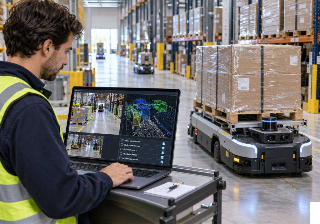
Warehouse engineer reviewing camera and LiDAR data on a laptop beside an autonomous pallet-carrying robot.

How Warehouse Robot Camera and LiDAR Annotation Works, From Labels to Quality Checks

Warehouse robot camera LiDAR annotation works best, when the buyer settles three things before labeling starts. Those are a warehouse-specific taxonomy, written rules for occlusion and partial objects, and a QA plan built on calibration and sync checks. Any supplier offering sensor data annotation for warehouse robots should prove those rules on your own sequences in a stratified pilot. 

Warehouse perception sits in an awkward middle ground. The sensors and file formats resemble autonomous driving, while the objects, distances, and failure modes belong to a very different world. Teams that scope robotics data services for autonomous forklifts with driving assumptions tend to pay for rework once stretch-wrapped pallets reach the labeling queue.

Key Takeaways

  • Warehouses are very different from public roads, so labeling rules written for self-driving cars need to be reworked for pallets, racks, and people working close to the robot.
  • Every label should connect to a real decision the robot makes, such as where it can safely drive or how to pick up a pallet.
  • Clear written rules for hidden or partly visible objects keep every labeler working the same way on the hardest scenes.
  • The choice between buying a labeling tool and hiring a full-service team depends mostly on who will keep the rules updated as your needs change.
  • A supplier’s self-driving car experience shows they have strong processes, while their warehouse know-how still has to be proven on your own data.
  • Share real sample data and sensor setup details up front, then test suppliers with a small trial that covers every warehouse condition and is checked against answers your team already trusts.

What Does Warehouse Robot Camera LiDAR Annotation Involve, and How Is It Different From Driving Data?

Warehouse robot camera LiDAR annotation is the labeling of synchronized RGB images and 3D point clouds captured by autonomous mobile robots (AMRs), automated guided vehicles (AGVs), and autonomous forklifts. It usually pairs 2D boxes or masks on camera frames with 3D cuboids or point-level segmentation on LiDAR, linked by shared object IDs. When both views of the same object must agree, the work becomes multisensor fusion annotation, which depends on calibration and timestamp alignment as much as on labeling skill. Some programs also add depth-camera data for close-range tasks such as fork alignment.

The domain differs from road driving in ways that change the labeling rules. KIT researchers building an automated annotation framework for industrial LiDAR data note that most public datasets, such as KITTI and Waymo, focus on roads. They also point to a shortage of freely available labeled LiDAR from warehouses and industrial halls. Most programs therefore build their own ground truth, which puts more weight on the buyer’s scope decisions. The main differences show up in five areas:

  • Range: Most relevant objects sit close to the robot, so small position and yaw errors carry more weight than at road distances.
  • Dual-role objects: A pallet is an obstacle to avoid and a target to engage, so it needs both detection and pose labels.
  • Surfaces: Stretch wrap, metal racking, and dock plates cause reflections, ghost points, and missing returns.
  • Lighting: Brightness swings between dock doors and trailer interiors within a single task.
  • People: Workers on foot move close to the robot and often appear half-hidden by racks or loads.

What Labels Should a Warehouse Camera and LiDAR Project Include?

Start from the robot’s decisions and work back to the classes. A navigation stack needs to know where it can drive and what might move. A pallet-handling stack needs pallet pose and fork-pocket geometry. Labels that no downstream model consumes add cost without adding capability, so each class should map to a specific model output. Most warehouse taxonomies cover five groups:

  • Dynamic agents: People, manual forklifts, pallet jacks, tuggers, and other robots, with 3D cuboids, 2D boxes, and track IDs that persist across frames and sensors.
  • Load carriers: Pallets by type and material, loaded or empty, wrapped or unwrapped, with yaw and fork-pocket locations.
  • Static infrastructure: Rack uprights and beams, shelving bays, walls, columns, dock doors, and dock plates, often as segmentation or cuboids.
  • Floor and free space: Drivable area, floor markings, and hazards such as spilled liquid, debris, strapping, and wrap scraps.
  • Attributes: Occlusion level, truncation, a reflective-surface flag, lighting condition, and high-visibility clothing on people.

Fork pockets deserve their own class and their own QA threshold. A 2025 study of pallet and pallet-hole detection for forklifts reported up to 95% pallet detection accuracy, against 72% for pallet holes. The authors traced the gap to holes resembling shadows and gaps at a distance, and annotators face the same ambiguity. In multi-sensor data labeling framework, cross-modal consistency rules help resolve these cases by checking whether camera annotations align with corresponding LiDAR geometry rather than relying on a single modality alone.

How Should a Supplier Handle Partial Pallets, Racks, and Occlusions?

Occlusion is constant in a warehouse, so the guideline has to settle it before annotators do. Pallets sit behind other pallets, people step out from between racks, and loads overhang their bases. Without written rules, each annotator invents a policy. Inter-annotator agreement then falls apart on the frames the robot finds hardest. A usable occlusion policy covers six points:

  • Extent convention: Decide whether cuboids cover the full estimated object or only the observed points, and apply the same choice in both modalities.
  • Minimum evidence: Define how many LiDAR points or what visible fraction justifies a label, and when an object moves to an ignore region.
  • Partial pallets: Label the pallet base and its load separately, and record when the base is hidden but the load is visible.
  • Racks: Where the robot localizes reliably, label static racking once in an aggregated, registered map and project those labels into each scan. This keeps rack geometry consistent and avoids redrawing the same uprights in every frame.
  • Reflective surfaces: Flag stretch-wrapped loads and shiny surfaces, and state how to treat ghost points and missing returns.
  • Track continuity: Keep the same ID when an object leaves view briefly, and define how many frames count as briefly.

Moving objects need a timing rule as well. A WACV 2026 study of systematic errors in 3D box annotations found boxes in public driving datasets misplaced by up to 2.5 m. Highly dynamic objects were the most affected, because a rotating LiDAR observes each object at a slightly different time. Forklifts move slower than cars but operate much closer to the robot, so small offsets still matter. Ask each supplier how its tooling handles per-point timestamps and motion compensation.

How Do You Compare an Annotation Platform With a Managed Annotation Service?

An annotation platform sells software, and your team runs the work. A managed service sells labeled output against a specification, while the supplier runs the workforce, guidelines, and QA. Many programs settle on a hybrid, pairing the buyer’s platform with the supplier’s trained annotators. The right choice depends on who will own guideline changes when the taxonomy shifts, as robotics taxonomies usually do.

Factor Annotation platform Managed annotation service
QA ownership Your team builds review queues and audits Supplier runs layered review against agreed metrics
Guideline changes You write and update every rule Supplier drafts edge-case rules for your approval
Fusion tooling Must load your formats and project 3D boxes into every camera Supplier’s tooling, which you should test on your data
Scaling limit Your annotation operations staff Supplier’s pool of trained annotators
Best fit Stable taxonomy and an in-house annotation ops lead Shifting taxonomy, volume swings, or a thin ops team

Whichever route you choose, test the tool on your own synchronized data before signing. Check that it loads your log format, projects 3D boxes correctly into every camera, and keeps track IDs across modalities. Ask who pays for rework when guidelines change after labeling starts. The wider build vs buy vs partner decision applies here, with sensor-specific tooling as an added constraint.

Can a Driving Multisensor Case Study Prove Warehouse Robotics Experience?

It proves part of what you need. A driving fusion project shows process capability: calibration validation, timestamp alignment, 3D cuboids, cross-modal ID persistence, and QA at volume. Those skills transfer directly and are hard to fake. The MultiCorrupt benchmark of LiDAR-camera fusion tested five detectors against ten corruption types, including spatial and temporal misalignment. Robustness varied by corruption type and fusion strategy, which is why sync and calibration discipline matter in any fused dataset.

A driving case does not prove warehouse judgment. Road guidelines say nothing about fork pockets, wrapped loads, rack beams at head height, or people half-hidden behind a pallet stack. Ask the supplier which of its driving rules it would change for your site. Then ask for a draft warehouse guideline before the pilot starts. A clear, specific answer is stronger evidence than a longer list of logos.

What Files Should Go Into the Initial Warehouse Annotation Brief?

A supplier can only quote and plan accurately from real inputs. Thin briefs produce optimistic quotes, followed by change orders once the edge cases appear. Send these files before the pilot is priced:

  1. Sample sequences: Raw logs, such as rosbag or MCAP files or per-frame point clouds and images, from every site and condition in scope.
  2. Calibration files: Camera intrinsics and LiDAR-to-camera extrinsics, versioned by robot and date, with notes on how they were validated.
  3. Sync documentation: Clock source, sensor rates, hardware or software triggering, and any known timing offsets.
  4. Rig and frame conventions: Sensor mounting heights, fields of view, coordinate frames, axis order, and yaw definition.
  5. Draft taxonomy and guideline: Classes, attributes, and edge-case rules, with visual examples of correct and incorrect labels.
  6. Gold set and acceptance criteria: Reference labels your team trusts, plus the metric thresholds the pilot must meet.
  7. Output specification: A sample label file in your target schema, with units, ID rules, and coordinate frame.
  8. Site notes: Pallet types, racking styles, dock and trailer work, lighting conditions, and shift patterns.
  9. Privacy and security terms: Treatment of faces, badges, and shipping labels, plus data residency and access controls.

Calibration and sync records belong in the brief because annotators cannot fix them. A 3D box that projects off the object in the image may be a labeling error or a calibration error. Only versioned calibration and sync records let the supplier tell which, and trace any drift back to its source.

How Should a Warehouse Annotation Pilot Be Sampled and Scored?

Sample the pilot by operating condition so every stratum the robot will meet appears several times. A random draw from fleet logs over-represents empty aisles and under-represents the frames that cause failures. Build the strata first, then fill each one with a few sequences:

  • Zones: Aisles, staging lanes, docks, trailer interiors, and charging areas.
  • Lighting: Bright dock doors, dim trailers, and night shifts.
  • Loads: Wood and plastic pallets, wrapped and unwrapped loads, and partial or damaged pallets.
  • Traffic: People and forklifts at close range, crossing paths, or hidden by racks.
  • Rigs: Each robot model or sensor configuration in the fleet.

Include continuous sequences as well as single frames, since track ID switches only show up over time. Label a gold subset internally and insert it blind into the supplier’s batch. Then score the pilot per stratum on agreed metrics:

  • Class accuracy: Precision and recall against the gold set.
  • 3D geometry: Center error, yaw error, or 3D IoU for pallets, people, and vehicles.
  • Cross-modal consistency: The share of projected 3D boxes that match their 2D labels.
  • Tracking: ID switches per sequence.
  • Process signals: Guideline questions raised, turnaround time, and pre-label correction rates.

Run a second, larger batch before committing to full volume, because quality often slips when a supplier expands the annotator pool. If the workflow uses model-generated pre-labels, monitor the correction rate closely; a rate that is unusually close to zero may indicate that annotators are accepting pre-labels without sufficient review. This is where many AI pilots fail to scale because early results may look strong, but performance often changes once the workflow expands across more annotators, higher volumes, and stricter production requirements.

How Digital Divide Data Can Help

Digital Divide Data supports warehouse perception programs with camera labeling, 3D LiDAR point cloud annotation, and fused annotation run as one workflow. Engagements start with scoping: sensor modalities, robot tasks, known failure points, and the taxonomy those imply. DDD teams then ingest and synchronize raw streams, apply AI-assisted pre-labeling with human review, and run domain expert validation against scenario-specific criteria. Multi-layer QA includes inter-annotator agreement checks and audit trails, so every delivered label is traceable.

DDD’s multisensor fusion case study for an autonomous vehicle developer shows the process side in practice. That program covered calibration and timestamp validation, 2D boxes and segmentation on images, 3D cuboids on LiDAR, and persistent object IDs across modalities. It also added scenario tagging for occlusion-heavy scenes and night-time driving. As this guide argues, a driving case proves process capability, so DDD demonstrates warehouse-specific judgment on your own data through a stratified pilot scored against your gold set.

Warehouse footage often shows workers’ faces, badges, and shipping labels. DDD handles sensor data under SOC 2 Type 2 and ISO 27001 controls, with GDPR-compliant handling of personal data. Pilots can then scale into continuous annotation pipelines as fleets and sites grow.

Build warehouse perception datasets your robots can rely on from the first batch. Talk to an Expert.

Conclusion

Warehouse perception data fails quietly when scope is vague. The taxonomy drifts, occlusion rules vary by annotator, and calibration errors surface as labeling errors months later. Buyers who fix the label set, edge-case rules, brief, and pilot design up front get a dataset they can audit and extend.

That gap widens as fleets spread across more sites and pallet types. Teams with versioned guidelines, stratified gold sets, and measurable acceptance criteria can add a new warehouse with a short pilot. 

References

Abdelhalim, G., Simon, K., Bensch, R., Parimi, S., & Qureshi, Bilal A. (2024). Automated AI-based annotation framework for 3D object detection from LiDAR data in industrial areas (SAE Technical Paper 2024-01-2999). SAE International. https://publikationen.bibliothek.kit.edu/1000172646

Beemelmanns, T., Zhang, Q., Geller, C., & Eckstein, L. (2024). MultiCorrupt: A multi-modal robustness dataset and benchmark of LiDAR-camera fusion for 3D object detection. https://arxiv.org/abs/2402.11677

Miro, A. J., af Klinteberg, L., Timus, B., Asefaw, A., Khoche, A., Gustafsson, T., Mansouri, S. S., & Daneshtalab, M. (2026). Correcting and quantifying systematic errors in 3D box annotations for autonomous driving. https://openaccess.thecvf.com/content/WACV2026/html/Miro_Correcting_and_Quantifying_Systematic_Errors_in_3D_Box_Annotations_for_WACV_2026_paper.html

Sutar, V., Maheshwari, M., & Mittal, A. (2025). Learning-based vision systems for semi-autonomous forklift operation in industrial warehouse environments. arXiv preprint arXiv:2511.06295. https://arxiv.org/abs/2511.06295

Frequently Asked Questions

Do warehouse robots need 3D cuboids, or are 2D boxes enough?

Most warehouse programs use both, linked by shared object IDs. Cuboids on LiDAR carry the position, size, and yaw that navigation and pallet handling depend on, and 2D labels on camera frames add the visual detail.

Should racks be labeled in every LiDAR frame?

Not always. Where the robot localizes reliably, teams can label static racking once in an aggregated map and project those labels into each scan. That keeps rack geometry consistent and avoids redrawing the same uprights in every frame.

How do I know an annotation supplier’s quality will hold at full volume?

Run a second, larger batch after the pilot and score it against the same blind gold set. Quality often slips when a supplier adds annotators, and a pre-label correction rate near zero can mean people are accepting model output without checking it.

Why should calibration files be part of an annotation brief?

Annotators cannot fix calibration, but they see its effects. A 3D box that projects off the object in the camera image could be a labeling error or a calibration error, and only versioned calibration and sync records show which.

How Warehouse Robot Camera and LiDAR Annotation Works, From Labels to Quality Checks Read Post »
3D LiDAR Data Annotation

3D LiDAR Data Annotation: What Precision Actually Demands

The consequences of getting LiDAR annotation wrong propagate directly into perception model failures. A bounding box that is too loose teaches the model an inflated estimate of object size. A box placed two frames late on a decelerating vehicle teaches the model incorrect velocity dynamics.

A pedestrian annotated as fully absent because occlusion made it difficult to label leaves the model with no training signal for one of the most safety-critical object categories. These are not edge cases in production LiDAR annotation programs. They are systematic failure modes that require specific annotation discipline and quality assurance infrastructure to prevent.

This blog examines what 3D LiDAR annotation precision actually demands, from the annotation task types and their quality requirements to the specific challenges of occlusion, sparsity, weather degradation, and temporal consistency. 3D LiDAR data annotation and multisensor fusion data services are the two annotation capabilities where Physical AI perception quality is most directly determined.

Key Takeaways

  • 3D LiDAR annotation requires spatial precision in all three dimensions simultaneously; positional errors that are acceptable in 2D bounding boxes produce systematic model failures when placed on point cloud data.
  • Temporal consistency across frames is a distinct annotation requirement for LiDAR: frame-to-frame box size fluctuations and incorrect object tracking IDs teach models incorrect velocity and motion dynamics.
  • Occluded and partially visible objects must be annotated with predicted geometry based on contextual inference, not simply omitted; omission produces models that miss objects whenever occlusion occurs.
  • Weather conditions, including rain, fog, and snow, degrade point cloud quality and introduce false returns, requiring annotators with the expertise to distinguish genuine objects from environmental artifacts.
  • Camera-LiDAR fusion annotation requires cross-modal consistency that single-modality QA does not check; an object correctly labeled in one modality but incorrectly in the other produces a conflicting training signal.

What LiDAR Produces and Why It Requires Different Annotation Skills

Point Clouds: Structure, Density, and the Annotator’s Challenge

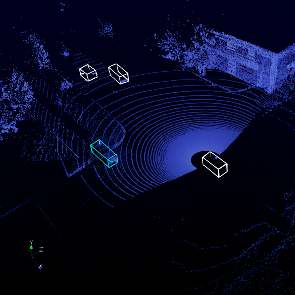
A LiDAR sensor emits laser pulses and measures the time each takes to return from a surface, building a three-dimensional map of the surrounding environment expressed as a set of x, y, z coordinates. Each point carries a position and typically a reflectance intensity value. The resulting point cloud has no inherent pixel grid, no colour information, and no fixed spatial resolution. Object density in the cloud varies with distance from the sensor: objects close to the vehicle may be represented by thousands of points, while an object at 80 metres may be represented by only a handful.

Annotators working with point clouds must navigate a three-dimensional space using software tools that allow rotation and zoom through the data, typically combining top-down, front-facing, and side-facing views simultaneously. Identifying an object’s boundaries requires understanding its three-dimensional geometry, not its visual appearance. The skills required are closer to spatial reasoning under geometric constraints than to the visual pattern recognition that image annotation demands, and the onboarding time for LiDAR annotation teams reflects this difference.

Why Point Cloud Data Is Not Just Another Image Format

Image annotation tools and workflows are not transferable to point cloud annotation without significant modification. The quality dimensions that matter are different: in image annotation, boundary placement accuracy is measured in pixels. In LiDAR annotation, it is measured in centimetres across three spatial axes simultaneously, and errors in any axis affect the model’s learned representation of object size, position, and orientation. 

The model architectures trained on LiDAR data, including voxel-based, pillar-based, and point-based processing networks, are sensitive to annotation precision in ways that differ from convolutional image models. The relationship between annotation quality and computer vision model performance is more direct and more spatially specific in LiDAR contexts than in standard image annotation.

Annotation Task Types and Their Precision Requirements

3D Bounding Boxes: The Core Task and Its Constraints

Three-dimensional bounding boxes, also called cuboids or 3D boxes, are the primary annotation type for object detection in LiDAR point clouds. A well-placed 3D bounding box encloses all points belonging to the object while excluding points from the surrounding environment, with the box oriented to match the object’s heading direction. The precision requirements are demanding: box dimensions should reflect the actual physical size of the object, not the extent of visible points, which means annotators must infer full geometry for partially visible or occluded objects. 

Orientation accuracy matters because the model uses heading direction for trajectory prediction and path planning. ADAS data services for safety-critical functions require 3D bounding box annotation at the precision standard set by the safety requirements of the specific perception function being trained, not a generic commercial annotation standard.

Semantic Segmentation: Classifying Every Point

LiDAR semantic segmentation assigns a class label to every point in the cloud, distinguishing road surface from sidewalk, building from vegetation, and vehicle from pedestrian at the point level. The precision requirement is higher than for bounding box annotation because every point contributes to the model’s learned class boundaries. Boundary regions between classes, where a road surface meets a kerb or where a vehicle body meets its shadow on the ground, are the areas where annotator judgment is most consequential and where inter-annotator disagreement is most likely. Annotation guidelines for semantic segmentation need to be specific about boundary point treatment, not just about object class definitions.

Instance Segmentation and Object Tracking

Instance segmentation distinguishes between individual objects of the same class, assigning unique instance identifiers to each car, each pedestrian, and each cyclist in a scene. It is the annotation type required for multi-object tracking, where the model must maintain the identity of each object across successive frames as the vehicle moves. Tracking annotation requires that each object receive the same identifier across every frame in which it appears, and that the identifier is consistent even when the object is temporarily occluded and reappears. 

Maintaining this consistency across large annotation datasets requires systematic quality assurance that checks identifier continuity, not just frame-level box accuracy. Sensor data annotation at the quality level required for tracking-capable perception models requires this cross-frame consistency checking as a structural component of the QA workflow.

The Occlusion Problem: Annotating What Cannot Be Seen

Why Occlusion Cannot Simply Be Ignored

Occlusion is the most common source of annotation difficulty in LiDAR data. A pedestrian partially hidden behind a parked car, a cyclist whose lower body is obscured by road furniture, a truck whose rear is out of the sensor’s direct line of sight: these are not rare scenarios. They are the normal condition in dense urban traffic. Annotators who respond to occlusion by omitting the occluded object or reducing the bounding box to cover only visible points produce training data that teaches the model to be uncertain about or to miss objects whenever occlusion occurs. In a deployed autonomous driving system, this produces exactly the failure mode in dense traffic that is most dangerous.

Predictive Annotation for Occluded Objects

The correct annotation approach for occluded objects requires annotators to infer the full geometry of the object based on contextual information: the visible portion of the object, knowledge of typical object dimensions for that class, the object’s trajectory in preceding frames, and contextual cues from other sensors. A pedestrian whose body is 60 percent visible allows a trained annotator to infer full height, approximate width, and likely heading with reasonable accuracy.

Annotation guidelines must specify this inference requirement explicitly, with worked examples and decision rules for different occlusion levels. Annotators who are not trained in this inference discipline will default to visible-point-only annotation, which is faster but produces systematically degraded training data for occluded scenarios.

Occlusion State Labeling

Beyond annotating the geometry of occluded objects, many LiDAR annotation programs require that annotators record the occlusion state of each annotation explicitly, classifying objects as fully visible, partially occluded, or heavily occluded. This metadata allows model training pipelines to weight examples differently based on annotation confidence, to analyze model performance separately for different occlusion levels, and to identify where the training dataset is under-represented in high-occlusion scenarios. Edge case curation services specifically address the under-representation of high-occlusion scenarios in standard LiDAR training datasets, ensuring that the scenarios where annotation is most demanding and model failures are most consequential receive adequate coverage in the training corpus.

Temporal Consistency in LiDAR

Why Frame-Level Accuracy Is Not Enough

LiDAR data for autonomous driving is collected as continuous sequences of frames, typically at 10 to 20 Hz, capturing the dynamic scene as the vehicle moves. A model trained on this data learns not only to detect objects in individual frames but to understand their motion, velocity, and trajectory across frames. This means annotation errors that are consistent across a sequence are less damaging than inconsistencies between frames, because a consistent error teaches a consistent but wrong pattern, while frame-to-frame inconsistency teaches no coherent pattern at all.

The most common temporal consistency failure is bounding box size fluctuation: annotators placing boxes of slightly different dimensions around the same object in successive frames because the point density and viewing angle change as the vehicle moves. A vehicle that appears to change physical size between consecutive frames is producing a training signal that will undermine the model’s size estimation accuracy. Annotation guidelines need to specify size consistency requirements across frames, and QA processes need to measure frame-to-frame size variance as an explicit quality metric.

Object Identity Consistency Across Long Sequences

Maintaining consistent object identifiers across long annotation sequences is particularly challenging when objects temporarily leave the sensor’s field of view and re-enter, when two objects of the same class pass close to each other, and their point clouds briefly merge, or when an object is first obscured and then reappears from behind cover. 

Annotation teams without systematic identity management protocols will produce sequences with identifier reassignment errors that teach the tracking model incorrect trajectory continuities. Video annotation discipline for temporal consistency in conventional video annotation carries over to LiDAR sequence annotation, but the three-dimensional nature of the data and the absence of visual cues make LiDAR identity management a harder problem requiring more structured annotator training.

Weather, Distance, and Sensor Challenges in LiDAR

How Adverse Weather Degrades Point Cloud Quality

Rain, fog, snow, and dust all degrade LiDAR point cloud quality in ways that create annotation challenges with no equivalent in camera data. Water droplets and snowflakes reflect laser pulses and produce false returns in the point cloud, appearing as clusters of points that do not correspond to any physical object. These false returns can superficially resemble real objects of similar reflectance, and distinguishing them from genuine objects requires annotators who understand both the physics of the degradation and the characteristic patterns it produces in the point cloud.

Annotation guidelines for adverse weather conditions need to specify how annotators should handle ambiguous clusters that may be environmental artifacts, what contextual evidence is required before annotating a possible object, and how to record uncertainty levels when annotation confidence is reduced. Programs that apply the same annotation guidelines to clear-weather and adverse-weather data without differentiation will produce an inconsistent training signal for exactly the conditions where perception reliability matters most.

Sparsity at Range and Its Annotation Implications

Point density decreases with distance from the sensor as laser beams diverge and fewer pulses return from any given object. An object at 10 metres may be represented by hundreds of points; the same object class at 80 metres may be represented by only a dozen. The annotation challenge at long range is that sparse representations make it harder to determine object boundaries accurately, to distinguish one object class from another of similar geometry, and to identify the orientation of an object with limited point coverage. 

The ODD analysis for autonomous systems framework is relevant here: the distance ranges that fall within the system’s operational design domain determine the annotation precision requirements that the training data must satisfy, and ODD-aware annotation programs specify different quality thresholds for different distance bands.

Sensor Fusion Annotation

Why LiDAR-Camera Fusion Annotation Is Not Two Separate Tasks

Autonomous driving perception systems increasingly fuse LiDAR point clouds with camera images to combine the spatial precision of LiDAR with the semantic richness of cameras. Training these fusion models requires annotation that is consistent across both modalities: an object labeled in the camera image must correspond exactly to the same object labeled in the point cloud, with matching identifiers, matching spatial extent, and temporally synchronized labels. 

Inconsistency between modalities, where a pedestrian is correctly labeled in the camera frame but slightly offset in the point cloud or vice versa, produces conflicting training signal that degrades fusion model performance. The role of multisensor fusion data in Physical AI covers the full scope of this cross-modal consistency requirement and its implications for annotation program design.

Calibration and Coordinate Alignment

Camera-LiDAR fusion annotation requires that the sensor calibration parameters are correct and that both annotation streams are operating in a consistent coordinate system. If the extrinsic calibration between the LiDAR and camera has drifted or was not precisely determined, points in the LiDAR coordinate frame will not project accurately onto the camera image plane. 

Annotators working on both streams simultaneously may compensate for calibration errors by adjusting their annotations in ways that introduce systematic inconsistencies. Annotation programs that treat calibration validation as a prerequisite for annotation, rather than as a separate engineering concern, produce more consistent fusion training data.

4D LiDAR and the Emerging Annotation Requirement

Newer LiDAR systems operating on frequency-modulated continuous wave principles add instantaneous velocity as a fourth dimension to each point, providing direct measurement of object radial velocity rather than requiring it to be inferred from position change across frames. Annotating 4D LiDAR data requires that velocity attributes are verified for consistency with observed object motion, adding a new quality dimension to the annotation task. As 4D LiDAR adoption increases in production autonomous driving programs, annotation services that can handle velocity attribute validation alongside spatial annotation will become a differentiating capability. Autonomous driving data services designed for next-generation sensor configurations need to accommodate this expanded annotation schema before 4D LiDAR becomes the production standard in new vehicle programs.

Quality Assurance for 3D LiDAR Annotation

Why Standard QA Metrics Are Insufficient

Annotation accuracy metrics for 2D image annotation, including bounding box IoU and per-class label accuracy, do not translate directly to LiDAR annotation quality assessment. A 3D bounding box that achieves an acceptable 2D IoU when projected onto a ground plane may still be incorrectly oriented or sized in the vertical dimension. Metrics that measure accuracy in the bird’s-eye view projection alone miss annotation errors in the height dimension that are consequential for object classification and for applications requiring accurate height estimation. Full 3D IoU measurement, orientation angle error, and explicit heading accuracy metrics are the quality dimensions that LiDAR QA frameworks should measure.

Gold Standard Design for LiDAR Annotation

Gold standard examples for LiDAR annotation QA present specific challenges that image annotation gold standards do not. A gold standard LiDAR scene needs to cover the full range of difficulty conditions: varying object distances, different occlusion levels, adverse weather representations, and the object classes that are most frequently annotated incorrectly. 

Designing gold standard scenes that adequately represent the tail of the difficulty distribution, rather than the average of the annotation task, is what distinguishes gold standard sets that actually surface annotator quality gaps from those that measure performance on the easy cases. Human-in-the-loop computer vision for safety-critical systems describes the quality assurance architecture where human expert review is systematically applied to the most safety-consequential annotation categories.

Inter-Annotator Agreement in 3D Space

Inter-annotator agreement for 3D bounding boxes is harder to measure than for 2D annotations because agreement must be assessed across position, dimensions, and orientation simultaneously. Two annotators may agree perfectly on an object’s position and dimensions but disagree on its heading by 15 degrees, which produces a meaningful difference in the model’s learned orientation representation. Agreement measurement frameworks for LiDAR annotation need to decompose agreement into these separate spatial components, identify which components show the highest disagreement across annotator pairs, and target guideline refinements at the specific spatial dimensions where annotator interpretation diverges.

Applications Beyond Autonomous Driving

Robotics and Industrial Automation

LiDAR annotation requirements for robotics and industrial automation differ from automotive perception in ways that affect annotation standards. Industrial manipulation robots need highly precise 3D object pose annotation, including not just position and orientation but specific grasp point locations on object surfaces. Warehouse autonomous mobile robots need accurate annotation of dynamic obstacles at close range in environments with dense, reflective infrastructure. 

The annotation standards developed for automotive LiDAR, which are optimized for road scene objects at driving speeds and distances, may not transfer directly to these contexts without domain-specific adaptation. Robotics data services address the specific annotation requirements of manipulation and mobile robot perception, including the close-range precision and object pose annotation that automotive-focused LiDAR annotation workflows do not typically prioritise.

Infrastructure, Mapping, and Geospatial Applications

LiDAR annotation for infrastructure inspection, corridor mapping, and smart city applications involves different object categories, different precision standards, and different temporal requirements from automotive perception annotation. Infrastructure LiDAR data needs annotation of linear features such as power lines and road markings, structural elements of varying scale, and vegetation that changes between survey passes. 

The annotation challenge in these contexts is less about temporal consistency at high frame rates and more about spatial precision and category consistency across long survey corridors. Annotation teams calibrated for automotive LiDAR need specific domain training before working on infrastructure annotation tasks.

How Digital Divide Data Can Help

Digital Divide Data provides 3D LiDAR annotation services designed around the precision standards, temporal consistency requirements, and cross-modal fusion demands that production Physical AI programs require.

The 3D LiDAR data annotation capability covers all primary annotation types, including 3D bounding boxes with full orientation and dimension accuracy, semantic segmentation at the point level, instance segmentation with cross-frame identity consistency, and object tracking across long sequences. Annotation teams are trained to handle occluded objects with predictive geometry inference, not visible-point-only annotation, and occlusion state metadata is captured as a standard annotation attribute.

For programs requiring camera-LiDAR fusion training data, multisensor fusion data services provide cross-modal consistency checking as a structural component of the QA workflow, not a post-hoc audit. Calibration validation is treated as a prerequisite for annotation, and cross-modal annotation agreement is measured alongside single-modality accuracy metrics.

QA frameworks include full 3D IoU measurement, orientation angle error tracking, frame-to-frame size consistency metrics, and gold standard sampling stratified across distance bands, occlusion levels, and adverse weather conditions. Performance evaluation services connect annotation quality to downstream model performance, closing the loop between data quality investment and perception system reliability in the deployment environment.

Build LiDAR training datasets that meet the precision standards and production perception demands. Talk to an expert!

Conclusion

3D LiDAR annotation is technically demanding in ways that standard image annotation experience does not prepare teams for. The spatial precision requirements, the temporal consistency obligations across dynamic sequences, the occlusion handling discipline, the weather artifact identification skills, and the cross-modal consistency demands of fusion annotation are all distinct competencies that require specific training, specific tooling, and specific quality assurance frameworks. 

Programs that approach LiDAR annotation as a harder version of image annotation, and apply image annotation standards and QA methodologies to point cloud data, will produce training datasets with systematic error patterns that surface in production as perception failures in exactly the conditions that matter most: dense traffic, occlusion, adverse weather, and long range.

The investment required to build annotation programs that meet the precision standards LiDAR perception models need is substantially higher than for image annotation, and it is justified by the role that LiDAR plays in the perception stack of safety-critical Physical AI systems. A perception model trained on precisely annotated LiDAR data is more reliable across the full operational envelope of the system. A model trained on imprecisely annotated data will fail in the scenarios where annotation difficulty was highest, which are also the scenarios where perception reliability matters most.

References

Valverde, M., Moutinho, A., & Zacchi, J.-V. (2025). A survey of deep learning-based 3D object detection methods for autonomous driving across different sensor modalities. Sensors, 25(17), 5264. https://doi.org/10.3390/s25175264

Zhang, X., Wang, H., & Dong, H. (2025). A survey of deep learning-driven 3D object detection: Sensor modalities, technical architectures, and applications. Sensors, 25(12), 3668. https://doi.org/10.3390/s25123668

Jiang, H., Elmasry, H., Lim, S., & El-Basyouny, K. (2025). Utilizing deep learning models and LiDAR data for automated semantic segmentation of infrastructure on multilane rural highways. Canadian Journal of Civil Engineering, 52(8), 1523-1543. https://doi.org/10.1139/cjce-2024-0312

Frequently Asked Questions

Q1. What is the difference between 3D bounding box annotation and semantic segmentation for LiDAR data?

3D bounding boxes place a cuboid around individual objects to define their position, dimensions, and orientation. Semantic segmentation assigns a class label to every individual point in the cloud, producing a complete spatial classification of the scene without object-level instance boundaries.

Q2. How should annotators handle occluded objects in LiDAR point clouds?

Occluded objects should be annotated with their full inferred geometry based on visible portions, object class size priors, and trajectory context from adjacent frames — not reduced to cover only visible points or omitted, as either approach produces models that miss or underestimate objects under occlusion.

Q3. Why is frame-to-frame bounding box consistency important for LiDAR training data?

Models trained on LiDAR sequences learn velocity and motion dynamics across frames. Box size fluctuations between frames for the same object produce conflicting signals about object dimensions and produce models with inaccurate size estimation and trajectory prediction capabilities.

Q4. What annotation challenges does adverse weather introduce for LiDAR data?

Rain, fog, and snow create false returns in the point cloud that can resemble real objects, requiring annotators with domain expertise to distinguish environmental artifacts from genuine objects and to record appropriate confidence levels when scan quality is degraded.

3D LiDAR Data Annotation: What Precision Actually Demands Read Post »

CuboidAnnotation

Cuboid Annotation for Depth Perception: Enabling Safer Robots and Autonomous Systems

Autonomous vehicles today are equipped with a variety of sensors, from monocular and stereo cameras to LiDAR and RADAR. These sensors generate vast amounts of raw data, but without interpretation, that data has limited value. Machine learning models rely on annotated datasets to translate pixels and points into a structured understanding. The quality and type of data annotation directly determine how effectively a model can learn to perceive depth, identify objects, and make real-time decisions.

Cuboid annotation plays a critical role in this process. By enclosing objects in three-dimensional bounding boxes, cuboids provide not only positional information but also orientation and scale. Unlike 2D annotations, which capture only height and width on a flat image, cuboids reflect the real-world volume of an object and its relationship to the surrounding environment.

In this blog, we will explore what cuboid annotation is, why it matters for depth perception, the challenges it presents, the future directions of the field, and how we help organizations implement it at scale.

What is Cuboid Annotation?

Cuboid annotation is the process of enclosing objects in three-dimensional bounding boxes within an image or point cloud. Each cuboid defines an object’s height, width, depth, orientation, and position in space, giving machine learning models the information they need to understand not only what an object is but also where it is and how it is aligned.

This approach goes beyond traditional two-dimensional annotations. A 2D bounding box can identify that a car exists in a frame and mark its visible outline, but it cannot tell the system whether the car is angled toward an intersection or parked along the curb. Polygons and segmentation masks improve boundary accuracy in 2D but still lack volumetric depth. Cuboids, by contrast, describe objects in a way that reflects the real world, making them indispensable for depth perception tasks.

In autonomous vehicle datasets, a cuboid drawn around another car helps the system estimate its size, direction of travel, and distance from the ego vehicle. For warehouse robots, cuboid annotation of shelves and packages provides precise information for safe navigation through narrow aisles and accurate placement or retrieval of items. In both cases, the cuboid acts as a simplified yet powerful representation of reality that can be processed efficiently by AI models.

By capturing orientation, scale, and occlusion, cuboid annotation creates a richer understanding of the environment than 2D methods can achieve. This makes it one of the most critical annotation types for building systems that must operate reliably in complex, safety-critical settings.

Why Cuboid Annotation Matters for Depth Perception

Depth estimation is one of the most difficult challenges in computer vision autonomy. Systems rely on a range of inputs to approximate distance and spatial layout. Monocular cameras are cost-effective and widely used but often ambiguous, as a single image does not provide reliable depth cues. Stereo cameras offer improvements by simulating human binocular vision, but their accuracy depends heavily on calibration and environmental conditions. RGB-D sensors add a dedicated depth channel that can yield precise results, yet they are expensive and less practical in outdoor or large-scale environments.

Cuboid annotations help address these challenges by acting as geometric priors for machine learning models. A cuboid encodes an object’s volume and orientation, giving the system a reference for understanding its position in three-dimensional space. This additional structure stabilizes depth estimation, particularly in monocular setups where spatial ambiguity is common. In practice, cuboids ensure that the model learns not just to recognize objects but also to reason about how those objects exist in depth relative to the observer.

The importance of this capability becomes clear in safety-critical applications. In autonomous driving, cuboids allow vehicles to gauge the distance and orientation of other cars, cyclists, and pedestrians with greater confidence, supporting collision avoidance and safe lane merging. In warehouse automation, cuboid annotations help robots detect shelving units and moving packages at the right scale, allowing them to navigate efficiently in crowded, constrained spaces. In defense and security robotics, accurate cuboid-based perception reduces the risk of misidentification in complex, high-stakes environments where errors could have serious consequences.

By providing explicit three-dimensional information, cuboid annotation ensures that depth perception systems are not simply relying on inference but are grounded in structured representations of the real world. This makes them an essential component of building reliable and safe autonomous systems.

Challenges in Cuboid Annotation

Despite the clear benefits of cuboid annotation for depth perception, several challenges limit its scalability and effectiveness in real-world applications.

Scalability

Annotating cuboids across millions of frames in autonomous driving or robotics datasets is resource-intensive and time-consuming. Even with semi-automated tools, the need for human oversight in edge cases means costs rise quickly as projects scale. For companies building safety-critical systems, this creates a tension between the need for large, diverse datasets and the expense of producing them.

Ambiguity in labeling

Objects that are only partially visible, heavily occluded, or deformable are notoriously hard to annotate accurately with cuboids. A car that is half-hidden behind a truck or a package wrapped in uneven material can produce inconsistencies in annotation, which later translate into unreliable predictions during deployment.

Sensor fusion complexity

In modern robotics and AV systems, cuboids must align across multiple data sources such as LiDAR, RADAR, and RGB cameras. Any misalignment between these inputs can cause errors in cuboid placement, undermining the reliability of multi-sensor perception pipelines.

Standardization gap

While some datasets enforce strict annotation policies, many others lack detailed guidelines. This makes it difficult to transfer models trained on one dataset to another or to integrate annotations from multiple sources. The absence of unified standards slows down progress and creates inefficiencies for developers who need their models to perform reliably across domains and geographies.

Future Directions for Cuboid Annotation

The future of cuboid annotation lies in making the process faster, more accurate, and more aligned with the safety requirements of autonomous systems.

Automation

Advances in AI-assisted labeling are enabling semi-automatic cuboid generation, where algorithms propose initial annotations and human annotators verify or refine them. This hybrid approach significantly reduces manual effort while maintaining the accuracy required for safety-critical datasets.

Synthetic data generation

Using simulation environments and digital twins, developers can create annotated cuboids for rare or hazardous scenarios that would be difficult or unsafe to capture in reality. This approach not only enriches datasets but also ensures that autonomous systems are trained on edge cases that are crucial for robustness.

Hybrid supervision methods

By combining cuboids with other forms of annotation, such as segmentation masks and point-cloud labels, systems gain a richer, multi-layered understanding of objects. This helps bridge the gap between efficient geometric representations and high-fidelity object boundaries, resulting in improved depth perception across modalities.

Safety pipelines

Cuboids, with their clear geometric structure, are well-suited to serve as interpretable primitives in explainable AI frameworks. By using cuboids as a foundation for safety audits and system certification, developers can provide regulators and stakeholders with transparent evidence of how autonomous systems perceive and react to their environment.

Read more: Major Challenges in Text Annotation for Chatbots and LLMs

How We Can Help

At Digital Divide Data (DDD), we understand that the quality of annotations directly shapes the safety and reliability of autonomous systems. Our teams specialize in delivering high-quality, scalable 3D annotation services, including cuboid labeling for complex multi-sensor environments. By combining the precision of skilled annotators with AI-assisted workflows, we ensure that every cuboid is accurate, consistent, and aligned with industry standards.

We work with organizations across automotive, humanoids, and defense tech to tackle the core challenges of cuboid annotation: scalability, consistency, and cost-effectiveness. Our robust quality assurance frameworks are designed to minimize ambiguity and misalignment across LiDAR, RADAR, and camera inputs. This ensures that models trained on DDD-annotated datasets perform reliably in the field.

By partnering with us, organizations can accelerate development cycles, reduce labeling overhead, and focus on building safer, more capable autonomous systems.

Read more: Long Range LiDAR vs. Imaging Radar for Autonomy 

Conclusion

Cuboid annotation has emerged as one of the most effective ways to translate raw sensor data into structured understanding for autonomous systems. By capturing not just the presence of objects but also their orientation, scale, and depth, cuboids provide the geometric foundation that makes reliable perception possible. This capability is essential in safety-critical domains such as autonomous driving, warehouse automation, and defense robotics, where even small errors in depth estimation can have serious consequences.

Ultimately, safer robots and autonomous systems begin with better data. Cuboid annotation represents a practical and interpretable solution for translating complex environments into actionable intelligence. As tools, datasets, and methodologies mature, it will continue to be a critical enabler of trust and reliability in autonomy.

Partner with DDD to power your autonomous systems with precise and scalable cuboid annotation. Safer autonomy starts with better data.


References

Sun, J., Zhou, M., & Patel, R. (2024). UniMODE: Unified monocular 3D object detection. In Proceedings of the IEEE/CVF Conference on Computer Vision and Pattern Recognition (CVPR) (pp. 10321–10330). IEEE.

V7 Labs. (2024). Image annotation: Definition, use cases & types. V7 Labs Blog. https://www.v7labs.com/blog

Waymo Open Dataset. (2024). 3D annotation guidelines. Waymo. https://waymo.com/open


FAQs

Q1. How do cuboid annotations compare with mesh or voxel-based annotations?
Cuboid annotations provide a lightweight and interpretable geometric representation that is efficient for real-time applications such as autonomous driving. Meshes and voxels capture finer detail and shape fidelity but are computationally heavier, making them less practical for systems where speed is critical.

Q2. Can cuboid annotation support real-time training or only offline datasets?
While cuboid annotation is primarily used for offline dataset preparation, advances in active learning and AI-assisted labeling are enabling near real-time annotation for continuous model improvement. This is particularly useful in simulation environments and testing pipelines.

Q3. What role does human oversight play in cuboid annotation?
Human oversight remains essential, especially for ambiguous cases such as occluded objects or irregular shapes. Automated tools can generate cuboids quickly, but human review ensures accuracy and consistency that are critical for safety.

Q4. Are there specific industries beyond robotics and automotive that benefit from cuboid annotation?
Yes. Healthcare uses cuboids in medical imaging to annotate organs or anatomical structures in 3D scans. Retail and logistics apply cuboids to track package volumes and optimize warehouse operations. Augmented and virtual reality systems also rely on cuboids to align virtual objects with real-world environments.

Q5. How do annotation errors affect downstream models?
Errors in cuboid placement, orientation, or scale can mislead models into misjudging depth or object size, resulting in unsafe behaviors such as delayed braking in vehicles or misalignment in robotic manipulation. Rigorous quality control is therefore essential.

Cuboid Annotation for Depth Perception: Enabling Safer Robots and Autonomous Systems Read Post »

longrangeLiDARandImagingRadar

Long Range LiDAR vs. Imaging Radar for Autonomy 

Long-range perception has become one of the defining challenges for autonomous vehicles. At highway speeds, a vehicle needs to identify obstacles, traffic conditions, and potential hazards several hundred meters ahead to make safe decisions. Distances from 200 meters up to 2 kilometers are often required to provide enough time for accurate sensing, prediction, and maneuvering. Without this extended view of the road, even the most advanced autonomy stack is limited in its ability to ensure safety in real-world conditions.

LiDAR’s ability to generate high resolution three-dimensional maps made it indispensable for early autonomous driving programs. At the same time, LiDAR has struggled with cost, scalability, and performance in adverse weather. Parallel to these challenges, a new innovation has elevated imaging radar, often referred to as 4D radar, which extends traditional radar by adding elevation data and richer point clouds. This technology is now moving rapidly into commercial production and is drawing significant investment from both automotive suppliers and autonomous vehicle companies.

This blog will provide a detailed comparison of long range LiDAR and Imaging Radar for Autonomy, examining their capabilities, challenges, and the role each is likely to play in the future of safe and scalable autonomy.

What is Long-Range LiDAR?

Long-Range LiDAR is a sensing technology designed to detect and measure objects hundreds of meters ahead of a vehicle by using laser light. It builds on the same principles as conventional LiDAR, which emits laser pulses and measures the time it takes for those pulses to reflect back from surrounding objects. The difference is that long-range systems are engineered for extended detection distances, enabling perception from 200 meters up to more than a kilometer in some advanced designs. This extended range makes them essential for autonomous driving on highways, where vehicles move at high speeds and require early detection of potential hazards.

Capabilities of Long-Range LiDAR

High-resolution 3D perception: LiDAR generates dense point clouds that capture the exact shape, size, and position of objects in the environment, making it extremely effective for identifying vehicles, pedestrians, and road infrastructure.

Extended detection distance: Modern long-range LiDAR systems are designed to detect objects several hundred meters ahead, providing the foresight required for safe highway driving and high-speed decision-making.

Precise mapping and localization: LiDAR offers centimeter-level accuracy, making it well-suited for high-definition mapping and helping vehicles localize themselves within a given environment.

Ability to detect small or irregular objects: Unlike some sensors that may overlook low-profile hazards, LiDAR can pick up small debris, animals, or obstacles on the road surface.

Support for redundancy in autonomy stacks: LiDAR often serves as a critical verification layer alongside radar and cameras, ensuring reliability by cross-validating inputs from other sensors.

Adaptability across conditions: While sensitive to weather, LiDAR remains highly effective in clear environments, both during the day and at night, without dependence on ambient light.

Challenges of Long-Range LiDAR

Eye-safety restrictions: Laser output power is tightly regulated to prevent harm to humans, which naturally limits the maximum range that LiDAR systems can safely achieve.

Sensitivity to adverse weather: Rain, fog, and snow scatter the laser light, causing signal degradation and reduced reliability in poor conditions.

Reflectivity limitations: Performance varies depending on the reflectivity of objects; dark or non-reflective surfaces are harder for LiDAR to detect at long distances.

High production cost: Complex optics, moving components (in some designs), and advanced electronics make LiDAR expensive to manufacture compared to radar.

Integration complexity: The data volume generated by high-resolution LiDAR requires powerful onboard computing resources, adding to the cost and complexity of integration.

Scalability concerns: While excellent for premium autonomous vehicles, widespread deployment in mass-market fleets is limited until costs and hardware size are reduced.

What is Imaging Radar?

Imaging radar, often referred to as four-dimensional (4D) radar, is an advanced form of automotive radar designed to deliver richer and more detailed perception than traditional radar systems. Conventional automotive radar provides range, azimuth (horizontal angle), and velocity information. Imaging radar adds elevation as a fourth dimension, producing three-dimensional point clouds that begin to resemble the outputs of LiDAR. This makes it possible to perceive the environment in far greater detail and at longer ranges, while also retaining radar’s native strengths such as weather resilience and cost-effectiveness.

In autonomous driving, imaging radar plays a crucial role in providing reliable perception under conditions where cameras and LiDAR may falter. By generating detailed environmental data that includes both object positions and their relative velocities, imaging radar helps vehicles make informed decisions at highway speeds and in adverse weather.

Capabilities of Imaging Radar

All-Weather Performance: Imaging radar maintains strong performance in rain, fog, and snow, where LiDAR and cameras are prone to degradation.

Extended Range: Capable of detecting objects at distances of 200 to 300 meters, imaging radar provides the foresight required for highway driving.

Native Velocity Measurement: Radar inherently captures Doppler information, enabling direct measurement of object speed without the need for additional processing.

Scalability and Cost Efficiency: Radar components are less expensive to produce than LiDAR, benefiting from decades of automotive mass manufacturing. This makes imaging radar more suitable for deployment in consumer-level fleets.

Support for Machine Learning Enhancement: Although the raw point clouds are sparse, modern signal processing and learning algorithms can transform this data into representations comparable to LiDAR outputs.

Robust Object Tracking: Imaging radar excels at monitoring the movement of vehicles, pedestrians, and other dynamic elements at long ranges, supporting critical driving maneuvers such as lane changes and merging.

Challenges of Imaging Radar

Lower Native Resolution: Compared to LiDAR, imaging radar produces less spatial detail, making it harder to detect small or irregular objects without significant algorithmic enhancement.

Sparse Point Clouds: The density of data is relatively low, which means machine learning methods must be used to interpolate and refine the perception results.

Limited Classification Accuracy: Radar is excellent at detecting that an object exists and estimating its velocity, but distinguishing between object types (for example, differentiating a pedestrian from a traffic sign) is more challenging than with LiDAR or cameras.

Integration Complexity: To maximize its value, imaging radar must be tightly integrated with LiDAR and cameras in a sensor fusion system, which requires additional computational resources and precise calibration.

Newness of Adoption: While radar has been in cars for decades, imaging radar is still relatively new, and large-scale validation in diverse conditions is ongoing.

Read more: How Stereo Vision in Autonomy Gives Human-Like Depth Perception

Comparing Long Range LiDAR vs. Imaging Radar

Long-range LiDAR and imaging radar are often presented as competitors, but in practice they offer distinct advantages that position them as complementary technologies. To understand how they fit into an autonomy stack, it is useful to examine them side by side across the key dimensions of range, resolution, weather robustness, velocity measurement, cost, and industry adoption trends.

Range remains one of the most critical requirements for highway autonomy. Long-range LiDAR has demonstrated detection capabilities beyond two kilometers in experimental FMCW systems, although most production-ready sensors achieve around 200 to 250 meters at typical reflectivity levels. Imaging radar, while not reaching the same extreme distances, offers reliable performance between 200 and 300 meters, and crucially, it maintains range in adverse weather conditions where LiDAR’s performance drops significantly.

Resolution is where LiDAR continues to excel. Its dense point clouds and fine spatial granularity allow it to detect small and irregular objects such as road debris or pedestrians at long distances. Imaging radar’s resolution is lower by comparison, but recent advances in signal processing and machine learning are rapidly narrowing this gap, producing outputs that are increasingly useful for perception algorithms.

Weather robustness is an area where radar clearly outperforms LiDAR. Radar waves penetrate fog, rain, and snow with far less degradation, while LiDAR often struggles in such conditions due to scattering effects. This reliability makes radar an indispensable tool for ensuring safety in environments where visibility is compromised.

Velocity measurement highlights another differentiator. Traditional time-of-flight LiDAR cannot measure velocity directly, though FMCW variants address this limitation. Radar, by contrast, natively measures velocity through Doppler shifts, providing a built-in advantage for tracking moving objects.

Cost and scalability are pressing considerations for manufacturers. LiDAR systems, especially long-range variants, remain expensive due to the complexity of their optics and lasers. Radar benefits from decades of mass production in the automotive industry, offering lower unit costs and a clearer path to large-scale deployment in consumer vehicles.

Industry trends further illustrate the divide. LiDAR continues to be a critical component in premium autonomous stacks where resolution and mapping fidelity are non-negotiable. At the same time, a growing number of automakers and suppliers, such as Mobileye and Continental, are prioritizing imaging radar for scalable and cost-sensitive deployment.

Read more: Leveraging Traffic Simulation to Optimize ODD Coverage and Scenario Diversity

How We Can Help

As LiDAR and imaging radar evolve, their effectiveness in autonomy depends on more than just hardware innovation. The performance of perception models is directly tied to the quality of annotated data used to train and validate them. This is where Digital Divide Data (DDD) provides unique value.

DDD has extensive expertise in training data services for autonomous systems, with capabilities that directly address the needs of both LiDAR and radar sensing technologies. For LiDAR, our teams deliver precise 3D point cloud annotation, including bounding boxes, semantic segmentation, and lane or object labeling, ensuring that models learn from highly accurate spatial data. For radar, DDD supports 4D point cloud labeling, capturing not only object location but also velocity and Doppler information that are essential for robust tracking and prediction.

Beyond single-sensor annotation, DDD specializes in sensor fusion datasets, aligning radar, LiDAR, and camera data into coherent training inputs. This approach mirrors the reality of autonomous perception stacks, where multiple sensors must work together to achieve reliability across environments.

 In a market where every percentage improvement in perception accuracy can make a measurable difference in safety, DDD plays a critical role in accelerating innovation.

Conclusion

The discussion around long-range LiDAR and imaging radar is often framed as a competition, yet the evidence shows a more collaborative future. LiDAR continues to set the standard for high resolution three-dimensional mapping, capable of identifying fine details and supporting high definition localization. Imaging radar, on the other hand, is rapidly maturing into a robust, scalable solution that performs reliably in all-weather conditions and delivers velocity data natively at lower cost.

For the autonomy industry, the choice is not between LiDAR or radar but rather how to integrate both into a sensor suite that maximizes safety and performance. LiDAR provides the granularity needed for precision tasks, while radar ensures continuity of perception when visibility is compromised. This complementary relationship is why leading automakers and suppliers are investing heavily in both technologies, with LiDAR pushing its range and resolution further, and radar evolving into a cornerstone of scalable deployment.

As the autonomy market matures, success will depend on building architectures that blend the strengths of each technology while addressing their limitations. LiDAR’s innovation race and radar’s renaissance are not parallel stories but intersecting ones, shaping a future where autonomous vehicles can operate safely and reliably across diverse environments. For engineers, policymakers, and industry stakeholders, the key is to recognize how each technology contributes to the collective goal of safe autonomy and to plan strategies that leverage both effectively.

Partner with Digital Divide Data to power your LiDAR and radar AI models with high-quality annotated datasets that accelerate safe and scalable autonomy.


References

Applied Sciences. (2024, April 10). Long-range imaging LiDAR with multiple denoising technologies. MDPI Applied Sciences. https://www.mdpi.com

Forbes. (2025, June 10). Advances in LiDAR and radar accelerate driving autonomy. Forbes. https://www.forbes.com

Motional. (2024, August 14). Imaging radar architecture paves the road to scalable autonomy. Motional Blog. https://motional.com/blog

Princeton University, & ETH Zurich. (2024, July 2). Radar fields: Frequency-space neural scene representations for FMCW radar. Proceedings of ACM SIGGRAPH 2024. https://dl.acm.org

Reuters. (2024, September 20). Mobileye shifts focus from LiDAR to imaging radar. Reuters. https://www.reuters.com


FAQs

Q1: What is the difference between imaging radar and traditional automotive radar?
Traditional radar provides only range, azimuth, and velocity, which is sufficient for adaptive cruise control and basic safety features. Imaging radar adds elevation and produces point clouds, making it far more useful for advanced driver assistance and autonomous driving.

Q2: How do LiDAR and radar complement camera-based systems in autonomy?
Cameras excel at color and texture recognition, such as traffic signs, lane markings, and pedestrians. LiDAR and radar provide depth, range, and velocity data that cameras cannot reliably deliver, particularly in low light or poor weather. Together, they form a complete perception system.

Q3: Why is FMCW LiDAR considered a breakthrough?
Unlike time-of-flight LiDAR, FMCW systems can measure velocity directly by detecting frequency shifts, similar to radar. This makes them more effective for tracking moving objects at long distances while also reducing susceptibility to interference from other LiDAR units.

Q4: Are there safety concerns with LiDAR at very long ranges?
Yes. Eye-safety standards limit the amount of laser power that can be emitted. This restricts how far a LiDAR system can operate under safe conditions, even though technologies like FMCW and advanced optics are working to extend that limit.

Q5: Which technology is more likely to be mass-produced for everyday vehicles?
Radar is more cost-effective and already benefits from decades of mass production in the automotive industry. LiDAR prices are falling, but they remain higher due to the complexity of the hardware. For now, radar is better positioned for widespread deployment in consumer-level vehicles.

Long Range LiDAR vs. Imaging Radar for Autonomy  Read Post »

Lidar2BAnnotation

How Accurate LiDAR Annotation for Autonomy Improves Object Detection and Collision Avoidance

LiDAR has become one of the most critical sensing technologies in the development of autonomous vehicles and advanced driver assistance systems (ADAS). By generating dense, three-dimensional point clouds of the surrounding environment, it provides the spatial awareness necessary for machines to understand the world in real time. Unlike cameras, which are sensitive to lighting conditions, or radar, which lacks fine-grained resolution, LiDAR combines accuracy with reliability, making it a cornerstone for safe navigation.

The effectiveness of LiDAR, however, depends not just on the sensor itself but on the quality of the data used to train and validate perception models. Raw point clouds are unstructured and cannot directly inform object detection or collision avoidance algorithms. They must first be annotated with precise labels that identify and classify vehicles, pedestrians, cyclists, road infrastructure, and other relevant objects. Lidar Annotation is the bridge that transforms raw sensor data into structured training material for machine learning models.

In this blog, we will explore how LiDAR annotation improves object detection and collision avoidance, the challenges involved, and strategies to improve accuracy.

Why LiDAR Annotation Quality Matters

LiDAR data captures millions of spatial points per second, creating detailed three-dimensional representations of an environment. This richness makes it indispensable for autonomous perception. Yet, without accurate labels, the dense point clouds are little more than geometric noise. Annotation provides the structure that transforms raw data into actionable insights by defining which clusters of points correspond to objects and what categories they belong to.

When annotation quality is poor, the effects are immediate and significant. Misaligned bounding boxes can distort an object’s true size or position, leading models to underestimate or overestimate the space required for safe navigation. Missing labels introduce blind spots that cause detection systems to ignore entire categories of objects, such as cyclists at intersections or pedestrians stepping off a curb. Incorrect class assignments, such as labeling a scooter as a bicycle, can confuse motion prediction modules that rely on object type to anticipate behavior.

These errors do not remain isolated. They propagate through the training process, embedding weaknesses into the detection algorithms themselves. A model trained on noisy labels may learn to consistently misinterpret common traffic scenarios. This results in degraded performance metrics, including lower precision and recall, which ultimately reduces the reliability of collision avoidance systems. The cost of these failures is not abstract; they can translate into delayed braking responses, unsafe lane changes, or missed hazard recognition in real-world driving conditions.

In contrast, precise and consistent annotation strengthens the entire perception pipeline. High-quality labels ensure that detection models capture the full range of object classes with accurate spatial localization. This fidelity enables systems to identify and track obstacles with confidence, even under challenging conditions such as occlusion, dense traffic, or long-range detection. The downstream effect is not only improved detection accuracy but also safer navigation decisions and more effective collision avoidance strategies.

The Link Between Detection Accuracy and Collision Avoidance

The journey from raw sensor input to a safe driving decision involves multiple interconnected stages. LiDAR provides the foundational data, which is first processed through object detection models. These models identify and classify surrounding entities such as vehicles, pedestrians, or cyclists. The outputs are then passed to prediction systems that estimate how these entities will move, and finally to planning and control modules that decide how the vehicle should respond. Collision avoidance depends on the integrity of this entire pipeline, but it begins with accurate object detection.

If detection falters at the start, every subsequent step is compromised. A missed detection means the prediction system never receives information about an obstacle, leaving the vehicle blind to potential hazards. An inaccurate bounding box or misclassified object skews trajectory forecasts and leads to unsafe or overly conservative maneuvers. This compounding effect makes the quality of annotation a safety-critical factor because detection models can only be as good as the data they were trained on.

Far-field detection is a particularly important dimension in this discussion. Objects that appear small and sparse in LiDAR point clouds are often difficult to label consistently, yet they are crucial for safe navigation. Early recognition of a vehicle merging from a distance or a pedestrian waiting at the edge of the road gives the system valuable seconds to react. These seconds can mean the difference between a smooth maneuver and a collision. Accurate far-field annotation ensures detection models are not only trained to recognize close-range objects but also capable of identifying hazards early enough for safe intervention.

The link between annotation accuracy, detection quality, and collision avoidance is therefore direct and measurable. When annotations are precise and consistent, detection models achieve higher reliability. This, in turn, enables prediction and planning modules to operate with confidence, leading to smoother trajectories, reduced emergency braking, and lower collision risk.

Key Challenges in LiDAR Annotation

Annotating LiDAR data is inherently complex because it involves labeling millions of points in three-dimensional space. Unlike images, which provide dense and visually intuitive pixels, point clouds are sparse and lack texture or color, making object boundaries harder to define. Several challenges consistently arise in this process, and each one has direct implications for the performance of object detection and collision avoidance systems.

Occlusions and overlaps

In real-world traffic scenarios, objects are often partially hidden behind others. A pedestrian walking between parked cars or a cyclist riding beside a truck may only appear in fragments within the point cloud. Accurately labeling such incomplete shapes requires experience and careful judgment. Poor handling of occlusions leads to fragmented or missing annotations that weaken detection models in precisely the scenarios where accurate recognition is most critical.

Far-field labeling

LiDAR excels at providing long-range visibility, but point density decreases with distance. Distant objects appear as sparse clusters of points that are easily overlooked or misclassified. Yet, these far-field annotations are essential because early detection allows autonomous systems to plan smoother and safer responses. Failure to capture this detail can reduce the system’s ability to anticipate and avoid hazards in time.

Class ambiguity

Differentiating between similar object types, such as scooters, bicycles, and motorcycles, is challenging when the point cloud resolution is low. Misclassifications not only degrade detection accuracy but also compromise motion prediction, since different object classes exhibit distinct movement patterns. This can result in unsafe assumptions during trajectory planning.

Annotation consistency

Large annotation projects often involve multiple labelers working on the same dataset. Variations in labeling standards or interpretation introduce inconsistencies that confuse training models. Even small differences in bounding box placement or class assignment accumulate over time, leading to reduced model performance and reliability.

Scalability

The sheer volume of LiDAR data generated by autonomous vehicles makes annotation a resource-intensive task. Balancing speed and quality is difficult, particularly when operating under project deadlines. Automated tools can accelerate the process but often require human oversight to maintain accuracy, adding to the complexity of scaling high-quality annotations.

Strategies That Improve LiDAR Annotation Accuracy

Improving the accuracy of LiDAR annotation requires a combination of the right tools, well-defined processes, and intelligent feedback loops. Since the quality of labels directly shapes the performance of detection models, organizations must treat annotation not as a low-level task but as a strategic investment in system safety and reliability. Several strategies have proven effective in raising annotation quality while maintaining scalability.

High-quality annotation tools

Advanced annotation platforms offer features such as three-dimensional bounding box snapping, point-level segmentation, and multi-view visualization. These tools reduce human error by helping annotators place labels more precisely and consistently across dense and sparse regions of the point cloud. Robust user interfaces also improve efficiency, which is crucial for handling large-scale datasets without sacrificing quality.

Active learning and re-annotation

Annotation is rarely perfect in the first pass. Active learning frameworks allow models to flag uncertain or misclassified instances for human review. This iterative approach ensures that the dataset continuously improves in quality. Re-annotation of weak labels, especially in far-field and occluded cases, can significantly enhance the detection performance of trained models.

Calibration with multi-sensor fusion

Combining LiDAR data with inputs from cameras or radar improves annotation accuracy by providing additional context. For example, camera imagery helps define object boundaries more clearly, while radar can confirm object movement. Aligning multiple sensors during annotation leads to labels that better reflect real-world conditions and improves the training data for multi-modal detection systems.

Quality assurance loops

Building structured review processes into the workflow ensures annotation consistency and reduces errors. Multi-pass reviews, peer validation, and automated checks such as Intersection over Union (IoU) thresholds provide measurable quality control. By catching inaccuracies early, these processes prevent errors from becoming entrenched in the training dataset.

Uncertainty-aware labeling

In cases where annotators are less confident, such as distant, partially occluded, or ambiguous objects, capturing uncertainty levels within the annotation can guide model training. This allows detection algorithms to handle uncertain regions more intelligently, improving both robustness and safety in deployment.

Impact on Object Detection

The quality of LiDAR annotation directly shapes the performance of object detection models, which are responsible for identifying vehicles, pedestrians, cyclists, and other critical elements in a driving environment. When annotations are precise and consistent, detection models learn to recognize objects with higher fidelity, resulting in measurable improvements in precision, recall, and overall reliability.

Accurate annotations reduce false negatives, ensuring that objects such as pedestrians crossing the road or cyclists approaching from the side are not missed. Missing detections represent some of the most dangerous failure modes because they eliminate any chance for the system to respond appropriately. At the same time, precise labeling also reduces false positives, which occur when the model mistakenly identifies objects that do not exist. False positives can cause unnecessary braking or evasive maneuvers, leading to inefficiencies, discomfort, and even secondary safety risks.

High-quality annotations also strengthen detection in challenging conditions. In far-field scenarios, well-labeled sparse point clusters enable models to recognize objects earlier, giving the system more time to react. Similarly, in environments with heavy occlusion, consistent labeling practices help the model learn to infer object presence from partial point clouds. This leads to more resilient performance in dense urban traffic and other real-world conditions where visibility is often limited.

Another critical advantage of accurate annotations is the ability to distinguish between object classes with greater precision. For example, differentiating between a cyclist and a motorcyclist, or a pedestrian and a scooter rider, enables downstream prediction models to anticipate movement patterns more accurately. These distinctions, rooted in high-quality labeling, help the detection system produce outputs that are not only accurate in space but also meaningful for behavior forecasting.

Impact on Collision Avoidance

Collision avoidance is one of the most safety-critical functions in autonomous driving and advanced driver assistance systems. It relies on timely and reliable information about the environment, which begins with accurate object detection powered by high-quality annotations. The ability of a vehicle to plan and execute safe maneuvers depends on how well it perceives its surroundings, and the quality of perception is directly tied to the fidelity of annotated training data.

When detections are more reliable, trajectory planning becomes more confident and precise. The system can accurately predict the motion of vehicles, cyclists, and pedestrians, allowing it to calculate safe paths in complex environments. This reduces the frequency of sudden emergency braking or abrupt steering corrections, which not only improves safety but also enhances passenger comfort and trust in the system.

Accurate annotations also play a critical role in reducing risks at urban intersections, where occlusion and dense traffic create complex scenarios. Well-trained detection models are better able to recognize partially visible pedestrians or vehicles waiting to cross, ensuring that the system accounts for all potential hazards. On highways, where reaction time is crucial, early detection of merging vehicles or obstacles in the distance gives the system additional seconds to adjust speed or change lanes safely.

At a broader scale, consistent annotation quality supports vehicle-to-everything (V2X) communication and fleet-level safety. When detection systems across multiple vehicles are trained on uniformly high-quality labels, their outputs become more predictable and interoperable. This consistency enables coordinated safety strategies, such as smoother traffic flow and cooperative collision avoidance across fleets of autonomous vehicles.

Read more: Active Learning in Autonomous Vehicle Pipelines

How DDD Can Help

Building reliable autonomous systems requires more than advanced algorithms and sensors. It depends on the quality and scale of data annotation, which is where specialized expertise becomes essential. Digital Divide Data (DDD) brings deep experience in delivering high-quality LiDAR annotation services designed to strengthen object detection and collision avoidance systems.

Expertise in 3D annotation

DDD’s teams are trained to work with complex point cloud data, applying accurate bounding boxes and segmentation techniques to capture even the most challenging objects. This includes far-field labeling, occlusion handling, and differentiation across object classes that directly influence detection and prediction quality.

Scalable operations

Autonomous driving projects generate massive volumes of LiDAR data, often collected continuously across fleets. DDD has the operational capacity to scale annotation efforts quickly, ensuring that growing datasets are processed without compromising accuracy or consistency.

Quality assurance at every step

A structured quality pipeline, including multi-pass reviews and automated validation checks, ensures that annotations meet stringent standards. This reduces variance between annotators and eliminates errors that can otherwise degrade detection performance.

Support for multi-sensor fusion

DDD’s capabilities extend to aligning LiDAR with complementary data sources such as camera and radar feeds. This provides richer, multi-modal training datasets that improve model robustness in complex driving environments.

Integration into AI workflows

By working closely with client engineering teams, DDD supports active learning cycles, re-annotation strategies, and dataset iteration. This ensures that annotations evolve with the model’s needs and continuously drive performance improvements.

Through this combination of domain expertise, scalable delivery, and rigorous quality control, DDD helps organizations unlock the full potential of LiDAR data. The result is not just cleaner datasets, but safer autonomous systems capable of detecting hazards early and avoiding collisions with greater confidence.

Read more: Simulation-Based Scenario Diversity in Autonomous Driving: Challenges & Solutions

Conclusion

The effectiveness of autonomous driving and advanced driver assistance systems is inseparable from the quality of their training data. LiDAR has emerged as a cornerstone technology for environmental perception, but its potential can only be realized when the raw point clouds are annotated with precision and consistency. Accurate annotations ensure that object detection models perform reliably across diverse conditions, from crowded intersections to high-speed highways, and enable collision avoidance systems to respond with confidence.

Annotation errors, on the other hand, can cascade through the entire perception pipeline. Misaligned or missing labels weaken detection, distort prediction, and compromise trajectory planning, ultimately increasing the risk of unsafe maneuvers. The opposite is also true: when annotation quality is prioritized, detection accuracy improves, false negatives decrease, and collision avoidance strategies become more effective. This direct link between annotation quality and safety outcomes underscores why LiDAR annotation is not just a technical task but a fundamental requirement for trustworthy autonomous systems.

Organizations that treat annotation as a strategic priority, supported by advanced tools, rigorous quality assurance, and expert teams, will be better positioned to build autonomous systems that the public can trust. As the industry advances, precise LiDAR annotation will remain a critical enabler of safer roads and more reliable vehicle autonomy.

Partner with DDD to ensure your LiDAR data powers safer, smarter, and collision-free autonomous systems.


References

Gupta, S., Kanjani, J., Li, M., Ferroni, F., Hays, J., Ramanan, D., & Kong, S. (2023, January). Far3Det: Towards far-field 3D detection. In Proceedings of the IEEE/CVF Winter Conference on Applications of Computer Vision (WACV) (pp. 692–701). IEEE. https://openaccess.thecvf.com/content/WACV2023/papers/Gupta_Far3Det_Towards_Far-Field_3D_Detection_WACV_2023_paper.pdf

Chen, W., Edgley, A., Hota, R., Liu, J., Schwartz, E., Yizar, A., Peri, N., & Purtilo, J. (2023). ReBound: An open-source 3D bounding box annotation tool for active learning [Preprint]. arXiv. https://doi.org/10.48550/arXiv.2303.06250


FAQs

Q1. What is the difference between LiDAR annotation and camera image annotation?
LiDAR annotation involves labeling three-dimensional point clouds, which are sparse and lack color or texture. Camera annotation, in contrast, is applied to dense two-dimensional pixel grids with richer visual cues. The two require different techniques and tools, but both play complementary roles in multi-sensor autonomous systems.

Q2. How do annotation errors in LiDAR datasets affect sensor fusion models?
When LiDAR labels are inconsistent or inaccurate, they create conflicts with camera and radar data during fusion. This can confuse detection algorithms and reduce the overall robustness of the perception system, even if the other sensors are well-labeled.

Q3. Can synthetic LiDAR data replace real annotated datasets?
Synthetic LiDAR data is valuable for training models on rare or hazardous scenarios, but it cannot fully replace real-world annotated datasets. Synthetic data complements real annotations, ensuring coverage of edge cases while maintaining grounding in authentic driving environments.

Q4. What role does annotation play in real-time collision avoidance?
Although annotation itself is an offline process, the quality of labeled datasets directly influences how models perform in real time. Better annotations lead to more reliable detection models, which in turn enable quicker and safer responses to imminent hazards.

Q5. Beyond autonomous driving, where else is LiDAR annotation applied?
LiDAR annotation supports a wide range of applications beyond transportation, including robotics, defense, smart city infrastructure, logistics, and spatial mapping for augmented and virtual reality systems.

How Accurate LiDAR Annotation for Autonomy Improves Object Detection and Collision Avoidance Read Post »

3D2Bpoint2Bcloud2Bannotation

3D Point Cloud Annotation for Autonomous Vehicles: Challenges and Breakthroughs

Autonomous vehicles rely on a sophisticated understanding of their surroundings, and one of the most critical inputs comes from 3D point clouds generated by LiDAR and radar sensors. These point clouds capture the environment in three dimensions, providing precise spatial information about objects, distances, and surfaces. Unlike traditional images, point clouds offer depth and structure, which are essential for safe navigation in dynamic and unpredictable road conditions.

To make sense of these vast collections of raw points, annotation plays a vital role. Annotation transforms unstructured data into labeled datasets that machine learning models can use to detect and classify vehicles, pedestrians, cyclists, traffic signs, and other key elements of the driving environment. Without accurate and consistent annotations, even the most advanced algorithms struggle to effectively interpret sensor inputs.

Understanding why 3D point cloud annotation is critical to autonomous driving, the challenges it presents, and the emerging methods for advancing safe and scalable self-driving technology.

Importance of 3D Point Cloud Annotation in Autonomous Driving

For autonomous vehicles, perception is the foundation of safe and reliable operation. Annotated 3D point clouds are at the heart of this perception layer. By converting raw LiDAR or radar data into structured, labeled information, they enable machine learning models to identify, classify, and track the elements of a scene with high precision. Vehicles, pedestrians, cyclists, road signs, barriers, and even subtle changes in road surface can all be mapped into categories that a self-driving system can interpret and act upon.

Unlike flat images, point clouds provide depth, scale, and accurate spatial relationships between objects. This makes them particularly valuable in addressing real-world complexities such as occlusion, where one object partially blocks another, or variations in size and distance that 2D cameras can misinterpret. For example, a child stepping into the road may be partially obscured by a parked car in an image, but in a point cloud, the geometry still reveals their presence.

High-quality data annotations also accelerate model training and validation. Clean, well-structured datasets improve detection accuracy and reduce the amount of training time required to achieve robust performance. They allow developers to identify gaps in model behavior earlier and adapt quickly, which shortens the development cycle. As autonomous vehicles expand into new environments with varying road structures, lighting conditions, and weather, annotated point clouds provide the adaptability and resilience needed to maintain safety and reliability.

Major Challenges in 3D Point Cloud Annotation

While 3D point cloud annotation is indispensable for autonomous driving, it brings with it a series of technical and operational challenges that make it one of the most resource-intensive stages of the development pipeline.

Data Complexity
Point clouds are inherently sparse and irregular, with millions of points scattered across three-dimensional space. Unlike structured image grids, each frame of LiDAR data contains points of varying density depending on distance, reflectivity, and sensor placement. Annotators must interpret this irregular distribution to label objects accurately, which requires advanced tools and highly trained personnel.

Annotation Cost
The process of labeling 3D data is significantly more time-consuming than annotating images. Creating bounding boxes or segmentation masks in three dimensions requires precise adjustments and careful validation. Given the massive number of frames collected in real-world driving scenarios, the cost of manual annotation quickly escalates, making scalability a major concern for companies building autonomous systems.

Ambiguity in Boundaries
Real-world conditions often introduce uncertainty into point cloud data. Objects may be partially occluded, scanned from an angle that leaves gaps, or overlapped with other objects. In dense urban environments, for example, bicycles, pedestrians, and traffic poles can merge into a single cluster of points. Defining clear and consistent boundaries under such circumstances is one of the most difficult challenges in 3D annotation.

Multi-Sensor Fusion
Autonomous vehicles rarely rely on a single sensor. LiDAR, radar, and cameras are often fused to achieve robust perception. Aligning annotations across these modalities introduces additional complexity. A bounding box drawn on a LiDAR point cloud must correspond precisely to its representation in an image frame, requiring synchronization and calibration across different sensor outputs.

Scalability
Autonomous vehicle datasets encompass millions of frames recorded in diverse geographies, traffic conditions, and weather scenarios. Scaling annotation pipelines to handle this volume while maintaining consistent quality across global teams is a persistent challenge. The need to capture edge cases, such as unusual objects or rare driving scenarios, further amplifies the workload.

Together, these challenges highlight why annotation has become both the most resource-intensive and the most innovative area of autonomous vehicle development.

Emerging Solutions for 3D Point Cloud Annotation

Although 3D point cloud annotation has long been seen as a bottleneck, recent breakthroughs are reshaping how data is labeled and accelerating the development of autonomous driving systems.

Advanced Tooling
Modern annotation platforms now integrate intuitive 3D visualization, semi-automated labeling, and built-in quality assurance features. These tools reduce manual effort by allowing annotators to manipulate 3D objects more efficiently and by embedding validation steps directly into the workflow. Cloud-based infrastructure also makes it possible to scale projects across distributed teams without sacrificing performance.

Weak and Semi-Supervision
Rather than requiring dense, frame-by-frame annotations, weak and semi-supervised methods enable models to learn from partially labeled or sparsely annotated datasets. This dramatically reduces the time and cost of data preparation while still delivering strong performance, especially when combined with active selection of the most valuable frames.

Self-Supervision and Pretraining
Self-supervised learning techniques leverage vast amounts of unlabeled data to pretrain models that can later be fine-tuned with smaller, labeled datasets. In the context of point clouds, this means autonomous systems can benefit from large-scale sensor data without requiring exhaustive manual labeling at the outset.

Active Learning
Active learning strategies identify the most informative or uncertain frames within a dataset and prioritize them for annotation. This ensures that human effort is concentrated where it has the greatest impact, improving model performance while reducing redundant labeling of straightforward cases.

Vision-Language Models (VLMs)
The emergence of multimodal AI models has opened the door to annotation guided by language and contextual cues. By leveraging descriptions of objects and scenes, VLMs can assist in disambiguating complex or ambiguous point clusters and speed up labeling in real-world driving scenarios.

Auto-Annotation and Guideline-Driven Labeling
Automated approaches are increasingly capable of translating annotation rules and specifications into machine-executed labeling. This allows teams to encode their quality standards into the system itself, producing annotations that are both consistent and scalable, while reserving human input for validation and correction.

Industry Applications for 3D Point Cloud

The advancements in 3D point cloud annotation directly translate into measurable benefits across the autonomous vehicle industry. As vehicles move closer to large-scale deployment, these applications demonstrate why precise annotation is indispensable.

Improved Safety
Reliable annotations strengthen the perception systems that detect and classify objects in complex environments. Better training data reduces false positives and missed detections, which are critical for preventing accidents and ensuring passenger safety in unpredictable traffic scenarios.

Faster Development Cycles
Annotated point clouds streamline model development by providing high-quality datasets that can be reused across experiments and iterations. With faster access to labeled data, research and engineering teams can test new architectures, validate updates, and deploy improvements more quickly. This efficiency shortens time to market and accelerates progress toward fully autonomous driving.

Cost Efficiency
Annotation breakthroughs such as weak supervision, automation, and active learning significantly reduce the burden of manual labeling. Companies can achieve the same or better levels of accuracy while investing fewer resources, making large-scale projects more financially sustainable.

Global Scalability
Autonomous vehicles must perform reliably across diverse geographies, weather conditions, and infrastructure. Scalable annotation pipelines enable datasets to cover everything from dense urban intersections to rural highways, ensuring that systems adapt effectively to regional variations. This global adaptability is essential for building AVs that can operate safely in any environment.

Recommendations for 3D Point Cloud Annotation in Autonomous Vehicles

As the autonomous vehicle ecosystem continues to expand, organizations must balance innovation with practical strategies for building reliable annotation pipelines. The following recommendations can help teams maximize the value of 3D point cloud data while managing cost and complexity.

Adopt Hybrid Approaches
A combination of automated annotation tools and human quality assurance offers the most efficient path forward. Automated systems can handle repetitive labeling tasks, while human reviewers focus on complex cases and edge scenarios that require nuanced judgment.

Leverage Active Learning
Instead of labeling entire datasets, prioritize frames that provide the greatest improvement to model performance. Active learning helps reduce redundancy by focusing human effort on challenging or uncertain examples, leading to faster gains in accuracy.

Invest in Scalable Infrastructure
Annotation platforms must be capable of handling multi-sensor data, large volumes, and distributed teams. Building a scalable infrastructure ensures that as datasets grow, quality and consistency do not degrade.

Establish Clear Annotation Guidelines
Consistency across large teams requires well-documented guidelines that define how to label objects, resolve ambiguities, and enforce quality standards. Strong documentation minimizes errors and ensures that annotations remain uniform across projects and regions.

Stay Aligned with Safety and Regulatory Standards
Emerging regulations in the US and Europe increasingly focus on data transparency, model explainability, and safety validation. Annotation workflows should be designed to align with these requirements, ensuring that datasets meet the expectations of both regulators and end-users.

How We Can Help

Building and maintaining high-quality 3D point cloud annotation pipelines requires expertise, scale, and rigorous quality control. Digital Divide Data (DDD) is uniquely positioned to support autonomous vehicle companies.

We have deep experience in handling large-scale annotation projects, including 2D, 3D, and multi-sensor data. Our teams are trained to work with advanced annotation platforms and can manage intricate tasks such as 3D segmentation, object tracking, and sensor fusion labeling.
We design workflows tailored to the specific needs of autonomous driving projects. Whether the requirement is bounding boxes for vehicles, semantic segmentation of urban environments, or cross-modal annotations combining LiDAR, radar, and camera inputs, DDD adapts processes to match project goals.

By partnering with DDD, autonomous vehicle developers can accelerate dataset preparation, reduce annotation costs, and improve the quality of their perception systems, all while maintaining flexibility and control over project outcomes.

Conclusion

3D point cloud annotation provides the foundation for perception systems that must identify, classify, and track objects in complex, real-world environments. At the same time, the process brings challenges related to data complexity, annotation cost, scalability, and cross-sensor integration. These hurdles have long made annotation one of the most resource-intensive aspects of building self-driving systems.

Yet the field is rapidly evolving. Advances in tooling, semi-supervised learning, self-supervision, active learning, and automated guideline-driven labeling are transforming how data is prepared. What was once a bottleneck is increasingly becoming an area of innovation, enabling companies to train more accurate models with fewer resources and shorter development cycles.

As the industry looks toward global deployment of autonomous vehicles, the ability to scale annotation pipelines while maintaining precision and compliance will remain essential. By combining emerging breakthroughs with practical strategies and expert partners, organizations can ensure that their systems are safe, efficient, and ready for real-world conditions.

Continued innovation in 3D point cloud annotation will be key to unlocking the next generation of safe, reliable, and scalable autonomous driving.

Partner with us to accelerate your autonomous vehicle development with precise, scalable, and cost-efficient 3D point cloud annotation.


References

O. Unal, D. Dai, L. Hoyer, Y. B. Can and L. Van Gool, “2D Feature Distillation for Weakly- and Semi-Supervised 3D Semantic Segmentation,” 2024 IEEE/CVF Winter Conference on Applications of Computer Vision (WACV), Waikoloa, HI, USA, 2024, pp. 7321-7330, doi: 10.1109/WACV57701.2024.00717.

Hekimoglu, A., Schmidt, M., & Marcos-Ramiro, A. (2024, January). Monocular 3D object detection with LiDAR guided semi-supervised active learning. In Proceedings of the 2024 IEEE/CVF Winter Conference on Applications of Computer Vision (WACV) (pp. 6156–6166). IEEE. 

Martins, M., Gomes, I. P., Wolf, D. F., & Premebida, C. (2024). Evaluation of point cloud data augmentation for 3D-LiDAR object detection in autonomous driving. In L. Marques, C. Santos, J. L. Lima, D. Tardioli, & M. Ferre (Eds.), Robot 2023: Sixth Iberian Robotics Conference (ROBOT 2023) Springer. https://doi.org/10.1007/978-3-031-58676-7_7


FAQs

Q1. What is the difference between LiDAR and radar point cloud annotation?
LiDAR generates dense, high-resolution 3D data that captures fine object details, while radar provides sparser information but excels at detecting motion and distance, even in poor weather. Annotation strategies often combine both to create more robust datasets.

Q2. How do annotation errors affect autonomous vehicle systems?
Annotation errors can propagate into model training, leading to misclassification, missed detections, or unsafe driving decisions. Even small inconsistencies can reduce overall system reliability, which is why rigorous quality assurance is essential.

Q3. Can open-source tools handle large-scale 3D point cloud annotation projects?
Open-source platforms provide flexibility and accessibility but often lack the scalability, security, and integrated quality controls required for production-level autonomous driving projects. Enterprises typically combine open-source foundations with custom or commercial solutions.

Q4. How is synthetic data used in 3D point cloud annotation?
Synthetic point clouds generated from simulations or digital twins can supplement real-world data, especially for rare or hazardous scenarios that are difficult to capture naturally. These datasets reduce reliance on manual annotation and broaden model training coverage.

Q5. What role do regulations play in point cloud annotation for autonomous vehicles?
US and EU regulations increasingly emphasize traceability, safety validation, and data governance. Annotation pipelines must meet these standards to ensure that labeled datasets are consistent, transparent, and compliant with evolving legal frameworks.

3D Point Cloud Annotation for Autonomous Vehicles: Challenges and Breakthroughs Read Post »

LiDAR2BAnnotation2Bfor2Bautonomous2Bdriving

LiDAR Annotation For Autonomous Driving Enhancing Vehicle Perception

While autonomous vehicles are making strides in approaches to real-world relevance, their single most daunting problem is navigating complex environments. A major challenge is perception; the ability for an autonomous car to “see” and understand what it’s seeing. The technologies that allow this perception are numerous and the most prominent of all technologies in the market is Light Detection and Ranging (LiDAR).

As per Statista, by 2030, nearly 12% of vehicles on the road are predicted to have Level 3 or higher autonomy which relies on LiDAR for precise perception and mapping of the surroundings.

LiDAR gives detailed three-dimensional maps of an environment, but for it to work well, the raw data it produces must be carefully labeled and annotated. This process is known as LiDAR annotation for autonomous driving – crucial for enabling AVs to understand and navigate the environment. Let’s dig deeper into the significance of LiDAR annotation for autonomous driving, inspect the ways in which it’s implemented, and discuss its challenges and role in creating autonomous vehicles.

What is LiDAR? 

LiDAR is a key technology for ADAS development that uses laser pulses to map the environment precisely in three dimensions. LiDAR systems fire lasers and measure the time it takes for each pulse to come back from various objects. They use that information to perform a model of surroundings, which are called point clouds. These maps form the basis of the infrared perception layers of self-driving cars.

Why is LiDAR Important for Autonomous Driving?

LiDAR is an industry-standard recognizing technology that helps in pinpointing the location of objects within centimeters. LiDAR technology performs equally well at night as it does during the day, making it viable in a diverse range of lighting situations. The most advantageous function of LiDAR is it gives 360-degree coverage of an area.

While LiDAR offers a detailed structural view, the raw data doesn’t directly inform us what the objects are — only where they are. But to process these raw maps into data points that can be used for autonomous vehicles to react, the data must be meticulously outlined. LiDAR annotation is important for the vehicles in order to interpret and analyze their surroundings.

Enhancing Object Detection and Classification

Annotations on LiDAR data are crucial since they help in classifying and localizing objects for autonomous vehicles. For instance:

  • Detecting a pedestrian crossing the road in time to avoid accidents.

  • Telling stationary objects (e.g., parked cars) apart from moving vehicles.

Sometimes the gain from manual data is labeled data which supports machine learning of self-driving cars to classify different types of objects. And this degree of precision is important for safer navigation.

Improving Depth Perception and Spatial Awareness

Because LiDAR is excellent at measuring depth, it is important for determining its real-time position in three dimensions. It enables autonomous vehicles to accurately understand where objects are located, how far away they are, and how they are orientated. Other functions include.

  • Resisting Dangers: Aiding cars in avoiding hazards.

  • Lane Detection: Safe vehicle lane discipline maintenance (at road complexity, etc.).

Large and well-annotated datasets allow autonomous systems to experience these edge cases and adapt their operation in the world.

What is LiDAR Annotation for Autonomous Driving?

LiDAR annotation refers to the process of labeling and organizing objects and entities in the point cloud data collected by LiDAR sensors. The dataset consists of the images all annotated with the relevant metadata and containing objects such as cars, trucks, pedestrians, cyclists, road infrastructure, etc. Annotation is necessary for this dataset to enable machine learning algorithms to train autonomous vehicles (AVs) to learn the behavior of their optimal response to their environment.

Types of LiDAR Annotation

3D Bounding Box: A three-dimensional bounding box that encloses objects presented on the point cloud capturing the 3D size, orientations, and position of the objects.

Semantic Segmentation: Classify each point of the cloud into known groups (roads, buildings, sidewalks, etc).

Instance Segmentation: Distinguishing between two instances of the same object class (2 pedestrians in the image close to each other)

All of the types of annotations are important for building accurate perception models which are critical to detecting and classifying objects in real-world scenarios.

Importance of LiDAR Annotation in Autonomous Industry

Diving automation is categorized into six levels by the Society of Automotive Engineers (SAE), from Level 0 (no automation) to Level 5 (full automation). For this reason, autonomous cars with Level 5 autonomy need perfect perception across every scenario. As per MIT Technology Review properly annotated LiDAR data can reduce false positives in object detection by 20% significantly improving vehicle safety and reliability. As per McKinsey & Company improving annotation accuracy by just 5% can lead to a 20% increase in object recognition and detection accuracy for autonomous vehicles.

Achieving this degree of accuracy relies even more on correct and thorough LiDAR annotation.

Important milestones in achieving full autonomy are provided below:

  • Data Diversity: Multiple geolocations, weather, and traffic scenarios to annotate data build AV models.

  • Edge Case Handling: Addressing uncommon phenomena enhances the robustness of AV systems, allowing them to handle both expected and unexpected events more effectively.

  • Continuous Improvements — Iteratively trained and refined models depend on high-quality annotated data to advance their potential.

Annotated LiDAR Data for Autonomous Driving Use Cases

Annotated LiDAR data is crucial for the execution of functions and the evolution of autonomous vehicle (AV) technology. A few of these are provided below.

  • Real-time localization and detection of object classes (e.g. vehicles, pedestrians, cyclists) using an annotated dataset. It enables the system to respond quickly and take access as per the situation.

  • Path Planning – Well-annotated data allows AVs to select the route that is least prone to delays. They help vehicles to evade obstacles and react to real-time traffic flows.

  • Detecting traffic signs and signals – Annotations create the needed data to identify traffic signs, signals, and road markings. This ensures that AVs will interpret these elements accurately and comply with traffic laws.

  • Weather and Natural Environment Adaptation- If trained on data annotated with different weather scenarios such as rain, fog, or snow, AVs can adapt their perception systems to make them optimal for different environments and weather conditions.

LiDAR Annotation process

LiDAR annotation refers to annotating data by pointwise or image-wise labeling the object elements in a structured and systematic manner. Ensuring high precision and detail, which can then be utilized to train the machine-learning model. However, the entire process of LiDAR annotation is provided as follows.

Step 1: Data Collection

It begins with positioning and orienting LiDAR sensors, generally mounted to vehicles, to read raw point cloud data. This data is then subjected to several processing steps designed to remove noise and irrelevant points from the data, making it ready for annotation.

Step 2: Annotation Tools

Then, data pre-processing is followed by the use of annotation software specialized in annotation quality. These tools also provide 3D visualizations, auto-labeling options, validation features, and more.

Step 3: Manual Labeling

In this step, human labelers identify objects manually and label point cloud data. Their knowledge guarantees precision, particularly in difficult cases that automated systems may not be equipped to handle.

Step 4: Quality Assurance

Some annotators are involved in cross-validating the data to keep the errors minimum and reliability maximum.

Then finally, the processed and annotated data is used for the training of Machine Learning (ML) models. Based on the performance of the model, the feedback is considered in making changes improving the annotations and generating better datasets for future improvement in AV functionality and LiDAR functionality.

LiDAR Annotation Challenges

Although LiDAR annotation is one key step to getting accurate LiDAR data for ML models, it has its own set of challenges.

  • High Complexity: Point clouds are typically dense and rich in information, comprising thousands to millions of points. To make matters worse, annotating this data requires a great deal of expertise and is a time-consuming process.

  • Ambiguity in Labeling: Some circumstances make the task of labeling difficult due to overlapping or obscured instances. For example:

  • A pedestrian obscured by a parked car.

  • A cyclist hidden behind grass near the road.

In these cases, judgment is required in order to understand it accurately.

  • Scalability: The annotation of such large datasets is very expensive and takes a lot of time. Thus, anchoring the growth and imposing scalability challenges is critical.

  • Maintaining Consistency: Annotations must be consistent while training ML models. Different standards of labeling can create data discrepancies and labeling standards can reduce the accuracy of the model.

How Can We Help?

As a data labeling and annotation company, we specialize in solving these challenges for LiDAR annotation, ensuring that AV companies leverage high-quality, accurate LiDAR data for machine learning models.

Handling High Complexity

We employ advanced AI tools and a humans-in-the-loop approach to manage the scale and intricacy of LiDAR data. Our team is trained to work with sophisticated algorithms, optimizing both speed and accuracy ensuring high-quality training data.

Resolving Ambiguity in Labeling

Our SMEs are skilled in using judgment to resolve ambiguous situations and employ contextual knowledge and advanced machine learning techniques to accurately label even difficult-to-spot objects.

Scaling Annotations Efficiently

We combine human expertise with AI automation to significantly reduce annotation time and cost. Our scalable approach allows us to handle datasets of any size, from small samples to massive collections of LiDAR data, while maintaining the necessary precision and consistency.

Ensuring Consistency Across Annotations

We establish strict guidelines and quality control processes to ensure that every annotation adheres to the same high standards. Our review mechanisms and SME oversight prevent discrepancies in labeling and delivering reliable and consistent data.

Read More: Multi-Sensor Data Fusion in Autonomous Vehicles — Challenges and Solutions

Why Choose Digital Divide Data?

At DDD, we are committed to delivering high-quality, scalable, and accurate LiDAR annotation services. We have the expertise and tools to handle the complexity and ambiguity of LiDAR data, and we ensure that your data is annotated with consistency and precision, enabling your machine-learning models to be safe and reliable.

Conclusion

LiDAR annotation performs a key role in autonomous vehicle perception systems. It transforms raw point cloud data into organized and labeled information, allowing AVs to function in their environments accurately and safely. Continuous improvement from operations such as automated processes, active learning, and HITL should increase the efficacy of the annotation process.

As self-driving space continues to progress, LiDAR annotation will only become vital in the long run. By prioritizing accurate and scalable annotation approaches today, we can make great strides toward the goal of fully autonomous driving – which means safer, smarter, and more efficient transportation in the near future.

Let us help you implement better outcomes for your AV projects and advance the capabilities of your machine-learning models using our autonomous vehicle solutions.

LiDAR Annotation For Autonomous Driving Enhancing Vehicle Perception Read Post »

Scroll to Top