Celebrating 25 years of DDD's Excellence and Social Impact. ✖

Physical AI

semantic2Band2Binstance2Bsegmentation

Semantic vs. Instance Segmentation for Autonomous Vehicles

Behind the sleek hardware and intelligent systems powering autonomous vehicles lies a complex web of perception technologies that enable machines to see, understand, and react to the world around them. Among these, two key techniques stand out: semantic segmentation and instance segmentation.

They allow an autonomous vehicle to know where the road ends, where a pedestrian begins, and how to respond in real time to a cluttered, unpredictable urban environment. From differentiating between two closely parked cars to detecting the edge of a curb under poor lighting, these segmentation methods are foundational to machine perception.

This blog explores the role of Semantic and Instance Segmentation for Autonomous Vehicles, examining how each technique contributes to vehicle perception, the unique challenges they face in urban settings, and how integrating both can lead to safer and more intelligent navigation systems.

What is Semantic and Instance Segmentation for Autonomous Vehicles

In autonomous driving, perception systems must translate raw visual data into a structured, actionable understanding. One of the most important components in this process is segmentation, which divides an image into distinct regions based on the objects or surfaces represented. This segmentation allows a vehicle to differentiate between the road, other vehicles, pedestrians, signage, and surrounding infrastructure, all of which are essential for safe navigation.

Semantic Segmentation 

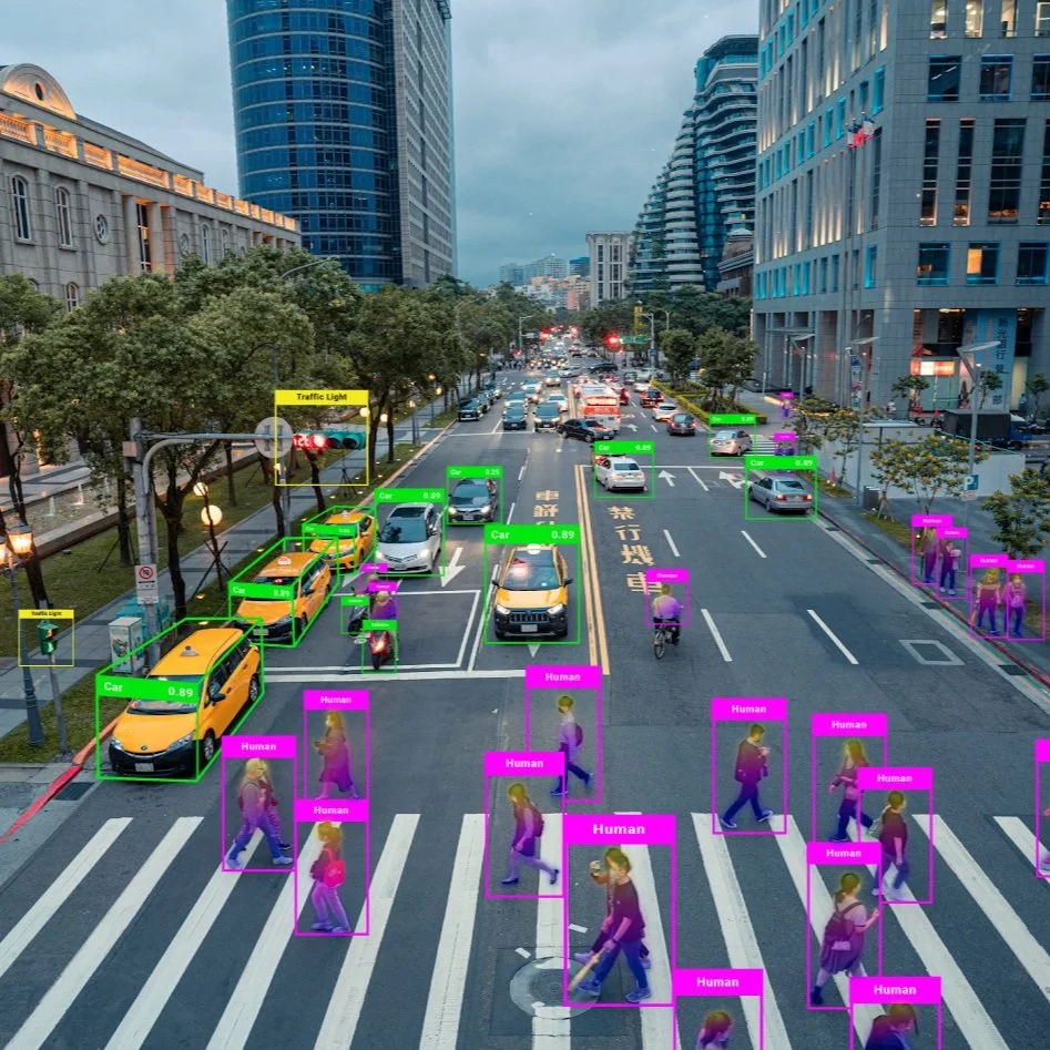
Semantic segmentation provides a broad understanding of the driving environment by assigning a category to each pixel in the image. All pixels that represent the same type of object, such as a building, a pedestrian, or the road, are grouped under a shared class label. This classification helps the vehicle recognize navigable surfaces, roadside boundaries, and static structures. In effect, semantic segmentation offers a map-like view of the surroundings, which is invaluable for high-level planning and general context awareness.

Despite its value, semantic segmentation cannot distinguish between separate objects of the same type. For example, while it can identify the presence of pedestrians in a scene, it cannot tell how many there are or where one individual ends and another begins. This limitation becomes critical in dense urban scenarios where vehicles must react differently to each nearby object. Without the ability to treat these objects as separate entities, the system cannot accurately track movement, predict behavior, or prioritize safety decisions in real time.

Advantages of Semantic Segmentation

Semantic segmentation offers several key benefits in the development and deployment of autonomous driving systems. Its primary strength lies in the ability to provide a comprehensive, high-level understanding of the environment by labeling every pixel with a class identifier. This full-scene categorization helps the vehicle recognize the structure of the road, the presence of sidewalks, crosswalks, curbs, lane markings, and traffic control elements such as signs or lights.

One significant advantage of semantic segmentation is its computational efficiency. Since it does not need to distinguish between individual object instances, it requires fewer resources, making it more suitable for real-time applications where rapid processing is essential. This efficiency is especially valuable in early perception stages or embedded systems where memory and processing power are limited.

Instance Segmentation

Instance segmentation builds on semantic segmentation by not only classifying pixels by object type but also distinguishing between individual instances within the same category. This means that two cars side by side or a group of pedestrians are treated as separate, uniquely identified objects. This capability is crucial for tracking motion over time, predicting trajectories, and making context-sensitive decisions. For autonomous driving, it enables the system to follow a specific vehicle, yield to a crossing pedestrian, or anticipate the movements of a cyclist in a way that semantic segmentation alone cannot support.

While semantic segmentation provides the foundational structure of a scene, instance segmentation enables nuanced object-level understanding. Together, they form a complementary system where one outlines the general layout and the other fills in the detailed behavior of dynamic elements. This dual-layered perception is particularly vital in urban environments where unpredictability, high object density, and rapid decision-making are the norms.

Advantages of Instance Segmentation

Instance segmentation provides an extra layer of intelligence by offering detailed, object-level awareness. Unlike semantic segmentation, it allows the vehicle to identify and distinguish between different objects within the same category. This capability is vital for dynamic interaction with the environment, where understanding individual behavior and movement patterns is necessary.

The main advantage of instance segmentation is its support for object tracking and trajectory prediction. For example, in a scenario with multiple pedestrians near a crosswalk, instance segmentation enables the vehicle to track each one separately, assess their movement patterns, and predict whether they intend to cross the street. This individualized attention makes it possible to make fine-grained driving decisions that prioritize safety and responsiveness.

Instance segmentation is also critical for collision avoidance and behavior prediction in dense traffic. By distinguishing between different vehicles, cyclists, or other moving agents, the system can estimate how each object is likely to behave and adapt its own actions accordingly. This is especially important in complex or crowded urban environments, where multiple agents are in motion simultaneously and in close proximity.

Integration of Semantic and Instance Segmentation in Urban Driving

In the dynamic and often unpredictable environment of urban driving, both semantic and instance segmentation play vital roles. Semantic segmentation provides a broad understanding of the scene, which is essential for navigation and path planning. Instance segmentation offers detailed information about individual objects, which is crucial for tasks like obstacle avoidance and interaction with other road users.

Recent advancements have seen the integration of both techniques into unified models, such as panoptic segmentation, which combines the strengths of semantic and instance segmentation to provide a comprehensive understanding of the scene. These integrated approaches are particularly beneficial in urban environments, where the complexity and density of objects require both broad and detailed scene interpretation.

By leveraging the strengths of both semantic and instance segmentation, autonomous vehicles can achieve a more robust and nuanced understanding of urban environments, leading to improved safety and efficiency in navigation and decision-making processes.

What are the Challenges of Semantic and Instance Segmentation

Urban environments present a complex array of visual elements, making accurate segmentation a formidable task. The challenges are multifaceted, impacting both semantic and instance segmentation techniques.

1. Occlusions and Overlapping Objects

In dense urban settings, objects frequently occlude one another. Pedestrians may be partially hidden by vehicles, or street signs might be obscured by foliage. Semantic segmentation often struggles in these scenarios, as it assigns the same label to all pixels of a class without distinguishing individual instances. Instance segmentation aims to overcome this by identifying separate objects, but occlusions can still lead to inaccuracies in delineating object boundaries.

2. Variability in Object Scales

Urban scenes encompass objects of varying sizes, from distant traffic signs to nearby pedestrians. This scale variability poses a significant challenge for segmentation algorithms, which must accurately identify and classify objects regardless of their size.

3. Dynamic Lighting and Weather Conditions

Lighting conditions in urban environments can change rapidly due to factors like time of day, weather, and artificial lighting. These variations can adversely affect the performance of segmentation models, which may have been trained under specific lighting conditions. To mitigate this, some approaches incorporate data augmentation techniques during training to expose models to a broader range of lighting scenarios.

4. Real-Time Processing Requirements

Autonomous vehicles require real-time processing of visual data to make immediate decisions. Semantic segmentation models often offer faster processing times but may lack the granularity needed for certain tasks. Instance segmentation provides more detailed information but at the cost of increased computational complexity. Balancing speed and accuracy remains a critical challenge in deploying these models in real-world urban driving scenarios.

5. Sparse and Noisy Data

Sensors like LiDAR generate point cloud data that can be sparse and noisy, especially at greater distances. This sparsity makes it difficult for segmentation algorithms to accurately identify and classify objects.

6. Dataset Limitations

The performance of segmentation models heavily depends on the quality and diversity of training datasets. Many existing datasets may not capture the full variability of urban environments, leading to models that perform well in training but poorly in real-world scenarios. Efforts are underway to develop more comprehensive datasets that include a wider range of urban scenes and conditions.

7. Integration of Multi-Modal Data

Combining data from multiple sensors, such as cameras and LiDAR, can enhance segmentation accuracy. However, integrating these data sources poses challenges in terms of synchronization, calibration, and data fusion. Developing models that can effectively leverage multi-modal data remains an active area of research.

Read more: In-Cabin Monitoring Solutions for Autonomous Vehicles

How Can We Help?

Digital Divide Data empowers AI/ML innovation by providing high-quality, human-annotated training data at scale. Here’s how we help autonomous driving companies solve annotation challenges.

Scalable, High-Precision Data Annotation

DDD specializes in large-scale data annotation services, including pixel-level labeling, object instance tagging, and 3D point cloud segmentation. These services are essential for training deep learning models to recognize and distinguish urban objects such as pedestrians, vehicles, road signs, and infrastructure under complex city conditions.

By integrating quality assurance workflows and domain-specific training for its workforce, DDD ensures that the labeled data used to train semantic and instance segmentation models meets industry standards for accuracy and consistency, particularly vital for safety-critical applications in autonomous driving.

Support for Multi-Modal and Diverse Urban Datasets

Modern autonomous systems rely on multi-sensor data fusion (e.g., LiDAR, RGB, radar). DDD supports annotation across these data types, enabling robust fusion-based segmentation models. Furthermore, DDD’s work often emphasizes geographic and environmental diversity, contributing to the development of models capable of generalizing across varied urban landscapes.

Enabling Rare Class Detection through Dataset Balancing

Rare but critical classes like emergency vehicles, construction zones, or atypical road behaviors are often underrepresented in datasets. DDD supports dataset balancing by sourcing, curating, and annotating niche scenarios, thus enabling models to recognize low-frequency but high-impact elements critical to safe driving.

Leveraging Human-in-the-Loop Processes

DDD incorporates human-in-the-loop methodologies in annotation workflows, particularly for edge cases common in urban scenes such as occluded pedestrians, irregular vehicle shapes, and ambiguous infrastructure. This hybrid approach, combining automated tools with skilled human reviewers, greatly improves annotation accuracy for complex urban segmentation datasets.

Read more: How to Conduct Robust ODD Analysis for Autonomous Systems

Conclusion

Urban driving scenes introduce significant challenges: occlusions, inconsistent lighting, sensor noise, and the need for real-time decision-making all push the limits of segmentation models. Overcoming these challenges requires more than just algorithmic sophistication; it demands high-quality annotated data, diverse and well-balanced datasets, and scalable workflows that integrate human expertise into the AI development lifecycle.

The evolution of semantic and instance segmentation techniques continues to play a critical role in advancing autonomous driving technologies. By addressing the inherent challenges of urban environments through innovative model architectures and data integration strategies, the field moves closer to realizing fully autonomous vehicles capable of safe and efficient navigation in complex cityscapes.

If your team is building perception systems for autonomous driving, let’s talk. We’re here to help you turn visual complexity into safe, actionable intelligence.

Let DDD power your computer vision pipeline with high-quality, real-world segmentation data. Talk to our experts today.

References:

Zou, Y., Weinacker, H., & Koch, B. (2021). Towards urban scene semantic segmentation with deep learning from LiDAR point clouds: A case study in Baden-Württemberg, Germany. Remote Sensing, 13(16), 3220. https://doi.org/10.3390/rs13163220

Vobecky, A., et al. (2025). Unsupervised semantic segmentation of urban scenes via cross-modal distillation. International Journal of Computer Vision. https://doi.org/10.1007/s11263-024-02320-3

Vobecky, A., et al. (2025). Unsupervised semantic segmentation of urban scenes via cross-modal distillation. International Journal of Computer Vision. https://doi.org/10.1007/s11263-024-02320-3

FAQs

1. How is segmentation different from object detection in autonomous driving?
While object detection identifies and localizes objects using bounding boxes, segmentation provides a much finer level of detail by classifying every pixel. This pixel-level understanding helps autonomous vehicles interpret the shape, boundary, and precise position of objects, which is essential for tasks like lane following or obstacle avoidance.

2. What role does synthetic data play in training segmentation models?
Synthetic data, generated from simulations or video game engines, is increasingly used to augment real-world datasets. It helps address class imbalances, rare scenarios, and edge cases while reducing the time and cost of manual annotation. However, models trained on synthetic data still require fine-tuning on real-world datasets to generalize effectively.

3. How do segmentation models handle moving objects versus static ones?
Segmentation itself is agnostic to motion; it labels objects based on appearance in a single frame. However, when used in video sequences, segmentation can be combined with tracking algorithms or temporal models to identify which objects are moving and predict their future positions.

4. Is instance segmentation always better than semantic segmentation for autonomous vehicles?
Not necessarily. Instance segmentation provides more detail, but it is also more computationally intensive. In some applications, such as identifying road surface or traffic signs, semantic segmentation is sufficient and more efficient. The choice depends on the task’s complexity, the required level of detail, and hardware constraints.

Semantic vs. Instance Segmentation for Autonomous Vehicles Read Post »

Autonomous systems industry experts participating in DDD’s roundtable at AutoSens US 2025

Insights from DDD’s Roundtable at Autosens US 2025

On 10th June, Sahil Potnis, VP of Product and Partnerships at DDD, brought together Autonomy industry leaders for a high-impact roundtable focused on problems autonomous companies are struggling with: collecting meaningful, high-quality data from sensors and cameras.

With around 10 experts at the table, the session started with a refreshingly candid discussion. Sahil pointed out that despite the demand, data collection is still too hard, too expensive, and far too limited for the scale we need to train and validate real-world systems. His perspective resonated with many in the room, setting the tone for collaborative and insightful discussions.

Throughout the session, Sahil emphasized the value of pairing annotated datasets with clearly defined KPIs to drive more focused development and smarter validation. He shared how this approach helps surface performance issues early but also ensures teams are working toward metrics that matter.

The group shared their perspectives on collaboration challenges, use-case gaps, and openly shared issues they’ve encountered in the field. What emerged was a genuine sense of community–people eager to learn from one another and push the industry forward.

Because when it comes to building smarter, safer, more capable systems, better data isn’t optional, it’s everything in the Autonomy industry.

Insights from DDD’s Roundtable at Autosens US 2025 Read Post »

ODD2BAnalysis2Bfor2BAutonomy

How to Conduct Robust ODD Analysis for Autonomous Systems

Autonomous systems are no longer experimental technologies operating in closed labs; they are rapidly becoming integral to how we move, deliver, monitor, and interact with our environments.

From self-driving cars and aerial drones to intelligent humanoids, the complexity of these systems requires that their operational boundaries are clearly understood, rigorously tested, and transparently communicated. This is where Operational Design Domain, or ODD analysis for autonomous systems, comes into play.

An ODD defines the specific conditions under which an autonomous system is designed to operate safely. It includes parameters such as weather conditions, road types, traffic scenarios, geographical boundaries, lighting conditions, and more. Think of it as the system’s declared comfort zone. If the system operates within that zone, its behavior should be both predictable and verifiably safe. Outside of it, the system is not guaranteed to function correctly, which introduces unacceptable risk.

This blog provides a technical guide to conducting robust ODD analysis for autonomous driving, detailing how to define, structure, validate, and evolve an Operational Design Domain using formal taxonomies, scenario-based testing, coverage metrics, and integration to ensure the safe and scalable deployment.

What Is an Operational Design Domain (ODD) and Why its Important?

An Operational Design Domain (ODD) defines the specific set of conditions under which an autonomous system is intended to operate safely. These conditions span across environmental, geographic, temporal, infrastructure, and dynamic factors. For example, a self-driving shuttle might be restricted to operating only on urban roads with speed limits under 30 km/h, in daylight hours, during dry weather. This collection of constraints forms its ODD. By clearly delineating the scope of operation, ODDs enable engineers to focus system development, testing, and safety validation on a bounded set of real-world conditions.

An ODD should be structured in a modular and exhaustive way. Key dimensions include “Scenery” (road layout, intersections), “Environment” (weather, lighting), and “Dynamic elements” (presence of other vehicles, pedestrians, animals). Using this framework helps prevent omissions in defining where and how an autonomous system should behave safely.

Beyond technical design implications, ODDs also play a pivotal role in regulatory compliance and safety assurance. Authorities in both the United States and Europe increasingly require autonomous system developers to submit detailed ODD documentation as part of their safety cases. The National Highway Traffic Safety Administration (NHTSA) and European safety frameworks aligned with UNECE and ISO guidelines expect that a system’s ODD be transparent, traceable, and demonstrably validated. In this context, an articulated and well-analyzed ODD becomes not just an engineering tool but a legal and ethical obligation.

How Do You Structure an ODD Analysis Using Standards and Taxonomies?

Building a robust ODD starts with organizing it through a formal taxonomy. This ensures that the domain is described in a structured, modular way instead of relying on free-text or ad hoc formats. It supports consistent communication across engineering, safety, and compliance teams and creates a dependable foundation for testing and validation.

Core ODD Dimensions
A comprehensive ODD typically includes multiple categories:

  • Scenery: road layouts, types, and intersections

  • Environment: weather conditions, lighting, and visibility

  • Dynamic Elements: other vehicles, pedestrians, and animals

  • Time: time-of-day or daylight constraints

  • Infrastructure Dependencies: signals, signage, connectivity requirements
    These categories define the operational envelope and make it easier to identify and assess system capabilities and limitations.

Benefits of Standardized Structure
Standardized structures ensure completeness and uniformity. International standards like ISO 34503 offer a baseline for describing each category in a clear and reusable format. This allows systems to scale across use cases or geographies without losing clarity or consistency.

Layered ODD Models for Depth
Some methodologies break down the ODD further into layered models- functional, situational, and behavioral. These layers help developers map system behavior and decision-making to specific operating conditions, offering a deeper analysis of how the system responds to real-world inputs.

Integration into Simulation and Testing Tools
Structured ODDs can be encoded into machine-readable formats that feed directly into simulation platforms and scenario libraries. This allows for automated scenario selection, test planning, and coverage tracking, significantly improving testing efficiency and traceability.

Foundation for Lifecycle Alignment
A structured ODD is essential not only for development but for every phase of the product lifecycle. It links environmental assumptions directly to system requirements, design decisions, validation strategies, and regulatory submissions, serving as a common reference across disciplines.

How To Manage ODD Changes as the Autonomous System Evolves?

An autonomous system’s ODD is rarely static. As the system matures, adapts to new markets, or incorporates new features, its ODD often expands to cover more complex or variable conditions. Managing this evolution is critical to maintaining system safety and ensuring that each expansion is accompanied by appropriate analysis, validation, and documentation.

Expanding the ODD without structured oversight can introduce risk. For example, adding nighttime operation, new weather conditions, or different road types may challenge sensor performance, decision-making algorithms, or fallback strategies. To manage these transitions effectively, ODD changes must be assessed methodically, with full awareness of how new conditions impact the existing safety case.

Key Practices for ODD Change Management:

Incremental Expansion Strategy
Begin with a narrow, well-understood ODD and expand it in controlled phases. This allows teams to develop confidence in a smaller domain before layering on new variables. Each new capability, such as driving in rain or on rural roads, should be treated as a discrete change that triggers new analysis and validation.

Change Impact Analysis
Use structured traceability to assess how each ODD modification affects system design, functional safety, performance requirements, and test coverage. For instance, if the new ODD includes foggy conditions, assess how perception sensors behave, whether braking performance is still within limits, and if previously validated scenarios are still valid under the new conditions.

Link ODD to Safety Engineering Artifacts
A robust ODD should be explicitly connected to all dependent safety assets:

  • Hazard analyses

  • Functional and technical requirements

  • Scenario libraries

  • Validation plans
    This traceability ensures that when the ODD changes, you can identify exactly which elements of the safety case must be revisited, reducing the chance of unaddressed risk.

Versioning and Documentation
Maintain detailed documentation of each ODD version, including what changes were made, why, and what corresponding updates were performed in testing and validation. Version control enables accountability and simplifies regulatory reporting.

Cross-Domain Applicability
In some cases, the same system architecture may be deployed across multiple environments (e.g., from highways to industrial sites). Change management methods should allow the ODD to be compared, merged, or branched to accommodate each domain while minimizing redundant analysis.

Continuous Monitoring
Even after deployment, systems should monitor real-world conditions to identify when they operate outside their declared ODD or encounter edge cases. These occurrences should trigger a feedback process for refining or extending the ODD safely.

How Do You Use Scenario-Based Testing to Validate ODD Analysis?

Scenario-based testing has become a central method for validating autonomous systems. It replaces the impractical approach of accumulating endless on-road miles with targeted, repeatable, and measurable tests that reflect the real-world situations a system may encounter. For this testing to be meaningful, it must be grounded in the Operational Design Domain (ODD). The ODD defines the space of operational conditions, and scenario-based testing explores that space with structured, representative examples.

When properly linked, the ODD serves as the basis for defining what kinds of scenarios are needed to prove system safety. Each condition outlined in the ODD should be reflected in a set of corresponding test cases that cover nominal behavior, edge cases, and failure modes.

Core Strategies for ODD-Driven Scenario Testing

Scenario Derivation from ODD Parameters
The starting point is to systematically derive scenarios from the parameters defined in the ODD. For instance, if the ODD includes urban roads during heavy rain and night-time conditions, there should be test scenarios simulating pedestrians crossing in poorly lit areas during rainfall. This ensures the system is tested in the same conditions under which it claims to be safe.

ODD-Tagging of Test Cases
Each test scenario should be tagged with the specific ODD conditions it represents. This tagging allows teams to track which parts of the ODD have been tested and which still lack coverage. As the ODD evolves, tagging also helps in updating only the necessary tests rather than rebuilding the entire suite.

Coverage Metrics and Risk-Based Prioritization
It’s not enough to have scenarios; the value lies in understanding how well they cover the ODD. Coverage can be measured by comparing the number and distribution of test scenarios across ODD parameters. Some factors, like weather or road type, may be high-risk and require more testing. Prioritization based on risk, frequency of occurrence, and historical incident data helps allocate testing resources efficiently.

Use of Simulation and Synthetic Environments
Simulators allow testing across a broad range of ODD conditions that are rare, dangerous, or costly to reproduce in the real world. Scenario libraries can be programmatically filtered using the ODD definition to generate or select only those scenarios that are relevant to the system’s operational domain. This enables large-scale validation with consistent traceability.

Boundary and Edge Case Testing
One of the most important contributions of ODD-driven testing is identifying and evaluating system behavior at the edges of the defined domain. These are the areas most likely to challenge the system’s capabilities, where conditions are borderline or transitions are occurring, such as dawn-to-dusk lighting changes or the onset of rain.

Adaptive Scenario Selection
Scenario-based testing should adapt as the ODD changes or as new insights emerge from operational data. By maintaining a formal link between the ODD and test scenario metadata, teams can automatically detect which tests need to be added or rerun when the ODD is updated.

Read more: Accelerating HD Mapping for Autonomy: Key Techniques & Human-In-The-Loop

What Metrics Help Measure ODD Coverage and Test Effectiveness?

Measuring how well an autonomous system has been tested within its Operational Design Domain (ODD) is a critical part of ensuring safety. Without metrics, it’s impossible to know whether the testing is representative, comprehensive, or aligned with the actual conditions the system will encounter. Coverage metrics offer a quantifiable way to assess whether the system has been evaluated across the full range of ODD parameters and how thoroughly those conditions have been exercised through scenario-based testing.

Effective coverage measurement goes beyond simply counting test cases. It involves understanding what parts of the ODD are covered, how often they are tested, and how critical those conditions are to system safety. The goal is not just volume, but relevance and depth.

Key Metrics and Evaluation Techniques

ODD Parameter Coverage
This measures which specific ODD conditions have been addressed in test scenarios. For example, if the ODD includes ten types of weather conditions but testing only covers three, that indicates a significant gap. Teams can define thresholds for minimum acceptable coverage across scenery types, lighting conditions, traffic scenarios, and more.

Risk-Weighted Coverage
Not all conditions are equally important. Some may be rare but high-risk (e.g., heavy snow with low visibility), while others are frequent but low-risk (e.g., sunny daytime in low-traffic areas). Risk-weighted metrics assign a higher value to tests that address combinations with higher safety implications. This helps prioritize the most meaningful scenarios and ensures that critical conditions are not overlooked.

Frequency of Occurrence vs. Test Representation
This involves comparing the real-world frequency of specific ODD conditions to their representation in the test suite. If certain scenarios occur often in the field but are underrepresented in testing, that misalignment could lead to unanticipated system failures. Aligning test distribution with operational exposure improves reliability.

Test Redundancy and Scenario Diversity
Measuring diversity helps avoid over-testing similar conditions while neglecting others. Even if multiple tests are labeled under the same weather condition, they should vary in other factors such as lighting, road curvature, and dynamic interactions. This ensures that the system is evaluated under a meaningful range of permutations.

Edge Case Density
Edge case testing focuses on the boundaries of the ODD, such as low-visibility thresholds, sudden weather transitions, or densely populated intersections. Tracking how many of these edge cases are included, and how often they are revisited, indicates how well the system’s performance envelope is being challenged.

Confidence Metrics and Uncertainty Quantification
Some teams also employ metrics to assess the system’s uncertainty or confidence levels across different ODD conditions. For example, if the system consistently exhibits low confidence in foggy environments, this could prompt additional testing, ODD refinement, or system redesign.

Scenario-to-ODD Traceability Score
This metric evaluates how well each scenario is linked back to specific ODD parameters. Strong traceability enables targeted regression testing and faster updates when the ODD changes, making the validation process more agile and maintainable.

How Can We Help in ODD Analysis for Autonomous Systems?

Digital Divide Data (DDD) offers end-to-end support for teams developing and scaling autonomous systems by delivering structured, actionable ODD analysis. Whether you’re launching in a new environment, expanding your operational reach, or adapting existing autonomy stacks to different regulatory or physical conditions.

By examining environmental factors, infrastructure dependencies, agent behavior, and robotic system capabilities, DDD enables product and engineering teams to align autonomy solutions with the practical demands of specific regions or markets.

Read more: In-Cabin Monitoring Solutions for Autonomous Vehicles

Conclusion

As autonomous systems continue to move from controlled environments into public spaces, the importance of clearly defining and rigorously validating their Operational Design Domain (ODD) cannot be overstated. A well-structured ODD acts as a contract between the system, its developers, and the world it operates in, setting the boundaries for safe operation, guiding design decisions, and serving as the foundation for testing, hazard analysis, and regulatory compliance.

Robust ODD analysis is not a one-time exercise. It’s a dynamic, ongoing process that evolves with system capabilities, deployment contexts, and operational feedback. By leveraging structured taxonomies, integrating the ODD into all stages of the development lifecycle, and validating through targeted, scenario-based testing, teams can ensure their autonomous systems perform safely and predictably within their intended environments.

Accelerate your autonomous deployment with DDD’s structured ODD solutions.

To learn more, talk to our experts

Frequently Asked Questions (FAQs)

What is the purpose of defining an ODD for autonomous systems?
An ODD outlines the specific conditions under which an autonomous system is expected to operate safely. This includes variables like weather, road types, lighting, traffic, and infrastructure. Defining an ODD sets clear boundaries for system capabilities and ensures all engineering, testing, and safety validation efforts are aligned with real-world operational constraints.

How often should an ODD be updated?
Updates are necessary whenever the system’s features expand, when it is deployed in new environments, or when real-world incidents reveal edge cases or risks that weren’t accounted for. Ongoing monitoring and structured change management help maintain the ODD’s relevance and safety coverage.

What’s the relationship between ODD and scenario-based testing?
Scenario-based testing is used to validate that an autonomous system performs safely across the full range of conditions defined in the ODD. Each scenario represents a combination of factors like road layout, weather, and traffic. Effective testing involves selecting or generating scenarios that reflect all ODD parameters, particularly edge cases and high-risk combinations.

How can ODD analysis support system scalability?
Robust ODD analysis enables teams to systematically assess and manage changes when expanding to new regions, use cases, or environments. It supports evaluating the portability of capabilities, identifying necessary engineering updates, and guiding scenario-based validation. This structured approach makes it easier to scale without compromising safety or performance.

References: 

ASAM e.V. (2023). ASAM OpenODD: Operational Design Domain Standard for ADAS/AD. https://www.asam.net/standards/detail/openodd/

Fraunhofer IESE. (2024). Cross-Domain Safety Engineering to Support ODD Expansion. Retrieved from https://www.iese.fraunhofer.de/

ISO. (2022). ISO 34503: Road vehicles — Taxonomy and definitions for terms related to driving automation systems for road vehicles — Operational Design Domain (ODD). International Organization for Standardization.

UK Department for Transport & BSI. (2022). PAS 1883: ODD Taxonomy for Automated Driving Systems. British Standards Institution.

How to Conduct Robust ODD Analysis for Autonomous Systems Read Post »

Objectdetection

Facial Recognition and Object Detection in Defense Tech

In a high-stakes defense environment, the speed and accuracy of information can define the outcome of missions, protect national borders, and save lives. Among the most critical enablers are facial recognition and object detection technologies.

These AI-driven systems are no longer confined to experimental labs or civilian applications; they are becoming central to how the military manages surveillance, secure facilities, conduct reconnaissance, and make tactical decisions in real time.

Facial recognition allows security forces to identify persons of interest across vast datasets, video feeds, and live drone surveillance, enabling more proactive threat detection and response. Object detection, on the other hand, powers everything from automated monitoring of suspicious vehicles and unattended baggage to identifying targets in combat zones. Whether deployed in UAVs scanning for threats over hostile terrain or in fixed-location cameras guarding critical infrastructure, these technologies form the backbone of a modern defense ecosystem that depends on automation for both strategic intelligence and real-time decision-making.

This blog explores how facial recognition and object detection in defense tech are transforming surveillance, threat detection, and decision-making. While also navigating challenges and recommendations, shaping their deployment.

Facial Recognition in Defense Tech

Facial recognition systems have rapidly evolved into indispensable tools for defense and security operations. Their applications extend beyond traditional surveillance, offering critical capabilities in identity verification, border control, watchlist monitoring, and mission-specific intelligence. However, as these systems mature, so do the tactics designed to undermine them, requiring equally advanced countermeasures and ongoing attention to legal and ethical implications.

Adversarial Attacks & Defenses

One of the most significant challenges facing facial recognition in defense is the emergence of adversarial attacks designed to fool AI systems. Cloaking techniques, which involve subtly altering a person’s appearance using algorithmically generated patterns, can render facial recognition systems ineffective. These patterns, often invisible to the human eye, are crafted to manipulate the model’s feature extraction layers, preventing accurate identification or causing deliberate misclassification.

To counter such threats, new defense systems are being developed that aim to purify the training data and harden recognition models against cloaked inputs. Among the most notable advancements is a training-time purification approach that filters out adversarial noise before it can corrupt the model. This method significantly reduces the success rate of cloaking attacks by refining the representation space, allowing the AI to learn more robust and generalized features. These defenses are particularly valuable in military systems that rely on long-term deployment in dynamic environments, where attackers may exploit open-source cloaking tools to bypass surveillance.

Cross-Spectrum Recognition

In operational scenarios where lighting is poor or visibility is limited, such as night-time patrols, covert surveillance, or operations in smoke-filled or foggy environments, traditional facial recognition systems based on visible light imagery become unreliable. To address these limitations, defense organizations are investing in cross-spectrum recognition technologies.

Cross-spectrum facial recognition leverages thermal-to-visible synthesis, a process that uses AI to generate a visible-light approximation of a thermal image. This allows standard recognition algorithms, trained on visible-light data, to function effectively even in complete darkness. By bridging the gap between thermal and visual spectrums, these technologies enable round-the-clock monitoring capabilities, particularly useful in perimeter defense, reconnaissance missions, and special operations conducted under low-light conditions.

Ethical & Legal Dimensions

As the use of facial recognition expands within defense tech operations, it raises critical questions around privacy, civil liberties, and accountability. Large-scale government surveillance programs, such as those managed by intelligence and law enforcement agencies, have sparked debate over the potential for misuse, biased algorithms, and a lack of transparency.

Programs run by defense tech have incorporated facial recognition into domestic and international intelligence workflows, often without full public disclosure or regulatory oversight. At the same time, research initiatives such as those under IARPA (Intelligence Advanced Research Projects Activity) aim to advance recognition capabilities to unprecedented levels of accuracy and scale.

The growing power of these systems has led to increasing calls for legislative guardrails and oversight mechanisms. Key concerns include the disproportionate impact of facial recognition errors on minority communities, the use of facial data without consent, and the potential for these tools to be used in ways that infringe on constitutional rights. For defense, maintaining public trust means not only building technically sound systems but also ensuring they are governed by clear policies, ethical frameworks, and transparent accountability structures.

Object Detection in Defense Tech

Object detection has become a cornerstone capability in modern defense operations, enabling automated systems to interpret visual data with speed and accuracy that surpasses human capability. From identifying potential threats in surveillance footage to guiding unmanned systems in complex combat environments, object detection plays a vital role in both strategic intelligence and real-time mission execution. As defense technology increasingly converges with AI, object detection is reshaping how information is gathered, targets are tracked, and operational decisions are made.

AI-Powered ISR & Targeting

Intelligence, Surveillance, and Reconnaissance (ISR) operations have traditionally relied on human analysts to interpret visual data collected from aerial and ground sensors. Today, AI-powered object detection systems are transforming ISR by automating the analysis of vast image and video datasets. One of the most prominent initiatives in this space is Project Maven, a U.S. Department of Defense program designed to integrate AI into battlefield decision-making. At the core of Project Maven is the ability to detect, classify, and track objects of interest, such as vehicles, weapons, or individuals, in drone footage and satellite imagery.

This automation dramatically accelerates the targeting cycle, reducing the time between identification and engagement of high-value targets. Object detection algorithms allow for real-time threat assessments, flagging suspicious movements or equipment without requiring constant human oversight. Beyond surveillance, object detection is also enabling advanced capabilities in unmanned ground vehicles (UGVs) and aerial systems. These platforms use AI to autonomously navigate terrain, track moving targets, and even assist in guiding munitions with high precision. In high-risk or GPS-denied environments, such autonomy can be critical to mission success and troop safety.

Adversarial Vulnerabilities

Despite its effectiveness, object detection is not immune to deception. Adversaries have developed techniques to exploit weaknesses in AI vision systems, most notably through patch-based adversarial attacks. These involve attaching carefully designed patterns, often resembling innocuous symbols or geometric shapes, to objects or vehicles to confuse or mislead detection algorithms. The result can be a failure to recognize a weapon, a misclassification of a hostile asset, or the complete evasion of automated tracking.

To counter these threats, defense researchers are developing inpainting-based defenses. These techniques aim to detect and digitally remove the adversarial patches from the input image before the object detection system processes it. By restoring a more “natural” visual representation, these defenses help the system recover its detection accuracy. In parallel, adversaries have also turned to more traditional forms of evasion such as camouflage, thermal masking, and concealment using foliage or terrain features. These low-tech countermeasures remain surprisingly effective, especially when combined with AI-targeted adversarial designs, underscoring the need for resilient, multi-modal detection systems.

System Integration & Ethics

As object detection systems become more integrated across defense platforms, their effectiveness increasingly depends on seamless fusion with other sensors and computing systems. Multi-modal integration, combining visible-spectrum cameras with thermal, infrared, radar, and acoustic sensors, provides a more comprehensive and reliable picture of the battlefield. Edge computing architectures allow this data to be processed locally on devices such as drones or autonomous vehicles, enabling low-latency decision-making even in disconnected or hostile environments. Predictive analytics further enhances these systems by using historical data and real-time observations to anticipate threats before they materialize.

However, the integration of object detection into weapons systems, particularly autonomous ones, raises profound ethical and legal questions. As lethal autonomous weapon systems (LAWS) become more capable, concerns about accountability, proportionality, and the risk of unintended engagements intensify. International discussions continue around the regulation or outright ban of fully autonomous weapons, with debates centered on the acceptable level of human control. For defense agencies, balancing technological advancement with ethical responsibility is critical, not only for compliance with international norms but also for maintaining legitimacy in the eyes of the global community.

Read more: Fleet Operations for Defense Autonomy: Bridging Human Control and AI Decisions

Challenges & Recommendations of Facial Recognition and Object Detection

Data Quality and Bias in Military AI

One of the most pressing challenges in deploying facial recognition and object detection in defense is the issue of poor data quality and model bias. AI systems trained on limited or non-representative datasets often perform inconsistently across different environments, lighting conditions, or demographic groups. In operational terms, this means identity mismatches in facial recognition or misclassification of key objects in surveillance feeds.

The recommendation here is to build more robust and representative datasets tailored to defense use cases, incorporating variations in terrain, time of day, atmospheric conditions, and population diversity. This should be complemented with continuous data auditing and the use of domain-specific data augmentation to help models generalize more effectively and reduce inherent biases.

False Positives, False Negatives, and Decision Integrity

A closely related concern is the occurrence of false positives and false negatives. In mission-critical defense operations, a false positive could result in the misidentification of a civilian as a hostile actor, while a false negative could allow a threat to go undetected. Both scenarios carry significant consequences for safety and mission outcomes.

To mitigate this, systems should be designed to include confidence scores and uncertainty estimates, giving human operators more nuanced insights into the AI’s decision-making. Additionally, employing ensemble models and multi-sensor fusion, such as combining visual and thermal data, can enhance reliability and minimize the chances of critical errors.

Adversarial Threats to Visual Recognition

Adversarial attacks are another significant threat to AI vision systems in defense. These include facial cloaking techniques that evade recognition and patch-based attacks that confuse object detection algorithms. Such tactics can effectively render AI systems blind to genuine threats. The defense against this lies in incorporating adversarial training methods that expose models to simulated attacks during development. Preprocessing techniques, like inpainting and data purification, can help restore the integrity of manipulated inputs. Creating adversarial testing environments also allows defense organizations to proactively assess vulnerabilities and improve system robustness before live deployment.

Human-AI Collaboration in High-Stakes Operations

The lack of structured human-AI collaboration frameworks presents another operational gap. Overreliance on AI systems without sufficient human oversight can result in blind trust and potentially catastrophic decisions. Conversely, sidelining AI can reduce efficiency and slow down responses.

A balanced approach involves integrating human-in-the-loop workflows, where AI assists rather than replaces decision-makers. This setup should include interpretable outputs and user interfaces that clearly communicate system confidence and rationale. Equally important is training defense personnel to understand AI limitations, fostering an environment of informed trust rather than unquestioning dependence.

Governance, Ethics, and Regulatory Oversight

The rapid integration of facial recognition and object detection into defense workflows has outpaced the development of regulatory and ethical oversight mechanisms. This creates uncertainty around issues such as privacy, consent, accountability, and adherence to international laws of engagement.

The recommendation here is to establish transparent and enforceable governance frameworks that define permissible applications and usage boundaries. This includes creating data governance policies, ethical review boards, and ensuring auditability of AI systems through explainable models and usage logs.

Operational Resilience in Mission-Critical Scenarios

Finally, mission readiness under operational stress remains a persistent concern. Defense AI systems must function reliably even in degraded environments, where communication is limited, adversaries deploy countermeasures, or natural conditions obscure visibility.

To address this, systems should be equipped with edge-processing capabilities to operate autonomously when disconnected from central servers. They should also be subjected to rigorous testing in both simulated and real-world defense scenarios to ensure resilience, adaptability, and fail-safe performance under pressure.

How We Can Help

Digital Divide Data (DDD) is uniquely positioned to support the defense tech in building resilient, ethical, and mission-ready AI systems through high-quality data services and scalable human-in-the-loop solutions. As AI adoption accelerates in surveillance, targeting, and threat detection workflows, the success of these applications increasingly depends on the quality, diversity, and security of the underlying data. DDD’s capabilities directly address these requirements.

We provide large-scale, high-fidelity data collection and annotation services tailored to defense and security contexts. This includes labeling of facial images under varied lighting, occlusion, and environmental conditions, as well as complex object detection tasks involving aerial, thermal, and multi-sensor imagery. By drawing from global, diverse data sources and using trained, security-vetted annotators, DDD helps ensure that AI models are trained on datasets that minimize bias and maximize operational generalizability.

We integrate human-in-the-loop workflows that enhance system reliability in high-stakes environments. Whether it’s verifying edge-case detections, annotating adversarial scenarios, or maintaining the accuracy of evolving datasets, DDD’s skilled teams offer continuous validation and refinement, critical for AI systems deployed in dynamic, adversarial settings. These workflows not only improve accuracy but also build in accountability and transparency, which are increasingly required in defense AI applications.

Our defense tech solutions are 100% U.S owned, operated by a U.S. workforce, and led by veterans. All data used in defense programs remains securely housed within the United States, ensuring compliance with data sovereignty requirements and the highest standards of national data protection.

Read more: Geospatial Data & GEOINT Use Cases in Defense Tech and National Security

Conclusion

As global threats grow more sophisticated, the defense sector is turning to advanced technologies like facial recognition and object detection to maintain strategic advantage and national security. These AI-driven capabilities are no longer experimental; they are embedded in mission-critical systems such as surveillance drones, unmanned vehicles, biometric access controls, and real-time targeting platforms.

To harness the full potential of these technologies, it is essential to strike a careful balance between technical innovation and responsible implementation. Defense systems must be built on diverse, high-quality datasets, hardened against manipulation, and designed with human oversight and ethical safeguards at their core. Investing in robust AI infrastructure is not just a matter of technological superiority; it is a matter of trust, accountability, and long-term resilience.

The future will depend not just on how powerful these systems become, but on how ethically, securely, and effectively they are deployed.

Partner with DDD to build secure, mission-ready AI systems using facial recognition and object detection in defense tech. Talk to our experts

Facial Recognition and Object Detection in Defense Tech Read Post »

Geo252BIntelligence252B2528GeoINT2529

Geospatial Data & GEOINT Use Cases in Defense Tech and National Security

Geospatial data has become a foundational asset in defense tech and national security operations. It broadly encompasses any information tied to a location, from satellite imagery and topographic maps to real-time sensor feeds and 3D models. In the defense sector, its significance has grown rapidly as the nature of warfare and intelligence gathering has shifted from static battlefield maps to dynamic, data-driven decision environments.

Geospatial data is now critical across various military functions: from early-warning systems and target acquisition to mission planning, logistics, and situational awareness. It underpins operations in diverse and complex terrains, urban battlegrounds, maritime chokepoints, and cyber-physical domains alike. Its value extends beyond just defense, supporting disaster response, infrastructure protection, and even pandemic monitoring.

This blog explores geospatial data & GEOINT use cases in defense and national security, highlighting how these technologies are driving recent innovations and operational strategies.

The Evolution of Geospatial Intelligence (GEOINT)

The roots of geospatial intelligence trace back to traditional cartography and reconnaissance, where physical maps and manual image interpretation formed the basis of battlefield strategy. Over time, as technology advanced, so did the sophistication of GEOINT. The rise of satellite imaging in the Cold War era marked a turning point, providing nations with a new level of visibility across borders and theaters of conflict. Today, that capability has expanded dramatically, with real-time feeds, hyperspectral imagery, and AI-assisted analysis redefining what is possible.

Modern GEOINT is no longer confined to static maps. It has evolved into a dynamic, multi-dimensional intelligence discipline that integrates geospatial data with artificial intelligence, machine learning, and real-time sensor fusion. These technologies enable defense analysts and commanders to not only visualize physical environments but also to predict movement, monitor behavioral patterns, and detect anomalies across domains.

Geospatial intelligence now plays a pivotal role in what are known as multi-domain operations, coordinated efforts that span land, air, sea, cyber, and space. Whether it’s supporting precision strikes, mapping urban terrain in real time, enabling autonomous drone navigation, or protecting digital infrastructure, GEOINT serves as the connective tissue between data and decisions in modern warfare.

This evolution marks a paradigm shift. What began as a supporting function is now a central pillar of national defense strategies, enabling speed, accuracy, and adaptability in complex, rapidly changing environments.

Use Cases of Geospatial Data and GEOINT in Defense Tech & National Security

Intelligence, Surveillance, and Reconnaissance (ISR)

Intelligence, Surveillance, and Reconnaissance (ISR) is a foundational pillar of modern military operations, enabling decision-makers to understand, anticipate, and respond to threats with speed and accuracy. At its core, ISR involves the collection, processing, and dissemination of information about adversarial forces, terrain, and activity, often under time-sensitive conditions. Today, geospatial data sits at the heart of this process.

The Role of Geospatial Data in ISR

Modern ISR relies heavily on geospatial data derived from satellites, manned aircraft, unmanned aerial vehicles (UAVs), ground-based sensors, and maritime platforms. These sources produce vast volumes of high-resolution imagery and telemetry data that must be interpreted rapidly to provide actionable intelligence. Geospatial intelligence (GEOINT) enables operators to:

  • Monitor adversarial movements and deployments

  • Detect changes in terrain, infrastructure, or activity patterns

  • Track time-series data to assess trends or anticipate actions

  • Fuse visual, radar, and multispectral data for more accurate detection

Geospatial data enhances ISR by anchoring intelligence within precise coordinates and temporal contexts, transforming raw visuals into operational insight.

AI and Foundation Models in ISR

The increasing complexity and volume of ISR data have accelerated the adoption of AI and machine learning models, particularly foundation models trained on vast datasets of satellite and aerial imagery. These models can:

  • Detect vehicles, aircraft, ships, and facilities automatically

  • Classify objects and activities (e.g., convoy movement, construction, force buildup)

  • Identify anomalies (e.g., sudden changes in terrain or unreported infrastructure)

  • Operate under diverse conditions, including night and poor weather (using SAR and thermal imagery)

Mission Planning and Terrain Analysis

Effective mission planning is impossible without a deep understanding of the physical, environmental, and structural complexities of the operational environment. In modern warfare, where the landscape can range from dense urban centers to remote mountainous terrain, geospatial data is the bedrock of planning, simulation, and tactical decision-making.

Why Terrain Intelligence Matters

Before boots hit the ground or autonomous systems are deployed, commanders must know:

  • Where threats may be hidden

  • Which paths offer the least resistance or exposure

  • How the landscape may affect communications or visibility

  • What risks do natural and man-made obstacles pose

Geospatial terrain analysis provides this foresight. It allows forces to rehearse missions virtually, conduct route feasibility studies, and tailor strategies to the terrain’s demands, minimizing the risk of surprise and optimizing operational efficiency.

Key Technologies in Terrain Analysis

Digital Elevation Models (DEMs):
DEMs offer precise height information of surface features, critical for planning helicopter landings, artillery placements, and line-of-sight (LOS) communications. In hilly or forested areas, they help anticipate visual obstructions or ambush points.

Land Use and Land Cover (LULC) Classification:
Geospatial tools classify terrain, such as urban, forest, desert, wetland, or agricultural zones. These classifications influence mobility, camouflage, and risk of detection. For instance, armored vehicles may avoid swampy terrain, while infantry units might use forests for cover.

3D Urban Mapping and Mesh Modeling:
Urban warfare demands a granular understanding of building layouts, alleyways, underground structures, and vertical access points (e.g., rooftops or subways). Advanced photogrammetry and LiDAR-derived 3D models are now routinely used for close-quarters mission rehearsals.

Real-Time Atmospheric and Environmental Data Integration:
Weather conditions, wind, fog, precipitation, and dust can dramatically impact visibility, aircraft performance, or the effectiveness of infrared sensors. Geospatial platforms now ingest meteorological data in real time to adapt plans dynamically.

Terrain Navigation and Autonomous Systems:
For drones, unmanned ground vehicles (UGVs), and autonomous naval vessels, terrain-aware navigation is essential. These systems use geo-tagged data to calculate elevation, identify natural barriers, and localize themselves even in GPS-denied environments.

Applications in Defense Scenarios

  • Reconnaissance and Infiltration: Identify safe and stealthy ingress/egress routes.

  • Fire Planning: Adjust artillery firing angles based on topography and slope.

  • Search and Rescue (SAR): Map out safe zones and terrain risk for deployment teams.

  • Logistics and Mobility Planning: Ensure convoys or supply chains avoid bottlenecks or bridges that can’t support heavy loads.

  • Cyber-Physical Simulations: Integrate terrain data into wargames and training simulators to test tactics in accurate virtual environments.

Border and Maritime Surveillance

Securing national boundaries both on land and at sea is a complex, resource-intensive endeavor that demands constant vigilance. In a time of increasing geopolitical tension, transnational crime, and illicit maritime activity, defense and homeland security agencies are turning to geospatial intelligence to ensure sovereignty, detect threats, and safeguard trade routes.

Geospatial surveillance systems are now the backbone of persistent monitoring, offering unmatched capabilities in detecting, classifying, and responding to suspicious activity across remote borders, coastal zones, and open oceans.

Geospatial Technologies in Use

Synthetic Aperture Radar (SAR):
Unlike traditional optical sensors, SAR can penetrate cloud cover and operate in total darkness, making it ideal for round-the-clock border and maritime surveillance. SAR is capable of detecting vehicle tracks, terrain disturbances, and unusual vessel movements even in low-visibility environments such as deserts, mountainous terrain, and high seas.

Thermal and Infrared Imaging:
Thermal sensors are instrumental in detecting heat signatures of individuals, vehicles, or boats, especially in night operations or during adverse weather. This capability is critical in identifying illegal border crossings, human trafficking movements, or unregistered vessels avoiding radar detection.

Automatic Identification Systems (AIS):
AIS transponders on ships transmit identity, position, course, and speed data. However, not all vessels use AIS legally. By fusing AIS data with SAR and electro-optical imaging, defense systems can detect “dark vessels” that deliberately disable their AIS to avoid detection, often used in smuggling, illegal fishing, or piracy.

Change Detection Algorithms and Pattern Recognition:
Satellite imagery over time allows agencies to compare changes in terrain or maritime routes. For example, repeated land disturbances near a border fence could signal illegal excavation or tunnel building, while altered shipping routes may indicate evasive behavior.

Persistent Surveillance from UAVs and HAPS (High-Altitude Pseudo Satellites):
Drones and high-altitude balloons equipped with EO/IR and radar payloads offer long-dwell surveillance over isolated or inaccessible regions, providing high-resolution feeds for both human analysts and AI systems.

Key Defense Applications

  • Border Security Monitoring: Detecting unauthorized crossings, vehicle incursions, and contraband movement across land borders in deserts, forests, or mountainous terrain.

  • Maritime Domain Awareness (MDA): Tracking vessel traffic, flag state violations, and illegal maritime operations in exclusive economic zones (EEZs) and critical chokepoints.

  • Anti-Piracy and Counter-Smuggling Operations: Identifying fast, unregistered boats operating off known smuggling corridors or near strategic maritime infrastructure.

  • Illegal Fishing Detection: Monitoring protected marine zones and identifying fishing trawlers operating without permits or in restricted areas a key issue in Southeast Asia, West Africa, and the Pacific.

  • Disaster and Refugee Movement Tracking: Supporting humanitarian missions by monitoring mass maritime migrations, especially in regions affected by conflict or natural disasters.

Read more: Top 10 Use Cases of Gen AI in Defense Tech & National Security

Autonomous Systems Navigation

Integration of autonomous systems into military operations is transforming how missions are conducted across air, land, and sea. Whether it’s unmanned ground vehicles (UGVs) conducting resupply, drones performing reconnaissance, or naval assets patrolling contested waters, the effectiveness of these autonomous platforms hinges on access to accurate and dynamic geospatial data.

Unlike manned missions, autonomous operations require a deeper pre-programmed understanding of the environment and the ability to adapt in real-time, often in GPS-denied or signal-contested scenarios. This is where high-fidelity geospatial intelligence becomes critical.

The Role of Geospatial Data in Autonomy

Autonomous military platforms must constantly answer three questions: Where am I? What’s around me? How do I get to the target location safely? 

Geospatial data provides the foundational input for all three, enabling machines to navigate, avoid hazards, and complete missions with minimal human intervention.

Core Components Enabling Autonomous Systems Navigation

High-Definition (HD) Maps:
HD maps contain precise representations of terrain features, road geometries, elevation profiles, obstacle zones, and traversable areas. These maps, often created using LiDAR and high-resolution satellite imagery, help autonomous vehicles understand not just location but context, such as sharp turns, inclines, restricted areas, and potential ambush sites.

Terrain-Referenced Navigation (TRN):
In GPS-denied or spoofed environments (a common tactic in modern electronic warfare), autonomous systems use terrain features like ridgelines, valleys, or man-made structures to localize themselves. By comparing onboard sensor inputs (camera, LiDAR, radar) with pre-mapped terrain models, they can navigate with a high degree of certainty even when GNSS is unavailable.

Simultaneous Localization and Mapping (SLAM):
For drones and ground vehicles operating in uncharted or dynamic environments, SLAM enables real-time mapping and localization. Geospatial SLAM systems fuse vision, radar, and inertial data to build and update their own maps while moving, critical for navigating unknown battlefields or collapsed urban areas.

Real-Time Map Updating via Recon Assets:
Autonomous systems don’t operate in isolation. Reconnaissance drones or satellites can relay updates on terrain changes, like roadblocks, craters, or enemy movement, which are then streamed to ground units to revise pathfinding decisions on the fly. This dynamic data flow is essential for last-mile operations, where outdated maps could mean mission failure or system loss.

Obstacle Detection and Avoidance:
Using fused geospatial and onboard sensor data, autonomous systems can classify and avoid obstacles such as debris, enemy assets, water bodies, or structural ruins, key for both stealth and safety in contested zones.

Use Cases in Defense Operations

  • Last-Mile Logistics: Autonomous ground convoys deliver supplies to forward operating bases or evacuation zones without risking human drivers in conflict areas.

  • Aerial Reconnaissance and Target Acquisition: UAVs use terrain and map data to fly at low altitude (terrain-following flight) to avoid radar detection while scanning specific geofenced regions.

  • Minefield Navigation: Unmanned platforms can use geospatial data and sensors to navigate around or clear suspected minefields autonomously.

  • Undersea Mapping and Patrol: Autonomous underwater vehicles (AUVs) rely on geospatial bathymetry and sonar-based SLAM to patrol and map littoral or deep-sea environments, often in strategic chokepoints.

Read more: Fleet Operations for Defense Autonomy: Bridging Human Control and AI Decisions

How We Can Help

As the demand for precise, actionable geospatial intelligence (GEOINT) grows across defense and national security, the ability to transform raw spatial data into mission-ready insights becomes a strategic imperative. Digital Divide Data (DDD) delivers tailored GEOINT solutions that empower defense organizations to gain a tactical and strategic edge.

DDD supports key geospatial workflows central to defense operations:

Map Building for Operational Planning:
DDD enables the creation of high-resolution, annotated maps that are essential for route planning, terrain analysis, and mission execution. These maps are enriched with geo-referenced features such as road networks, infrastructure, and elevation profiles.

Disaster Modeling and Humanitarian Support:
Leveraging satellite imagery and change detection models, DDD supports disaster response scenarios by generating geospatial layers that help defense and relief agencies assess damage, identify access routes, and coordinate aid delivery.

Satellite Navigation (SatNav) Validation:
We assist in validating SatNav systems by mapping and classifying terrain features used in autonomous vehicle localization and targeting systems. Our services help improve navigational accuracy in GPS-contested or denied environments.

Imagery Intelligence (IMINT) for Battle Damage Assessment (BDA):
Our teams are trained in IMINT workflows to support post-strike analysis. We annotate and interpret aerial and satellite imagery to evaluate strike accuracy, infrastructure damage, and residual threats, key for BDA and national security targeting operations.

DDD’s expertise lies not only in data processing but in delivering intelligent outputs that meet the standards required by defense analysts, AI developers, and ISR teams. With a dedicated US workforce and a focus on ethical impact, DDD ensures mission-critical geospatial workflows are supported with precision, scalability, and confidentiality.

Conclusion

As global defense strategies evolve to meet the demands of asymmetric warfare, cyber-physical threats, and rapid-response operations, geospatial data has emerged as a critical enabler of modern military capability. From strategic surveillance to autonomous navigation and real-time battlefield coordination, geospatial intelligence is no longer a supporting element; it is the foundation upon which decisions are made and missions are executed.

Yet, with this strategic importance comes the responsibility to build secure, interoperable, and ethically sourced geospatial ecosystems. As defense organizations scale their use of AI and automation, the demand for high-quality, annotated, and mission-specific geospatial data will only increase.

Let’s build smarter, safer, and more strategic defense ecosystems together. Talk to our experts

Geospatial Data & GEOINT Use Cases in Defense Tech and National Security Read Post »

in cabin2Bmonitoring2Bsolutions2Bfor2Bautonomous2Bvehicles

In-Cabin Monitoring Solutions for Autonomous Vehicles

As autonomous vehicles (AVs) move steadily toward higher levels of automation, the focus on safety and performance has broadened. As vehicles assume more control, understanding the in-cabin monitoring systems on how occupants behave, respond, or require assistance becomes just as critical.

This includes being able to detect medical emergencies, unsafe or erratic behavior, improper use of safety restraints, or situations that could compromise privacy or security.

In-cabin monitoring is no longer a supplementary feature but a prerequisite for intelligent systems that can personalize experiences, improve crash response through adaptive airbag deployment, and even provide fallback control in critical scenarios. As autonomy shifts human drivers into passive occupants, the car must become contextually aware of what is happening inside.

This blog explores in-cabin monitoring solutions for autonomous vehicles and highlights the key functions, critical technologies driving their development.

Key Functions of In-Cabin Monitoring Systems in AVs

In-Cabin Monitoring Systems (ICMS) encompass a range of technologies and models designed to assess and interpret the state of the vehicle’s occupants and interior environment. These systems are not monolithic; rather, they comprise several interrelated subsystems, each responsible for a specific function that contributes to overall safety, comfort, and user personalization. Below are the core components that define modern ICMS implementations:

Driver Monitoring Systems (DMS):
With higher levels of driving automation, the driver transitions from a constant operator to a fallback-ready user. This makes it essential to assess driver readiness and cognitive state in real time. DMS typically tracks fatigue, distraction, intoxication, and gaze or attention level. AI models process facial landmarks, eye movement, and head pose to infer whether the driver is alert and capable of resuming control if needed.

Occupant Monitoring Systems (OMS):
OMS focuses on the broader cabin, ensuring that all passengers are accounted for and safe. This includes detecting seat occupancy, verifying seatbelt usage, identifying children or unattended passengers, and assessing occupant posture. Systems must adapt to complex seating configurations and dynamically identify scenarios such as a child sleeping in a booster seat or an adult reclining across two seats.

Environmental Monitoring
While not core to all ICMS, environmental sensing enhances occupant safety and comfort by tracking lighting conditions, in-cabin temperature, and air quality. This data can support automatic climate adjustments or trigger alerts in the case of unsafe air or thermal levels.

Emergency Detection
A growing area of focus is identifying medical or behavioral emergencies. These include detecting if a passenger has fainted, is unresponsive, or is displaying aggressive or erratic movements. This capability is critical for shared AVs where there is no human driver to intervene in real-time.

Together, these functions form the backbone of ICMS, enabling vehicles to move beyond reactive safety and toward proactive, context-aware decision-making.

Personalization Features

The role of ICMS is no longer confined to safety. These systems now underpin personalization features, adjusting climate settings, recommending media, or even modifying airbag deployment based on occupant age or posture.

This dual-purpose trajectory is shaping industry standards and pushing automakers to think of ICMS not only as a regulatory requirement but as a strategic advantage. With regulatory bodies in regions like the EU mandating DMS in new vehicle models, widespread adoption is inevitable.

As the industry transitions into autonomy at scale, ICMS will become central to how vehicles understand and interact with humans, both drivers and passengers alike.

Technologies Powering In-Cabin Monitoring Systems

The effectiveness of In-Cabin Monitoring Systems hinges on a tightly integrated stack of sensors, computer vision models, and AI algorithms. These technologies work together to interpret complex, real-world occupant behavior with speed and precision. As the automotive industry evolves, so does the sophistication of the tools powering ICMS.

Sensor Suite: From RGB to mmWave
ICMS begins with data collection, and the choice of sensors plays a critical role in performance. Most systems use a mix of RGB cameras, infrared (IR) sensors for night vision, and Time-of-Flight (ToF) or depth cameras to capture three-dimensional spatial data. In some cases, mmWave radar is added to provide robust detection even in occluded conditions (e.g., blankets covering a child) or poor lighting. While LiDAR has proven valuable for external sensing, its in-cabin use is still limited due to cost and integration complexity.

Computer Vision and AI Models
Once data is captured, AI models process and analyze it in real-time. Common techniques include:

  • Object and Pose Detection: Frameworks like YOLO (You Only Look Once) and MTCNN (Multi-task Cascaded Convolutional Networks) are used to detect faces, hands, and body posture. These detections are crucial for downstream tasks like fatigue or gaze estimation.

  • Emotion and Demographic Classification: Convolutional Neural Networks (CNNs) and multi-modal classifiers are used to infer emotions, age, and gender, all of which can be inputs for adaptive systems such as climate control, infotainment preferences, or emergency response prioritization.

  • Activity Recognition: Advanced models trained on multi-task datasets can identify complex behaviors such as eating, texting, sleeping, or aggressive movement. These are essential for both safety and personalization.

Sensor Fusion Models
Combining modalities enhances system robustness. For example, radar + infrared fusion helps identify passengers in low-light conditions or when parts of the body are occluded. Sensor fusion also improves reliability across various environmental conditions, making the system suitable for 24/7 deployment in real-world scenarios.

Annotation and Dataset Requirements
Training accurate models requires extensive, high-quality data. ICMS datasets must include detailed annotations such as:

  • Facial keypoints and gaze vectors

  • Posture labels and pose classification

  • Multi-occupant scenarios with occlusions or overlapping bodies

Complex edge cases, like detecting a child in a booster seat while partially obscured by an adult, require custom annotation pipelines. Datasets like TICaM (Thermal In-Car Monitoring) offer a foundation, but real-world applications often demand project-specific data collection and labeling strategies.

Learn more: Simulation-Based Scenario Diversity in Autonomous Driving: Challenges & Solutions

In-Cabin Monitoring Solutions for Autonomous Vehicles

As automotive companies race to build intelligent, context-aware vehicles, the demand for high-quality annotated data to train In-cabin monitoring systems has never been greater. This is where Digital Divide Data (DDD) plays a pivotal role. With deep expertise in behavioral data annotation and AI workflow integration, DDD enables AV companies to accelerate the development and deployment of in-cabin monitoring solutions.

Specialized Expertise in DMS and OMS
DDD’s annotation teams are trained to label complex behavioral signals essential for Driver and Occupant Monitoring Systems. Whether it’s detecting micro-expressions that indicate fatigue or accurately labeling multi-occupant postures, DDD provides the precision and context needed to train reliable models.

Custom Annotation Pipelines for Complex Scenarios
No two ICMS projects are the same. From labeling facial keypoints in low-light conditions to identifying subtle gestures across overlapping bodies, DDD develops custom pipelines tailored to each client’s model architecture and objectives. These pipelines include bounding boxes, segmentation masks, gaze tracking, posture classification, and gesture labeling, delivered with consistent accuracy at scale.

Global Workforce, Localized Compliance
With a global talent pool trained on safety-critical annotation workflows, DDD combines speed and scalability with high-quality results. Annotations undergo multiple layers of validation, often using human-in-the-loop (HITL) systems that ensure continuous learning and refinement.

HITL-Driven Feedback Loops
To maximize model performance, DDD integrates continuous feedback mechanisms between annotation teams and client-side model developers. This enables active learning, where challenging edge cases, such as partial occlusions or ambiguous gestures, are iteratively labeled and used to retrain models for improved accuracy.

Learn more: Enhancing In-Cabin Monitoring Systems for Autonomous Vehicles with Data Annotation

Conclusion

As vehicles move closer to full autonomy, In-Cabin Monitoring Systems (ICMS) are emerging as foundational components, not just for safety, but for delivering intelligent, human-centric experiences. From detecting driver fatigue to adapting cabin environments based on occupant behavior, ICMS is shaping how future vehicles will interact with passengers.

This transformation demands more than just sophisticated algorithms; it requires precise, context-aware data to train systems that can interpret human nuances in real-time. As the automotive industry accelerates toward L4–L5 autonomy, the importance of high-quality annotated data and flexible, scalable labeling workflows cannot be overstated.

By bridging the gap between raw data and intelligent models, DDD empowers autonomous vehicle stakeholders to build ICMS that are safe, adaptive, and ready for real-world deployment.

To learn more, talk to our AV experts.

In-Cabin Monitoring Solutions for Autonomous Vehicles Read Post »
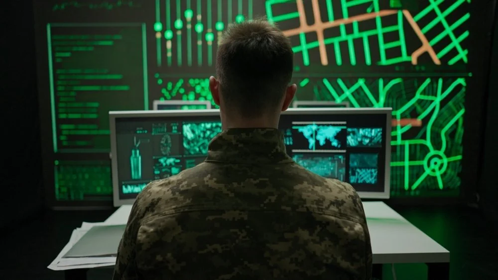
A row of futuristic unmanned ground vehicles (UGVs) resembling compact military tanks with tracked wheels and turrets, photographed in an outdoor environment

Fleet Operations for Defense Autonomy: Bridging Human Control and AI Decisions

By Umang Dayal

June 05, 2025

Modern defense strategies are undergoing a significant transformation as nations race to integrate autonomous systems into their fleet operations across air, land, sea, and space.

With autonomous systems capable of executing missions faster, with greater precision, and at reduced risk to human life, their adoption is accelerating. However, this shift raises a critical challenge: how to balance the efficiency of AI-driven autonomy with the oversight, judgment, and adaptability of human decision-makers.

This blog explores the evolving landscape of fleet operations in defense autonomy, focusing on how modern militaries are bridging the gap between rapid AI-driven decision-making and human oversight.

The Shift to Autonomous Defense Fleets

Over the past decade, the defense sector has steadily advanced from piloting isolated autonomous platforms to developing integrated, AI-enabled fleet operations. This evolution is driven by the operational need to outpace adversaries in environments where speed, scale, and coordination are critical. Whether it’s swarms of aerial drones providing real-time surveillance, unmanned surface vessels patrolling contested waters, or autonomous ground convoys delivering logistics support, AI is rapidly becoming central to modern defense readiness.

Unlike legacy systems that operated under rigid, pre-programmed instructions, today’s autonomous fleets are designed to adapt, making decisions in real-time based on sensor inputs, mission objectives, and environmental changes. This dynamic autonomy enables forces to respond faster and more effectively to emerging threats. For example, autonomous unmanned aerial systems (UAS) can conduct ISR (Intelligence, Surveillance, Reconnaissance) missions continuously, feeding high-resolution data into AI engines that generate actionable insights within seconds. Naval operations are seeing similar transformations, with autonomous vessels capable of long-duration deployments without resupply or human presence.

At the strategic level, defense planners see autonomy not as a replacement for human operators but as a way to extend their reach. The goal is to create force multipliers, platforms that can operate semi-independently, coordinate with manned units, and execute tasks that would be too dangerous or too resource-intensive for humans alone. The shift to autonomous defense fleets marks a fundamental rethinking of how military assets are deployed, coordinated, and supported, laying the groundwork for a more agile and resilient force structure.

Importance of Human-AI Collaboration in Fleet Operations for Defense Autonomy

As AI systems become more capable of making tactical and strategic decisions in defense environments, the role of human oversight becomes even more critical. Autonomous systems can navigate, identify targets, and even initiate responses based on data-driven models, but they lack context, moral reasoning, and the ability to weigh consequences in the nuanced way a human can. In high-stakes scenarios where a single misjudgment could lead to unintended escalation or collateral damage, human judgment is irreplaceable.

Human-AI collaboration in defense operations ensures that AI systems serve as decision-support tools rather than autonomous actors operating in a vacuum. This is particularly important in lethal contexts, where legal and ethical frameworks require a “human-in-the-loop” to authorize or supervise decisions. These models of interaction, ranging from direct control to supervisory oversight, are essential to maintaining accountability, compliance with international humanitarian law, and operational trust.

Moreover, humans bring domain expertise, cultural intelligence, and experience-based reasoning that AI simply cannot replicate. In contested environments where adversaries may intentionally deceive or spoof autonomous systems, human intuition and adaptability become decisive advantages. AI may detect a pattern or anomaly, but it’s a human who determines whether that anomaly represents a threat, a mistake, or a benign irregularity.

Ultimately, the success of AI in defense fleet operations doesn’t lie in replacing people, it lies in enabling better decisions, faster responses, and smarter resource deployment through intelligent collaboration.

Key Technologies Enabling Combined Human-AI Fleet Operations

The transition from manual to autonomous fleet operations in defense is underpinned by a suite of emerging technologies that allow AI and human operators to function as cohesive teams. These technologies are not just enabling autonomy, they’re shaping how decisions are made, delegated, and supervised in mission-critical environments.

At the core is the Human-in-the-Loop (HiTL) and Human-on-the-Loop (HoTL) architecture. In HiTL systems, humans make or approve decisions before execution, ensuring oversight in every action. In HoTL configurations, AI systems can execute actions independently, but a human supervises and can intervene or override decisions as needed. These models provide scalable oversight, allowing operators to manage multiple systems simultaneously without losing situational awareness or control.

Sensor fusion is another foundational technology, aggregating data from a range of inputs, visual, thermal, radar, acoustic, and more, into a unified operational picture. This real-time synthesis enables both AI and human operators to act on accurate, comprehensive information. Combined with edge computing, which allows data to be processed locally on the device rather than in a centralized server, this ensures low-latency responses critical for battlefield scenarios.

Explainable AI (XAI) is becoming essential for fostering trust in autonomous decisions. In a military setting, commanders must understand why an AI system made a recommendation, especially when lives are on the line. XAI tools provide interpretable feedback, helping human operators validate and contextualize AI-driven insights before taking action.

Finally, a secure, resilient communications infrastructure is vital to maintain the flow of data between humans and autonomous systems. This includes encrypted mesh networks, satellite-based communication links, and redundancy protocols that ensure continuity even under cyber or electronic warfare attacks.

These technologies, when integrated thoughtfully, enable a synchronized human-AI defense operation, where machines handle scale and speed, while humans ensure judgment, compliance, and strategic alignment. The result is not just automation, but a force architecture optimized for agility, resilience, and trust in the face of complex threats.

Learn more: Reducing Hallucinations in Defense LLMs: Methods and Challenges

Challenges and Risk Factors in Fleet Operations for Defense Autonomy

While the integration of AI into defense fleet operations offers transformative potential, it also introduces complex challenges that cannot be ignored. At the core is the issue of trust calibration, deciding when to rely on AI outputs and when to override them. Over-trusting AI can lead to catastrophic consequences if systems misinterpret a situation or are manipulated by adversarial inputs. Under-trusting AI, on the other hand, can negate the very efficiencies and speed it is meant to deliver. Building systems that clearly communicate confidence levels, uncertainties, and rationale is essential for informed human oversight.

Adversarial environments pose another major risk. Unlike controlled commercial applications, defense settings are contested by intelligent opponents actively trying to mislead or disrupt autonomous systems. Techniques like sensor spoofing, data poisoning, and electromagnetic jamming can misguide AI models or degrade their decision-making quality. Ensuring resilience through adversarial training, redundancy, and fallback modes is a top priority in such scenarios.

Interoperability remains a persistent hurdle. Defense fleets are composed of heterogeneous systems from multiple vendors and legacy platforms, often designed without modern AI integration in mind. Achieving seamless communication, coordination, and decision-sharing between manned and unmanned assets requires robust interface standards, real-time data protocols, and system-level testing, none of which are trivial in fast-evolving battlefield environments.

Another critical issue is cybersecurity. Autonomous systems, especially those with remote connectivity and real-time data streams, expand the attack surface for adversaries. A single exploited vulnerability in an AI-enabled platform could lead to system hijack, intelligence leaks, or operational disruption. This makes secure-by-design architectures, ongoing threat modeling, and real-time monitoring indispensable for fleet-level autonomy.

Lastly, legal and accountability gaps persist. When AI makes or executes a decision that results in unintended consequences, it’s often unclear where responsibility lies. Current military doctrines and international laws are still catching up with questions of liability, proportionality, and ethical compliance in autonomous operations. Establishing clear governance, chain-of-command protocols, and audit trails is essential for operational legitimacy.

Addressing these challenges head-on is not optional, it’s foundational. Without solutions to these risks, the effectiveness and adoption of AI in defense fleet operations will remain constrained, no matter how advanced the technology becomes.

Learn more: How GenAI is Transforming Administrative Workflows in Defense Tech

How Digital Divide Data Can Help

Digital Divide Data (DDD) plays a critical role in enabling the responsible deployment of AI across defense fleet operations by supporting both the technical infrastructure and the human-AI collaboration necessary for mission success. As autonomous systems become more data-driven and real-time in nature, the need for accurate, scalable, and secure data workflows becomes central.

Our Human-in-the-Loop (HiTL) services are purpose-built for defense-grade AI operations. We provide data annotation, validation, and continuous feedback mechanisms that train and refine autonomous models to perform reliably in complex environments. Whether it’s object recognition for ISR systems, behavioral classification in maritime surveillance, or threat detection from aerial data streams, our teams ensure the data powering your models reflects operational realities and edge-case scenarios.

Our experience in data curation and compliance-driven workflows ensures that defense AI deployments adhere to the highest standards of quality, security, and traceability. We specialize in structured datasets for fleet operations, autonomy benchmarking, and model stress-testing, services essential for building trusted, testable AI systems that remain aligned with legal and ethical frameworks.

Conclusion

The integration of AI-driven autonomy into defense fleet operations marks a pivotal shift in modern military strategy. The future of defense fleets lies in seamless collaboration between intelligent systems and human operators, combining the speed and scale of AI with the experience, ethics, and contextual awareness unique to people.

Bridging human control and AI decision-making is essential not only for operational effectiveness but also for maintaining accountability, trust, and compliance with legal and ethical standards. This hybrid approach ensures that autonomous fleets can operate safely and adaptively in contested, high-stakes environments while empowering commanders with better situational awareness and decision support.

Achieving this balance will define the next generation of defense capabilities, one where autonomy amplifies human potential rather than replaces it, ultimately securing strategic advantage in complex and dynamic spaces.

Let’s discuss how DDD can support your next-generation defense autonomy initiatives. Contact our experts

References:

Defense Innovation Board. (2023). Responsible artificial intelligence guidelines for the Department of Defense. U.S. Department of Defense. https://www.ai.mil

Scharre, P., & Horowitz, M. C. (2023). Artificial intelligence and the future of war. Center for a New American Security. https://www.cnas.org/publications/reports

DARPA. (2024). Mosaic warfare and human-machine teaming. Defense Advanced Research Projects Agency. https://www.darpa.mil

NATO ACT. (2023). Autonomous systems in multi-domain operations: Human-machine integration. NATO Allied Command Transformation. https://www.act.nato.int

Fleet Operations for Defense Autonomy: Bridging Human Control and AI Decisions Read Post »

Simulation2BServices

Simulation-Based Scenario Diversity in Autonomous Driving: Challenges & Solutions

As autonomous vehicles edge closer to widespread adoption, the industry’s central challenge remains the same: Safety.

Despite enormous advancements, the road ahead is unpredictable, shaped by an almost infinite combination of factors, including weather patterns, pedestrian behavior, erratic drivers, road construction, and even cultural driving norms. Testing for such variability in physical environments is costly and time-consuming, and dangerously inadequate for edge-case scenarios that are rare yet high-risk.

This is where simulation comes into play. Simulation has become the industry’s most powerful tool for accelerating development, enabling engineers to test thousands of driving scenarios in a fraction of the time it would take in the real world. Scenario diversity refers to the breadth and variability of driving situations modeled in a simulation. This includes differences in road geometry, actor behaviors, lighting conditions, traffic density, and unexpected obstacles. Diverse scenarios are what allow autonomous driving systems to experience the long-tail of rare, high-risk events that rarely occur during routine driving but are critical to system reliability.

In this blog, we will discuss scenario diversity in simulation for autonomous driving, why it’s important, what the associated challenges are, and how to solve them.

The Limits of Real-World Testing in Autonomous Driving

Despite being the ultimate ground truth, real-world testing presents significant limitations when it comes to preparing autonomous vehicles for the complexities of public roads. One of the most glaring issues is its inefficiency in exposing AV systems to rare but high-stakes scenarios, known as edge cases. These are the unpredictable situations that occur infrequently but carry significant safety implications, such as a pedestrian suddenly darting into traffic, a vehicle running a red light, or unexpected debris on a highway. Encountering these scenarios during naturalistic testing can take millions of driven miles, an impractical and risky proposition.

Real-world testing is also resource-intensive. Each mile driven on public roads involves vehicle hardware, safety drivers, permits, insurance, and environmental impact. Not only is it expensive, but it also puts the public at risk if the AV software encounters a scenario it has not been adequately trained to handle.

Furthermore, real-world testing is inherently reactive rather than proactive. Engineers must wait for edge cases to occur organically rather than being able to design and iterate on them in a controlled environment. This lag stifles the pace of development and hampers the ability to debug and fine-tune AV systems with precision. It also restricts the ability to test vehicles in hazardous conditions, such as severe weather, nighttime in dense traffic, or school zones during peak hours, without endangering human lives.

In contrast, simulation offers a pathway to safety and scalability by allowing developers to recreate, vary, and stress-test these difficult scenarios under controlled, repeatable conditions. But for simulation to fulfill that promise, it must move beyond repetition of simple driving patterns and embrace a methodology built around diverse, dynamic scenario modeling. That is the bridge between testing and true safety readiness.

What is Scenario Diversity in Autonomous Driving Simulations

Scenario diversity in simulation refers to the comprehensive range of distinct driving situations and environmental conditions that autonomous vehicles are exposed to during virtual testing. Unlike basic simulation runs that might repeat standard driving patterns, such as straight highway cruising or simple stop-and-go city traffic, scenario diversity emphasizes varying multiple elements simultaneously to reflect the complexity of real-world driving.

A “scenario” in the autonomous vehicle context can encompass a broad set of factors: road layouts (highways, urban streets, intersections, roundabouts), environmental conditions (rain, fog, night, glare), dynamic actors (pedestrians, cyclists, other vehicles), traffic behaviors (aggressive lane changes, jaywalking, sudden braking), and unexpected events (obstacles on the road, emergency vehicles, construction zones). The value lies in the variation and combinations of these parameters, which generate an extensive set of test cases, each presenting unique challenges for perception, decision-making, and control systems.

For example, the same scenario of a pedestrian crossing can be diversified by altering the time of day, the pedestrian’s speed and intent, the vehicle’s approach speed, and the surrounding traffic density. When multiplied across thousands of such permutations, scenario diversity creates a rich tapestry of experiences that stress-test an autonomous vehicle’s capabilities.

This approach goes beyond simple coverage of the “typical” or “expected” scenarios and intentionally targets the “long tail” of rare, high-risk events. Capturing this breadth is essential because autonomous driving systems must be resilient not only in common situations but also when facing unpredictable, complex interactions that could otherwise lead to failures.

By defining and varying scenarios along multiple axes, simulation environments become powerful tools for exposing gaps in system robustness and for validating how AV software performs under conditions that would be difficult, dangerous, or impossible to recreate repeatedly on real roads.

Importance of Scenario Diversity for Safety in Autonomy Solutions

Scenario diversity is fundamental to achieving safety in autonomous driving because it addresses one of the core challenges: preparing vehicles to handle the unexpected. Autonomous systems rely heavily on machine learning models trained on vast amounts of data, but these models tend to perform well only within the scope of scenarios they have “seen” during training and testing. Without exposure to diverse situations, vehicles risk becoming brittle, performing adequately in routine conditions but failing when faced with novel or complex events.

Diverse scenarios enable comprehensive coverage of edge cases and long-tail events, which are often the root causes of accidents and system failures. By incorporating these into simulations, developers can identify weaknesses in perception, prediction, and planning modules before deployment.

Moreover, scenario diversity supports the robustness of machine learning models by providing varied and representative data that helps avoid overfitting to common conditions. This variation is critical for building adaptable AV systems capable of generalizing well across different geographic locations, weather conditions, and traffic cultures.

Beyond training, diverse scenarios serve as rigorous stress tests that benchmark system performance in challenging conditions, such as poor visibility, erratic actor behavior, or sudden changes in road geometry. These tests reveal vulnerabilities that may not surface under average driving conditions, enabling targeted improvements and iterative validation. It is this deliberate and structured variation in simulation that forms the backbone of safer autonomous driving systems.

Scenario Diversity Challenges in Autonomous Driving

While scenario diversity is crucial for safe autonomous driving, delivering it effectively within simulation environments is a complex task fraught with technical and organizational challenges. Below, we explore the key obstacles in detail.

The Combinatorial Explosion of Scenario Variability

One of the foremost challenges is the sheer scale of variability that needs to be captured. Autonomous driving involves countless interacting variables: different road types (highways, urban streets, intersections), environmental factors (weather, lighting, road conditions), dynamic actors (vehicles, pedestrians, cyclists), and behavioral patterns (aggressive driving, jaywalking, emergency maneuvers).

When these parameters are combined, the total number of possible scenarios grows exponentially, often referred to as the combinatorial explosion. This creates a vast and practically infinite space of potential test cases, making exhaustive coverage impossible. To manage this, simulation teams must develop sophisticated prioritization and sampling techniques, focusing on scenarios with the highest safety relevance, such as those known to cause accidents or stress AV systems.

Ensuring Realism and Validity in Simulation

Scenario diversity is only valuable if the simulated scenarios are realistic and valid. Simulations must accurately model real-world physics, sensor responses, and actor behaviors to produce meaningful test outcomes. Any discrepancy between the virtual environment and real conditions can introduce a “sim-to-real gap,” where results from simulation do not reliably predict actual vehicle performance.

This gap arises from limitations in sensor modeling (e.g., imperfect LiDAR or camera simulation), simplified traffic participant behavior models, or physics engines that cannot fully replicate complex interactions like tire-road friction or occlusions. Addressing this challenge requires continuous advances in simulation fidelity, sensor calibration, and behavioral modeling, often validated against real-world data.

Data Annotation and Labeling Bottlenecks

High-quality annotations are essential to define and validate diverse scenarios within simulations. These annotations specify object identities, trajectories, environmental conditions, and event timings. Creating such detailed metadata manually is labor-intensive, costly, and time-consuming, which slows down the scenario generation pipeline.

Although automated annotation tools and synthetic data generation techniques have reduced some of this burden, there remains a significant gap in maintaining large, accurately labeled scenario databases. Without reliable annotations, it becomes difficult to systematically generate, search, and evaluate diverse scenarios for their impact on system performance.

Regulatory and Cultural Hurdles

Regulatory acceptance of simulation-based testing, especially using synthetic or AI-generated scenarios, remains cautious and uneven across regions. Many safety authorities require extensive real-world validation, making it challenging to rely solely on simulation results for certification.

Building trust requires transparent, standardized processes for scenario generation, documentation, and validation. Additionally, the industry must bridge the cultural divide between traditional automotive safety practices and the software-centric, data-driven nature of autonomous vehicle development. This includes educating regulators and stakeholders on the rigor and reproducibility of simulation testing.

Integrating Scenario Diversity into Development Workflows

Introducing broad scenario diversity into autonomous vehicle development processes is not trivial. Teams must balance testing a wide range of scenarios (breadth) against deep analysis and debugging of specific critical cases (depth).

Without mature tooling and well-defined workflows, the volume of simulation data and scenario variants can overwhelm engineers and slow down iterative development. Maintaining continuous feedback loops, where simulation insights directly inform system improvements, requires robust infrastructure and cross-functional coordination.

Read more: Guidelines for Closing the Reality Gaps in Synthetic Scenarios for Autonomy?

How We Overcome the Challenges of Scenario Diversity

At Digital Divide Data (DDD), we understand that achieving sufficient scenario diversity in simulation is essential to advancing the safety and performance of autonomous driving solutions. Our expertise in autonomous vehicle data collection, data labeling for autonomous driving, and simulation-driven development enables us to tackle the complexity of this challenge with precision.

Advanced Scenario Prioritization Through Data Analytics

We utilize sophisticated data analytics and risk-based prioritization models to address the combinatorial explosion of real-world driving conditions. We identify the most safety-critical scenarios by analyzing autonomous driving datasets, historical incident reports, and high-risk edge cases. This ensures simulation for autonomous vehicles is focused on exposing vulnerabilities that impact system safety and reliability, ultimately enhancing the robustness of AI in autonomous vehicles.

Enhancing Realism with High-Fidelity Data Annotation

DDD specializes in creating richly annotated automotive datasets critical for modeling realistic driving environments. Our globally distributed teams use cutting-edge tools and stringent QA processes to label objects, behaviors, and contextual details with high precision. This level of quality narrows the sim-to-real gap and strengthens the validity of simulation-based testing, supporting more dependable autonomous vehicle AI validation.

Scalable Annotation and Synthetic Data Generation

To overcome the limitations of manual labeling, we combine AI-assisted annotation with synthetic data generation. This scalable approach accelerates the development of diverse autonomous vehicle training data libraries, helping clients maintain expansive and accurate scenario databases. These hybrid pipelines are essential for companies building advanced autonomy solutions that must evolve rapidly in line with emerging challenges.

Embedding Scenario Diversity in Development Pipelines

We work closely with AV engineering teams to seamlessly integrate scenario diversity into existing simulation and development workflows. Our support spans automated scenario generation, test execution, and result analytics. This ensures consistent feedback loops that streamline iteration and align with agile practices, critical for developing and scaling autonomous vehicle solutions in dynamic environments.

At DDD, we provide a complete stack of autonomous vehicle data and simulation support services, combining deep domain expertise in autonomous vehicle annotation, scenario planning, and automobile datasets. By bridging data operations with AI development, we empower our clients to meet the complex demands of autonomy in AI and deliver production-ready autonomous vehicle AI systems that are safer, smarter, and regulation-ready.

Read more: Accelerating HD Mapping for Autonomy: Key Techniques & Human-In-The-Loop

Conclusion

By systematically exposing autonomous systems to a wide spectrum of driving environments, actor behaviors, and edge-case events, scenario diversity enables developers to identify weaknesses, build resilience, and reduce the likelihood of failure under real-world conditions. It provides a safe, scalable, and repeatable means to explore and refine system performance in ways that are simply not feasible or ethical on public roads.

As the AV industry matures, simulation with diverse, high-fidelity scenarios will be the proving ground where trust is built, safety is validated, and innovation moves from concept to reality. Scenario diversity is not just a testing strategy.

Partner with Digital Divide Data to build safer autonomous systems through smarter, scenario-driven simulation. To learn more, Talk to our experts.

Simulation-Based Scenario Diversity in Autonomous Driving: Challenges & Solutions Read Post »

HD2BMapping

Accelerating HD Mapping for Autonomy: Key Techniques & Human-In-The-Loop

High-definition (HD) maps have become a cornerstone of autonomous vehicle (AV) systems, offering centimeter-level precision that enables vehicles to interpret and navigate complex driving environments. These maps provide far more than just road layouts; they include detailed annotations such as lane boundaries, traffic signs, road curvature, crosswalks, and elevation changes, essential elements that help autonomous systems make informed driving decisions.

However, creating and maintaining such maps at scale remains one of the most labor-intensive and costly aspects of deploying AV technology commercially. This blog will examine the key techniques in HD mapping for autonomy and learn how HITL enhances the scalability and accuracy of HD maps.

What is HD Mapping for Autonomy

HD (High-Definition) mapping refers to the creation of extremely detailed, centimeter-level maps designed specifically for autonomous vehicles. Unlike standard navigation maps used in consumer GPS systems, HD maps are built to give self-driving systems a ground-truth reference of their environment, offering both geometric and semantic understanding of the road. This includes lane boundaries, lane centerlines, traffic signs, crosswalks, stop lines, curbs, and even the slope and curvature of the road surface.

An HD map serves as a static complement to the dynamic perception stack of an autonomous vehicle. While sensors like LiDAR, radar, and cameras capture real-time information, the HD map provides a prior, essentially a structured and highly accurate reference layer that helps the vehicle localize itself precisely and make context-aware decisions. For instance, an AV can anticipate a sharp curve or a hidden stop sign based on HD map data before its sensors detect it, enabling smoother and safer navigation.

These maps are typically built through a fusion of data collected by sensor-equipped mapping fleets and manual annotation processes. After raw sensor data is collected, algorithms attempt to extract relevant features, but due to the variability in real-world conditions, occlusions, lighting changes, and inconsistent infrastructure, human intervention is still essential to ensure accuracy and completeness.

A key distinction is that HD maps are not just about navigation; they are about prediction and safety. They enable the AV to anticipate road conditions and make more informed choices, which becomes especially important in complex urban environments. However, this level of detail requires frequent updates and large-scale data processing, making the mapping process not only technical but also logistically intensive.

HD Mapping Techniques for Autonomy

Creating high-fidelity, production-grade HD maps for autonomous driving involves a blend of advanced sensing technologies, data processing algorithms, and specialized mapping strategies. These techniques must balance precision, scalability, and update frequency to ensure autonomous vehicles have an accurate, up-to-date representation of their operating environment. Below are the key techniques currently shaping the HD mapping landscape.

Sensor Fusion from Multi-Modal Data Sources
At the foundation of HD map creation is sensor fusion, the process of combining inputs from multiple sensor types to form a comprehensive spatial understanding of the environment. LiDAR provides dense 3D point clouds that capture road geometry and elevation with centimeter-level accuracy. Cameras contribute semantic information such as colors, textures, and road signs. Radar adds depth and robustness in adverse weather conditions. Integrating these data streams ensures redundancy, improves feature detection accuracy, and provides a richer environmental model than any single sensor alone.

Simultaneous Localization and Mapping (SLAM)
SLAM algorithms are central to aligning sensor data with geographic coordinates. They enable vehicles to build a map of an environment while simultaneously estimating their position within it. In the context of HD mapping, SLAM is used to create geo-referenced 3D representations of roads and infrastructure, allowing for consistent, real-world alignment of features like lanes, traffic lights, and barriers. Modern SLAM implementations often include loop closure detection, which corrects for drift and enhances long-range mapping accuracy.

Crowd-Sourced and Fleet-Based Mapping
To accelerate map scalability, many companies leverage fleet vehicles for continuous data collection. These vehicles, often equipped with reduced-cost sensor suites compared to dedicated mapping units, collect data passively during operation. By aggregating data from thousands of vehicles, map providers can update road changes faster and expand coverage without deploying dedicated survey teams. Crowd-sourced mapping introduces challenges in standardization and noise filtering, which are addressed using consensus algorithms and data quality checks.

Machine Learning for Feature Extraction and Classification
Deep learning models play a pivotal role in automating the extraction of map features from raw sensor data. Convolutional neural networks (CNNs) and transformer-based architectures are commonly used to identify lane markings, road edges, pedestrian crossings, and signage. Semantic segmentation helps distinguish between road types and surface materials, while object detection models recognize contextual elements such as stop signs or bollards. Training these models on diverse datasets improves their generalization across varied road environments.

Change Detection and Incremental Map Updates
Instead of rebuilding maps from scratch, modern HD mapping workflows prioritize change detection, identifying differences between new sensor data and the existing map. This enables incremental updates that are more efficient and cost-effective. Algorithms analyze deltas in point clouds, imagery, and annotations to pinpoint altered features, such as a shifted lane or new construction barrier. These changes are then flagged for human validation or automatically updated, depending on model confidence and application criticality.

Cloud-Based Map Storage and Real-Time Distribution
HD maps are no longer static datasets; they’re dynamic, cloud-hosted platforms that continuously evolve. Map data is stored, versioned, and served from centralized cloud systems, which enable real-time updates and over-the-air delivery to vehicles in the field. These platforms often use layered architecture, separating base geometry, traffic rules, and temporary data (like construction zones) to allow targeted updates and minimize data transfer loads to vehicles.

Hybrid Mapping Architectures: Dense vs. Sparse Representations
Some mapping providers adopt dense HD maps with centimeter-level detail, while others favor sparse or semantic maps that prioritize essential navigational cues. Dense maps are better for full autonomy (L4/L5), where ultra-precise localization is needed, especially in urban environments. Sparse maps, often used by companies pursuing vision-only approaches, offer greater scalability and lower bandwidth requirements. The choice depends on the autonomy stack architecture and sensor strategy of the AV developer.

Simulation-Driven Validation of Map Data
Before maps are deployed to vehicles, they are often validated in simulation environments. This allows developers to test how autonomous systems will behave when using the updated map data, evaluating localization performance, route planning, and safety-critical decisions under varied conditions. Simulation ensures that errors or omissions in the map are caught before they affect real-world operations, improving both safety and reliability.

Read more: Guidelines for Closing the Reality Gaps in Synthetic Scenarios for Autonomy?

How HITL Accelerates HD Mapping for Autonomy

Sensor Data Ingestion and Automated Feature Extraction
HD map creation begins with raw data collected from sensor-equipped vehicles, LiDAR, radar, GPS, and high-resolution cameras. This data is fed into automated pipelines powered by computer vision and deep learning models, which attempt to identify critical road features such as lane boundaries, curbs, traffic lights, and signage. While these models can handle well-structured scenarios confidently, they often falter in complex, occluded, or changing environments. This is where human input becomes essential.

Intelligent Task Routing Based on Model Confidence
Machine learning models assign confidence scores to each output, and only low-confidence or ambiguous cases are routed to human annotators. This approach reduces human workload by focusing their attention where it’s needed most, on scenes with construction, visual occlusions, unusual layouts, or other edge cases. It prevents wasteful redundancy while preserving high accuracy in critical mapping regions.

Pre-Labeling and Human Validation for Efficiency
Instead of starting from scratch, human annotators often work from pre-labeled data, annotations generated by the AI model. These initial outputs serve as a draft that annotators refine or confirm. This significantly accelerates annotation speed, often halving the time required per task. It also standardizes output quality and improves the consistency of labels across large teams. Corrections made in this process are captured and fed back into the training pipeline, enhancing the model over time.

Continuous Model Improvement Through Active Learning
HITL workflows enable a feedback loop where human corrections directly improve machine performance. This is typically implemented through active learning, where the model selectively queries human annotators for the most informative data points. Each corrected instance becomes a training example, allowing the model to generalize better to complex or rare scenarios in future iterations. Over time, this loop reduces the system’s dependence on human intervention while increasing its mapping accuracy.

Accelerated Map Updates for Dynamic Environments
Roads evolve constantly due to construction, seasonal changes, and new infrastructure. Traditional remapping methods are often too slow and expensive to respond in real time. HITL enables fast, parallelized human validation of localized changes, allowing maps to be updated within days or even hours. Distributed annotation teams, supported by AI-powered tools, can quickly review and integrate new data into production maps, keeping them aligned with real-world conditions.

Scalable Quality Assurance Without Sacrificing Speed
HITL workflows incorporate multi-tiered quality assurance, including peer review, automated consistency checks, and escalation of critical errors to expert annotators. This layered approach ensures that every map feature meets the high-precision standards required for safety-critical AV applications. By combining speed and accuracy, HITL offers a sustainable path to scale.

Strategic Integration of Human Insight and Automation
The value of HITL lies not in replacing automation but in complementing it. Humans are deployed strategically, where their contextual understanding, reasoning, and intuition provide a clear advantage. When supported by smart tooling and machine assistance, human annotators can operate with both speed and precision. This collaboration creates a mapping workflow that is faster, more adaptive, and ultimately more cost-effective than either automation or manual processes alone.

How We Can Help

At DDD, we specialize in delivering comprehensive navigation and mapping solutions that enhance the efficiency, accuracy, and scalability of autonomous systems. Our offerings span across a variety of Autonomy applications, ensuring that the maps and navigation systems we create are not only precise but also adaptable to dynamic, real-world conditions.

By integrating advanced technologies with human expertise, we provide robust, high-quality maps that empower autonomous vehicles and robotics to navigate safely and efficiently, even in complex or ever-changing environments.

Read more: Developing Effective Synthetic Data Pipelines for Autonomous Driving

Conclusion

HD mapping is a cornerstone of autonomous vehicle technology, providing the spatial and semantic context required for safe and reliable navigation. Yet, the creation and maintenance of these high-precision maps remain among the most resource-intensive and technically complex challenges in the autonomy ecosystem.

Human-in-the-Loop (HITL) workflows offer a practical and powerful solution to bridge the gap between automation and operational reality. By combining the efficiency of machine learning techniques with the precision and judgment of human oversight, HITL enables faster, more accurate, and more scalable HD map production.

The path to autonomy isn’t about choosing between humans and AI; it’s about designing systems where the two work seamlessly together to meet the demands of real-world autonomy at scale.

Looking to strengthen your HD mapping and navigation operations with a reliable Human-in-the-Loop partner? Get in touch with our experts!

Accelerating HD Mapping for Autonomy: Key Techniques & Human-In-The-Loop Read Post »

Scroll to Top