Celebrating 25 years of DDD's Excellence and Social Impact. ✖

Autonomous Driving

topologicalmapsinautonomy

Topological Maps in Autonomy: Simplifying Navigation Through Connectivity Graphs

Autonomous systems are expected to navigate the world with the same ease and intuition that humans often take for granted. A delivery robot weaving through a crowded warehouse, a drone inspecting a bridge, or a self-driving car adjusting to a sudden detour: each depends on how well it understands and navigates its environment. At the heart of that capability lies one of the most difficult problems in autonomy: building a map that is both accurate and efficient enough to support real-time decision-making.

Topological maps represent it as a network of meaningful locations linked by navigable paths. This shift toward connectivity graphs transforms navigation from a geometric puzzle into something closer to how people naturally think about space: rooms connected by hallways, intersections leading to destinations, and choices made through relationships rather than coordinates.

Topological maps reduce computational complexity and enable long-range planning to scale far more effectively. They are interpretable in ways that dense point clouds are not, which means they can be shared, reasoned about, and adapted more easily over time. Yet they also introduce new questions about accuracy, adaptability, and the balance between abstraction and detail.

In this blog, we will explore how these topological maps in autonomy simplify navigation, why they are becoming essential for large-scale autonomous systems, and what challenges still remain in building machines that can understand their world not just by measurement, but by connection.

What Are Metric Maps?

Most autonomous systems begin with a familiar idea: if you can measure the world precisely enough, you can move through it safely. Metric maps operate on that principle. They use data from LiDAR, cameras, or depth sensors to build dense geometric reconstructions of the environment, often down to a few centimeters of accuracy. Every wall, floor, and obstacle is represented as a coordinate in space, allowing algorithms to calculate exact positions and paths.

While this approach works remarkably well in controlled settings, it begins to show its limits as the scale grows. A single warehouse or urban block can generate gigabytes of map data that must be constantly updated to remain useful. Small shifts, a moved shelf, or a parked vehicle can make sections of the map obsolete. It is not that metric maps fail; they simply demand a level of precision and maintenance that becomes increasingly impractical as environments change and expand.

There’s also a cognitive gap. Metric maps describe the world in a language that computers understand but people rarely use. Humans don’t think in coordinates or grid cells. We think in places, paths, and relationships. That difference matters when designing systems meant to operate in human spaces and communicate decisions in human terms.

What Are Topological Maps?

Topological maps start from a simpler premise: not every detail matters equally. Instead of modeling every corner and curve, they capture how locations connect. Each node represents a meaningful place, a doorway, a hallway junction, or a loading bay, while edges describe how one place leads to another. The map becomes a connectivity graph, a web of relationships that abstracts away unnecessary geometry but retains the structure needed for decision-making.

This abstraction dramatically reduces complexity. A topological map can represent an entire building or city with just a few hundred nodes instead of millions of data points. But the appeal goes beyond efficiency. The structure itself is easier to interpret, modify, and explain. When a robot needs to reroute, it doesn’t sift through every possible coordinate; it simply chooses a different path across the graph.

That said, the simplicity of topological maps can be misleading. They depend on reliable perception to recognize when a location has been visited before or when two paths connect. If nodes are poorly defined or connections misrepresented, navigation errors can accumulate quickly. The elegance of the model only works when the underlying recognition and mapping processes remain consistent.

The Shift Toward Hybrid Systems

Few systems today rely purely on one mapping method. Instead, the trend points toward hybrid architectures that combine metric precision with topological reasoning. A self-driving car might use a local metric map to detect lane boundaries while simultaneously navigating through a topological graph of roads and intersections. Similarly, a mobile robot could use LiDAR data for fine obstacle avoidance but rely on a place graph for global route planning.

This layered design reflects a broader realization of autonomy: no single representation is complete. Metric maps offer the fidelity needed for control, while topological maps provide the abstraction necessary for scalability and interpretability. Together, they form a hierarchical navigation framework, where low-level motion planning and high-level reasoning coexist rather than compete.

Building Topological Maps for Autonomy

Node Definition and Selection

The first step in building a topological map is deciding what counts as a “place.” This might sound simple, but in practice, it requires judgment. Nodes are not arbitrary points; they represent meaningful, distinguishable locations where decisions about movement occur. In an office, that could be a doorway, a corridor intersection, or a room boundary. For an outdoor vehicle, it might be a junction, a turn, or a visually unique landmark like a tree cluster or a light pole.

Selecting nodes often involves identifying landmarks that are stable and recognizable over time. Algorithms may use visual features, depth data, or even semantic cues to detect such points. Some systems cluster sensor readings into spatial groups, while others rely on machine learning to determine which locations are distinctive enough to serve as reliable anchors. The key is finding a balance; too few nodes and the map becomes vague, too many and the graph loses its efficiency.

Node definition also touches on perception. What looks like one “place” to a robot’s LiDAR might appear as several distinct locations to a camera-based system. Developers must decide which sensory inputs define place identity and how much variation (lighting, angle, partial occlusion) the system should tolerate before declaring a new node. These design choices ultimately determine how well the robot can recognize and reuse its map later.

Edge Construction

Edges connect the nodes and define the navigable relationships between them. They can represent direct travel paths, doorways, or even conceptual transitions like “take the elevator to floor two.” The process of establishing these edges often relies on odometry, motion models, or simultaneous observations that confirm two locations are reachable from each other.

Edges can carry more information than simple connectivity. Many systems assign weights to edges that represent distance, time, or traversal difficulty. A corridor blocked by moving workers, for example, might temporarily have a higher traversal cost than an alternate route. Some approaches even allow edges to change dynamically, adapting to traffic flow, energy constraints, or environmental updates.

The result is a graph that reflects not just structure but context. It’s a living model of how the environment can be navigated under different conditions. This adaptability gives topological maps a unique advantage in real-world autonomy, where “shortest” doesn’t always mean “best.”

Updating and Maintaining the Graph

Once built, a topological graph is far from static. Environments evolve, and so must the map. Robots continuously add new nodes as they explore unfamiliar territory, remove outdated ones when spaces are remodeled, and update edges when connectivity changes. The process is often incremental, using loop closure to detect when a previously visited place reappears in the robot’s field of view.

Maintaining the consistency of this evolving graph poses several challenges. Small localization errors can accumulate over time, leading to distorted connectivity or misplaced nodes. Systems may use probabilistic reasoning to verify whether a new observation corresponds to an existing node or if it should create a new one. Environmental dynamics, like seasonal lighting, movable furniture, or temporary obstacles, add another layer of complexity.

Effective graph maintenance depends on continuous validation and pruning. Old or redundant connections must be trimmed, and new ones integrated without breaking the graph’s logic. The better a system can manage this process, the more reliable its navigation becomes, even after months or years of operation in the same environment.

Applications of Topological Maps in Autonomy

Mobile Robots in Structured Environments

In industrial and research settings, topological navigation has become increasingly practical. A mobile robot inspecting equipment across multiple factory floors, for instance, benefits from recognizing each corridor or inspection point as a node within a graph. The robot does not need to rebuild a detailed metric map every time it moves through a familiar area. It simply traverses a sequence of nodes it already understands.

This approach significantly reduces processing overhead and speeds up navigation cycles. It also allows for modularity: new sections of a facility can be added to the graph without having to re-map the entire space. Maintenance teams or engineers can even interpret and adjust the graph manually, since it corresponds to how humans visualize spatial layouts, by rooms, sections, and hallways, rather than coordinates and point clouds.

Structured environments like offices, warehouses, and laboratories are particularly suited for such systems. The consistency of layout makes it easier to define nodes and maintain connectivity over long periods, enabling reliable, semi-autonomous operation with minimal recalibration.

Autonomous Vehicles and Urban Navigation

At the city scale, the strengths of topological mapping become more evident. Instead of relying solely on high-resolution metric maps that quickly grow outdated, a vehicle can plan routes through an abstracted graph of intersections, lanes, and zones. This graph can be combined with semantic information such as “traffic-light-controlled junction” or “restricted lane,” helping the vehicle make higher-level decisions that go beyond simple geometry.

For example, when a street is closed, the car doesn’t need to reconstruct its metric surroundings; it only needs to update or bypass an edge in its topological network. This reduces both latency and computational load. The system remains explainable, too. Routes can be described in plain language: “take the second right, then continue three blocks to the main square,” aligning better with how humans give and understand directions.

Field and Underground Robotics

Topological mapping also holds promise in environments that resist traditional mapping techniques. Underground tunnels, mines, and disaster zones present conditions where GPS is unreliable, visibility is low, and surfaces are irregular. Metric maps in such contexts often drift or fragment due to poor sensor feedback.

A topological graph, however, can maintain connectivity even when geometric precision is compromised. Robots navigating a mine, for instance, might treat each junction as a node and use inertial or sonar data to estimate connectivity between them. Even if the exact distances fluctuate, the logical structure of “this tunnel connects to that one” remains stable. This continuity allows the system to keep functioning in conditions where detailed geometry would fail.

Human–Robot Interaction

Another overlooked advantage of topological maps lies in how they align with human mental models of space. People tend to describe environments relationally, “go past the lab and turn left at the elevator,” not in coordinates or angles. Topological representations capture this logic directly.

When a robot communicates using node-based reasoning (“I’m in corridor 3, moving toward storage room B”), the interaction feels intuitive. Humans can interpret the robot’s understanding of space, correct it if needed, and even guide it verbally through its graph. This transparency matters in collaborative environments like hospitals, offices, or shared manufacturing spaces, where trust and predictability are as important as technical accuracy.

The convergence of human reasoning and robotic mapping suggests a broader shift in design philosophy: from systems that merely navigate to systems that can explain how and why they navigate the way they do.

Technical Challenges for Topological Maps

Node Ambiguity and Redundancy

A recurring challenge in topological navigation is deciding when two locations are genuinely different. In environments that look repetitive, like office corridors or underground tunnels, visual or spatial similarity can trick the system into thinking it has been somewhere new. This node ambiguity leads to redundant or conflicting graph entries, which in turn make navigation unreliable.

One solution is to enrich node identity with semantic and sensory context. Instead of defining a place solely by its visual appearance, systems can combine cues such as Wi-Fi fingerprints, ambient sound, or temperature variations. Multi-modal data helps disambiguate locations that appear alike but behave differently. However, this approach introduces its own complexities: more data means more computation and more decisions about which cues to trust when they disagree.

The balance is delicate. Too strict a definition of “new” places can make the map sparse and incomplete; too lenient, and it becomes cluttered with duplicates. The best systems often rely on probabilistic matching, accepting that certainty in perception is rarely absolute.

Graph Maintenance Over Time

A topological graph is never finished. Buildings are remodeled, paths are blocked, lighting changes, and outdoor terrain evolves with the seasons. Over time, these shifts can make even well-constructed maps unreliable. Maintaining graph quality requires periodic verification, either by re-exploration or through feedback from other agents using the same map.

The process resembles cognitive maintenance in humans: we occasionally revisit old routes to check whether they still work. For robots, this can involve comparing sensor data against stored representations and deciding whether to update or delete an edge. Automated “map hygiene” routines are becoming more common, though they must operate carefully to avoid erasing valid but temporarily unavailable connections.

Balancing Resolution and Efficiency

A topological map should be compact, but not simplistic. The right level of resolution depends on how the robot operates. A service robot moving between rooms might only need nodes for doorways and corridors, while a drone navigating a dense urban area could require finer segmentation.

The challenge lies in managing graph density, too coarse, and the system loses navigational precision; too detailed, and it approaches the complexity of a metric map, negating the original benefit. Adaptive resolution, where the system refines or merges nodes based on operational frequency or uncertainty, appears to be a promising direction. It suggests a dynamic rather than fixed understanding of “place,” shaped by experience rather than predefined thresholds.

Integration with Metric Layers

Topological and metric representations are often portrayed as separate, but in reality, they depend on each other. A robot’s ability to move smoothly from one node to another relies on local metric data, precise obstacle positions, surface textures, and motion constraints. Conversely, the metric layer benefits from the topological layer’s structure, which limits the scope of pathfinding and prevents endless search in irrelevant areas.

Synchronizing these two layers is not trivial. If a robot updates its metric map but fails to reflect those changes in its topological graph, inconsistencies arise. Similarly, adding or removing edges in the graph without adjusting the corresponding local maps can lead to unexpected navigation failures. Successful integration requires continuous feedback between both layers, ensuring that high-level reasoning and low-level control remain aligned.

The growing interest in unified navigation stacks, where metric and topological reasoning coexist within a shared data framework, reflects a shift toward systems that learn and adapt as a whole rather than as loosely coupled parts.

Read more: How Autonomous Vehicle Solutions Are Reshaping Mobility

Conclusion

Topological maps represent a shift in how autonomous systems understand and move through the world. Instead of drowning in geometry, they focus on relationships, how one place connects to another, how movement unfolds through networks of meaning. This abstraction may appear like a simplification, but in practice, it brings autonomy closer to how humans think about navigation: flexible, context-aware, and interpretive.

Topological mapping is more than an engineering technique. It’s a quiet rethinking of what it means for machines to know where they are, and how they choose to move from here to there.

Read more: Vision-Language-Action Models: How Foundation Models are Transforming Autonomy

How We Can Help

Building and maintaining reliable topological maps requires more than smart algorithms. It depends on access to clean, diverse, and well-structured data. That is where Digital Divide Data (DDD) fits in. The company specializes in managing the data backbone that powers intelligent navigation and perception systems, helping organizations move from experimentation to large-scale deployment.

Our teams support autonomy developers across several layers of the workflow. For mapping and localization, they curate and annotate multimodal sensor data, LiDAR scans, camera feeds, and telemetry streams, ensuring consistency across time and environments. For place recognition and graph-based navigation, they provide semantic labeling and connectivity mapping services that allow engineers to train and validate algorithms on realistic, domain-specific datasets.

Partner with Digital Divide Data to transform your spatial data into intelligent, scalable mapping solutions that accelerate real-world autonomy.


References

  • Karkus, P., Dey, D., & Hsu, D. (2024). TopoNav: Topological Navigation for Efficient Exploration in Sparse-Reward Environments. IEEE International Conference on Robotics and Automation (ICRA), Baltimore, USA.

  • Saari, J., Kallio, T., & Valpola, H. (2024). PlaceNav: Topological Navigation through Place Recognition. IEEE ICRA, Tampere University, Finland.

  • Churchill, W., Newman, P., & Posner, I. (2024). AutoInspect: Long-Term Autonomous Industrial Inspection Using Topological Graphs. Oxford Robotics Institute, UK.

  • Ariza, J., Sastre, M., & Borras, A. (2024). Topological SLAM for Deformable Environments. Endomapper Consortium, Spain.

  • Kumar, A., & Feng, Y. (2025). Real-Time Topological Mapping in Confined Environments. University of Leeds, UK.

  • Chen, L., & Raina, A. (2025). Diffusion-Based Navigation Without Explicit Maps: A Contrast to Topological Planning. Dartmouth Robotics, USA.


FAQs

Q1. How are topological maps different from occupancy grids?
Occupancy grids represent free and occupied spaces in continuous detail, while topological maps abstract those details into nodes and connections. The former excels at local precision; the latter excels at global reasoning.

Q2. Are topological maps suitable for dynamic environments?
Yes, but they need periodic updates. Since nodes and edges represent relationships rather than fixed geometry, they can adapt more easily to layout changes or temporary obstacles.

Q3. Can topological maps work without visual sensors?
They can. Many systems use LiDAR, sonar, or even magnetic and inertial data to define connectivity when visual cues are unreliable.

Q4. Do topological maps replace SLAM?
Not exactly. SLAM provides the metric foundation that can inform or refine the topological graph. The two approaches often operate in tandem.

Q5. How scalable are topological maps for multi-robot systems?
They scale well because multiple agents can share and update a common graph asynchronously. Each robot contributes local updates, and the system merges them into a unified connectivity model.

Topological Maps in Autonomy: Simplifying Navigation Through Connectivity Graphs Read Post »

Autonomousvehiclesolutions

How Autonomous Vehicle Solutions Are Reshaping Mobility

The idea of mobility has always been closely tied to freedom, encompassing how far we can travel, how quickly we can arrive, and how safely we return. Over the past decade, that idea has been quietly rewritten by the rise of autonomous vehicle solutions. What began as a handful of experimental self-driving cars has evolved into a global race to develop systems capable of transporting people and goods with minimal human intervention. This shift isn’t simply about replacing drivers with machines; it’s about reimagining how cities, supply chains, and public spaces function when vehicles can think for themselves.

The underlying technology appears deceptively simple: a combination of sensors, algorithms, and decision-making frameworks that allow vehicles to perceive their surroundings and react in real time. Yet beneath that simplicity lies a staggering amount of data work. Every lane marking, pedestrian movement, and roadside object must first be seen, labeled, and understood through a process known as autonomous vehicle annotation. Those labeled datasets, together forming autonomous vehicle training data, are what enable these systems to learn from millions of miles of virtual and physical driving.

Autonomous vehicle solutions are beginning to reshape mobility in ways that extend beyond technology. They influence how cities plan parking, how commuters choose routes, and even how accessibility is defined for those who cannot drive. Still, progress feels uneven. Some regions are rushing toward wide deployment, while others remain cautious, balancing innovation with public safety concerns. What’s clear is that autonomy is no longer a distant vision; it’s an evolving ecosystem of data, infrastructure, and human oversight that continues to adapt as it learns.

In this blog, we will explore how autonomous vehicle solutions are redefining mobility through data-driven development, from the foundations of perception and annotation to the real-world transformations they are driving across industries and communities.

Foundations of Autonomous Vehicle Solutions

Autonomous vehicle solutions are built on an intricate network of technologies that must operate together in perfect sync. At the surface, it might look like a car that drives itself, but beneath the hood lies a complex orchestration of perception systems, decision-making models, and connectivity frameworks. Each layer plays a specific role, yet they all depend on one crucial factor: data that accurately represents the real world.

The perception layer allows a vehicle to “see” its surroundings through cameras, radar, and LiDAR sensors. These raw data streams are then interpreted by machine learning models that identify pedestrians, vehicles, road signs, and countless other elements of the driving environment. It’s not unlike how a human driver scans the road and makes snap judgments, except that an autonomous vehicle must process thousands of data points every second with mathematical precision.

Once the vehicle has a sense of its environment, algorithms determine how to act, when to change lanes, slow down, or stop altogether. These systems rely heavily on the lessons embedded in their training data. If the data lacks variety or accuracy, the vehicle’s decision-making may falter in unfamiliar or complex scenarios.

Vehicles communicate with one another, with traffic infrastructure, and with centralized systems that aggregate performance data. This feedback loop enables continuous learning and model improvement. But none of it works without the initial groundwork of high-quality annotation, the process that translates raw images and sensor data into structured information the AI can learn from.

In practice, building a reliable autonomous system is less about creating a single, perfect algorithm and more about orchestrating a continuous workflow, from raw data collection and annotation to model training and deployment. Each stage informs the next, forming a cycle of refinement that gradually moves autonomy from the lab into everyday lide.

The Critical Role of Autonomous Vehicle Annotation

Before an autonomous vehicle can make intelligent decisions, it must first understand what it’s looking at. That understanding doesn’t emerge magically from algorithms, it’s taught, painstakingly, through a process known as autonomous vehicle annotation. Every traffic sign, cyclist, and stretch of road surface must be labeled by human experts or semi-automated tools, creating a structured visual language that machine learning models can interpret.

Annotation might sound procedural, but it’s arguably one of the most defining steps in developing autonomous systems. The precision and consistency of labeling directly affect how reliably a vehicle perceives its environment. A poorly annotated pedestrian in a dataset could later translate into hesitation or misjudgment in a real-world scenario. Conversely, well-curated annotations, ones that include edge cases like partial occlusions or nighttime reflections, help the vehicle anticipate the unpredictable.

Different types of data annotation serve different purposes. Bounding boxes are often used for quick object detection, while semantic segmentation divides every pixel of an image into meaningful categories, such as road, car, or pedestrian. LiDAR point cloud annotation captures the three-dimensional structure of a scene, providing spatial awareness crucial for depth perception. More specialized forms, like keypoint tracking, map human or vehicle movement across frames, allowing the system to anticipate motion rather than merely react to it.

Yet annotation isn’t only about accuracy, it’s about context. The same object can appear vastly different depending on weather, lighting, or geography. A stop sign in rural France looks nothing like one in Texas. This is why teams often combine manual expertise with automation tools and quality audits to maintain consistency across datasets.

As autonomous vehicle solutions mature, annotation pipelines are evolving too. Semi-automated systems now handle repetitive tasks, while human annotators focus on complex or ambiguous cases that require judgment. It’s a blend of precision and pragmatism: humans bring understanding; machines bring speed. Together, they generate the high-quality annotated data that allows vehicles to navigate safely in the real world.

Building Reliable Models with High-Quality Training Data

If annotation gives an autonomous vehicle its ability to “see,” then training data is what allows it to think. Every decision the system makes, when to accelerate, yield, or merge, stems from patterns it has learned from thousands of hours of curated driving data. In practice, the quality of this training data often determines how confidently a vehicle behaves in complex or unfamiliar situations.

Collecting such data is neither quick nor simple. Fleets of instrumented cars gather video, LiDAR, radar, and GPS information across varied environments: crowded city centers, mountain roads, and suburban intersections. But the raw data itself isn’t immediately useful. It must be filtered, balanced, and annotated before it becomes part of a training pipeline. Teams often spend months ensuring that every dataset reflects real-world diversity, different lighting conditions, road textures, and weather patterns, because the smallest gap in representation can create blind spots in model performance.

Synthetic data is starting to fill some of those gaps. Instead of waiting for a rare snowstorm or unusual traffic event, engineers can simulate these conditions in virtual environments and feed them into the model. This approach appears to reduce the risks and costs associated with large-scale field testing. Still, simulated data has its own limitations; it may capture geometry and motion accurately but fail to represent the unpredictability of human behavior on the road.

Bias in training data remains another quiet but significant challenge. If most of the collected data comes from one geography, say temperate U.S. highways, the system might underperform on European cobblestone streets or narrow urban lanes. The goal, then, isn’t to amass the most data, but the right data, balanced, context-rich, and validated against real-world outcomes.

Reliable autonomous vehicle training data ultimately acts as the moral compass of the machine. It teaches vehicles not just what to recognize but how to interpret subtle cues: a pedestrian’s hesitation at a crosswalk, the shadow of an approaching cyclist, or the temporary chaos of a construction zone. The stronger the data foundation, the more confident and adaptive the autonomous system becomes once it leaves the test track and joins everyday traffic.

Transforming Urban Mobility Through Data-Driven Autonomy

Autonomous vehicle solutions are beginning to change how cities breathe, move, and grow. What once depended entirely on human drivers is slowly being re-engineered through a feedback loop of data and intelligence. Streets, traffic lights, and even parking systems are starting to adapt to vehicles that can communicate, anticipate, and self-coordinate. The result isn’t immediate or uniform, but the outlines of a new urban mobility model are becoming visible.

In cities where congestion has long dictated the rhythm of daily life, automation introduces an unexpected calm. Vehicles that learn from shared training data can adjust speeds collectively, smoothing traffic flow rather than amplifying stop-and-go patterns. Over time, these micro-adjustments could reduce idle emissions and reclaim lost commuting hours. It’s easy to picture the appeal, shorter travel times, fewer accidents, cleaner air, but the transition also exposes a tension between technological potential and social readiness. Some communities may embrace the efficiency; others may question what it means for jobs or public control of transportation systems.

The data itself drives much of this transformation. Every trip becomes a feedback event: sensors capture environmental and behavioral data, upload it to the cloud, and refine algorithms that guide the next round of driving decisions. This constant learning loop helps autonomous fleets adapt to local driving styles, seasonal changes, and evolving traffic regulations. Yet, the same loop raises questions about ownership and privacy, who controls the information collected on public roads, and how transparently is it used?

Urban infrastructure is quietly adjusting in response. Planners are rethinking intersections to favor predictive signaling, experimenting with curbside drop-off zones, and reducing parking footprints as shared fleets replace personal cars. The deeper shift, though, lies in mindset. Mobility is moving from a static, individually owned asset to a dynamic, shared service, one that depends on data cooperation between municipalities, private companies, and citizens.

Training Data to Real-World Deployment

Bridging the gap between well-labeled training data and a functioning autonomous fleet is a lot harder than it looks on paper. What happens in a controlled training environment rarely translates perfectly to public roads. The road from lab to deployment is full of recalibration, iteration, and sometimes, uncomfortable surprises.

The process usually begins with simulation, millions of virtual miles where models are stress-tested under every imaginable condition. These digital environments allow developers to introduce extreme or rare events without endangering anyone: a pedestrian stepping off the curb too late, an unexpected lane closure, or the erratic movements of a delivery van double-parked in traffic. Simulation helps refine the algorithms’ initial instincts, but it remains a simplified version of reality. Eventually, those models must graduate to the real world, where weather, human unpredictability, and infrastructure inconsistencies test every assumption.

Validation and testing become a continuous cycle rather than a final stage. Each real-world run generates new data, revealing gaps that weren’t visible in simulation. Engineers feed this data back into the training pipeline, adjust the labeling standards, and retrain the models. In this sense, the system is never “finished”; it’s always learning, always re-evaluating.

Collaboration plays a quiet yet critical role here. Automakers, AI developers, and data service providers need a shared language for quality, compliance, and safety. When they align, on annotation standards, version control, and data governance, the journey from dataset to deployment becomes smoother. When they don’t, delays and inconsistencies creep in quickly.

There’s also a growing recognition that data governance isn’t just a technical concern; it’s an ethical one. Questions of who owns the data, how long it’s retained, and how transparently it’s used are becoming central to deployment strategies. A well-designed governance framework doesn’t just protect companies from liability, it strengthens public confidence in the technology itself.

The Business Impact of Autonomous Vehicle Solutions

The conversation around autonomous vehicle solutions often centers on technology and safety, but beneath those headlines lies a quieter economic transformation. As autonomy moves closer to mainstream deployment, it is quietly redrawing the boundaries of multiple industries, transportation, logistics, insurance, and even data services.

For automotive manufacturers, autonomy represents both a challenge and a strategic pivot. The traditional model of selling vehicles to individual consumers is gradually giving way to fleet-based, service-oriented operations. Companies are beginning to think less about units sold and more about miles driven. The value now lies not only in the vehicle itself but in the intelligence it carries, the software, data infrastructure, and continuous updates that keep it operational and adaptive.

In the logistics sector, autonomous vehicle solutions are streamlining last-mile delivery, warehouse coordination, and long-haul trucking. Even small efficiency gains, reduced idle time, optimized routing, or predictive maintenance can add up to enormous savings when scaled across thousands of vehicles. These changes also reshape labor patterns. Some driving roles may diminish, but new ones are emerging in data labeling, fleet supervision, and systems maintenance.

The rise of autonomous vehicle annotation and training data pipelines has also given birth to an entirely new data economy. Behind every functioning self-driving system is a massive ecosystem of annotators, data engineers, and quality assurance specialists ensuring the accuracy and fairness of the training data. As AI-driven transportation becomes more prevalent, the demand for such data services continues to grow. For many companies, this has opened new business opportunities that extend far beyond automotive boundaries.

There’s also a cultural shift happening inside boardrooms. Data is no longer viewed as a by-product but as a strategic asset. Businesses that can collect, clean, and interpret it effectively hold a competitive advantage, not just in vehicle autonomy but across the emerging landscape of intelligent mobility. Still, monetizing data responsibly remains a delicate balance. Consumers and regulators are increasingly attentive to privacy, and companies that overlook ethical considerations risk losing the very trust that adoption depends on.

Read more: Vision-Language-Action Models: How Foundation Models are Transforming Autonomy

How We Can Help

Behind every successful autonomous vehicle solution is an immense amount of data preparation, hours of labeling, verification, and validation that rarely make the headlines. This is where Digital Divide Data (DDD) plays a critical role. For organizations building perception systems or refining decision models, DDD provides the infrastructure, expertise, and ethical grounding to make those systems dependable and scalable.

DDD’s approach to autonomous vehicle annotation combines precision with context. Rather than treating annotation as a purely mechanical task, teams are trained to understand the driving environment, recognize edge cases, and ensure consistency across complex data types like LiDAR point clouds, thermal imagery, and 3D bounding boxes. This attention to contextual accuracy allows developers to train models that respond more naturally to real-world variations, differences in lighting, weather, or regional signage that often trip up automated systems.

Equally important is DDD’s capacity to handle autonomous vehicle training data at scale. Managing large, multimodal datasets requires not only skilled annotators but also strong data governance practices. DDD helps clients streamline their entire data pipeline, from ingestion and cleaning to labeling, validation, and delivery, while ensuring compliance with international privacy and security standards. The focus isn’t just on speed or volume; it’s on data integrity and traceability, which are essential for regulatory approval and public trust.

What sets DDD apart is its commitment to responsible AI operations. By combining human expertise with scalable annotation infrastructure, DDD enables companies to accelerate development without compromising on quality or ethics. Its social impact model also creates skilled employment opportunities in emerging markets, building an inclusive workforce that contributes to some of the world’s most advanced mobility technologies.

Read more: Mapping and Localization: The Twin Pillars of Autonomous Navigation

Conclusion

Autonomous vehicle solutions are reshaping the very structure of mobility, from how data is collected and interpreted to how transportation systems evolve around it. The success of this transformation depends not just on advanced algorithms or hardware innovation, but on the unseen foundation of accurate, well-managed data. Every model, every prediction, and every decision on the road reflects the quality of its annotation and training data.

The journey toward autonomy is a continuous process of learning, refinement, and shared responsibility. Those who invest early in high-quality data pipelines, transparent annotation standards, and ethical AI practices are likely to shape not just the future of autonomous driving, but the future of mobility itself.

Autonomy, after all, isn’t just about vehicles moving without drivers; it’s about creating movement that is smarter, safer, and ultimately more human in its design.

Partner with Digital Divide Data (DDD) to power your autonomous vehicle solutions with expertly annotated, diverse, and compliant training data.


References

  • European Commission. (2024). Automated mobility in Europe: Where are we now? Directorate-General for Research and Innovation.

  • Karlsruhe Institute of Technology (KIT) & Deutsche Bahn. (2025). KIRA Autonomous Shuttle Pilot Study. Karlsruhe Institute of Technology.

  • National Highway Traffic Safety Administration. (2024). Automated Vehicle Transparency and Engagement for Safe Testing (AV STEP). U.S. Department of Transportation.

  • National Renewable Energy Laboratory. (2024). Vehicle & Mobility Technologies Annual Impact Report. U.S. Department of Energy.

  • SHOW Project. (2024). Lessons learned from shared automated vehicle pilots in Europe. Horizon Europe.

  • World Economic Forum. (2025). Autonomous Vehicles: Timeline and Roadmap Ahead. World Economic Forum.


FAQs

Q1. What factors currently limit the widespread adoption of autonomous vehicle solutions?
Several challenges remain: regulatory fragmentation across regions, public skepticism, and the sheer cost of data collection and validation. Many companies are still testing how to scale safely while maintaining consistent standards for data quality and system transparency.

Q2. Are autonomous vehicle annotations still done manually, or is it fully automated now?
Most teams use a hybrid model. AI-assisted tools can automate routine labeling, but human oversight remains essential for complex scenes, contextual judgment, and quality control. Fully automated annotation systems are improving, but they still struggle with nuance and edge cases.

Q3. How does training data diversity affect model performance in autonomous driving?
Diversity is crucial. Models trained only on uniform conditions, say, clear daytime highways, often fail when faced with night driving, rain, or local signage differences. Balanced datasets that include varied lighting, weather, and road conditions are key to real-world reliability.

Q4. What ethical considerations should companies keep in mind when using autonomous vehicle training data?
Data privacy, consent, and transparency are major priorities. Companies must ensure that personally identifiable information (PII) captured in video or sensor feeds is anonymized, and that data handling complies with both U.S. and EU regulations such as GDPR.

How Autonomous Vehicle Solutions Are Reshaping Mobility Read Post »

Mappingandlocalization

Mapping and Localization: The Twin Pillars of Autonomous Navigation

Every autonomous system, whether it’s a car gliding down a city street or a drone inspecting a power line, depends on more than just sensors and algorithms. Beneath all the talk about perception and path planning lies a quieter, more fundamental question: where exactly am I? The answer to that question determines everything else: how the machine moves, how it anticipates obstacles, and how it decides what happens next.

Mapping and localization sit at the core of that process. Mapping builds the digital context, an internal model of the world that the system must navigate. Localization helps the machine understand its position within that model, moment to moment, meter by meter. The two work in constant dialogue, one describing the world, the other confirming the vehicle’s place in it. Without both, autonomy starts to unravel.

Over the past few years, progress in high-definition mapping, lightweight or “map-less” navigation, and multi-sensor fusion has changed how engineers think about autonomy itself. The challenge is no longer just to make a vehicle move on its own, but to let it adapt when the map grows outdated or when sensors misread the world. The newest systems appear less dependent on static maps and more capable of learning their surroundings on the fly. Still, that shift raises its own questions, about scalability, safety, and the cost of keeping these digital environments accurate across thousands of miles of unpredictable terrain.

In this blog, we will explore how mapping and localization together shape the future of autonomous navigation. We’ll look at how both functions complement each other, how technology has evolved, and what challenges still make this field one of the most complex frontiers in modern engineering.

Understanding Mapping and Localization

Autonomous systems rely on two deeply connected abilities: the capacity to understand their environment and the capacity to find themselves within it. Mapping and localization make that possible. They’re often discussed together, but each solves a very different problem. Mapping gives an autonomous system the world it needs to navigate. Localization tells it where it stands inside that world.

What is Mapping in Autonomy?

At its simplest, mapping is about turning sensor data into something navigable. A robot’s LiDAR scans, camera feeds, or radar reflections are transformed into structured representations, a kind of digital terrain that it can reason about. Depending on the level of autonomy, those maps vary in precision and complexity.

High-definition (HD) maps are the gold standard for vehicles operating in dense or fast-changing environments. They contain centimeter-level accuracy and capture details like lane boundaries, road signs, and curbs. This kind of precision gives a car the confidence to plan precise maneuvers in traffic or construction zones, where a single meter of error could mean failure.

Standard-definition (SD) maps simplify the world. They outline roads, intersections, and routes without the fine-grained geometry of HD versions. They suit systems that rely more on real-time perception, like delivery robots or small drones, where storage, bandwidth, and update costs are more constrained.

Then there are map-less approaches, which are starting to blur traditional boundaries. Instead of relying on detailed pre-built maps, these systems interpret their surroundings in real time using learned scene understanding. Some teams describe this as building “implicit maps,” but the idea is less about storing every detail and more about teaching the vehicle to generalize from experience. The promise is appealing: less dependence on expensive updates and more flexibility when roads change or data goes stale. Still, this approach may not fully replace HD mapping anytime soon; it shifts the challenge from maintenance to generalization.

What is Localization in Autonomy?

If mapping defines the environment, localization defines the vehicle’s position within it. It’s the digital equivalent of a person checking their location on a GPS map, except that an autonomous car can’t rely on a smartphone signal alone. It must reconcile data from multiple sensors, constantly cross-checking what it “sees” with what it “expects” to see.

There are a few main ways to achieve this. GNSS-based localization provides global positioning but can falter in urban canyons or tunnels. LiDAR-based methods use point clouds to match the vehicle’s surroundings with a stored map, often with remarkable precision. Visual SLAM (Simultaneous Localization and Mapping) lets a camera-equipped system build and localize within its own evolving map, ideal for drones or smaller ground robots. And multi-sensor fusion brings these inputs together, balancing the strengths of each while minimizing their individual weaknesses.

Localization matters because it anchors every other decision. Without knowing exactly where it is, a vehicle can’t predict the path of a pedestrian, stay within a lane, or plan a safe route home. The process looks effortless when it works well, but behind the scenes, it’s a constant negotiation between imperfect sensors, uncertain data, and the shifting reality of the world outside.

The Symbiotic Relationship Between Mapping and Localization

Mapping and localization are often treated as separate disciplines, one building the environment, the other navigating through it, but in reality, they depend on each other in ways that are easy to overlook. A map without localization is just a static picture. Localization without a map is guesswork. When these two processes operate in sync, they form a continuous feedback loop that keeps autonomous systems grounded in a changing world.

A well-constructed map acts as a prior for localization. It provides the vehicle with reference points, lane markers, building edges, and traffic signs that help it align its sensor data with the real world. When the system observes a feature it recognizes, it can correct for drift and refine its understanding of position. That process gives the vehicle spatial confidence, even when the raw data becomes noisy or incomplete.

The relationship also runs in the other direction. Precise localization improves the map itself. Every time a vehicle drives through an area, it collects fresh observations: slightly different lighting, new lane markings, temporary barriers. When these localized data points are aggregated and reconciled, they contribute to an updated map that reflects the world as it actually is, not as it was when the map was first drawn.

This cycle is what makes modern mapping “living.” Instead of being static assets that quickly go out of date, maps are starting to behave more like shared, evolving datasets. Fleets of vehicles continuously feed information back to mapping systems, allowing small discrepancies, like a shifted curb or faded crosswalk, to be corrected before they cause downstream errors.

The more systems rely on high-precision maps, the more those maps need constant maintenance. Conversely, systems that learn to localize with less prior information gain adaptability but sacrifice some absolute accuracy. The balance between these two approaches appears to define where the field is heading: not a world entirely free of maps, but one where maps update themselves through localization feedback.

That transition from static to self-updating mapping doesn’t just improve performance; it also helps autonomous systems remain resilient when environments change unexpectedly, during construction, after a storm, or when GPS temporarily fails.

Technological Evolution in Mapping and Localization

The most interesting developments haven’t come from any single breakthrough but from small, complementary advances that, together, have started to make autonomy more flexible and less fragile.

HD-Map-Centric Innovations

High-definition mapping remains a cornerstone of autonomous navigation. These maps are still unmatched in precision and serve as the foundation for safety-critical applications like highway automation or urban ride-sharing. What has evolved, however, is how these maps are used.

Recent approaches no longer treat HD maps as static databases but as dynamic layers that interact with perception systems in real time. Instead of relying on perfect alignment, localization algorithms now tolerate small inconsistencies, adjusting for new road markings, temporary lane closures, or partial occlusions. Many systems integrate semantic context directly into mapping, identifying not just shapes or distances but what those features represent: a lane divider, a crosswalk, or a no-entry zone. This shift from geometric to semantic mapping appears subtle, but it’s central to making autonomous systems interpret the world rather than simply measure it.

At the industry level, HD maps have found renewed purpose in advanced driver-assistance systems (ADAS). Companies deploying Level-3 automation, for instance, are using map data to predict traffic patterns and enforce safety envelopes. The map becomes less a static layer of geometry and more a predictive model of road behavior.

The Rise of Map-less and Hybrid Systems

While HD maps dominate the premium segment, a quiet countertrend has emerged: the push toward map-less and hybrid localization. The motivation isn’t ideological, it’s practical. Maintaining dense, globally synchronized maps is expensive, and real-world conditions change faster than many mapping pipelines can keep up.

Map-less systems attempt to bypass this issue altogether by teaching vehicles to interpret the world on their own. Instead of relying on preloaded geometry, they build temporary, on-the-fly representations as they move. The idea is closer to how humans navigate, using cues, context, and memory rather than fixed coordinates. These systems may not achieve centimeter precision, but they often perform surprisingly well in unfamiliar or rapidly changing settings.

A middle ground has also taken shape: hybrid localization. Here, lightweight semantic or topological maps provide just enough structure for navigation, while perception systems fill in the gaps. It’s a flexible strategy that lowers map-update costs and expands coverage to areas where HD mapping isn’t economically viable. For global scalability, this hybrid model seems to be gaining traction; it offers a workable balance between stability and adaptability.

Multi-Sensor and Learning-Based Localization

Localization accuracy has always depended on the quality and diversity of sensory input. Recent developments point toward richer fusion and more learning-driven inference. Cameras, LiDAR, radar, inertial units, and GNSS receivers all capture different aspects of reality, and when their data streams are combined intelligently, the results can exceed the reliability of any single sensor.

What’s new is how this fusion happens. Instead of deterministic filters or rule-based weighting, newer pipelines learn relationships among sensors from data itself. These models estimate uncertainty dynamically, allowing systems to trust one sensor more than another depending on conditions, say, leaning on LiDAR at night or cameras during heavy rain. The goal isn’t perfection but consistency: a localization estimate that remains dependable even when one or more sensors falter.

Another emerging direction links ground and aerial perspectives. Some experiments use satellite imagery or aerial maps to align vehicle trajectories over large areas. It’s an unconventional approach that hints at future global mapping frameworks where ground vehicles and aerial data continuously reinforce each other.

Mapping and Localization Challenges in Autonomy

For all the progress in mapping and localization, autonomy still runs into stubborn, sometimes unglamorous obstacles. Many of these challenges aren’t about the sophistication of algorithms but the messy realities of operating in the physical world. The closer systems get to deployment at scale, the more those limitations surface.

Dynamic Environments

Roadworks shift lanes overnight, buildings alter GPS signals, and seasonal elements like snow or fog distort sensor readings. Even subtle changes, such as a newly painted crosswalk or a delivery truck blocking a sensor, can degrade localization accuracy. Maps that were pristine during testing can become unreliable in days. While some systems adapt by blending live perception with stored data, no one has quite solved how to make digital maps “age gracefully.” The idea of self-updating maps appears promising, but keeping them consistent without creating data conflicts remains a complex logistical task.

Scalability

The precision of HD mapping is both its strength and its weakness. Building centimeter-level maps for every road, globally, is technically possible but economically unrealistic. Each kilometer requires extensive data collection, annotation, and verification. The cost compounds when updates are factored in. Autonomous fleets operating across continents face a practical question: how much map detail is enough? Many developers now experiment with scalable alternatives, standard-definition maps, or learned scene priors, but the trade-off between resolution and coverage still defines the pace of adoption.

Edge Computation

Even with better algorithms, real-time localization taxes hardware. High-fidelity LiDAR scans, image sequences, and IMU data all compete for limited processing resources. In a lab, a high-end GPU can handle it comfortably, but on the road, where power, heat, and latency matter, efficiency becomes critical. Efforts to optimize this balance have led to hybrid approaches like low-latency SLAM variants for slower vehicles or compact fusion pipelines that distribute processing between the vehicle and the cloud. Still, pushing these computations to the edge often means deciding which bits of precision can safely be lost.

Weather and Lighting Variability

Environmental variability continues to expose the limits of current systems. Bright sunlight can wash out camera features, while heavy rain can scatter LiDAR signals. Snow in particular is notoriously difficult: it changes both the landscape and the reflectivity of surfaces, confusing algorithms that rely on visual contrast. Multi-sensor fusion helps, but no combination eliminates the uncertainty that bad weather brings. Engineers often accept a pragmatic middle ground, building systems that degrade gracefully rather than fail catastrophically.

Privacy and Regulation

Mapping the world at high resolution inevitably collides with questions of privacy and data governance. European regulations impose strict boundaries on how location data and imagery can be stored or shared. In the United States, state-level laws add their own layers of complexity. This fragmented regulatory landscape shapes not just how maps are distributed but how they are built. Some companies anonymize visual data, others strip semantic details, and a few avoid storing raw environments altogether. These strategies reduce compliance risk but sometimes also reduce map utility. The balance between protecting privacy and enabling safe autonomy is still being negotiated.

Future Outlook

The future of mapping and localization seems to be moving toward systems that adapt, learn, and collaborate rather than rely solely on pre-defined accuracy.

World Models and Self-Updating Maps

The concept of a static map is slowly losing relevance. In its place, developers are exploring world models, digital environments that evolve alongside real-world conditions. These models integrate perception, localization, and prediction into one framework. Instead of updating maps manually, vehicles feed real-time sensory data back into shared models that adjust automatically. It’s not quite autonomy learning from scratch, but something closer to collective memory.

The appeal is clear: a fleet of delivery vans in London, for example, could continuously refine its local world model as they operate, capturing small environmental changes long before they appear in traditional map updates. The trade-off lies in coordination. Who owns the updates? How are conflicts resolved when different systems perceive the same scene differently? These questions are technical but also ethical, and they’ll likely define how “intelligent” mapping evolves in the coming decade.

Federated Mapping

Federated mapping builds on this idea of collaboration but with a stronger focus on privacy. Instead of sharing raw sensory data, individual vehicles contribute processed map insights, compressed features, semantic tags, or statistical updates. This approach allows fleets to collectively improve their understanding of the environment without exposing sensitive or identifying information.

In Europe, especially, where data protection frameworks are strict, this method may become a necessity rather than an option. Federated systems appear to strike a workable balance between utility and compliance, enabling continuous improvement without centralized data hoarding. For large-scale autonomy, that balance might be the difference between pilot success and long-term deployment.

Standardization and Interoperability

As mapping technologies multiply, standardization becomes a survival issue. Without shared formats or exchange protocols, even the most advanced maps risk becoming isolated silos. Efforts are underway to define interoperable standards that let maps, sensors, and localization modules from different providers communicate more easily.

The push for interoperability isn’t just about convenience. It enables broader collaboration across industries, automakers, mapping companies, municipalities, and software developers, all working within compatible frameworks. If achieved, it could reduce redundant mapping efforts and help accelerate deployment across regions that today require custom solutions for every platform.

AI-Driven Localization

The next wave of localization may depend less on handcrafted algorithms and more on learned intuition. Models trained across diverse environments can generalize spatial understanding beyond fixed coordinates, recognizing patterns rather than memorizing features. This shift may allow vehicles to localize effectively even in places they’ve never seen before, or when parts of the environment have changed dramatically.

Still, it’s unlikely that pure AI will replace structured mapping soon. What’s emerging instead is a layered approach: data-driven localization built on top of stable, human-verified spatial frameworks. Machines learn from context, but humans still set the boundaries of what “accurate” means. It’s a partnership that mirrors how the broader field of autonomy itself continues to evolve, part engineering, part adaptation, and always just a little uncertain.

How We Can Help

Building reliable mapping and localization systems doesn’t start with algorithms. It starts with data; clean, labeled, and consistent data that machines can learn from without inheriting noise or bias. This is where Digital Divide Data (DDD) comes into the picture.

Autonomous systems depend on massive volumes of sensor data: LiDAR point clouds, camera imagery, GPS traces, and environmental metadata. Turning that raw input into something usable requires meticulous annotation and structuring. DDD specializes in this process, combining human expertise with AI-assisted workflows to prepare datasets that meet the precision demands of mapping and localization pipelines.

Simply put, DDD helps autonomous system developers close the loop between raw perception and operational reliability. The company’s work ensures that what vehicles “see” is clear enough to keep them oriented, no matter where they are in the world.

Conclusion

Mapping and localization continue to define the boundaries of what autonomous systems can achieve. They represent the difference between movement and navigation, between a machine that reacts and one that understands its surroundings. Over the past few years, these technologies have matured from static tools into adaptive frameworks, constantly negotiating with uncertainty, learning from feedback, and adjusting to change.

For industries developing autonomous vehicles, drones, or delivery robots, this convergence marks both an opportunity and a challenge. The opportunity lies in deploying systems that can adapt safely to unpredictable environments. The challenge lies in maintaining the data quality, structure, and precision that those systems depend on.

As autonomy spreads into new sectors and terrains, success will hinge not on faster sensors or bigger models but on clarity, how precisely a system can define the world and locate itself within it. In the race toward autonomy, the real milestone isn’t just driving without a driver; it’s navigating without uncertainty.

Partner with Digital Divide Data to transform complex sensor data into accurate, actionable intelligence that keeps machines aligned with the real world.


References

Yang, Y., Zhao, X., Zhao, H. C., Yuan, S., Bateman, S. M., Huang, T. A., Beall, C., & Maddern, W. (2025). Evaluating global geo-alignment for precision learned autonomous vehicle localization using aerial data. arXiv. https://arxiv.org/abs/2503.13896

Leitenstern, M., Sauerbeck, F., Kulmer, D., & Betz, J. (2024). FlexMap Fusion: Georeferencing and automated conflation of HD maps with OpenStreetMap. Technical University of Munich. https://portal.fis.tum.de/en/publications/flexmap-fusion-georeferencing-and-automated-conflation-of-hd-maps

Ali, W., Jensfelt, P., & Nguyen, T.-M. (2024, July 28). HD-maps as prior information for globally consistent mapping in GPS-denied environments. arXiv. https://arxiv.org/abs/2407.19463


Frequently Asked Questions (FAQs)

How does real-time mapping differ from traditional HD mapping?
Real-time mapping focuses on updating the environment continuously as a vehicle moves, using on-board sensors to detect changes and feed updates back into the system. Traditional HD maps, by contrast, are pre-built and periodically refreshed through dedicated data collection. Real-time approaches reduce dependency on large-scale remapping but require significant onboard computing power and data synchronization.

Why can’t GPS alone handle localization for autonomous vehicles?
GPS is excellent for general navigation, but unreliable for the precision autonomy demands. In dense urban areas, signals bounce off buildings or get blocked entirely. Even a small error, say half a meter, can cause a vehicle to drift out of its lane or misinterpret an intersection. Localization systems correct these errors by fusing GPS data with LiDAR, cameras, and inertial sensors.

Are map-less navigation systems more scalable than HD-map-based ones?
They can be, but not always. Map-less systems are easier to deploy because they don’t rely on detailed pre-mapped environments, which makes global expansion faster. However, they often struggle with repeatability and accuracy in complex settings like tunnels, narrow streets, or heavy traffic. Many developers are leaning toward hybrid systems that balance flexibility with structure.

What makes data annotation so crucial for mapping and localization models?
Annotation turns unstructured sensor data into labeled information that models can interpret. If lane markings, signs, or curbs are mislabeled, localization systems inherit those inaccuracies, leading to navigation errors. The quality of annotated data directly affects how well an autonomous system can understand and position itself within its environment.

Mapping and Localization: The Twin Pillars of Autonomous Navigation Read Post »

VRU

Why Accurate Vulnerable Road User (VRU) Detection is Critical for Autonomous Vehicle Safety

Even with the most advanced LiDAR arrays, radar systems, and AI vision models, autonomous vehicles still struggle with a fundamental challenge: human interaction. Pedestrians who dart across the street, cyclists weaving between lanes, or motorcyclists accelerating at unpredictable moments- these are the real stress tests for any self-driving system. Collectively known as Vulnerable Road Users, or VRUs, they represent the edge cases that determine whether autonomy can be called truly safe. 

The sensors and models that govern AV behavior are improving rapidly, yet identifying and interpreting human movement, especially when it breaks expected patterns, remains the hardest task in the stack.

The idea that accurate VRU detection is merely a technical challenge misses the point. It is just as much about ethics and trust as it is about computer vision. A misread pedestrian gesture or a split-second delay in recognizing a cyclist is not an abstract algorithmic error; it’s a moment with real-world consequences.

This blog examines how detection precision, data diversity, and shared situational awareness are becoming the foundation for autonomous safety in Vulnerable Road User (VRU) Detection.

What is VRU

In driving and road-safety terminology, VRU stands for Vulnerable Road User. Its full form and its meaning point to the same thing; i.e. anyone who moves through traffic without a protective shell, from pedestrians to cyclists to motorcyclists. That definition is what makes them so consequential, because a VRU has almost nothing between their body and the road when a vehicle misjudges the moment.

VRU Detection in AV Safety

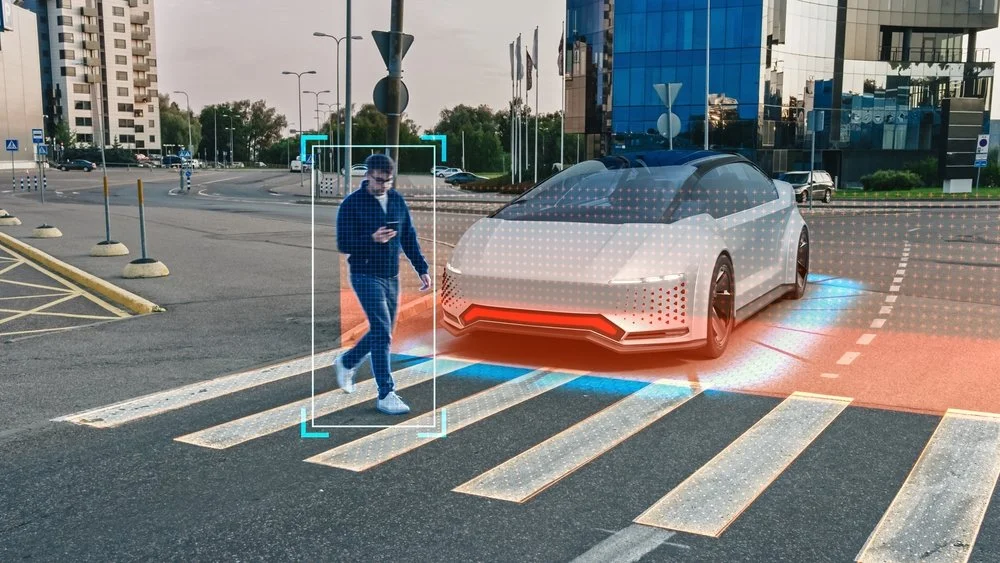
VRU detection is about teaching machines to recognize and respond to the most unpredictable elements on the road: us. Autonomous vehicles rely on a layered perception system, comprising LiDAR for spatial mapping, cameras for color and context, radar for depth, and increasingly, V2X (Vehicle-to-Everything) signals for cooperative awareness. Together, these sensors attempt to identify pedestrians, cyclists, and motorcyclists who might cross paths with the vehicle’s trajectory.

The challenge, though, is not just technical range or resolution. It lies in behavioral complexity. A pedestrian looking at their phone behaves differently from one who makes eye contact with a driver. Cyclists may switch lanes abruptly to avoid a pothole, or ride close to the curb where they blend into background clutter. Motorcyclists appear and vanish from radar frames faster than most models can track. The variability in human movement, combined with lighting changes, partial occlusion, or reflections, makes consistent detection extraordinarily difficult.

Even the best models trained on large datasets can falter in real-world situations. A paper bag floating across a crosswalk may be flagged as a pedestrian. A child emerging from behind a parked SUV might not be detected at all until the last possible moment. These aren’t rare occurrences; they represent the kind of “edge cases” that engineers lose sleep over. The problem isn’t reaction time or braking performance; it’s perceptual precision. A fraction of a second spent misclassifying or failing to track a human figure can turn a routine encounter into a crash scenario.

VRU detection, then, is not just about seeing. It’s about interpreting movement in context, deciding whether that figure on the sidewalk might step forward, or whether a cyclist wobbling near the curb is likely to merge into traffic. The success of AV safety will depend less on how far a sensor can see and more on how deeply a system can understand the intent behind what it sees.

Foundations of Reliable Vulnerable Road User (VRU) Detection

If perception is the brain of an autonomous vehicle, then data is its memory, and right now, that memory is uneven. Most public datasets used to train VRU detection models are heavily skewed toward controlled conditions: clear daylight, adult pedestrians, predictable crosswalks. Real cities are far messier. They have fog, cluttered signage, reflective puddles, and kids darting between parked cars. When models trained on pristine data are deployed in that chaos, errors multiply in ways that seem obvious only in hindsight.

Capturing these scenarios is complicated, sometimes ethically questionable, and occasionally dangerous. No one can stage thousands of near-collision events just to enrich a dataset. This is where simulation begins to fill the gap. Synthetic data, when generated with realistic physics and textures, can introduce the rare edge cases that real-world collection tends to avoid.

In 2024, Waymo and Nexar published a large-scale VRU injury dataset that helped researchers understand the circumstances of real incidents. Their findings fed directly into simulation frameworks designed to reproduce those conditions safely. Similarly, the DECICE project in Europe used synthetic augmentation pipelines to expose detection models to low-visibility and high-occlusion environments, situations that traditional datasets underrepresent. The results suggested that even limited synthetic training can significantly improve generalization, especially in urban intersections.

Simulation also plays a critical role in testing. A recent initiative from Carnegie Mellon University’s Safety21 Center (2025) introduced “Vehicle-in-Virtual-Environment” (VVE) testing, which allows an autonomous car to operate in a blended reality: real sensors and hardware responding to virtual VRUs projected into the system. This setup makes it possible to evaluate how perception and decision-making interact during near-miss moments that would be too risky to replicate physically. In practice, this is what modern VRU testing looks like: validating detection and response against staged crossings, occlusions, and low-visibility cases inside a controlled loop, long before any of it is trusted on a public street.

Still, there’s a balance to strike. Synthetic data can’t perfectly capture the unpredictability of human motion, the uneven gait of a pedestrian in a hurry, or the hesitation before a cyclist commits to a turn. Overreliance on simulation risks training models that look statistically impressive but lack behavioral nuance. The most promising work appears to blend both worlds: real-world data for grounding, synthetic data for coverage. Reliable detection doesn’t come from more data alone, but from the right mix of data that reflects how humans actually behave on the street.

Cooperative VRU Safety for Autonomy

For years, most VRU detection research focused on what an individual vehicle could see. The thinking was simple: give the car more sensors, better models, faster processors, and it would become safer. That assumption is starting to look incomplete. True safety may depend less on what one vehicle perceives and more on what the entire environment can sense and share.

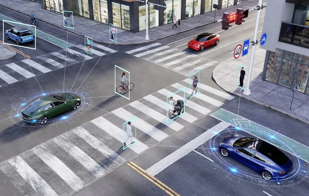
Cooperative systems, what researchers call C-V2X, or Cellular Vehicle-to-Everything, are changing that narrative. By allowing vehicles, traffic lights, and roadside sensors to exchange information in real time, AVs can detect VRUs that their own cameras or LiDAR might miss. A cyclist hidden behind a truck, for instance, might still be detected by a nearby camera-equipped intersection node and broadcast to approaching vehicles within milliseconds.

The idea isn’t just about redundancy, it’s about foresight. If one system spots a potential risk early, others can react faster. Edge computing makes this possible. Rather than sending sensor data to distant servers for processing, it’s analyzed locally, close to where the event occurs. European pilots like DECICE (2025) have demonstrated this approach at urban intersections, where localized compute units identify and track VRUs, then relay warnings directly to nearby vehicles. The reduction in communication lag translates to faster braking decisions and smoother avoidance maneuvers.

There’s also a behavioral layer to this evolution. Some AV prototypes now adjust their behavior based on the predicted intent of nearby humans. If a pedestrian’s trajectory suggests hesitation, the car may ease acceleration to signal awareness. If a cyclist’s head movement hints at a lane change, the vehicle can create additional buffer space. These micro-adjustments, though still experimental, make AVs feel less robotic and more socially attuned, a subtle but important shift in public trust.

Cooperative safety is moving toward something more ecosystemic: a shared web of awareness connecting humans, infrastructure, and machines. The vision isn’t just that every car becomes smarter, but that every intersection, streetlight, and roadside sensor contributes to collective understanding. It’s a future where vehicles don’t operate as isolated agents but as participants in a city-wide dialogue about safety, a conversation where even the most vulnerable voices are finally heard.

Recommendations for Vulnerable Road User (VRU) Detection

Recognizing a person on the road is one thing; understanding what that person intends to do is another. Will that pedestrian at the curb actually cross, or are they just waiting for a rideshare? Will the cyclist glance over their shoulder before turning, or veer suddenly into the lane? These small contextual cues can mean the difference between a safe stop and a near-miss.

One notable example is VRU-CIPI (CVPRW 2025), a project focused on crossing-intention prediction at intersections. Rather than relying solely on bounding boxes and trajectories, it incorporates motion patterns, posture analysis, and even subtle environmental context, like nearby traffic lights or pedestrian signals, to forecast likely actions.

Another approach, PointGAN (IEEE VTC 2024), improves how LiDAR systems interpret sparse or noisy point clouds, a problem that often leads to missed detections in crowded or visually complex areas. By generating synthetic but physically consistent data, the model helps fill in those blind spots where traditional sensors fall short.

Still, the technology isn’t flawless. Intent-prediction networks can overfit to certain gestures or fail to generalize across cultures. People in Paris, for instance, cross differently than those in Phoenix. Lighting, weather, and even local driving etiquette can shift how “intention” manifests visually. The risk is that a system trained in one region might misread human behavior in another, an issue that global AV developers are still grappling with.

Engineers are leaning on multimodal sensor fusion, combining LiDAR depth accuracy with camera semantics, radar motion cues, and V2X infrastructure data. This hybrid approach appears to reduce false negatives and helps AVs “see” around corners by sharing signals from nearby vehicles or roadside units.

Despite the progress, the question remains open: can machines ever truly read human intent with enough subtlety to match the instincts of an experienced driver? The current trajectory suggests we’re getting closer, but understanding motion is not the same as understanding behavior. Bridging that gap will likely define the next decade of AV perception research.

Future Outlook of VRU

The next five years are likely to redefine what “safe autonomy” means. Instead of pushing for faster reaction times or higher detection accuracy in isolation, researchers are starting to design systems that learn collectively and think contextually. The lines between perception, prediction, and policy are blurring, giving rise to a more connected ecosystem of safety.

One direction gaining momentum is the integration of digital twins, virtual replicas of real streets and intersections that evolve in real time. These environments simulate how pedestrians and vehicles interact, allowing engineers to test new safety algorithms across thousands of what-if scenarios before a single wheel turns.

Another trend that’s emerging is federated learning across fleets. Rather than pooling all raw sensor data, which would raise privacy and bandwidth issues, vehicles share only the learned model updates from their experiences. This way, a near-miss event in Los Angeles might quietly improve a vehicle’s decision-making model in Amsterdam within days. It’s a small but meaningful shift toward collective intelligence that doesn’t rely on massive centralized data storage.

Technologically, the move is toward end-to-end perception models that not only detect but also understand motion dynamics. Instead of separate modules for object detection, tracking, and path prediction, these architectures unify the process, reducing latency and improving decision consistency. Some teams are even developing explainable AI frameworks to trace why an AV acted a certain way in a given situation, critical for regulatory transparency and public confidence.

What’s emerging isn’t just a smarter car, but a smarter environment: a cooperative mesh of vehicles, infrastructure, and AI systems that share responsibility for keeping people safe.

Read more: The Pros and Cons of Automated Labeling for Autonomous Driving

How We Can Help

Building safer autonomous systems isn’t just about algorithms; it begins with data that mirrors reality. At Digital Divide Data (DDD), our role often starts where most models struggle, in the nuance of annotation, the quality of simulation inputs, and the interpretation of behaviors that machines don’t yet fully grasp.

Our teams work across multimodal datasets that include synchronized LiDAR, radar, and camera feeds, capturing the world from multiple vantage points. It’s tedious work, but precision here is what allows perception models to tell a stroller apart from a cyclist, or to recognize when a person standing on the curb is more than just a static object. We annotate not only who is present in a scene but what they might be doing, walking, hesitating, turning, or looking toward a vehicle. These micro-labels are often what transform an average model into one capable of predicting intent, not just position.

We also help clients align synthetic and real-world data. Simulation is powerful, but only if the digital pedestrians behave like real ones. Our teams validate and calibrate simulated VRU behavior against real datasets to ensure the resulting models don’t inherit artificial bias. This process has become increasingly important for clients building digital twins and training reinforcement-learning-based planners.

Read more: Sensor Fusion Explained: Why Multiple Sensors are Better Than One

Conclusion

Autonomous vehicles’ success will ultimately depend on how well they understand human behavior. Among all the technical challenges, accurate detection of vulnerable road users remains the most consequential. The progress made in the past two years, across datasets, cooperative systems, and predictive modeling, shows that this is no longer a peripheral research topic. It sits at the very center of what it means to make autonomy safe, ethical, and socially acceptable.

Vehicles must interpret context, predict intent, and act with a level of caution that mirrors human empathy. Getting there will require more than incremental improvements in sensor fidelity or algorithmic accuracy. It will demand deeper collaboration between engineers, policymakers, ethicists, and the data specialists who ensure the world inside the model looks like the world outside the windshield.

As these systems evolve, one truth becomes clearer: autonomy is not achieved when the vehicle can drive itself, but when it can share the road responsibly with those who cannot protect themselves. Accurate VRU detection is where that responsibility begins, and where the future of safe, human-centered mobility will be decided.

Learn how DDD can strengthen your VRU detection pipelines and help your systems understand what really matters in human movement and the intent behind it.


References

Aurora Innovation. (2024). Prioritizing pedestrian safety. Aurora Tech Blog. Retrieved from https://aurora.tech/blog

Carnegie Mellon University, Safety21 Center for Connected and Automated Transportation. (2025, July). Vehicle-in-Virtual-Environment (VVE) testing for VRU safety of connected and automated vehicles. U.S. Department of Transportation University Transportation Centers Program.

Computer Networks. (2024). Modeling and evaluation of cooperative VRU protection with VAM (C-V2X). Elsevier.

Conference on Computer Vision and Pattern Recognition Workshops (CVPRW). (2025). VRU-CIPI: Crossing Intention Prediction at Intersections. IEEE.

DECICE Project. (2025). Intelligent edge computing for cooperative VRU detection: Project summary and findings. European Commission CORDIS Reports.

European New Car Assessment Programme (Euro NCAP). (2024, February). VRU protection protocols update 2024. Retrieved from https://www.euroncap.com/en

McKinsey & Company. (2025, June). The road to safer AVs in Europe: Managing urban mobility risk. McKinsey Mobility Insights.

Nexar & Waymo. (2024, November). Vulnerable Road User injury dataset and insights for autonomous perception systems. Waymo Research Publications.

Vehicular Technology Conference (VTC). (2024). PointGAN: Enhanced VRU detection in point clouds. IEEE.

FAQs

What does VRU stand for in driving?

VRU stands for Vulnerable Road User. In a driving and traffic-safety context, the term refers to people who use the road without the protection of an enclosed vehicle; most commonly pedestrians, cyclists, and motorcyclists, but also wheelchair users, children, and older adults. The shorthand “VRU” is used throughout autonomous-vehicle and ADAS engineering because these road users are simultaneously the hardest to detect reliably and the most at risk when detection fails.

What is the difference between a VRU and a regular road user?

A regular road user is usually shielded by the structure of a car, truck, or bus; a metal frame, crumple zones, airbags, and seatbelts. A vulnerable road user has none of that. That single distinction is why VRU detection is treated as its own problem in autonomous driving: the same misclassification that is harmless for a parked vehicle can be fatal for a person on foot or on two wheels.

What kinds of sensors are most reliable for detecting VRUs in poor visibility conditions?

No single sensor performs best across all conditions. LiDAR handles depth and structure well, but can struggle in heavy rain or fog. Cameras offer rich color and texture but fail in low light. Increasingly, manufacturers combine thermal imaging and millimeter-wave radar with existing systems to maintain consistent detection at night or in adverse weather. The trade-off is cost and calibration complexity, which are still major barriers to large-scale deployment.

How does intent prediction differ from trajectory prediction in AV systems?

Trajectory prediction models where a VRU will move based on its current motion. Intent prediction goes a step deeper; it tries to infer why they might move, or if they plan to move at all. For example, a person standing near a crosswalk may be detected as stationary, but their posture or gaze direction might reveal an intention to step forward. This subtle shift from physics-based to behavior-aware modeling is what separates traditional perception from proactive safety.

What’s the next frontier after detection and prediction?

The next major step is explainability, understanding why an AV interpreted a situation the way it did. As regulators demand post-incident transparency, manufacturers are developing interpretable AI pipelines that can reconstruct decision logic in human-readable terms. This isn’t just for accountability; it’s also how the public begins to trust that these systems see and understand the world in ways compatible with human judgment.

Why Accurate Vulnerable Road User (VRU) Detection is Critical for Autonomous Vehicle Safety Read Post »

automatedlabeling

The Pros and Cons of Automated Labeling for Autonomous Driving

Autonomy is one of the most data-hungry fields in artificial intelligence. The accuracy of perception, planning, and control systems depends heavily on massive volumes of carefully labeled data. Each camera frame, LiDAR point cloud, and radar sweep needs to be annotated before it can be used to train or validate models. As fleets grow and sensors capture increasingly complex environments, the need for high-quality annotations has scaled into the billions.

This scale problem has led to the growing adoption of automated labeling techniques. By combining machine learning models with rules-based heuristics, companies are building pipelines that can automatically assign labels to large quantities of raw sensor data. Approaches such as pseudo-labeling, vision-language model inference, and automated HD-map generation are becoming common components of advanced data engines. These methods promise significant gains in efficiency and allow continuous retraining as new fleet data is collected.

This blog explores automated labeling in the autonomous driving industry, examines the advantages of automation, the associated challenges, and best practices for building hybrid pipelines that combine automation with human validation.

Understanding Automated Labeling in Autonomous Driving

The shift toward automated labeling has been driven by the limitations of purely manual approaches. Annotating data for autonomous vehicles is uniquely complex because it spans multiple modalities, including high-resolution video, three-dimensional LiDAR point clouds, and radar signals. Capturing this variety requires not only extensive labor but also technical expertise to ensure consistency and accuracy. As sensor coverage and fleet size expand, the industry has sought solutions that can meet scale demands without overwhelming cost structures.

Automated labeling can also extend to HD map generation, where repeated sensor passes are stitched together to build road-level maps that identify lanes, intersections, and drivable areas. In some cases, sensor fusion techniques combine camera, LiDAR, and radar data to improve accuracy and robustness, particularly in challenging conditions such as poor lighting or adverse weather.

While the goal of automated labeling is efficiency and scale, its use in autonomous driving is more than just a cost-saving measure. By enabling faster iteration and broader data coverage, it has become a cornerstone of modern development pipelines. At the same time, because errors in automated labels can propagate through model training, the approach requires careful integration with validation and governance frameworks to ensure safety and compliance.

A key emerging trend across both regions is the use of vision-language models combined with sensor fusion to improve labeling pipelines. By leveraging contextual understanding from language models alongside the spatial precision of LiDAR and radar, automated systems can produce richer and more accurate labels. This integration is expected to form the backbone of next-generation auto-labeling pipelines, enabling both scale and robustness while maintaining the flexibility to adapt across markets.

Core Advantages of Automated Labeling in Autonomy

Automated labeling is not simply a cost-saving measure; it has become a strategic enabler for advancing autonomous driving systems. By reducing reliance on manual annotation and leveraging model-driven labeling pipelines, organizations can build data engines that are faster, more scalable, and better equipped to handle real-world complexity.

Scalability and Speed

Manual labeling cannot keep pace with the exponential growth of sensor data generated by autonomous vehicle fleets. Automated pipelines, such as AIDE and ZOPP, are capable of producing millions of labels at a significantly lower cost and in a fraction of the time. This scalability allows continuous retraining of perception models, ensuring that new data can be incorporated into production systems without long delays. Faster iteration cycles also mean that companies can test and deploy improvements more rapidly, a critical factor in a competitive industry.

Coverage of Long-Tail and Rare Scenarios

One of the persistent challenges in autonomous driving is the long tail of rare events, such as unusual traffic configurations, emergency vehicles, or debris on the road. Manual labeling teams struggle to capture enough examples of these scenarios to train robust models. Automated labeling, particularly when combined with offboard processing and zero-shot learning, can extend coverage to these rare cases. Systems like ZOPP demonstrate how open-vocabulary panoptic perception can generate labels for previously unseen objects, expanding the diversity of training data without requiring exhaustive manual effort.

Robustness in Challenging Conditions

Environmental variability is another factor that makes manual labeling insufficient. Driving conditions shift across seasons, lighting, and weather. Automated labeling techniques that leverage radar, LiDAR, and camera inputs have shown improvements in detecting road features under low-light or adverse conditions. For example, trajectory-based road auto-labeling with LiDAR–camera fusion has proven more effective in snow-covered environments compared to vision-only systems. By enhancing robustness under difficult conditions, auto-labeling supports the development of perception models that are more reliable in the real world.

Structured Labels for Model Efficiency

By organizing labels into structured formats that align with end-to-end driving models, auto-labeling pipelines can reduce inference latency while maintaining accuracy. This approach not only streamlines model training but also contributes to real-time performance, which is critical for safety in autonomous driving systems.

Challenges of Automated Labeling for Autonomous Driving

While automated labeling offers clear advantages in scale and efficiency, it also introduces risks that cannot be overlooked. In the context of autonomous driving, where safety and reliability are non-negotiable, the limitations of automation must be carefully managed. Current research and industry practices highlight several critical challenges.

Label Noise and Error Propagation

One of the most significant risks of automated labeling is the propagation of errors. Pseudo-labels generated by models can reinforce their own mistakes if used directly for retraining. For instance, methods applied to 3D scene-flow auto-labeling often assume rigid motion, yet this assumption breaks down in complex urban scenes with dynamic interactions. Such systematic errors can cascade through the training pipeline, eroding the accuracy and trustworthiness of deployed models.

Domain and Seasonal Drift

Automated labeling pipelines often fail to generalize across changing conditions. A system that performs well on summer highway data may misinterpret scenes in winter when road markings are obscured or when lighting conditions differ significantly. This issue of domain drift undermines the robustness of automated approaches. As a result, human-in-the-loop validation remains essential to identify and correct errors that arise from seasonal or geographic shifts.

Bias and Taxonomy Gaps

Another concern is the risk of bias and inconsistency in label taxonomies. Zero-shot and open-vocabulary approaches can generate labels that are misaligned with local standards. For example, road signs differ across jurisdictions in the United States and Europe, yet automated systems may apply the same label categories without accounting for these differences. Without careful localization and quality assurance, such mismatches can produce data that is technically valid but operationally unusable in certain markets.

Safety and Regulatory Concerns

The most pressing challenge lies in ensuring compliance with safety and regulatory requirements. Automated pipelines alone cannot provide the level of assurance required in safety-critical domains. These frameworks underscore a broader principle: automation must be paired with governance, testing, and oversight to ensure that labeled data meets the stringent safety requirements of autonomous driving.

Best Practices for Automated Labeling in Autonomy 

The challenges of automated labeling do not render it unsuitable for autonomous driving, but they highlight the importance of designing pipelines with safeguards. Industry experience and recent research point toward several best practices that balance the efficiency of automation with the reliability required for safety-critical systems.

Human-in-the-Loop Validation

Even the most advanced automated labeling systems require human oversight. Human reviewers are essential for correcting systematic errors, validating rare or ambiguous scenarios, and ensuring compliance with regulatory standards. By embedding human validation at critical points in the pipeline, companies can mitigate the risks of error propagation while maintaining the benefits of scale.

Sensor Fusion Auto-Labeling

Reliance on a single modality, such as vision, can expose automated pipelines to vulnerabilities in low-light, fog, or adverse weather conditions. Combining LiDAR, radar, and camera data creates a more resilient labeling framework. Sensor fusion auto-labeling not only improves robustness across environments but also strengthens confidence in the labeled datasets used for training.

Continual Learning Pipelines

Automated labeling is most effective when integrated into a continual learning loop. As fleets collect new data, pseudo-labels can be generated and used for incremental retraining. Quality assurance steps must be embedded within this process to prevent compounding errors. This approach allows models to evolve dynamically with real-world data while keeping quality under control.

Structured Labeling and Standards

Structured labeling practices ensure that auto-generated labels are consistent, interpretable, and aligned with regulatory requirements. Standardized taxonomies, particularly those adapted for different jurisdictions, help avoid mismatches between datasets and deployment environments. Aligning automated pipelines with structured frameworks makes them more transparent and easier to audit for compliance.

Future Outlook

Several trends are shaping how this technology will be integrated and governed.

Increasing Reliance on Foundation Models

Foundation models trained on multimodal data are expected to take on a central role in auto-labeling. These models are capable of generating consistent labels across camera, LiDAR, and radar inputs, reducing fragmentation in annotation workflows. As their capabilities improve, the industry will move closer to scalable pipelines that can label new data streams with minimal manual intervention.

Hybrid Pipelines as the Standard

Looking ahead, the most successful strategies will be those that combine automation with structured human oversight. Hybrid pipelines will allow automation to handle the bulk of large-scale labeling, while human experts focus on complex, rare, or safety-critical cases. This balance will not only reduce costs and accelerate development but also ensure that systems remain trustworthy in deployment.

How We Can Help

At Digital Divide Data (DDD), we recognize that automation alone cannot solve the challenges of autonomous driving data pipelines. Automated labeling provides speed and scale, but safety, consistency, and compliance still depend on human expertise. DDD specializes in bridging this gap by combining automation with high-quality human-in-the-loop processes tailored to the specific needs of automotive AI.

Our teams bring deep experience in multimodal data annotation, including camera, LiDAR, and radar. We help autonomous driving companies validate automatically generated labels, correct errors that automation may overlook, and ensure that datasets meet both technical and regulatory standards. With multilingual capabilities and region-specific knowledge, we also address the challenge of adapting taxonomies across different geographies.

By partnering with DDD, organizations gain access to scalable resources that enhance the efficiency of automated pipelines without compromising on quality. We enable companies to move faster, reduce costs, and expand coverage of rare and complex driving scenarios, all while maintaining the level of trust and accountability required in a safety-critical industry.

Conclusion

Automated labeling can process massive datasets efficiently, expand coverage of rare scenarios, and improve robustness across challenging conditions. Structured labeling techniques are also beginning to enhance model efficiency, offering tangible performance gains for end-to-end driving systems.

Yet the risks remain equally significant. Label noise, domain drift, and taxonomy mismatches can compromise safety if not carefully managed. In safety-critical contexts such as autonomous vehicles, automation cannot replace the assurance provided by human validation and regulatory compliance. The industry’s experience shows that relying solely on automation is not enough to meet the trust and accountability standards required for real-world deployment.

The most promising path forward is a hybrid approach that integrates automation with human expertise and governance. Automated systems handle the scale, while human reviewers and structured frameworks safeguard quality and compliance. This combination ensures that innovation does not come at the expense of reliability.

For autonomous driving to deliver on its promise, data pipelines must be both scalable and trustworthy. Automated labeling, when implemented responsibly, can serve as a force multiplier, helping the industry move faster while still meeting the rigorous standards of safety and accountability that the public and regulators demand.

Looking to scale your autonomous driving data pipelines without compromising safety and compliance? Partner with Digital Divide Data (DDD) to combine the efficiency of automated labeling with the assurance of expert human validation.


References

Liu, M., Yurtsever, E., Fossaert, J., Zhou, X., Zimmer, W., Cui, Y., Zagar, B. L., & Knoll, A. C. (2024). A survey on autonomous driving datasets: Statistics, annotation quality, and a future outlook. arXiv Preprint arXiv:2401.01454. https://arxiv.org/abs/2401.01454

Li, X., & Chen, Y. (2024). AIDE: Automatic data engine for autonomous vehicle object detection. In Proceedings of the IEEE/CVF Conference on Computer Vision and Pattern Recognition (CVPR) (pp. 11245–11254). IEEE. https://doi.org/10.1109/CVPR.2024.01124

Waymo. (2024, October 22). Waymo’s end-to-end multimodal model: Advancing AV perception with automation. Waymo Tech Blog. https://blog.waymo.com

Wayve. (2025, March 18). Demonstrating generalizable AI driving in the US. Wayve Blog. https://wayve.ai/blog/generalization-us


FAQs

Q1. How does automated labeling compare in cost to traditional manual labeling?
Automated labeling can reduce costs significantly, often by an order of magnitude, since large volumes of data can be annotated with minimal human intervention. However, human-in-the-loop validation is still required, which means costs are not eliminated entirely but are redistributed toward quality control rather than bulk annotation.

Q2. Can automated labeling fully replace human annotators in autonomous driving?
Not at present. While automated systems handle scale efficiently, they struggle with ambiguous or novel scenarios. Human reviewers are still essential for ensuring accuracy in safety-critical cases and for adapting taxonomies across jurisdictions.

Q3. What role do foundation models play in automated labeling?
Foundation models bring multimodal capabilities that allow labeling across cameras, LiDAR, and radar with greater consistency. They also enable zero-shot labeling, which expands coverage to rare or unseen categories. This reduces reliance on manual taxonomy building but introduces challenges related to bias and interpretability.

Q4. Are automated labeling methods evaluated by regulators?
Regulators do not currently evaluate labeling methods directly. Instead, compliance frameworks such as Euro NCAP and UNECE focus on system-level safety validation. However, because data quality underpins system safety, companies are expected to prove that their labeling pipelines, whether automated or manual, meet high standards of reliability.

Q5. How does automated labeling address edge cases like accidents or unusual infrastructure?
Automated systems often miss or mislabel rare edge cases, which are among the most critical for safety. Companies typically rely on targeted data collection and manual annotation for such scenarios. Automated methods can assist in surfacing potential edge cases, but expert review remains necessary.

Q6. Is automated labeling equally effective across geographies?
No. Differences in signage, infrastructure, and driving norms across regions can reduce the accuracy of automated labels. For this reason, localized taxonomies and human review are vital when deploying autonomous driving systems.

The Pros and Cons of Automated Labeling for Autonomous Driving Read Post »

administrativedataprocessing

How Administrative Data Processing Enhances Defense Readiness

Umang Dayal

17 Sep, 2025

Defense readiness is measured not only by the size of an arsenal or the training of forces but also by the ability to respond rapidly, coordinate effectively, and make mission-critical decisions with confidence. In modern theaters of conflict, where operations span multiple domains and timelines are compressed, access to accurate and timely information often determines success or failure.

Much of the attention in defense technology focuses on weapons systems, cyber capabilities, and battlefield innovations. Yet, the foundation of readiness lies in something less visible: administrative data processing. Mission reports, personnel records, equipment maintenance logs, training schedules, and supply chain documentation are often treated as routine paperwork. In reality, when properly processed, they form the backbone of strategic and operational agility.

Administrative data processing transforms fragmented and often inconsistent records into structured, accessible, and actionable information. Through processes such as data curation, transcription, metadata enrichment, search indexing, and analytics, defense organizations gain the ability to connect dots across systems, identify risks before they escalate, and allocate resources with precision.

This blog explores how administrative data processing directly enhances defense readiness by creating clarity out of complexity. It examines the core capabilities that make it possible, the practical applications across defense operations, and the emerging trends that are reshaping the way data supports mission success.

Administrative Data Processing in Defense Tech

In defense operations, administrative data is generated at every level of activity. Logs from field missions, personnel training records, equipment maintenance histories, supply chain documents, and after-action reports all contribute to the administrative backbone of an organization. This data exists in both structured formats, such as databases and spreadsheets, and unstructured formats, such as reports, transcripts, and communications.

When left in raw form, administrative records often create more challenges than solutions. They can be incomplete, inconsistent, or stored across multiple silo, which makes integration difficult. Raw records may capture information but rarely provide the clarity or context required for strategic or tactical decisions. The result is a gap between the information available and the insights required to act.

Administrative data processing bridges this gap. By applying methods such as data curation, metadata insertion, and indexing, defense organizations transform unrefined records into reliable and actionable information. Clean and accessible data strengthens situational awareness by ensuring commanders and analysts see a unified picture rather than fragmented inputs. It also streamlines resource allocation, as accurate records allow leaders to understand where equipment, personnel, and logistics are positioned in real time.

The difference between raw and processed administrative data is the difference between a pile of unorganized mission notes and a searchable, structured record that informs both immediate responses and long-term planning.

Major Capabilities of Administrative Data Processing in Defense Tech

Data Curation

Defense data originates from multiple sources, each with its own formats, levels of accuracy, and standards. Data curation ensures that this information is cleaned, de-duplicated, and aligned to consistent formats. By eliminating redundancies and validating accuracy, curated data becomes interoperable across systems, units, and even coalition partners. This consistency forms the baseline for trust in information, enabling commanders to act on data without hesitation.

Mission-Critical Transcription and Logging

Transcription and logging transform raw communications, operational reports, and surveillance notes into structured records. In mission environments where decisions must be documented and reviewed, accurate logs provide accountability and traceability. They also support post-mission analysis, allowing leaders to learn from past operations and strengthen future readiness. Without reliable transcription, critical details may be lost or overlooked, undermining operational effectiveness.

Metadata Insertion

Raw data is far more powerful when paired with context. Metadata insertion adds essential attributes such as time stamps, security classifications, unit identifiers, and geographic coordinates. These markers make data easier to retrieve, verify, and share. In defense settings where compliance and traceability are paramount, metadata ensures that information is both usable and auditable, while also maintaining its relevance over time.

Search Indexing

The scale of administrative data in defense organizations can overwhelm even the most prepared teams. Search indexing organizes records into accessible repositories, allowing critical information to be found quickly under pressure. For analysts and commanders, this capability reduces time spent searching through archives and ensures that relevant information is surfaced when it is needed most. In fast-moving environments, this can be the difference between proactive and delayed responses.

Insight Generation and Analytics

Once data is curated, transcribed, enriched, and indexed, it becomes a foundation for insight generation. Analytics tools can transform these datasets into dashboards that track readiness, predict maintenance needs, and forecast supply chain demands. Rather than reacting to problems after they arise, defense organizations can anticipate challenges and adjust resources accordingly. This shift from reactive to proactive decision-making enhances both operational efficiency and strategic preparedness.

Real-World Applications for Administrative Data Processing

Logistics and Supply Chain

Defense logistics are among the most complex in the world, involving the movement of equipment, munitions, and personnel across multiple domains and geographies. Administrative data processing ensures that records of inventory, transportation schedules, and procurement activities are accurate and up to date. With curated and indexed data, leaders can identify bottlenecks, predict shortages, and ensure resources reach the front line without delay. This directly strengthens operational readiness by minimizing disruptions in the supply chain.

Training and Personnel Management

Personnel readiness depends on maintaining detailed records of training schedules, certifications, and performance. When administrative data from multiple training programs is curated and enriched with metadata, commanders can quickly assess unit preparedness and identify skill gaps. Streamlined scheduling and record-keeping allow for more efficient allocation of training resources, ensuring that forces remain mission-ready at all times.

Maintenance and Lifecycle Management

Equipment reliability is fundamental to readiness, and administrative data plays a central role in tracking maintenance cycles, inspections, and repairs. Structured logs highlight patterns of wear and potential points of failure, enabling predictive maintenance strategies. Instead of reacting to unexpected breakdowns, organizations can anticipate needs and prevent downtime, ensuring that critical assets remain operational when they are needed most.

Operational Planning and Simulations

Planning future missions requires not only intelligence data but also a clear picture of past operations, resource availability, and training readiness. Indexed and annotated administrative data provide the inputs for simulations, wargames, and scenario planning. By incorporating lessons learned from prior missions and combining them with current resource assessments, decision-makers gain a realistic understanding of readiness levels and potential outcomes under different conditions.

Key Benefits for Defense Organizations

Speed and Agility

In defense operations, delays can have severe consequences. Administrative data processing accelerates access to information by transforming fragmented records into structured, searchable, and retrievable formats. Leaders can quickly obtain the data they need to make timely decisions, enabling forces to act with speed and precision.

Accuracy and Compliance

Defense organizations must operate under strict reporting standards and regulatory frameworks. By curating data, inserting metadata, and maintaining standardized records, administrative data processing reduces errors and ensures compliance with oversight requirements. Accurate information also minimizes the risk of miscommunication across units and commands.

Enhanced Situational Awareness

A unified operational picture is possible only when information from logistics, personnel, and equipment systems is integrated. Processed administrative data provides that clarity, allowing commanders to view readiness levels holistically rather than through fragmented snapshots. This broader perspective improves planning and supports coordinated action across domains.

Scalable Readiness

As defense organizations modernize and increasingly operate in coalition settings, data volume and complexity continue to grow. Administrative data systems that are standardized and scalable ensure readiness practices can evolve with these demands. Whether scaling within a single command or across allied forces, effective data processing supports consistent readiness at every level.

Emerging Trends in Defense Administrative Data Processing

AI-Driven Automation

Artificial intelligence is reshaping how administrative data is handled in defense. Automated transcription systems capture communications in real time, anomaly detection tools flag irregularities in logs, and predictive analytics generate early warnings about equipment or supply chain vulnerabilities. These capabilities reduce manual workloads while increasing the speed and reliability of insights.

Secure Cloud and Edge Computing

The adoption of cloud and edge technologies allows administrative data to be processed closer to where it is generated. For forward-deployed units, this means access to curated and analyzed information without relying solely on centralized data centers. Secure cloud and edge solutions also ensure that large datasets remain both accessible and protected, supporting operational decisions in real time.

Interoperability Frameworks

Defense readiness increasingly depends on coalition operations, where data must flow seamlessly across national and organizational boundaries. Interoperability frameworks enable different systems to exchange curated and metadata-rich administrative records without loss of context or accuracy. This ensures that multinational forces can align quickly, share situational awareness, and act as a unified front.

Data Governance and Cybersecurity

The value of administrative data makes it a target for cyber threats. Strong governance frameworks, combined with rigorous cybersecurity measures, ensure that sensitive and classified data is both usable and secure. Defense organizations are investing in access controls, encryption, and audit trails to protect administrative data while maintaining the agility required for operational use.

Read more: Why Multimodal Data is Critical for Defense-Tech

Recommendations for Administrative Data Processing 

Invest in Enterprise-Wide Data Curation Frameworks

Defense organizations should establish standardized practices for cleansing, validating, and managing administrative data across all units and systems. This ensures consistency and builds trust in the information that underpins readiness decisions.

Standardize Logging and Transcription Practices

A unified approach to recording mission communications, operational logs, and reports minimizes discrepancies and creates a reliable foundation for analysis. Standardization also strengthens traceability and accountability across commands.

Adopt Metadata-First Strategies

Embedding context such as timestamps, classification levels, and source identifiers at the point of data entry accelerates retrieval and ensures compliance with regulatory requirements. Metadata-first strategies transform raw records into readily usable assets.

Integrate Analytics Platforms

Analytics tools should be embedded into administrative data workflows to convert curated datasets into readiness dashboards, predictive maintenance alerts, and strategic planning tools. Integration ensures leaders can move from static reporting to real-time insight generation.

Read more: How Synthetic Data Accelerates Training in Defense Tech

Conclusion

Defense readiness is often defined by visible elements such as equipment strength, force posture, and training. Yet beneath these elements lies an invisible foundation: the ability to process and transform administrative data into reliable intelligence. Mission reports, maintenance logs, personnel records, and supply chain documents may appear routine, but when curated, enriched, and analyzed, they become critical enablers of operational agility.

Effective administrative data processing allows defense organizations to act with speed, precision, and foresight. It turns fragmented records into unified pictures of readiness, supports predictive maintenance and logistics, and strengthens compliance across highly regulated environments. As the defense landscape grows more complex, the ability to transform data into insight is no longer optional but central to mission success.

Looking forward, readiness in the digital age will increasingly depend on how well administrative data is managed. The organizations that build robust frameworks for curation, transcription, metadata, indexing, and analytics will be the ones prepared to anticipate challenges, coordinate seamlessly with allies, and maintain a decisive edge in any operational environment.

How We Can Help

Digital Divide Data (DDD) brings proven expertise in building secure, accurate, and scalable data solutions tailored to mission-driven industries. For the defense tech, this expertise translates into strengthening readiness through reliable administrative data processing.

  • Secure Data Curation: DDD ensures that data from multiple defense sources is cleansed, validated, and standardized, providing a trusted foundation for analysis and decision-making.

  • Mission-Critical Transcription and Logging: Our teams handle sensitive communications and operational records with precision, converting them into structured, traceable data sets ready for use in defense systems.

  • Metadata Insertion and Indexing: We add essential context to raw information, making it discoverable, compliant, and auditable, while enabling rapid access during high-pressure situations.

  • Analytics-Ready Outputs: DDD prepares data pipelines that seamlessly integrate with business intelligence platforms, predictive models, and AI tools, ensuring that administrative data directly fuels readiness insights.

With a focus on accuracy, security, and scalability, DDD helps defense organizations transform administrative data into a readiness multiplier, enabling leaders to make faster, more informed, and more confident decisions.

Partner with Digital Divide Data to transform administrative data into mission-ready intelligence that drives faster, more reliable decisions.


References

Department of Defense. (2024, November 4). DoD Directive 5105.89: Chief Digital and Artificial Intelligence Office. U.S. Department of Defense.

European Defence Agency. (2025, April). Annual report 2024. European Defence Agency.

NATO. (2024, December). Digital backbone and reference architecture for interoperability. NATO Communications and Information Agency.


Frequently Asked Questions (FAQs)

Q1: How does administrative data processing differ from operational or battlefield data management?
Administrative data processing deals with structured and unstructured records such as mission logs, personnel files, maintenance reports, and supply chain documents. Operational or battlefield data focuses on real-time inputs like sensor feeds, drone imagery, or intelligence reports. Both are critical, but administrative data often provides the long-term backbone that enables sustained readiness.

Q2: Can administrative data processing support multinational defense collaborations?
Yes. By curating data and embedding standardized metadata, defense organizations can create interoperable records that are easier to share across allied forces. This improves coordination, ensures compliance with differing national requirements, and supports joint readiness exercises.

Q3: What role does automation play in processing administrative data?
Automation reduces the manual burden of transcription, indexing, and data validation. AI-driven tools can process large volumes of logs, detect anomalies, and generate readiness insights more quickly than traditional methods, allowing personnel to focus on higher-value decision-making tasks.

Q4: What is the biggest challenge in leveraging administrative data for readiness?
The primary challenge is balancing accessibility with security. Sensitive and classified data must remain protected against unauthorized access and cyber threats, while still being available for those who need it to make rapid operational decisions.

Q5: How can defense organizations build a stronger data-centric culture?
Leaders can foster a data-centric culture by investing in training, setting standards for data stewardship, and aligning incentives to reward accuracy and consistency in administrative data practices. Embedding this mindset across ranks ensures that data is treated as a strategic asset rather than a byproduct of operations.

How Administrative Data Processing Enhances Defense Readiness Read Post »

ODDCoverage

Leveraging Traffic Simulation to Optimize ODD Coverage and Scenario Diversity

The safe deployment of autonomous vehicles depends on a clear understanding of the conditions in which they are designed to operate. These boundaries are formally described as the Operational Design Domain (ODD). An ODD may include specific types of roads, weather conditions, speed limits, geographic areas, and traffic environments. By defining these limits, developers can establish clear expectations for how an autonomous system should function safely.

Yet defining the ODD is only the first step. The more difficult challenge lies in testing whether an autonomous system can truly handle the full variety of situations that may arise within those boundaries. This is where scenario diversity becomes critical. Scenario diversity refers to the breadth of situations, behaviors, and interactions that a vehicle may encounter, including both everyday conditions and rare but high-impact events. For example, normal lane-keeping and merging behaviors must be tested alongside unusual but possible situations such as sudden pedestrian crossings or aggressive cut-ins from other drivers.

Real-world testing is constrained by time, geography, and cost. More importantly, it is unlikely to expose a system to the rare and unpredictable events that often matter most for safety. Physical testing can validate certain behaviors under realistic conditions, but it cannot efficiently explore the full spectrum of scenarios across an ODD.

In this blog, we will explore how traffic simulation strengthens the testing and validation of autonomous vehicles by expanding ODD coverage, increasing scenario diversity, ensuring relevance and realism, and integrating into broader safety pipelines to support safer and more reliable deployment.

The Role of Traffic Simulation in AV Development

Traffic simulation is one of the most powerful tools available for testing and validating autonomous vehicles. At its core, simulation provides a digital environment where vehicles interact with roads, infrastructure, and other traffic participants under carefully controlled conditions. Unlike physical testing, where weather, traffic flow, and human behavior are unpredictable, simulation allows these factors to be defined, adjusted, and repeated as needed.

There are different layers of simulation used in the development process. Microscopic simulation models individual vehicles and their interactions, capturing details such as lane changes, braking patterns, and following distances. Macroscopic simulation looks at traffic as a flow, providing insights into congestion patterns and overall traffic density. Within these categories, simulation methods can also be agent-based, where vehicles and pedestrians act with some level of autonomy, or rule-based, where behaviors are more structured and deterministic. Together, these approaches create environments that range from predictable to highly dynamic, which is essential for testing how an autonomous system adapts.

The strength of traffic simulation lies in its ability to generate scenarios that are controlled, scalable, and repeatable. Controlled environments allow developers to isolate variables and test specific behaviors, such as how an autonomous vehicle responds to an abrupt lane change by a nearby car. Scalability makes it possible to run thousands of variations overnight, something that would take months or years on public roads. Repeatability ensures that the same conditions can be recreated consistently, which is crucial for verifying whether system improvements actually result in better performance.

Most importantly, simulation bridges a critical gap. Real-world testing exposes vehicles to authentic conditions but cannot cover the full variety of scenarios defined by an ODD. Simulation fills in those gaps by enabling systematic exploration of rare events, edge cases, and combinations of factors that are unlikely to occur naturally during limited road testing. By combining physical trials with simulation, developers create a comprehensive testing strategy that balances realism with breadth of coverage.

Understanding ODD Coverage

Operational Design Domain coverage refers to the degree to which testing explores the full set of conditions outlined in an ODD. It is not enough to state that a vehicle is intended for “urban roads” or “highways in clear weather.” Developers must ensure that testing activities actually expose the system to the range of variations within those categories. For example, urban roads may include wide multi-lane avenues, narrow residential streets, school zones, and intersections with complex traffic signaling. Coverage must therefore reflect the diversity of conditions that exist in practice.

ODD coverage is often confused with ODD completeness, but the two concepts are distinct. ODD completeness refers to the quality and precision of the ODD definition itself. A complete ODD might specify not just “urban areas” but also the types of intersections, the expected traffic densities, the lighting conditions, and the maximum number of vulnerable road users present. ODD coverage, on the other hand, focuses on testing. It asks whether simulations and road trials have actually evaluated system performance across those detailed parameters.

To make coverage measurable, developers rely on specific metrics. Distributional balance ensures that testing does not overemphasize common conditions while neglecting rare but important ones. Exposure to rare events measures whether the system has been tested against the long-tail scenarios that often challenge safety. Representativeness checks that the conditions simulated reflect the real-world distributions within the intended ODD, so the system is not overprepared for unusual situations at the expense of typical ones.

By treating ODD coverage as a quantifiable goal rather than a general aspiration, developers gain visibility into where testing is strong and where it is lacking. This clarity allows simulation to be used strategically, filling gaps that are difficult or impossible to address through physical testing alone.

Scenario Diversity as a Testing Imperative

Achieving broad ODD coverage is necessary, but it is not sufficient on its own. Autonomous vehicles must also be tested against a diverse range of scenarios that occur within those boundaries. Scenario diversity captures this dimension. It refers to the variety of interactions, behaviors, and environmental contexts that a vehicle might face during operation. Without sufficient diversity, testing risks overlooking conditions that could expose critical weaknesses.

Simply working through an ODD checklist does not guarantee robust safety. For instance, an ODD might include “highway driving,” but the scenarios within that category can vary dramatically. A vehicle must handle steady traffic flow, sudden congestion, merging at on-ramps, and vehicles weaving at high speeds. The same applies to urban settings, where interactions with pedestrians, cyclists, and public transport create countless possible situations. Scenario diversity ensures that these variations are not treated as a single condition but are tested in their many forms.

Diversity also requires attention to rare but high-risk events. These events might include an aggressive cut-in from a driver who misjudges space, a pedestrian emerging suddenly from behind a parked truck, or a cyclist crossing against traffic lights. While individually uncommon, such scenarios carry significant safety implications. A system that performs well in common conditions but fails in these rare interactions cannot be considered truly reliable.

Methods to Expand ODD Coverage in Simulation

Expanding ODD coverage requires more than running standard simulations. It involves using structured methods to systematically increase the range of conditions and interactions tested. Several approaches can be combined to ensure both breadth and depth in scenario design.

Parameterized Scenarios
One of the most direct methods is to adjust parameters within a scenario, such as vehicle speed, traffic density, road friction, lighting, or actor behavior. By systematically varying these inputs, developers can explore a wide range of outcomes from a single scenario template. This allows both common and extreme conditions to be tested without requiring entirely new scenario designs each time.

Data-Driven Scenarios
Real-world driving logs provide a rich source of authentic interactions that can be reconstructed in simulation. By replaying these events, developers can test how autonomous systems respond to conditions that have been observed in practice. Data-driven approaches also capture cultural and regional differences in driving behavior, which are essential when validating ODDs across multiple geographies.

Synthetic and AI-Generated Scenarios
Generative methods use artificial intelligence to create new but plausible scenarios that have not been recorded in real-world data. These scenarios are particularly valuable for exploring long-tail risks. For example, AI-generated variations can simulate rare pedestrian movements, unusual traffic violations, or unexpected combinations of environmental conditions. This approach helps anticipate events that may not yet exist in recorded datasets but remain within the bounds of possibility.

Combinatorial Expansion
Complex situations often arise from the interaction of multiple factors, such as weather, traffic density, and driver behavior occurring simultaneously. Combinatorial expansion explores these intersections by systematically varying several inputs at once. This method uncovers under-tested areas of the ODD where overlapping conditions could reveal system vulnerabilities.

Ensuring Scenario Relevance and Realism

Expanding ODD coverage through simulation is valuable only if the scenarios remain relevant and realistic. A large library of artificial events has limited utility if those events do not reflect conditions that could plausibly occur within the defined ODD. Maintaining this balance is one of the central challenges in simulation-based testing.

One risk is that synthetic or AI-generated scenarios may introduce behaviors or interactions that are technically possible but not representative of real-world driving. For example, an overly aggressive lane change or an improbable pedestrian trajectory might stress-test the system but fail to provide meaningful insights about performance under genuine conditions. Such unrealistic scenarios can distort test results and create false confidence or unnecessary alarm.

Another challenge lies in balancing edge-case generation with everyday coverage. It is important to test rare, high-risk events, but overemphasizing them can skew validation results. An autonomous vehicle must not only survive extreme situations but also operate smoothly under the far more common day-to-day traffic conditions. Ensuring that scenario libraries reflect both ends of this spectrum prevents systems from being over-optimized for rare events at the expense of routine reliability.

Validation frameworks play a crucial role in addressing these challenges. Regulatory-aligned frameworks set guidelines for scenario plausibility, coverage requirements, and traceability. By embedding validation standards into simulation workflows, developers ensure that every scenario, whether common or rare, contributes meaningfully to the safety case. This alignment also builds confidence that simulation-based results can withstand external review and regulatory scrutiny.

Realism and relevance are not static qualities. As ODDs evolve and new real-world data becomes available, scenario libraries must be continuously refined. Ongoing monitoring and feedback loops help maintain alignment between simulated conditions and the environments in which vehicles are deployed. This iterative process ensures that simulation remains a trustworthy complement to physical testing.

Measuring Metrics for Coverage and Diversity

Building extensive scenario libraries is only effective if developers can measure how well those scenarios achieve ODD coverage and diversity. Without clear metrics, testing efforts risk becoming arbitrary, leaving critical gaps undiscovered. Defining and tracking the right measures ensures that simulation contributes directly to safety and reliability.

Coverage Percentage

One fundamental measure that captures how much of the ODD has been tested. This can be quantified by mapping the tested scenarios against the dimensions of the ODD, such as road types, weather conditions, traffic densities, and time-of-day variations. A high coverage percentage indicates broad exposure, but it must be interpreted carefully, since not all conditions carry equal risk.

Scenario Novelty

It measures how different new scenarios are compared to existing ones. High novelty indicates that the testing program is exploring new areas of the ODD space rather than repeating similar conditions. Novelty can be quantified using similarity measures across scenario parameters or outcomes, ensuring that testing avoids redundancy and uncovers fresh challenges.

Frequency Alignment

Evaluates whether simulated scenarios match the real-world distribution of conditions within the ODD. If a city’s roads experience heavy congestion during peak hours, simulations must reflect that reality rather than focusing disproportionately on light-traffic conditions. Frequency alignment ensures that testing results remain relevant and transferable to actual deployment environments.

Metrics also play a role in deciding when testing is “enough.” Absolute completeness is neither possible nor practical, but thresholds based on coverage, novelty, and alignment can provide defensible stopping criteria. By monitoring these indicators, developers can justify that their testing efforts have systematically addressed both common conditions and the rare events most critical to safety.

Integration with Safety Assessment Pipelines

Traffic simulation is most effective when it is embedded within a broader safety assessment framework. Autonomous vehicles cannot be validated through simulation alone, but simulation can play a central role when combined with physical testing, real-world data, and hardware integration. Together, these methods create a multi-layered safety pipeline that strengthens confidence in system performance.

Combination of Simulation and Physical Testing

Simulation allows for rapid and exhaustive exploration of scenarios, while physical testing validates how the vehicle performs in real-world conditions, including hardware dynamics and environmental unpredictability. By aligning these two approaches, developers ensure that insights from simulation are grounded in reality.

Hardware-in-the-loop (HIL) testing

In this assessment, actual vehicle components are connected to a simulation environment. This method tests how sensors, control systems, and actuators respond under simulated conditions, creating a realistic link between software performance and physical hardware behavior. HIL provides an efficient way to validate the interaction between digital models and real-world components without exposing vehicles to unnecessary risk.

Feedback Loops

When incidents or anomalies occur in real-world operations, they should inform the next cycle of simulation. Reconstructing these events virtually allows developers to test whether updates to the system can address the weaknesses that were revealed. Over time, this continuous cycle of simulation and feedback strengthens scenario diversity and improves overall safety coverage.

Read more: How Accurate LiDAR Annotation for Autonomy Improves Object Detection and Collision Avoidance

How We Can Help

Digital Divide Data (DDD) provides the expertise and scalable resources needed to strengthen simulation pipelines for autonomous vehicle development. Expanding ODD coverage and scenario diversity depends on high-quality, well-structured data, and this is where DDD delivers value.

Our teams support the creation of simulation-ready datasets through data annotation and enrichment that capture complex traffic participants, environmental conditions, and edge-case behaviors. We work with clients to curate diverse datasets that reflect the many dimensions of ODDs, including rare and high-risk scenarios that are often underrepresented in real-world data.

By partnering with DDD, organizations can focus on advancing their core technologies while relying on a trusted partner to ensure that their data foundation is strong, diverse, and ready to support rigorous simulation-driven testing.

Read more: How Stereo Vision in Autonomy Gives Human-Like Depth Perception

Conclusion

Traffic simulation has become an essential tool in advancing the safety and reliability of autonomous vehicles. By enabling controlled, scalable, and repeatable testing, it provides a pathway to explore the full breadth of conditions defined within an ODD. More importantly, it allows developers to introduce scenario diversity, ensuring that vehicles are prepared not only for routine driving but also for rare and high-risk events that pose the greatest challenges to safety.

Physical testing will always remain an important part of validation, but it cannot deliver the range or efficiency required to achieve comprehensive ODD coverage. Simulation fills this gap by allowing developers to generate and refine scenarios at scale, measure their effectiveness through clear metrics, and continuously improve testing pipelines through feedback loops. When integrated into broader safety assessment frameworks, simulation strengthens confidence that autonomous systems can handle the complexity of real-world operation.

Looking ahead, advances in artificial intelligence, adaptive testing methods, and regulatory alignment will only expand the role of simulation. As autonomous vehicles move closer to widespread deployment, simulation will not simply support testing efforts but will stand as a cornerstone of safety validation. For practitioners, the priority is clear: use simulation strategically, measure outcomes rigorously, and maintain a strong focus on diversity and realism to ensure that autonomous systems can meet the expectations of both regulators and the public.

Partner with Digital Divide Data to build the simulation pipelines that drive safer, more reliable deployment.


References

Scanlon, J. M., Kusano, K. D., Daniel, T., Alderson, C., Ogle, A., & Victor, T. (2025). Waymo simulated driving behavior in reconstructed fatal crashes within an autonomous vehicle operating domain. Waymo Research. https://waymo.com/research/waymo-simulated-driving-behavior-in-reconstructed/

Wu, V., Yu, Z., Li, Z., Lan, S., & Alvarez, J. M. (2024, June 17). End-to-end driving at scale with Hydra-MDP. NVIDIA Technical Blog. https://developer.nvidia.com/blog/end-to-end-driving-at-scale-with-hydra-mdp/

Gao, Y., Piccinini, M., Zhang, Y., Wang, D., Möller, K., Brusnicki, R., Zarrouki, B., Gambi, A., Totz, J. F., Storms, K., Peters, S., Stocco, A., Alrifaee, B., Pavone, M., & Betz, J. (2025). Foundation models in autonomous driving: A survey on scenario generation and scenario analysis. arXiv. https://doi.org/10.48550/arXiv.2506.11526


FAQs

Q1. What is the difference between ODD definition and ODD coverage?
The ODD definition describes the conditions under which an autonomous vehicle is designed to operate, such as road types, weather, and traffic environments. ODD coverage measures how thoroughly testing explores those defined conditions to confirm that the system can handle them.

Q2. Can simulation fully replace physical road testing?
No. Simulation greatly expands the range of scenarios that can be tested, but physical testing is still necessary to validate performance in real-world conditions, including hardware behavior and environmental variability. The two approaches complement each other.

Q3. How do AI-generated scenarios differ from data-driven scenarios?
Data-driven scenarios replicate events from recorded driving logs, ensuring authenticity. AI-generated scenarios synthesize new but plausible situations that may not yet have been captured in real-world data, allowing developers to anticipate rare or emerging risks.

Q4. How do regulators view the role of simulation in AV testing?
Both US and European regulators are increasingly recognizing simulation as a legitimate component of safety validation. However, scenarios must be realistic, relevant, and traceable to the ODD to be accepted within safety assessments.

Q5. What steps can smaller AV developers take to adopt simulation effectively?
Smaller teams can leverage open-source simulation platforms, cloud-based infrastructure, and partnerships with data specialists like DDD to scale their testing. This enables access to comprehensive scenario coverage without the need for large in-house resources.

Leveraging Traffic Simulation to Optimize ODD Coverage and Scenario Diversity Read Post »

Syntheticdatadefensetech

How Synthetic Data Accelerates Training in Defense Tech

Artificial intelligence has become a cornerstone of defense tech, shaping how militaries analyze intelligence, plan missions, and operate autonomous systems. The ability of AI to process vast amounts of information faster than human analysts creates a decisive edge in contested environments. From identifying hidden threats in complex sensor data to guiding unmanned vehicles through hostile terrain, defense applications increasingly depend on the quality of the data used to train and validate these systems.

Yet data itself has become a strategic bottleneck. Collecting military datasets is expensive, time-consuming, and often constrained by security classifications. Many critical scenarios, such as rare adversarial tactics or extreme weather conditions, occur so infrequently that gathering enough real-world examples is nearly impossible. These challenges slow down the pace of AI development at a time when defense organizations are under pressure to innovate rapidly.

Synthetic data has emerged as a practical solution to this challenge. Generated through simulations, physics-based models, or advanced generative AI techniques, synthetic data provides the diversity and scale required to train robust military AI without exposing classified raw information.

In this blog, we explore how synthetic data accelerates training in defense tech by addressing data challenges, expanding applications across domains, and preparing AI systems for future operational demands.

The Data Challenges in Defense Tech

Building effective military AI systems depends on large volumes of high-quality data, yet defense organizations face unique obstacles that make this requirement difficult to meet. Unlike commercial applications, where data is abundant and openly accessible, military contexts are defined by secrecy, scarcity, and operational complexity. These conditions create barriers that slow down development cycles and limit the performance of deployed systems.

One of the most significant constraints is the strict security environment in which defense data is generated and stored. Intelligence and surveillance outputs are often classified, which restricts how they can be shared or reused across different units or allied nations. This siloed approach protects sensitive information but also prevents researchers and developers from accessing the breadth of data required for advanced AI training.

Another challenge is the rarity of edge cases. Many of the scenarios that military AI systems must learn to handle, such as detecting concealed threats, operating in extreme weather, or responding to unconventional tactics, occur infrequently in real-world operations. This lack of representation means that training datasets tend to be biased toward common and predictable patterns, leaving AI models underprepared for the unexpected.

The cost and logistics of data collection add further complexity. Gathering real-world sensor data requires field exercises, deployment of specialized equipment, or flight operations, each of which involves significant time and financial resources. In addition, annotating this data for training purposes is labor-intensive and often demands domain-specific expertise, compounding the expense.

Synthetic Data in Defense Tech

Synthetic data addresses the core limitations of real-world military datasets by creating scalable, secure, and flexible alternatives. Rather than relying exclusively on data collected during operations or training exercises, defense organizations can now generate large volumes of artificial data tailored to the needs of AI development. This shift not only accelerates the pace of training but also expands the scope of what AI systems can be prepared to handle.

There are several approaches to producing synthetic data. Simulation-based methods model operational environments such as battlefields, urban terrain, or maritime zones, enabling AI to learn from realistic but controlled scenarios. Physics-based approaches replicate the behavior of sensors like radar or infrared systems, ensuring that outputs are consistent with how equipment performs in the field. Generative AI techniques further enrich these methods by creating lifelike imagery, signals, or environmental variations that expand the diversity of training sets. Hybrid workflows, which combine multiple approaches, are increasingly used to balance realism, variability, and efficiency.

Scalability

With the right tools, defense teams can generate millions of samples in a fraction of the time and cost required for field collection. This allows AI models to be trained on balanced datasets that include both common and rare events, reducing the risk of blind spots in deployment.

Security

By training AI systems on synthetic datasets that do not contain sensitive or classified information, organizations can share resources across teams and even with allies while maintaining strict data protection standards. This makes it possible to pursue collaborative defense AI projects without compromising national security.

Flexibility

Defense organizations can tailor datasets to specific mission profiles, whether preparing systems for desert operations, maritime surveillance, or contested electromagnetic environments. This adaptability ensures that AI models are not just effective in general conditions but are also fine-tuned for the unique demands of each operational theater.

Applications Across Military Domains

The impact of synthetic data in defense becomes most evident when examining its applications across various operational domains. By providing scalable and realistic training inputs, synthetic datasets enhance the performance of AI systems that are central to modern military missions.

Intelligence, Surveillance, and Reconnaissance (ISR):
Synthetic data strengthens computer vision models used in analyzing imagery from electro-optical, infrared, and synthetic aperture radar sensors. These systems often operate in environments with limited visibility or under adversary countermeasures, where real-world examples are scarce. Synthetic datasets can replicate diverse conditions, such as nighttime operations, cluttered urban settings, or obscured targets, improving recognition accuracy and reliability.

Radar and RF Spectrum Analysis:
Modern battlefields are defined by contested electromagnetic environments where signals can be disrupted, masked, or intentionally manipulated. Training AI to distinguish legitimate signals from interference requires exposure to a wide variety of scenarios. Synthetic RF and radar data can generate those conditions at scale, enabling AI systems to identify and classify signals more effectively while preparing for adversarial tactics.

Autonomous Systems:
Unmanned aerial vehicles, ground robots, and maritime platforms depend on AI for navigation and decision-making in unpredictable conditions. Synthetic datasets allow these systems to be trained on diverse terrains, weather conditions, and threat scenarios without risking expensive equipment or personnel during live testing. The result is more resilient autonomy in environments where reliability is mission-critical.

Wargaming and Simulation:
Synthetic environments also play a crucial role in strategic decision-making. By creating artificial battle scenarios, commanders and analysts can test how AI-enabled systems might perform in various conflict settings. These simulations provide valuable insights into operational readiness and help refine strategies without the risks or costs of large-scale exercises.

Accelerating Training Cycles in Defense Tech

One of the most powerful advantages of synthetic data in defense is its ability to compress the time required to develop and deploy AI systems. Traditional military AI projects often face extended cycles of data collection, data annotation, model training, and field validation. Synthetic datasets streamline these steps, allowing teams to move from prototype to deployment at a much faster pace.

Rapid prototyping: Synthetic data enables AI teams to start building models without waiting for new data collection campaigns. With configurable simulators and generative tools, developers can quickly produce datasets that replicate the operational conditions of interest. This accelerates early experimentation and helps identify promising approaches sooner.

Domain randomization: Real-world environments are inherently unpredictable. Domain randomization techniques introduce controlled variation into synthetic datasets, exposing AI systems to a wide range of conditions such as shifting lighting, weather, terrain, or signal interference. By training on these diverse examples, models are better equipped to generalize to unseen situations.

Bridging the sim-to-real gap: While synthetic data is powerful, it works best when paired with smaller sets of real-world data. Combining the two allows models to benefit from the scale and diversity of synthetic datasets while grounding them in operational realities. This hybrid approach reduces the gap between training performance and field performance.

Continuous updates: Defense environments and adversary tactics evolve rapidly. Synthetic data pipelines allow for continuous refresh of training datasets, ensuring that AI systems can adapt without the delays associated with large-scale field data collection. This makes it possible to maintain operational relevance and resilience over time.

Risks and Limitations of Synthetic Data

While synthetic data offers transformative advantages for military AI, it is not without challenges. To realize its full potential, defense organizations must recognize and address the risks that come with relying on artificial datasets.

Fidelity challenges:
Synthetic data is only as good as the models and methods used to generate it. Poorly constructed simulations or generative tools may introduce unrealistic artifacts, leading AI systems to learn patterns that do not exist in real-world conditions. This risk can cause overfitting and undermine operational reliability if not carefully managed.

Validation needs:
No synthetic dataset can completely replace the ground truth offered by real-world data. AI models trained on synthetic examples must still be validated against real operational datasets to confirm accuracy and resilience. Without rigorous benchmarking, there is a danger of deploying systems that perform well in synthetic environments but fail in live scenarios.

Ethical and legal concerns:
Synthetic data also raises questions about oversight and governance. Defense applications inherently involve dual-use technologies that could be applied outside military contexts. Ensuring that synthetic data generation and use remain aligned with ethical standards and international regulations is essential to maintaining legitimacy and trust.

Resource balance:
Synthetic data is a powerful complement to real-world data, but it should not be seen as a replacement. Deciding when to use synthetic inputs and when to invest in collecting real examples requires careful judgment. An overreliance on synthetic sources may reduce exposure to the nuances and unpredictability of real operational conditions.

Read more: Guide to Data-Centric AI Development for Defense

The Road Ahead

The role of synthetic data in military AI is still evolving, but its trajectory points toward deeper integration into defense innovation pipelines. As both threats and technologies advance, synthetic data will become an indispensable element in ensuring that AI systems remain adaptable, resilient, and ready for deployment.

Integration with digital twins
Defense organizations are moving toward creating comprehensive digital twins of operational environments. These digital replicas can be used to model entire battlefields, fleets, or supply chains, generating continuous streams of synthetic data for AI training. This approach provides a closed-loop system where data, models, and operational insights are constantly refined together.

Advances in generative AI
Generative models are making synthetic datasets increasingly realistic and diverse. With the ability to mimic complex environments, adversary tactics, and multi-modal sensor outputs, generative AI ensures that training data captures the unpredictability of modern conflict. These advances reduce the gap between simulated and real-world conditions, improving the trustworthiness of AI systems.

Policy and standardization efforts
As synthetic data becomes more prominent, defense alliances are investing in frameworks to ensure consistency and interoperability. NATO and European partners are working toward standardizing synthetic training environments, while US initiatives focus on aligning government, industry, and research communities. These policies will help set benchmarks for quality, security, and ethical use.

A vision of adaptability
Looking ahead, synthetic data has the potential to redefine how military AI evolves. Instead of waiting months or years for new datasets, defense teams can adapt AI systems on demand as adversaries develop new strategies. This adaptability could shift the balance of technological advantage, allowing militaries to innovate at the pace of conflict.

Read more: Why Multimodal Data is Critical for Defense-Tech

How DDD Can Help

At Digital Divide Data (DDD), we understand that synthetic data alone does not guarantee effective AI in Defense Tech. The true value comes from how it is generated, validated, and integrated into mission-ready systems. Our expertise lies in building high-quality data pipelines that make synthetic data usable and reliable for defense applications.

By combining technical expertise with operational scalability, DDD helps defense organizations unlock the full potential of synthetic data. Our role is to ensure that synthetic datasets are not just abundant but also trustworthy, secure, and mission-ready.

Conclusion

Synthetic data is rapidly becoming more than just a tool for supplementing military AI. It is emerging as a strategic accelerator that addresses some of the most pressing challenges in defense innovation. By enabling scalable data generation, reducing reliance on sensitive or classified material, and preparing systems for rare and unpredictable scenarios, synthetic data empowers defense organizations to build AI that is both adaptable and resilient.

As defense organizations continue to modernize, the integration of synthetic ecosystems will shape the future of military AI. Those who invest in secure, scalable, and high-quality synthetic data pipelines today will be better positioned to respond to tomorrow’s challenges.

Embracing synthetic data is not simply a matter of efficiency. It is a matter of ensuring that military AI systems are prepared to operate effectively in the environments where they are needed most.

Partner with DDD to build secure, scalable, and high-quality synthetic data pipelines that power next-generation military AI.


References

NATO. (2024, November 27). NATO launches distributed synthetic training environment to meet rising demand. Retrieved from https://www.nato.int

Patel, A. (2024, June 14). NVIDIA releases open synthetic data generation pipeline for training large language models. NVIDIA Blog. https://blogs.nvidia.com/blog/nemotron-4-synthetic-data-generation-llm-training/

Novogradac, M. M. (2024, March 5). Soldiers test new synthetic training environment. U.S. Army. https://www.army.mil/article/274266/soldiers_test_new_synthetic_training_environment


FAQs

Q1. How does synthetic data differ from classified training data in terms of security?
Synthetic data can be generated without exposing sensitive details, making it safe to share across teams or with allied nations, unlike classified datasets, which must remain restricted.

Q2. Can synthetic data replace live training exercises?
No. While it can supplement and accelerate AI training, live exercises remain essential for validation and for testing the human-machine interface in real operational conditions.

Q3. What role does synthetic data play in electronic warfare?
It can generate diverse and contested spectrum scenarios, helping AI systems learn to recognize and adapt to adversarial jamming or deceptive signal tactics.

Q4. Is synthetic data equally valuable for small defense contractors as it is for large programs?
Yes. Smaller contractors benefit from faster prototyping and reduced costs by using synthetic datasets to train AI systems before moving into costly field trials.

Q5. How quickly can synthetic datasets be updated to reflect evolving threats?
With the right tools, synthetic pipelines can generate new datasets in weeks or even days, ensuring that AI models remain relevant as adversary tactics change.

How Synthetic Data Accelerates Training in Defense Tech Read Post »

Active2BLearning2Bin2BAutonomous2BVehicles

Active Learning in Autonomous Vehicle Pipelines

Autonomous vehicle development is fundamentally a data-driven challenge. Every mile driven produces vast amounts of raw information from cameras, LiDAR, radar, and other sensors. To transform that raw information into safe decision-making, models need to be trained and validated on massive, diverse, and high-quality datasets. The difficulty lies not in capturing the data but in making it usable. Annotating large volumes of sensor data is both expensive and time-consuming, creating a bottleneck that slows progress across the industry.

The real challenge lies in identifying the small fraction of data that truly improves model robustness, particularly when dealing with rare and unpredictable driving scenarios. Without a mechanism to filter and prioritize, development pipelines risk being overwhelmed by the scale of labeling required. Active Learning provides a practical solution to this problem by systematically identifying the most valuable data for annotation, allowing teams to focus their resources on what matters most. Instead of labeling every mile of footage, engineers can target uncertain predictions, diverse scenarios, and safety-critical edge cases. The result is a pipeline that learns faster, costs less to maintain, and adapts more effectively to new environments.

In this blog, we will explore how Active Learning can transform autonomous vehicle development pipelines, from addressing the challenges of massive, complex datasets to strategically selecting the most valuable samples for annotation.

The Role of Data in Autonomous Vehicle Development

Autonomous vehicles must be able to handle an extraordinary range of driving conditions, from crowded city intersections to rural roads with minimal signage. This challenge is often described as the “long-tail problem.” While most driving scenarios are routine and well-represented in datasets, safety is most often compromised in rare, unpredictable, and edge-case events. These long-tail scenarios might involve an unusual pedestrian movement, a vehicle behaving unexpectedly, or adverse weather conditions that alter sensor performance. Capturing and learning from these rare cases is critical, yet they represent only a small fraction of the total data collected.

Compounding this challenge is the complexity of annotating perception data. Unlike simpler computer vision tasks, AV datasets involve multi-modal inputs such as LiDAR point clouds, high-resolution video, radar signals, and inertial measurements. Each frame requires precise annotations across multiple sensor modalities, often including 3D bounding boxes, lane markings, and semantic segmentation. Producing this level of annotation is resource-intensive, requiring skilled human input, quality control mechanisms, and significant time investment.

Inefficient data loops further slow down the deployment process. Fleets generate petabytes of raw data daily, but without intelligent selection, much of it is stored, filtered minimally, and eventually discarded or left unused due to annotation constraints. This leads to wasted resources and delays in model improvement. As a result, the ability to identify, prioritize, and annotate the most impactful data becomes a strategic differentiator for organizations working to advance autonomous vehicle technology.

What Active Learning Brings to Autonomous Vehicle Pipelines

Active Learning offers a structured way to address the inefficiencies of traditional data workflows. At its core, the approach is about prioritization: instead of labeling everything, the system identifies which pieces of data will provide the greatest benefit to model training. This means that the annotation effort is concentrated on the most informative samples rather than being spread thin across massive amounts of redundant footage.

In the context of autonomous driving, Active Learning is best understood as part of a closed-loop process. Data is continuously captured from fleets on the road, then filtered through algorithms that determine which segments hold the highest value for training. These selected samples are sent for annotation, after which they are used to retrain the model. The updated model is evaluated against validation benchmarks, redeployed into the fleet, and the cycle begins again. Each iteration sharpens the system’s ability to recognize and handle complex scenarios.

By focusing on uncertain predictions, rare conditions, or scenarios with high safety implications, models improve more quickly and require fewer annotated samples. This not only reduces labeling costs but also accelerates the pace of deployment. In effect, Active Learning transforms an overwhelming stream of raw fleet data into a carefully curated pipeline that continually drives measurable improvements in performance and safety.

Key Approaches for Data Selection in AV Pipelines

Building an effective Active Learning strategy requires clarity on how to identify the most valuable data. Different approaches to data selection target different weaknesses in the model, and combining them often produces the strongest results.

One of the most widely used methods is uncertainty-based selection. Here, the system prioritizes data where the model shows low confidence in its predictions. These cases are often the most informative because they expose gaps in the model’s current understanding. By labeling and retraining on such samples, developers can close those gaps more efficiently.

Diversity-based selection ensures that the training set captures the full range of operating conditions. Autonomous vehicles encounter variability in geography, traffic density, road structures, lighting, and weather. Curating data that reflects this variety helps the model generalize better across regions and conditions. Without diversity, systems may perform well in one environment but fail in another.

Another critical approach is scenario-driven or scenario-critical selection. Instead of treating all samples equally, the pipeline highlights situations that directly affect planning and decision-making. These might include complex merges, unusual pedestrian movements, or interactions at poorly marked intersections. Labeling these examples can disproportionately strengthen safety-critical behaviors.

Finally, consistency checks can identify valuable training data by flagging disagreements between different models, sensor modalities, or even between model iterations. If LiDAR and camera streams produce conflicting results, or if a new model version disagrees sharply with its predecessor, these inconsistencies signal data worth reviewing and annotating.

Together, these approaches provide a comprehensive toolkit for selecting the right data at the right time, ensuring that the Active Learning pipeline delivers meaningful and sustained improvements.

When to Use Active Learning in Autonomous Vehicle Pipelines

Not a one-size-fits-all solution. Its impact depends on where an organization is in the development cycle and the specific challenges it faces. Knowing when to apply Active Learning makes the difference between incremental efficiency and transformative gains.

In the early stages of model development, it can help accelerate progress with fewer annotated samples. Instead of spending heavily to label vast amounts of basic driving data, teams can focus on the segments where the model struggles most, creating a strong foundation without overwhelming costs.

As fleets scale, data volume becomes both an asset and a liability. Vehicles on the road generate terabytes of data daily, far more than can realistically be annotated. Active Learning provides a way to manage these inflows by filtering out redundancy and prioritizing only what will drive model performance forward. This makes it possible to expand data pipelines without exploding labeling budgets.

Long-tail scenario discovery is another critical use case. Rare events, such as a pedestrian crossing against traffic or a vehicle making an unusual maneuver, have outsized importance for safety. Active Learning helps surface these edge cases more effectively than random selection, ensuring that models are trained on the situations that matter most.

Domain adaptation is equally important as companies expand to new geographies or operating conditions. A model trained in sunny, dry climates may falter in snowy or rainy environments. Active Learning helps identify the most relevant new data for these conditions, making adaptation faster and more cost-effective.

Finally, Active Learning supports continuous improvement after deployment. As vehicles encounter real-world conditions, feedback loops allow the system to highlight challenging or misclassified data for retraining. This ensures that models do not stagnate but instead evolve alongside the complexity of real-world driving.

Practical Pipeline Design Considerations

Integrating Active Learning into an autonomous vehicle pipeline requires more than just choosing a data selection strategy. The pipeline itself must be designed to handle scale, maintain quality, and ensure that insights translate into measurable performance improvements.

Integration with Data Engines

Fleets collect enormous amounts of multi-modal data, but without a system to ingest, filter, and process it efficiently, Active Learning cannot deliver its full value. Data engines must be capable of identifying potential high-value samples in near real time, tagging them, and routing them to annotation teams without bottlenecks.

Balancing Automation and Human-in-the-Loop Review 

Algorithms can identify uncertain or diverse samples, but human expertise is still required to validate complex or ambiguous cases. This balance ensures that the model learns from high-quality labels, while also keeping the annotation effort manageable.

Evaluation Loops

Active Learning is not only about training but also about improving validation coverage. By deliberately selecting scenarios that stress-test the system, teams can build validation sets that more accurately reflect real-world performance and safety requirements.

Scaling Challenges

Fleet-scale Active Learning requires robust infrastructure, from cloud storage and distributed processing pipelines to annotation management platforms that can coordinate thousands of tasks simultaneously. Without this backbone, even the best-designed Active Learning strategies risk breaking down under the weight of the data.

How We Can Help

Implementing Active Learning in autonomous vehicle pipelines requires both technical expertise and scalable operational support. While algorithms can identify the right data to prioritize, turning that data into high-quality training material still depends on precise annotation, rigorous workflows, and human judgment. This is where Digital Divide Data (DDD) provides a unique advantage.

DDD brings extensive experience in large-scale data annotation, including the complex labeling tasks that autonomous vehicle systems demand. Whether it involves 3D bounding boxes for LiDAR, semantic segmentation for camera feeds, or multi-sensor alignment, our team is equipped to deliver accurate annotations at scale. This expertise ensures that Active Learning pipelines are not just efficient in data selection but also effective in converting that data into reliable training inputs.

Conclusion

The path to safe and scalable autonomous vehicles is shaped not just by how much data is collected but by how effectively that data is used. Relying on sheer volume of labeled samples is neither sustainable nor efficient, especially when fleets generate more information than can ever realistically be annotated. What matters most is the ability to identify and prioritize the data that will deliver the greatest impact on model performance and safety.

Active Learning provides a disciplined way to achieve this. By targeting uncertain predictions, diverse conditions, and safety-critical scenarios, it ensures that annotation budgets are invested where they count the most. Integrated into closed-loop development pipelines, Active Learning accelerates iteration cycles, reduces costs, and strengthens the ability of AV systems to handle the long tail of real-world driving.

For companies working at the forefront of autonomous mobility, the question is no longer whether to collect more data, but how to make data work smarter. Active Learning transforms the avalanche of fleet data into a strategic asset that directly advances performance, safety, and readiness for deployment.

Partner with us to build smarter AV data pipelines powered by Active Learning and world-class annotation teams.


References

Yu, Y., Chung, C., George, P., Mao, T., & Xiao, Y. (2024, April 10). Build an active learning pipeline for automatic annotation of images with AWS services. AWS Machine Learning Blog. https://aws.amazon.com/blogs/machine-learning/build-an-active-learning-pipeline-for-automatic-annotation-of-images-with-aws-services/

Huber, A., Heineke, K., Kellner, M., & Möller, T. (2025, June 23). Autonomous vehicles: The future of European transport? https://www.mckinsey.com/industries/automotive-and-assembly/our-insights/autonomous-vehicles-the-future-of-european-transport


FAQs

How is Active Learning different from traditional data filtering methods?
Traditional filtering often relies on simple heuristics such as removing low-quality data or sampling evenly across conditions. Active Learning, by contrast, uses model-driven signals like uncertainty, diversity, or inconsistency to identify which samples will add the most value for training.

Can Active Learning reduce the overall cost of AV development?
Yes. By focusing on the most informative data points, it minimizes the amount of annotation required while still driving strong improvements in performance. This reduces labeling costs significantly and shortens development timelines.

Is Active Learning only relevant for perception models?
No. While commonly applied to perception tasks such as object detection and scene segmentation, Active Learning can also enhance planning and prediction modules by surfacing scenarios that directly influence vehicle decision-making.

How does Active Learning handle new environments where little data is available?
In domain adaptation scenarios, Active Learning is especially useful. It highlights data from the new environment that is most different or most uncertain relative to the existing model, allowing faster adaptation with fewer labeled samples.

What are the risks of relying too heavily on Active Learning?
If not carefully designed, Active Learning strategies can introduce bias by repeatedly focusing on certain scenario types while neglecting others. Pipelines must combine multiple selection strategies and maintain strong evaluation loops to avoid overfitting to narrow subsets of data.

Active Learning in Autonomous Vehicle Pipelines Read Post »

Scroll to Top